Chattahoochee River aerial image in Harris County, Georgia
Chattahoochee River aerial image in Harris County, GeorgiaAerial view of Chattahoochee River in Harris County, Georgia.

Official websites use .gov
A .gov website belongs to an official government organization in the United States.
Secure .gov websites use HTTPS
A lock () or https:// means you’ve safely connected to the .gov website. Share sensitive information only on official, secure websites.
Images from the Southeast Region.
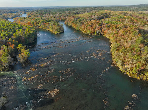
Aerial view of Chattahoochee River in Harris County, Georgia.
Aerial view of Chattahoochee River in Harris County, Georgia.

Julie Hobbs, a USGS hydrologic technician, installs a wave sensor near Venice, Fla., Monday, October 7, 2024, ahead of Hurricane Milton’s projected landfall in Florida’s Gulf Coast Wednesday. USGS photo by Sean Townsend.
Julie Hobbs, a USGS hydrologic technician, installs a wave sensor near Venice, Fla., Monday, October 7, 2024, ahead of Hurricane Milton’s projected landfall in Florida’s Gulf Coast Wednesday. USGS photo by Sean Townsend.

USGS Hydrologic Technician Pamela Loftin looks on at the aftermath of severe flooding on Pigeon River in Newport, Tennessee. USGS crews were onsite October 1 to measure high-water marks to determine how high the flood waters reached at this location. Photo by Logan Combs, USGS.
USGS Hydrologic Technician Pamela Loftin looks on at the aftermath of severe flooding on Pigeon River in Newport, Tennessee. USGS crews were onsite October 1 to measure high-water marks to determine how high the flood waters reached at this location. Photo by Logan Combs, USGS.

Andrew Robinson, a USGS hydrological technician, is making a measurement at Ebenezer Creek at Springfield, GA. This site number is 02198690. (Photo by Andrew Robinson, USGS.)
Andrew Robinson, a USGS hydrological technician, is making a measurement at Ebenezer Creek at Springfield, GA. This site number is 02198690. (Photo by Andrew Robinson, USGS.)

Drew Robinson, a USGS hydrological technician, is putting a Rapid Deployment Gauge together for the Georgia Department of Transportation on Wednesday, August 7. He built the RDG and deployed it in Statesboro in the early evening. That RDG was used to help the local community experiencing bad floods on Lotts Creek.
Drew Robinson, a USGS hydrological technician, is putting a Rapid Deployment Gauge together for the Georgia Department of Transportation on Wednesday, August 7. He built the RDG and deployed it in Statesboro in the early evening. That RDG was used to help the local community experiencing bad floods on Lotts Creek.

U.S. Geological Survey, Caribbean Florida Water Science Center main office, located in 10770 N 46th St, Tampa, FL 33617.
U.S. Geological Survey, Caribbean Florida Water Science Center main office, located in 10770 N 46th St, Tampa, FL 33617.

Mail in deceased butterflies, moths, and skippers and help United States Geological Survey(USGS) scientists establish a Lepidoptera Research Collection (LRC). Specimens will help USGS scientists identify contaminants and environmental factors which may be contributing to the decline of insect populations.
Mail in deceased butterflies, moths, and skippers and help United States Geological Survey(USGS) scientists establish a Lepidoptera Research Collection (LRC). Specimens will help USGS scientists identify contaminants and environmental factors which may be contributing to the decline of insect populations.

High water in the Walnut Creek watershed in Raleigh, North Carolina, in 2022. Flooding can impact nearby infrastructure, including homes, businesses, roads and trails. Credit: Kristina Hopkins, USGS.
High water in the Walnut Creek watershed in Raleigh, North Carolina, in 2022. Flooding can impact nearby infrastructure, including homes, businesses, roads and trails. Credit: Kristina Hopkins, USGS.

A map of black carp observations in the Mississippi River basin reported to the USGS Nonindigenous Aquatic Species database as of November 30, 2022. This map is not a complete representation of species abundance or distribution. These data include incidental captures by the public and reports from federal and state agencies.
A map of black carp observations in the Mississippi River basin reported to the USGS Nonindigenous Aquatic Species database as of November 30, 2022. This map is not a complete representation of species abundance or distribution. These data include incidental captures by the public and reports from federal and state agencies.

Legna Torres-Garcia deploys oceanographic instrumentation to measure waves, currents, water temperature and water levels in Dorado, Puerto Rico in October 2022. This deployment will improve computer model accuracy related to total water level forecast. USGS Photo by David Thompson.
Legna Torres-Garcia deploys oceanographic instrumentation to measure waves, currents, water temperature and water levels in Dorado, Puerto Rico in October 2022. This deployment will improve computer model accuracy related to total water level forecast. USGS Photo by David Thompson.

After Hurricane Ian, USGS scientist Scott Greenwood services the USGS streamgage on the St. Johns River near Sanford, Florida. Photograph taken October 6, 2022. Credit: Gene Grimm, USGS.
After Hurricane Ian, USGS scientist Scott Greenwood services the USGS streamgage on the St. Johns River near Sanford, Florida. Photograph taken October 6, 2022. Credit: Gene Grimm, USGS.

After Hurricane Ian, USGS scientist Scott Greenwood services the USGS streamgage on the St. Johns River near Sanford, Florida. Photograph taken October 6, 2022. Credit: Gene Grimm, USGS.
After Hurricane Ian, USGS scientist Scott Greenwood services the USGS streamgage on the St. Johns River near Sanford, Florida. Photograph taken October 6, 2022. Credit: Gene Grimm, USGS.

After Hurricane Ian, USGS scientist Scott Greenwood services the USGS streamgage on the St. Johns River near Sanford, Florida. Photograph taken October 6, 2022. Credit: Gene Grimm, USGS.
After Hurricane Ian, USGS scientist Scott Greenwood services the USGS streamgage on the St. Johns River near Sanford, Florida. Photograph taken October 6, 2022. Credit: Gene Grimm, USGS.

After Hurricane Ian, USGS safety and occupational health specialist Sean Raabe retrieves a USGS storm surge sensor at Fernandina Beach, Florida. Photograph taken October 5, 2022. Credit: Hannah Flynn, USGS.
After Hurricane Ian, USGS safety and occupational health specialist Sean Raabe retrieves a USGS storm surge sensor at Fernandina Beach, Florida. Photograph taken October 5, 2022. Credit: Hannah Flynn, USGS.

USGS hydrologic technician Megan Bock surveys high water marks from Hurricane Ian in Marineland, Florida. Photograph taken October 4, 2022. Credit: Fabian Kahn, USGS.
USGS hydrologic technician Megan Bock surveys high water marks from Hurricane Ian in Marineland, Florida. Photograph taken October 4, 2022. Credit: Fabian Kahn, USGS.

USGS safety and occupational health specialist Sean Raabe verifies the elevation of a USGS water level sensor in New Smyrna Beach, Florida. Photograph taken October 2, 2022. Credit: Hannah Flynn, USGS.
USGS safety and occupational health specialist Sean Raabe verifies the elevation of a USGS water level sensor in New Smyrna Beach, Florida. Photograph taken October 2, 2022. Credit: Hannah Flynn, USGS.

USGS hydrologic technician Emily Robinson documents high water marks from Hurricane Ian on a house near Buckingham, Florida. Photograph taken October 2, 2022. Credit: Roberto Ravelo, USGS.
USGS hydrologic technician Emily Robinson documents high water marks from Hurricane Ian on a house near Buckingham, Florida. Photograph taken October 2, 2022. Credit: Roberto Ravelo, USGS.

Lukas Medo, a USGS hydrologic technician, installs a water-level sensor in Levy County, Florida, September 26, ahead of Hurricane Ian's landfall. Photo by Patrick Marasco, USGS.
Lukas Medo, a USGS hydrologic technician, installs a water-level sensor in Levy County, Florida, September 26, ahead of Hurricane Ian's landfall. Photo by Patrick Marasco, USGS.

Tres científicos del Servicio Geológico de los Estados Unidos en equipo de buceo instalando una boya de olas y un sensor de presión a 60 pies de profundad para medir las olas y niveles de agua en Isla Verde, Puerto Rico.
Tres científicos del Servicio Geológico de los Estados Unidos en equipo de buceo instalando una boya de olas y un sensor de presión a 60 pies de profundad para medir las olas y niveles de agua en Isla Verde, Puerto Rico.

Three U.S. Geological Survey scientists in scuba gear work to install a wave buoy and pressure sensor 60 feet underwater to measure waves and water levels in Isla Verde, Puerto Rico.
Three U.S. Geological Survey scientists in scuba gear work to install a wave buoy and pressure sensor 60 feet underwater to measure waves and water levels in Isla Verde, Puerto Rico.

Two U.S. Geological Survey scientists set-up equipment to survey a beach in Dorado, Puerto Rico. This equipment will monitor how the beach and shoreline change through time. USGS Image.
Two U.S. Geological Survey scientists set-up equipment to survey a beach in Dorado, Puerto Rico. This equipment will monitor how the beach and shoreline change through time. USGS Image.