
Sound Waves Newsletter: August-November 2025
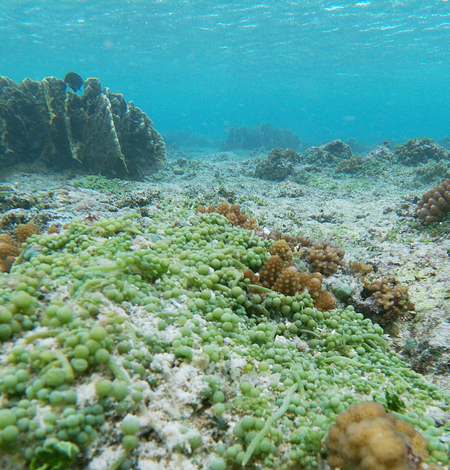
New USGS, NPS Study: Submarine Groundwater Discharge Fuels Algal Growth, Threatening Coral Reefs in American Samoa
New USGS-led research finds that submarine groundwater discharge (SGD)—the unseen flow of freshwater and nutrients from land to sea—is a key driver of water quality and nutrient loading on the island of Ofu, American Samoa, with implications for reef resilience in a changing climate.
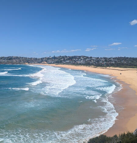
Shoreline Forecasting Takes a Leap Forward in Global Modeling Challenge
How well can we predict the future of changing shorelines? That question was put to the test in ShoreShop2.0, a recently published collaborative benchmarking study that pitted dozens of scientific teams against one of coastal science’s toughest challenges: forecasting shoreline change with limited data.
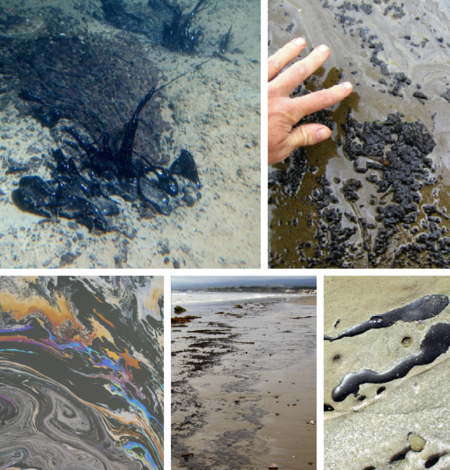
Oil “Fingerprinting” Distinguishes Natural Seeps from Spills off Southern California
Off the coast of southern California, oil naturally seeps from the seafloor, bubbling up to the surface and washing ashore as sticky tarballs. For decades, these natural seeps have complicated the work of regulators and resource managers, who must determine whether tar on beaches originates from human-caused spills or natural processes.
Natural Disaster Preparedness Starts with Science
The USGS Coastal and Marine Hazards and Resources Program provides information needed to protect coastal communities
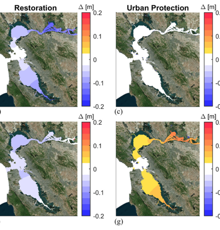
Modeling Flood-Mitigation Strategies in San Francisco Bay
As sea levels rise and storms intensify, protecting coastal communities is becoming a pressing challenge—especially in places like San Francisco Bay, one of the nation’s most urbanized estuaries. A new USGS-led study explores how different flood-mitigation strategies—shoreline hardening, wetland restoration, and floodgates—affect water levels across the Bay.
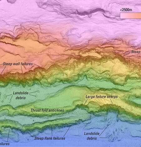
New seafloor mapping offshore Kodiak Island, Alaska, reveals extensive submarine landslides
In summer 2025, a research team led by the USGS worked with the NOAA ship Rainier to map a large swath of seafloor offshore of Kodiak Island, Alaska, along the Alaska-Aleutian Trench.
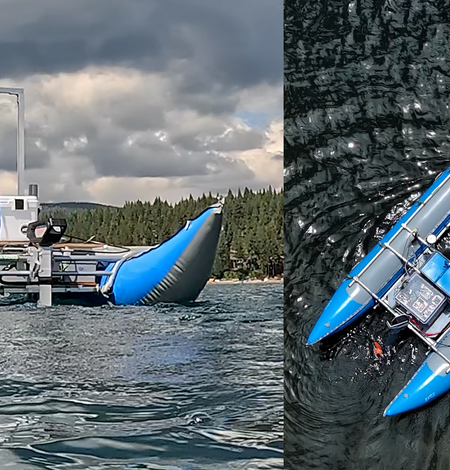
Meet the Autonomous MAPping CATaraft, or Autonomous MAPCAT
The Autonomous MAPCAT is a USGS-designed vessel that can be used to transport any number of scientific packages at, or just below, the air-water interface. The equipment can then be accurately navigated along a user configurable survey route. Scientific instrument packages can include a multi-camera system, sonar mapping equipment, or chemical sensors, for example.
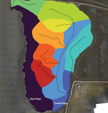
Seasonal erosion and accretion in a San Francisco Bay marsh
Salt marshes, critical buffers against coastal erosion, rely on a net gain of sediment to maintain their elevation and resilience as sea levels rise. A new study examines how two different sediment delivery routes—wave-battered marsh edges and meandering tidal creeks—combine to shape the future of these vital ecosystems.
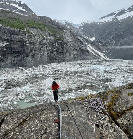
USGS Measures Glacial Flooding in Juneau, Alaska
U.S. Geological Survey scientists are monitoring flooding on the Mendenhall River as water releases from Suicide Basin’s glacier-dammed lake.

Sediment contaminants in Puget Sound: Implications for ecosystem health and remediation
For decades, chemicals from industry and development have lingered in the sediments of Puget Sound, threatening marine life and human health. Despite more than 30 years of remediation and monitoring, some contaminants remain stubbornly persistent in the Sound’s marine inhabitants and nearshore environment, raising questions about how best to restore this critical ecosystem.
Woods Hole Coastal and Marine Science Center Newsletter: August-November 2025
Welcome to our newsletter, where we share science stories, popular social media posts, recent publications, fieldwork activities, and more center happenings.
Annual Reports and General Information Product for Woods Hole Coastal and Marine Science Center
Learn about our research focus areas and yearly accomplishments and progress, while enjoying an array of stunning imagery.

Woods Hole Science Stroll 2025
On August 9, 2025, the USGS and several other science organizations located in Woods Hole, Massachusetts, hosted hands-on activities and informative displays for the annual Woods Hole Science Stroll.
-
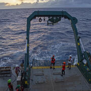
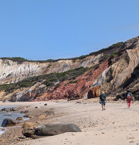
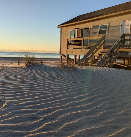
Photo Roundup: August-November 2025 Photo Roundup: August-November 2025
A selection of coastal and ocean videos and photographs from across the USGS.