
Hazards
Hazards
USGS studies the cause, distribution and potential of coastal and submarine hazards associated with earthquakes, submarine landslides, tsunamis, coastal inundation, and oil and gas spills. USGS develops models to help evaluate and forecast hazard probability and occurrence. Assessing hazards in the submarine environment prepares society for potential events that affect health and safety.
Filter Total Items: 15

Seafloor Benthic Mapping and Characterization: Enhancing our Understanding of Aleutian Islands’ Hazards, Potential Seabed Minerals and Deep Corals
A USGS-led expedition in the Aleutian Arc off Alaska will provide critical information on energy resources, underwater earthquakes and other hazards, seafloor habitats, and biological resources, including key fisheries, as well as potential seabed minerals.
By
Ecosystems Mission Area, Natural Hazards Mission Area, Coastal and Marine Hazards and Resources Program, Land Management Research Program, Species Management Research Program, Eastern Ecological Science Center, Pacific Coastal and Marine Science Center, St. Petersburg Coastal and Marine Science Center, Wetland and Aquatic Research Center , Woods Hole Coastal and Marine Science Center, Hawaiian Volcano Observatory, Deep Sea Exploration, Mapping and Characterization

Cascadia Subduction Zone Marine Geohazards
Societal Issue: Uncertainty related to rupture extent, slip distribution, and recurrence of past subduction megathrust earthquakes in the Pacific Northwest (northern CA, OR, WA, and southern BC) leads to ambiguity in earthquake and tsunami hazard assessments and hinders our ability to prepare for future events.
By
Natural Hazards Mission Area, Coastal and Marine Hazards and Resources Program, Pacific Coastal and Marine Science Center, Santa Cruz Core Scanning Laboratory, Santa Cruz Core Laboratories, Santa Cruz Core Splitting Laboratory, Deep Sea Exploration, Mapping and Characterization, Subduction Zone Science

California Seafloor Mapping Program
The California Seafloor Mapping Program (CSMP) is a cooperative program to create a comprehensive coastal and marine geologic and habitat base map series for all of California's State waters.

Seafloor Faults off Southern California
More than 22 million people live along Southern California’s coast, and many more migrate there every year. Faults and earthquake threats in this region have been heavily studied on land. USGS aims to boost our knowledge about faults on the seafloor, so they can be included in hazard assessments.

Hazards: EXPRESS
Marine geohazards including earthquakes, landslides, and tsunamis lie offshore of densely populated areas of California, Oregon, and Washington. One goal of EXPRESS is to improve assessments of these hazards.

Probabilistic Forecasting of Earthquakes, Tsunamis, and Earthquake Effects in the Coastal Zone
The nation's coastlines are vulnerable to the interrelated hazards posed by earthquakes, landslides, and tsunamis. In the marine environment these events often occur in concert, and distant triggers can cause severe local effects, making the issue global in scope. As the population continues to migrate toward the coastlines, the social impacts of these hazards are expected to grow.

Coastal and Marine Geohazards of the U.S. West Coast and Alaska
Coastal and marine geohazards are sudden and extreme events beneath the ocean that threaten coastal populations. These underwater hazards include earthquakes, volcanic eruptions, landslides, and tsunamis. The tectonically active west coast of the Americas is prone to such hazards, as it lies along the boundaries of major tectonic plates that make up the Earth's crust—the North American, Caribbean...

EXPRESS: Expanding Pacific Research and Exploration of Submerged Systems
EXPRESS is a multi-year, multi-institution cooperative research campaign in deep sea areas of California, Oregon, and Washington, including the continental shelf and slope. EXPRESS data and information are intended to guide wise use of living marine resources and habitats, inform ocean energy and mineral resource decisions, and improve offshore hazard assessments.

Tsunami Record from the Great 1906 San Francisco Earthquake
Shortly after the Great San Francisco earthquake of April 18, 1906, a sea level disturbance (tsunami) was recorded at the Presidio tide gauge station in San Francisco (the station is now located nearby at Ft. Point). What type of mechanism (earthquake rupture, landslide, other) generated the tsunami recorded at the Presidio tide gauge station?

Atlantic and Gulf of America Submarine Landslides-Tsunami Hazards Project
Submarine landslides and tsunamis along the U.S. Atlantic and Gulf of America coasts are rare, but the risks associated with these natural hazards are high. While most earthquakes in these margins are low in magnitude, and so shaking from them is not intense, they can still cause a lot of damage. The Atlantic and Gulf of America margins are heavily urbanized, support extensive port and industrial...
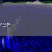
Preliminary simulations of the 2010 Chilean tsunami
Preliminary simulations of the 2010 Chilean tsunami from the 27 February 2010 M=8.8 subduction zone earthquake, offshore Bio-Bio, Chile

Caribbean Tsunami and Earthquake Hazards Studies
Puerto Rico and the Virgin Islands are located at an active plate boundary between the North American plate and the northeast corner of the Caribbean plate. Plate movements have caused large magnitude earthquakes and devastating tsunamis. The USGS has an ongoing program to identify and map the faults in this region using various geophysical and geological methods in order to estimate the location...