
A large destructive landslide occurred near Oso, Washington on March 22, 2014. Computer simulations indicate that it could have behaved very differently (with much less mobility and consequent destructiveness) if the ground had been less porous and water-saturated. This video shows the results of two computer simulations.
LCMAP Change Stories: Gone in 60 Seconds
Active
By Land Change Monitoring, Assessment, and Projection
April 29, 2020
Oso, Washington Landslide
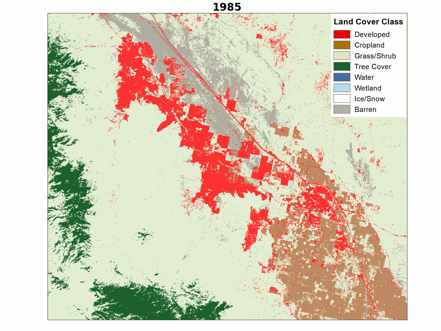
At first glance, the most striking patterns in land cover change over time in this animation of the Oso, Washington area would appear to be forest harvest and regrowth, but a more dramatic change emerged in 2014.
Media

Sources/Usage: Public Domain. View Media Details
The deep green that signals Tree Cover in the USGS Land Change Monitoring, Assessment, and Projection (LCMAP) Primary Land Cover product give way to the light tan of grass and shrubland from 1985-2017, only to be overtaken once again by green as trees regrow and mature.
But watch the end of the animation closely and you’ll notice another, more drastic change. On March 22, 2014, a 40 mile-per-hour landslide pushed 19 million tons of debris through the small residential development of Steelhead Haven in the space of a single minute.
This forest and small community at the base of the ridgeline near the North Fork Stillaguamish River were destroyed in the disaster, with the visible scar covering one-half square mile and causing temporary damming of the river.
The area remains mostly grassland/shrubland and has yet to return to its previous forested state, though 43 cedar trees were planted as a memorial to the 43 lives lost to the disaster.
Explore more LCMAP Change Stories by following the links below.

LCMAP Change Stories: Crops Give Way to Concrete LCMAP Change Stories: Crops Give Way to Concrete
Less than 15 miles separate the city of Plainfield from the nearby metropolis of Indianapolis, the capital of Indiana and the state’s largest urban center.
LCMAP Change Stories: Building a Boomtown, Block by Block
The desert outpost of Palm Springs, California and the surrounding Thousand Palms region has experienced explosive population growth over the past four decades, with tract after tract of development filling in previously barren landscapes along Interstate 10.
LCMAP Change Stories: It's a Sprawl World After All
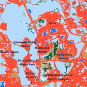
The man-made Florida playland of Walt Disney World has grown outward on all sides since the amusement park’s construction commenced in the 1960s. Much of that growth has overtaken the wetlands, tree cover and grassland/shrublands near Orlando.

LCMAP Change Stories: Hurricanes in the Everglades
When Atlantic hurricanes make landfall in south Florida, the coastal marshes and mangrove forests of the Everglades often act as a buffer that protects residents from rising sea levels, high winds and storm surge.

LCMAP Change Stories: Alabama Tornadoes
The USGS Land Change Monitoring, Assessment, and Projection initiative aims to identify where the landscape is changing and why.
Below are multimedia items associated with this project.

Oso Landslide Computer Simulations
A large destructive landslide occurred near Oso, Washington on March 22, 2014. Computer simulations indicate that it could have behaved very differently (with much less mobility and consequent destructiveness) if the ground had been less porous and water-saturated. This video shows the results of two computer simulations.
At first glance, the most striking patterns in land cover change over time in this animation of the Oso, Washington area would appear to be forest harvest and regrowth, but a more dramatic change emerged in 2014.
Media
Sources/Usage: Public Domain. View Media Details
The deep green that signals Tree Cover in the USGS Land Change Monitoring, Assessment, and Projection (LCMAP) Primary Land Cover product give way to the light tan of grass and shrubland from 1985-2017, only to be overtaken once again by green as trees regrow and mature.
But watch the end of the animation closely and you’ll notice another, more drastic change. On March 22, 2014, a 40 mile-per-hour landslide pushed 19 million tons of debris through the small residential development of Steelhead Haven in the space of a single minute.
This forest and small community at the base of the ridgeline near the North Fork Stillaguamish River were destroyed in the disaster, with the visible scar covering one-half square mile and causing temporary damming of the river.
The area remains mostly grassland/shrubland and has yet to return to its previous forested state, though 43 cedar trees were planted as a memorial to the 43 lives lost to the disaster.
Explore more LCMAP Change Stories by following the links below.
LCMAP Change Stories: Crops Give Way to Concrete LCMAP Change Stories: Crops Give Way to Concrete
Less than 15 miles separate the city of Plainfield from the nearby metropolis of Indianapolis, the capital of Indiana and the state’s largest urban center.
LCMAP Change Stories: Building a Boomtown, Block by Block
The desert outpost of Palm Springs, California and the surrounding Thousand Palms region has experienced explosive population growth over the past four decades, with tract after tract of development filling in previously barren landscapes along Interstate 10.
LCMAP Change Stories: It's a Sprawl World After All
The man-made Florida playland of Walt Disney World has grown outward on all sides since the amusement park’s construction commenced in the 1960s. Much of that growth has overtaken the wetlands, tree cover and grassland/shrublands near Orlando.
LCMAP Change Stories: Hurricanes in the Everglades
When Atlantic hurricanes make landfall in south Florida, the coastal marshes and mangrove forests of the Everglades often act as a buffer that protects residents from rising sea levels, high winds and storm surge.
LCMAP Change Stories: Alabama Tornadoes
The USGS Land Change Monitoring, Assessment, and Projection initiative aims to identify where the landscape is changing and why.
Below are multimedia items associated with this project.
Oso Landslide Computer Simulations
A large destructive landslide occurred near Oso, Washington on March 22, 2014. Computer simulations indicate that it could have behaved very differently (with much less mobility and consequent destructiveness) if the ground had been less porous and water-saturated. This video shows the results of two computer simulations.
A large destructive landslide occurred near Oso, Washington on March 22, 2014. Computer simulations indicate that it could have behaved very differently (with much less mobility and consequent destructiveness) if the ground had been less porous and water-saturated. This video shows the results of two computer simulations.