
David I Donato
By profession and avocation, David I. Donato is an applied mathematician and computational scientist. David has contributed as a quantitative professional to a number of the programs of the Department of the Interior, including offshore minerals leasing, quantitative policy analysis, information dissemination, and geographic and regional studies.
In addition to his work in applied mathematics, statistics, and scientific computation, he has developed and administered Web sites and has designed and built interactive Web applications. He has also applied his knowledge of quantitative micro-economics to various studies and analyses, including work with mercury in fish and land-change modeling. Because of his particular interest in probability and mathematical statistics, he specializes in stochastic computer simulation. David is an expert scientific programmer and a prolific technical writer. In recent years he has worked on statistical modeling of mercury in fish tissue and spatially-explicit land-change modeling.
Research Interests
- Modeling spatially-explicit environmental and land-use futures
- Designing scientific computer models for generality and radically deep interoperation
- Developing (designing and coding) stochastic computer simulations and models
- Solving difficult quantitative and computational problems using mathematics, statistics, GIScience, economics, and comput
Science and Products
The USGS pursues research programs related to land change and land-change modeling as well as environmental mercury as a contaminant that affects the health of fish and other wildlife.

Bioaccumulation of Mercury in Fish Varied by Species and Location in the Chesapeake Bay Watershed—Summary of Existing Data and a Roadmap for Integrated Monitoring

Develop Cloud Computing Capability at Streamgages using Amazon Web Services GreenGrass IoT Framework for Camera Image Velocity Gaging

Land Change Monitoring and Modeling

Mercury Cycling and Bioaccumulation in the Upper Hudson River Basin--Fishing Brook
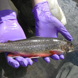
Mercury in Fish from 21 National Parks in the West

Modeling the Effects of Climate and Land Use Change on Crucial Wildlife Habitat
Science and Products
The USGS pursues research programs related to land change and land-change modeling as well as environmental mercury as a contaminant that affects the health of fish and other wildlife.
Bioaccumulation of Mercury in Fish Varied by Species and Location in the Chesapeake Bay Watershed—Summary of Existing Data and a Roadmap for Integrated Monitoring
Develop Cloud Computing Capability at Streamgages using Amazon Web Services GreenGrass IoT Framework for Camera Image Velocity Gaging
Land Change Monitoring and Modeling
Mercury Cycling and Bioaccumulation in the Upper Hudson River Basin--Fishing Brook
Mercury in Fish from 21 National Parks in the West
Modeling the Effects of Climate and Land Use Change on Crucial Wildlife Habitat
*Disclaimer: Listing outside positions with professional scientific organizations on this Staff Profile are for informational purposes only and do not constitute an endorsement of those professional scientific organizations or their activities by the USGS, Department of the Interior, or U.S. Government