
Working records in 2019 using printout from 1935
Jerrod D. Wheeler
Jerrod is currently the Acting Data Chief - Wyoming and Western Wyoming Field Office Chief. Jerrod began his career with USGS in 2000. He is responsible for surface-water, groundwater and water-quality monitoring across western Wyoming.
Jerrod is the Field Office Chief of the Western Wyoming Field Office and is responsible for the collection, review and publication of hydrologic products and the use of hydroacoustics throughout Wyoming. Jerrod has partnered in investigative studies including developing the use of near-stream wells near streamgages to help understand groundwater/surface-water interaction. He also provided field and training support to the National Science Foundation’s McMurdo Dry Valleys long-term ecological research program in Antarctica. Prior to the USGS, Jerrod was employed by Inberg-Miller Engineers as a Staff Geologist.
Science and Products

Snake River Basin Streamflow and Water Temperature
The USGS WY-MT Water Science Center operates streamgages in the Snake River Basin in Wyoming that report streamflow in the mainstem of the Snake River and tributary streams. During the spring of 2022, in cooperation with the Teton Conservation District, thermistors were installed at six sites in the basin to record and report water temperature data. There are currently 12 sites in the basin that...

Characterization and Quantification of Salinity Loads from Blacks Fork above Smiths Fork near Lyman, Wyoming
The Blacks Fork is a stream that contributes a salinity load to the Colorado River Basin. In order to quantify the salinity load, collection of continuous streamflow and specific conductance data, and monthly sampling for total-dissolved solids will occur from April 2018 through September 2019. Calculations of monthly and annual salinity loading from the Blacks Fork were published in 2021.

Characterization of Fish Creek and Evaluation of Nutrient Inputs to Watershed
Fish Creek, an approximately 15-mile long tributary of the Snake River, is located in Teton County in western Wyoming near the town of Wilson. Local residents began observing an increase in the growth of algae and aquatic plants in Fish Creek in about 2000.
Filter Total Items: 23

Working records in 2019 using printout from 1935

Ice Measurement Equipment
Doppler is used to peer under the ice to "see" the flow in the Little Wind River near Riverton, Wyoming.
Doppler is used to peer under the ice to "see" the flow in the Little Wind River near Riverton, Wyoming.

Intern Using Doppler
One of our interns uses Dopplar to gather streamflow data through the ice at the Little Wind River near Riverton, Wyoming.
One of our interns uses Dopplar to gather streamflow data through the ice at the Little Wind River near Riverton, Wyoming.

Doppler through the ice
An intern uses Dopplar to gather streamflow data through the ice at the Little Wind River near Riverton, Wyoming.
An intern uses Dopplar to gather streamflow data through the ice at the Little Wind River near Riverton, Wyoming.

ADCP Bridge Measurement
Measuring streamflow with ADCP on the South Fork of the Shoshone River near Valley, WYoming.
Measuring streamflow with ADCP on the South Fork of the Shoshone River near Valley, WYoming.

Auguring holes to measure streamflow, Blacks Fork Robertson
Auguring holes to measure streamflow, Blacks Fork RobertsonAuguring holes to measure streamflow, Blacks Fork Robertson
Auguring holes to measure streamflow, Blacks Fork Robertson
Auguring holes to measure streamflow, Blacks Fork RobertsonAuguring holes to measure streamflow, Blacks Fork Robertson

Chopping ice to create open channel to measure streamflow, Blacks Fk
Chopping ice to create open channel to measure streamflow, Blacks FkChopping ice to create open channel to measure streamflow, Blacks Fk
Chopping ice to create open channel to measure streamflow, Blacks Fk
Chopping ice to create open channel to measure streamflow, Blacks FkChopping ice to create open channel to measure streamflow, Blacks Fk

Blackrock Creek streamgage
Blackrock Creek streamgage

USGS WY-MT WSC Riverton Office
USGS WY-MT WSC Riverton Office

Using a GPS station to get highly precise streamflow measurement
Using a GPS station to get highly precise streamflow measurementUsing a GPS station to get highly precise streamflow measurement
Using a GPS station to get highly precise streamflow measurement
Using a GPS station to get highly precise streamflow measurementUsing a GPS station to get highly precise streamflow measurement

Ice jam, Middle Popo Agie River
Ice jam, Middle Popo Agie River

Ice jam on Little Wind River (06235500)
Ice jam on Little Wind River Ice jam on Little Wind River (06235500), February 2017. Streamgage destoryed soon after photo taken.
Ice jam on Little Wind River Ice jam on Little Wind River (06235500), February 2017. Streamgage destoryed soon after photo taken.

Measuring streamflow from a cableway, Green River blw Fontenelle Resv
Measuring streamflow from a cableway, Green River blw Fontenelle ResvMeasuring streamflow from a cableway using an ADCP, Green River blw Fontenelle Reservoir, WY
Measuring streamflow from a cableway, Green River blw Fontenelle Resv
Measuring streamflow from a cableway, Green River blw Fontenelle ResvMeasuring streamflow from a cableway using an ADCP, Green River blw Fontenelle Reservoir, WY

Measuring streamflow of the Green River near LaBarge
Measuring streamflow of the Green River near LaBargeMeasuring streamflow of the Green River near LaBarge
Measuring streamflow of the Green River near LaBarge
Measuring streamflow of the Green River near LaBargeMeasuring streamflow of the Green River near LaBarge

Measuring streamflow of New Fork River
Measuring streamflow of New Fork River

Digging trench to bury cable transmitting GW data to streamgage
Digging trench to bury cable transmitting GW data to streamgageDigging trench in which to bury cable transmitting groundwater data from well to streamgage
Digging trench to bury cable transmitting GW data to streamgage
Digging trench to bury cable transmitting GW data to streamgageDigging trench in which to bury cable transmitting groundwater data from well to streamgage

Setting up Groundwater Streamgage on Green River nr LaBarge
Setting up Groundwater Streamgage on Green River nr LaBargeSetting up Groundwater Streamgage on Green River nr LaBarge
Setting up Groundwater Streamgage on Green River nr LaBarge
Setting up Groundwater Streamgage on Green River nr LaBargeSetting up Groundwater Streamgage on Green River nr LaBarge

Measuring streamflow using ADCP, Fish Creek
Measuring streamflow using ADCP, Fish Creek

Flood Waters Take USGS Streamgage Wind River near Crowheart, WY
Flood Waters Take USGS Streamgage Wind River near Crowheart, WYGagehouse at 06225500 Wind River near Crowheart WY right before it washed away.
Jul 01 2011; 13,900 ft3/s
Flood Waters Take USGS Streamgage Wind River near Crowheart, WY
Flood Waters Take USGS Streamgage Wind River near Crowheart, WYGagehouse at 06225500 Wind River near Crowheart WY right before it washed away.
Jul 01 2011; 13,900 ft3/s
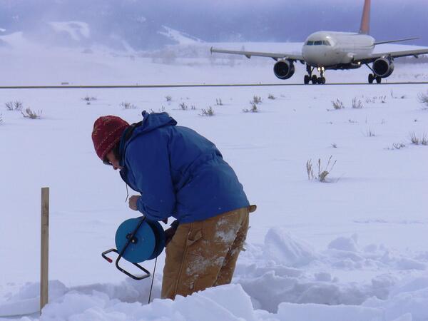
Taking a water-level measurement in a monitoring well at Jackson Hole
Taking a water-level measurement in a monitoring well at Jackson HoleTaking a water-level measurement in a monitoring well at Jackson Hole Airport.
Taking a water-level measurement in a monitoring well at Jackson Hole
Taking a water-level measurement in a monitoring well at Jackson HoleTaking a water-level measurement in a monitoring well at Jackson Hole Airport.

Measuring water level in streambank piezometer nr Wind Riv at Kinnear
Measuring water level in streambank piezometer nr Wind Riv at KinnearMeasuring water level in streambank piezometer nr Wind River at Kinnear
Measuring water level in streambank piezometer nr Wind Riv at Kinnear
Measuring water level in streambank piezometer nr Wind Riv at KinnearMeasuring water level in streambank piezometer nr Wind River at Kinnear
Science and Products
Snake River Basin Streamflow and Water Temperature
The USGS WY-MT Water Science Center operates streamgages in the Snake River Basin in Wyoming that report streamflow in the mainstem of the Snake River and tributary streams. During the spring of 2022, in cooperation with the Teton Conservation District, thermistors were installed at six sites in the basin to record and report water temperature data. There are currently 12 sites in the basin that...
Characterization and Quantification of Salinity Loads from Blacks Fork above Smiths Fork near Lyman, Wyoming
The Blacks Fork is a stream that contributes a salinity load to the Colorado River Basin. In order to quantify the salinity load, collection of continuous streamflow and specific conductance data, and monthly sampling for total-dissolved solids will occur from April 2018 through September 2019. Calculations of monthly and annual salinity loading from the Blacks Fork were published in 2021.
Characterization of Fish Creek and Evaluation of Nutrient Inputs to Watershed
Fish Creek, an approximately 15-mile long tributary of the Snake River, is located in Teton County in western Wyoming near the town of Wilson. Local residents began observing an increase in the growth of algae and aquatic plants in Fish Creek in about 2000.
Filter Total Items: 23
Working records in 2019 using printout from 1935
Working records in 2019 using printout from 1935
Ice Measurement Equipment
Doppler is used to peer under the ice to "see" the flow in the Little Wind River near Riverton, Wyoming.
Doppler is used to peer under the ice to "see" the flow in the Little Wind River near Riverton, Wyoming.
Intern Using Doppler
One of our interns uses Dopplar to gather streamflow data through the ice at the Little Wind River near Riverton, Wyoming.
One of our interns uses Dopplar to gather streamflow data through the ice at the Little Wind River near Riverton, Wyoming.
Doppler through the ice
An intern uses Dopplar to gather streamflow data through the ice at the Little Wind River near Riverton, Wyoming.
An intern uses Dopplar to gather streamflow data through the ice at the Little Wind River near Riverton, Wyoming.
ADCP Bridge Measurement
Measuring streamflow with ADCP on the South Fork of the Shoshone River near Valley, WYoming.
Measuring streamflow with ADCP on the South Fork of the Shoshone River near Valley, WYoming.
Auguring holes to measure streamflow, Blacks Fork Robertson
Auguring holes to measure streamflow, Blacks Fork RobertsonAuguring holes to measure streamflow, Blacks Fork Robertson
Auguring holes to measure streamflow, Blacks Fork Robertson
Auguring holes to measure streamflow, Blacks Fork RobertsonAuguring holes to measure streamflow, Blacks Fork Robertson
Chopping ice to create open channel to measure streamflow, Blacks Fk
Chopping ice to create open channel to measure streamflow, Blacks FkChopping ice to create open channel to measure streamflow, Blacks Fk
Chopping ice to create open channel to measure streamflow, Blacks Fk
Chopping ice to create open channel to measure streamflow, Blacks FkChopping ice to create open channel to measure streamflow, Blacks Fk
Blackrock Creek streamgage
Blackrock Creek streamgage
USGS WY-MT WSC Riverton Office
USGS WY-MT WSC Riverton Office
Using a GPS station to get highly precise streamflow measurement
Using a GPS station to get highly precise streamflow measurementUsing a GPS station to get highly precise streamflow measurement
Using a GPS station to get highly precise streamflow measurement
Using a GPS station to get highly precise streamflow measurementUsing a GPS station to get highly precise streamflow measurement
Ice jam, Middle Popo Agie River
Ice jam, Middle Popo Agie River
Ice jam on Little Wind River (06235500)
Ice jam on Little Wind River Ice jam on Little Wind River (06235500), February 2017. Streamgage destoryed soon after photo taken.
Ice jam on Little Wind River Ice jam on Little Wind River (06235500), February 2017. Streamgage destoryed soon after photo taken.
Measuring streamflow from a cableway, Green River blw Fontenelle Resv
Measuring streamflow from a cableway, Green River blw Fontenelle ResvMeasuring streamflow from a cableway using an ADCP, Green River blw Fontenelle Reservoir, WY
Measuring streamflow from a cableway, Green River blw Fontenelle Resv
Measuring streamflow from a cableway, Green River blw Fontenelle ResvMeasuring streamflow from a cableway using an ADCP, Green River blw Fontenelle Reservoir, WY
Measuring streamflow of the Green River near LaBarge
Measuring streamflow of the Green River near LaBargeMeasuring streamflow of the Green River near LaBarge
Measuring streamflow of the Green River near LaBarge
Measuring streamflow of the Green River near LaBargeMeasuring streamflow of the Green River near LaBarge
Measuring streamflow of New Fork River
Measuring streamflow of New Fork River
Digging trench to bury cable transmitting GW data to streamgage
Digging trench to bury cable transmitting GW data to streamgageDigging trench in which to bury cable transmitting groundwater data from well to streamgage
Digging trench to bury cable transmitting GW data to streamgage
Digging trench to bury cable transmitting GW data to streamgageDigging trench in which to bury cable transmitting groundwater data from well to streamgage
Setting up Groundwater Streamgage on Green River nr LaBarge
Setting up Groundwater Streamgage on Green River nr LaBargeSetting up Groundwater Streamgage on Green River nr LaBarge
Setting up Groundwater Streamgage on Green River nr LaBarge
Setting up Groundwater Streamgage on Green River nr LaBargeSetting up Groundwater Streamgage on Green River nr LaBarge
Measuring streamflow using ADCP, Fish Creek
Measuring streamflow using ADCP, Fish Creek
Flood Waters Take USGS Streamgage Wind River near Crowheart, WY
Flood Waters Take USGS Streamgage Wind River near Crowheart, WYGagehouse at 06225500 Wind River near Crowheart WY right before it washed away.
Jul 01 2011; 13,900 ft3/s
Flood Waters Take USGS Streamgage Wind River near Crowheart, WY
Flood Waters Take USGS Streamgage Wind River near Crowheart, WYGagehouse at 06225500 Wind River near Crowheart WY right before it washed away.
Jul 01 2011; 13,900 ft3/s
Taking a water-level measurement in a monitoring well at Jackson Hole
Taking a water-level measurement in a monitoring well at Jackson HoleTaking a water-level measurement in a monitoring well at Jackson Hole Airport.
Taking a water-level measurement in a monitoring well at Jackson Hole
Taking a water-level measurement in a monitoring well at Jackson HoleTaking a water-level measurement in a monitoring well at Jackson Hole Airport.
Measuring water level in streambank piezometer nr Wind Riv at Kinnear
Measuring water level in streambank piezometer nr Wind Riv at KinnearMeasuring water level in streambank piezometer nr Wind River at Kinnear
Measuring water level in streambank piezometer nr Wind Riv at Kinnear
Measuring water level in streambank piezometer nr Wind Riv at KinnearMeasuring water level in streambank piezometer nr Wind River at Kinnear