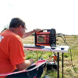
Intro
John Masterson is the Associate Director for Science Operations in the New York Water Science Center. He completed his B.A. in Geosciences at SUNY Geneseo and M.S. in Geosciences at the University of Missouri-Columbia. John began his USGS career at the New York Water Science Center on Long Island in 1987, transferred to the New England Water Science Center in Massachusetts in 1990, and has returned to the New York Water Science Center in 2021. He specializes in computer model applications to study groundwater flow dynamics and is an author of numerous USGS technical reports and peer-reviewed articles on groundwater resources in coastal aquifer systems. John is currently serving as the project coordinator for the ongoing NYSDEC-USGS cooperative investigation of groundwater sustainability of the Long Island regional aquifer system.
Science and Products
Managing water resources on Long Island, New York, with integrated, multidisciplinary science
Simulated effects of sea-level rise on the shallow, fresh groundwater system of Assateague Island, Maryland and Virginia
Simulation of groundwater flow in the regional aquifer system on Long Island, New York, for pumping and recharge conditions in 2005–15
Water for Long Island: Now and for the future
Development of simulated groundwater-contributing areas to selected streams, ponds, coastal water bodies, and production wells in the Plymouth-Carver region and Cape Cod, Massachusetts
Documentation of a groundwater flow model developed to assess groundwater availability in the Northern Atlantic Coastal Plain aquifer system from Long Island, New York, to North Carolina
Sustainability of groundwater supplies in the Northern Atlantic Coastal Plain aquifer system
Assessment of groundwater availability in the Northern Atlantic Coastal Plain aquifer system From Long Island, New York, to North Carolina
Potential effects of sea-level rise on the depth to saturated sediments of the Sagamore and Monomoy flow lenses on Cape Cod, Massachusetts
Scientific information in support of water resource management of the Big River area, Rhode Island
Science for the stewardship of the groundwater resources of Cape Cod, Massachusetts
Simulation of water-table aquifers using specified saturated thickness
Pre-USGS Publications
May 1 – 5, 2011
to Coastal Embayments, Western Cape Cod, Massachusetts: in Proceedings of the Geological Society of America National Meeting, Boston, Massachusetts,
November 1-10, 2001.
public-supply wells, streams, ponds, and coastal embayments, western Cape Cod, Massachusetts: in Proceedings of the National Ground Water Association Northeast Focus Ground Water Conference, Burlington, Vermont, October 20-21, 1998.
computerized visualization of fluid-particle pathlines for simulated contaminant plumes in ground-water, Massachusetts Military Reservation, Cape Cod, Massachusetts: in Proceedings of the Geological Society of America Annual Meeting, Seattle, Washington, October 24-27, 1994, v. 26, No. 7.
withdrawals and recharge on the hydrology of the sole-source Cape Cod Aquifer,
Massachusetts: in Proceedings of the National Ground Water Association Focus
Conference on Eastern Ground Water Issues, Burlington, Vermont, October 3-5,
1994.
Groundwater Sustainability of the Long Island Aquifer System
Saltwater-Interface Mapping - Long Island, New York
Hydrogeologic-Framework Mapping - Long Island, New York
Groundwater-Flow Modeling - Long Island, New York
Groundwater Sustainability - Long Island, New York
Delineation of the Hydrogeologic Framework and Saltwater-Freshwater Interface and Determination of Water-Supply Sustainability of Long Island, New York
Groundwater Availability of the Northern Atlantic Coastal Plain
Science and Products
- Publications
Filter Total Items: 47
Managing water resources on Long Island, New York, with integrated, multidisciplinary science
Nutrients, harmful algal blooms, and synthetic chemicals like per- and polyfluoroalkyl substances (PFAS) and 1,4-dioxane threaten Long Island’s water resources by affecting the quality of drinking water and ecologically sensitive habitats that support the diverse wildlife throughout the island. Understanding the occurrence, fate, and transport of these potentially harmful chemicals is critical toSimulated effects of sea-level rise on the shallow, fresh groundwater system of Assateague Island, Maryland and Virginia
The U.S. Geological Survey, in cooperation with the National Park Service, developed a three-dimensional groundwater-flow model for Assateague Island in eastern Maryland and Virginia to assess the effects of sea-level rise on the groundwater system. Sea-level rise is expected to increase the altitude of the water table in barrier island aquifer systems, possibly leading to adverse effects to ecosySimulation of groundwater flow in the regional aquifer system on Long Island, New York, for pumping and recharge conditions in 2005–15
A three-dimensional groundwater-flow model was developed for the aquifer system of Long Island, New York, to evaluate (1) responses of the hydrologic system to changes in natural and anthropogenic hydraulic stresses, (2) the subsurface distribution of groundwater age, and (3) the regional-scale distribution of groundwater travel times and the source of water to fresh surface waters and coastal recWater for Long Island: Now and for the future
Do you ever wonder where your water comes from? If you live in Nassau or Suffolk County, the answer is, groundwater. Groundwater is water that started out as precipitation (rain and snow melt) and seeped into the ground. This seepage recharges the freshwater stored underground, in the spaces between the grains of sand and gravel in what are referred to as aquifers. Long Island has three primary aqDevelopment of simulated groundwater-contributing areas to selected streams, ponds, coastal water bodies, and production wells in the Plymouth-Carver region and Cape Cod, Massachusetts
IntroductionThe U.S. Geological Survey (USGS), in support of the Massachusetts Estuaries Project (MEP), delineated groundwater-contributing areas to various hydrologic receptors including ponds, streams, and coastal water bodies throughout southeastern Massachusetts, including portions of the Plymouth-Carver aquifer system and all of Cape Cod. These contributing areas were delineated over a 6-yearDocumentation of a groundwater flow model developed to assess groundwater availability in the Northern Atlantic Coastal Plain aquifer system from Long Island, New York, to North Carolina
The U.S. Geological Survey developed a groundwater flow model for the Northern Atlantic Coastal Plain aquifer system from Long Island, New York, to northeastern North Carolina as part of a detailed assessment of the groundwater availability of the area and included an evaluation of how these resources have changed over time from stresses related to human uses and climate trends. The assessment wasSustainability of groundwater supplies in the Northern Atlantic Coastal Plain aquifer system
Groundwater is the Nation’s principal reserve of freshwater. It provides about half our drinking water, is essential to food production, and facilitates business and industry in developing economic well-being. Groundwater is also an important source of water for sustaining the ecosystem health of rivers, wetlands, and estuaries throughout the country. The decreases in groundwater levels and otherAssessment of groundwater availability in the Northern Atlantic Coastal Plain aquifer system From Long Island, New York, to North Carolina
Executive SummaryThe U.S. Geological Survey began a multiyear regional assessment of groundwater availability in the Northern Atlantic Coastal Plain (NACP) aquifer system in 2010 as part of its ongoing regional assessments of groundwater availability of the principal aquifers of the Nation. The goals of this national assessment are to document effects of human activities on water levels and groundPotential effects of sea-level rise on the depth to saturated sediments of the Sagamore and Monomoy flow lenses on Cape Cod, Massachusetts
In 2014, the U.S. Geological Survey, in cooperation with the Association to Preserve Cape Cod, the Cape Cod Commission, and the Massachusetts Environmental Trust, began an evaluation of the potential effects of sea-level rise on water table altitudes and depths to water on central and western Cape Cod, Massachusetts. Increases in atmospheric and oceanic temperatures arising, in part, from the releScientific information in support of water resource management of the Big River area, Rhode Island
The Rhode Island Water Resources Board (RIWRB) is concerned that the demand for water may exceed the available public water supply in central and southern Rhode Island. Although water is often assumed to be plentiful in Rhode Island because of abundant rainfall, an adequate supply of water is not always available everywhere in the state during dry periods. Concerns that water demand may exceed supScience for the stewardship of the groundwater resources of Cape Cod, Massachusetts
Groundwater is the sole source of drinking water and a major source of freshwater for domestic, industrial, and agricultural uses on Cape Cod, Massachusetts. Groundwater discharged from aquifers also supports freshwater pond and stream ecosystems and coastal wetlands. Six hydraulically distinct groundwater-flow systems (lenses) have been delineated on Cape Cod. Of the approximately 450 million galSimulation of water-table aquifers using specified saturated thickness
Simulating groundwater flow in a water-table (unconfined) aquifer can be difficult because the saturated thickness available for flow depends on model-calculated hydraulic heads. It is often possible to realize substantial time savings and still obtain accurate head and flow solutions by specifying an approximate saturated thickness a priori, thus linearizing this aspect of the model. This specifiPre-USGS Publications
Masterson, J.P., Pope, J.P., Fienen, M.N., Monti, Jack Jr., Nardi, M.R., and Finkelstein, J.S., 2016, MODFLOW-NWT model used to assess groundwater availability in the Northern Atlantic Coastal Plain aquifer system from Long Island, New York to North Carolina: U.S. Geological Survey data release. https://dx.doi.org/10.5066/F7MG7MKRMasterson, J.P., Walter, D.A., Langevin, Christian, 2015, Effects of Sea-Level Rise on Coastal Aquifer Systems – Potential Economic and Ecological Impacts, Eastern U.S.: in Proceedings of Geological Society of America Annual Meeting, Baltimore MD, November, 2015.Masterson, J. P., Banks, W.S., Johnson, C. D., Gutierrez, B., and Fienen, M. N., 2011, Hydrologic assessment of the potential effects of sea-level rise on Assateague Island National Seashore, Maryland: in Proceedings of the National Ground Water Association National Groundwater Summit, Baltimore, Maryland,
May 1 – 5, 2011
Masterson, J. P., and Garabedian, S.P., 2006, Effects of sea-level rise on a coastal aquifer system, Cape Cod, Massachusetts: in Proceedings of the Geological Society of America National Meeting, Philadelphia, Pennsylvania, October 22-26, 2006.Masterson, J. P., and D. A. Walter, 2001, Hydrologic Analysis of the Sources of Water
to Coastal Embayments, Western Cape Cod, Massachusetts: in Proceedings of the Geological Society of America National Meeting, Boston, Massachusetts,
November 1-10, 2001.
Masterson, J.P., 1998, Effects of natural and artificial stresses on the sources of water to
public-supply wells, streams, ponds, and coastal embayments, western Cape Cod, Massachusetts: in Proceedings of the National Ground Water Association Northeast Focus Ground Water Conference, Burlington, Vermont, October 20-21, 1998.
Masterson, J.P., Hess, K.M., Kruger, M.H., and Davis, J. C., 1994, Three dimensional
computerized visualization of fluid-particle pathlines for simulated contaminant plumes in ground-water, Massachusetts Military Reservation, Cape Cod, Massachusetts: in Proceedings of the Geological Society of America Annual Meeting, Seattle, Washington, October 24-27, 1994, v. 26, No. 7.
Masterson, J.P., and Barlow, P.M., 1994, Effects of simulated changes in ground-water
withdrawals and recharge on the hydrology of the sole-source Cape Cod Aquifer,
Massachusetts: in Proceedings of the National Ground Water Association Focus
Conference on Eastern Ground Water Issues, Burlington, Vermont, October 3-5,
1994.
Masterson, J.P., and Walter, D.A., 1994, The Effects of Changes in Aquifer Properties on Simulated Fluid Particle Pathlines, Cape Cod, Massachusetts: in Morganwalp, D.W., and Aronson, D. A., eds., 1994, U.S. Geological Survey Toxic Substances Hydrology Program-- Proceedings of the Technical Meeting, Colorado Springs, Colorado, September 20-24, 1993: U.S. Geological Survey Water-Resources Investigations Report 94-4014. - Science
Groundwater Sustainability of the Long Island Aquifer System
Groundwater sustainability can be best defined as the development and use of groundwater in a manner that can be maintained for an indefinite time without causing unacceptable environmental or socioeconomic consequences. Informed management of the Long Island aquifer system can help ensure a regionally sustainable groundwater resource. The USGS and New York State Department of Environmental...Saltwater-Interface Mapping - Long Island, New York
HomeSaltwater intrusion is the most common type of water-quality degradation in coastal-plain aquifers. In coastal areas, the hydraulic head under predevelopment (nonpumping) conditions is higher on land than in the surrounding saltwater embayments; thus, fresh groundwater flows seaward (from areas of high potential to areas of lower potential) and meets saltwater at an equilibrium point...Hydrogeologic-Framework Mapping - Long Island, New York
HomeLong Island is underlain by unconsolidated Holocene deposits, glacial deposits of Pleistocene age, and coastal-plain deposits of Late Cretaceous age. These sediments consist of gravel, sand, silt, and clay underlain by crystalline bedrock of early Paleozoic age (fig. 1). The bedrock is relatively impermeable, and forms the base of the groundwater-flow system on Long Island. The geologic and...Groundwater-Flow Modeling - Long Island, New York
HomeNumerical models provide a means to synthesize existing hydrogeologic information into an internally consistent mathematical representation of a real system or process, and thus are useful tools for testing and improving conceptual models or hypotheses of groundwater-flow systems. The goal of this effort is to develop a regional model for the Long Island aquifer system to simulate changes in...Groundwater Sustainability - Long Island, New York
HomeGroundwater sustainability can best be defined as the development and use of groundwater in a manner that can be maintained for an indefinite time without causing unacceptable environmental or socioeconomic consequences. Informed management of the Long Island aquifer system can help ensure a regionally sustainable groundwater resource. This study will evaluate the sustainability of Long Island...Delineation of the Hydrogeologic Framework and Saltwater-Freshwater Interface and Determination of Water-Supply Sustainability of Long Island, New York
Problem Long Island’s sole-source aquifer system, which includes the Lloyd, Magothy, Jameco, and upper glacial aquifers, supplies groundwater to over 2.8 million people. As a coastal aquifer system, it is susceptible to saltwater intrusion. Past pumpage and sewering (fig. 1) resulted in increased salinity in most aquifers in all counties (Buxton and Shernoff, 1999; Misut and others, 2004; MisutGroundwater Availability of the Northern Atlantic Coastal Plain
Background The North Atlantic Coastal Plain (NACP) covers a land area of approximately 34,000 mi 2 along the eastern seaboard of the United States from Long Island, N.Y., southward to the northern portion of North Carolina. This area is underlain by a thick wedge of sedimentary deposits that form a complex groundwater system in which the sands and gravels function as confined aquifers, and the - Maps
- News