
Maya Hayden, Ph.D.
I am an environmental scientist and lead outreach and engagement for the USGS Pacific Coastal and Marine Science Center in Santa Cruz, California. My primary role is as a bridge between coastal hazards science and decision-making audiences.
I develop and lead collaborative, interdisciplinary stakeholder engagement efforts to ensure that USGS coastal hazards science is actionable and centered on the needs of end-users. I also co-lead internal efforts to expand our Coastal and Marine Hazards and Resources Program capacity and infrastructure to further support stakeholder engagement, science communications, and social science efforts.
I have extensive experience sharing capacity to plan for and adapt to climate-driven coastal hazards. I currently support efforts to understand how changing storms and sea-level rise affect coastal flooding, erosion, and rising groundwater hazards. I work collaboratively with science and modeling teams, software developers, and coastal decision makers (e.g., land use planners, resource managers) to design and deliver hazard products and web tools that support coastal climate resilience for communities and ecosystems. I help research teams identify and connect with end-users to understand and prioritize their needs, guide product design and delivery through iterative end-user feedback, facilitate communication and coordination across large and complex interdisciplinary teams, and develop and implement trainings, communications materials, and technical assistance to ensure products and tools are useful and usable for target audiences.
Science and Products
Typhoon Merbok Disaster Recovery Project: Accomplishments

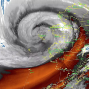
Typhoon Merbok Disaster Emergency Recovery Efforts

Connecting with our stakeholders - developing a better understanding of use and usability for science products

Building a Coastal Flood Hazard Assessment and Adaptation Strategy with At-Risk Communities of Alaska

Coastal Storm Modeling System (CoSMoS)
Science and Products
Typhoon Merbok Disaster Recovery Project: Accomplishments
Typhoon Merbok Disaster Emergency Recovery Efforts
Connecting with our stakeholders - developing a better understanding of use and usability for science products
Building a Coastal Flood Hazard Assessment and Adaptation Strategy with At-Risk Communities of Alaska