
Photo taken from a bridge over Ferguson Marsh. Hydrologic technicians Ryan and Justin kayaking through Ferguson Marsh to identify sampling locations for potential CyanoHABs.
Images
Images intro.
Filter Total Items: 96

Identifying Sampling Locations
Photo taken from a bridge over Ferguson Marsh. Hydrologic technicians Ryan and Justin kayaking through Ferguson Marsh to identify sampling locations for potential CyanoHABs.

Collecting florescence field reading
USGS scientist, Kyle Puls, collecting a florescence field reading at DeSoto, KS.
USGS scientist, Kyle Puls, collecting a florescence field reading at DeSoto, KS.

Collecting a florescence field reading at DeSoto, KS
Collecting a florescence field reading at DeSoto, KSUSGS scientist, Kyle Puls, collecting a florescence field reading at DeSoto, KS from a closer view.
Collecting a florescence field reading at DeSoto, KS
Collecting a florescence field reading at DeSoto, KSUSGS scientist, Kyle Puls, collecting a florescence field reading at DeSoto, KS from a closer view.

Dawn at WaterOne
The view from the WaterOne sampling location in Olathe, Kansas along the Kansas River on a late April morning. The sun is just starting to shred light over the hills in the background.
The view from the WaterOne sampling location in Olathe, Kansas along the Kansas River on a late April morning. The sun is just starting to shred light over the hills in the background.

Daytime sampling at WaterOne
USGS scientist, Talia Klein, sampling at the WaterOne monitor location on a sunny April afternoon.
USGS scientist, Talia Klein, sampling at the WaterOne monitor location on a sunny April afternoon.

Water sampling at WaterOne
USGS scientist, Talia Klein, sampling at the WaterOne monitor location on a cold day in March.
USGS scientist, Talia Klein, sampling at the WaterOne monitor location on a cold day in March.
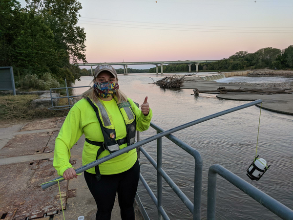
USGS scientist prepares to collect a red-dye sample in Olathe, Kansas
USGS scientist prepares to collect a red-dye sample in Olathe, KansasUSGS scientist Chantelle Davis prepares to collect a red-dye sample, at sunrise, for the Time of Travel study in Olathe, Kansas.
USGS scientist prepares to collect a red-dye sample in Olathe, Kansas
USGS scientist prepares to collect a red-dye sample in Olathe, KansasUSGS scientist Chantelle Davis prepares to collect a red-dye sample, at sunrise, for the Time of Travel study in Olathe, Kansas.

Collecting a red-dye sample in Olathe, Kansas
USGS scientist uses a weighted basket sampler to collect a Time of Travel red-dye sample at WaterOne in Olathe, Kansas.
USGS scientist uses a weighted basket sampler to collect a Time of Travel red-dye sample at WaterOne in Olathe, Kansas.
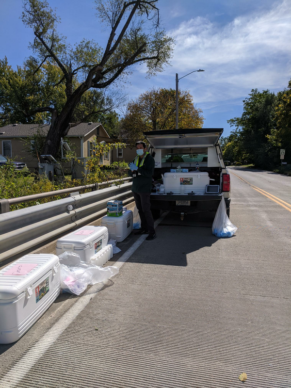
Samples collected during the red-dye study trial run in Desoto, Kansas
Samples collected during the red-dye study trial run in Desoto, KansasUSGS scientist watches over the many samples collected during the red-dye study trial run in Desoto, Kansas while he awaits the next sample.
Samples collected during the red-dye study trial run in Desoto, Kansas
Samples collected during the red-dye study trial run in Desoto, KansasUSGS scientist watches over the many samples collected during the red-dye study trial run in Desoto, Kansas while he awaits the next sample.
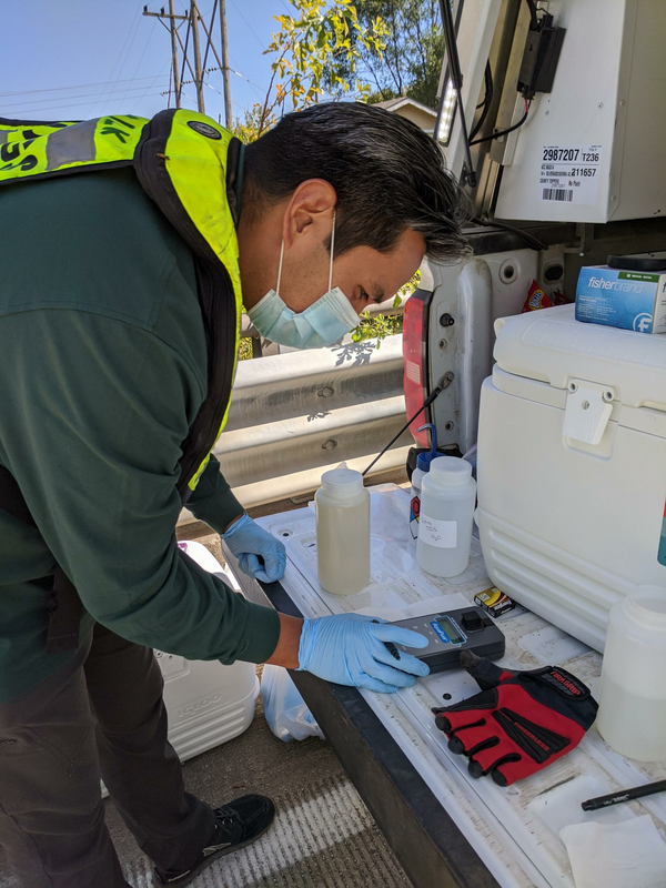
Getting a field fluorometer reading from a red-dye study sample
Getting a field fluorometer reading from a red-dye study sampleUSGS scientist Ian Gambill gets a field fluorometer reading from a recently collected red-dye study sample from the Kansas River in DeSoto, Kansas.
Getting a field fluorometer reading from a red-dye study sample
Getting a field fluorometer reading from a red-dye study sampleUSGS scientist Ian Gambill gets a field fluorometer reading from a recently collected red-dye study sample from the Kansas River in DeSoto, Kansas.

Kansas Landsat State Mosaic
Located just southeast of Osborne, Kansas, is the Geodetic Center of North America. The Geodetic Center is the initial point upon which all North American surveys, deeds, and maps are based.
Capital Topeka
Image Source Landsat 8
Population 2,937,880
Located just southeast of Osborne, Kansas, is the Geodetic Center of North America. The Geodetic Center is the initial point upon which all North American surveys, deeds, and maps are based.
Capital Topeka
Image Source Landsat 8
Population 2,937,880

View of Instrument Lab at the Organic Geochemistry Research Laboratory at the KS WSC
View of Instrument Lab at the Organic Geochemistry Research Laboratory at the KS WSCLab Instrumentation used for target analyses at the OGRL at the KS WSC. Image is of part of the Instrument Laboratory.
View of Instrument Lab at the Organic Geochemistry Research Laboratory at the KS WSC
View of Instrument Lab at the Organic Geochemistry Research Laboratory at the KS WSCLab Instrumentation used for target analyses at the OGRL at the KS WSC. Image is of part of the Instrument Laboratory.

Big Blue River near Manhattan, Kansas
Photograph of Big Blue River downstream of Tuttle Creek Reservoir showing the opposite riverbank covered in various foliage.
Photograph of Big Blue River downstream of Tuttle Creek Reservoir showing the opposite riverbank covered in various foliage.

ToT Kansas River at Topeka
Photo from the bank of the Kansas River at Topeka for the Time of Travel study.
Photo from the bank of the Kansas River at Topeka for the Time of Travel study.

Kansas River at Topeka
View of the sunrise from the Topeka water plant site (0688990) on the Kansas River.
View of the sunrise from the Topeka water plant site (0688990) on the Kansas River.

ToT Kansas River At Wamego
Photo from the bridge overlooking the Kansas River at Wamego for the Time of Travel study.
Photo from the bridge overlooking the Kansas River at Wamego for the Time of Travel study.

National Oil and Gas Assessment Provinces
This is a graphic from the USGS National Oil and Gas Assessment Explorer application, which allows user to drill into 70 oil and gas assessment provinces throughout the United States.
This is a graphic from the USGS National Oil and Gas Assessment Explorer application, which allows user to drill into 70 oil and gas assessment provinces throughout the United States.

Testing water
USGS scientists showing students how they test water samples in the lab.
USGS scientists showing students how they test water samples in the lab.

Water and Village model
USGS scientists showing students how water flows through a village using a model.
USGS scientists showing students how water flows through a village using a model.

Presenting a groundwater model
USGS scientist teaching students about the water cycle using a groundwater model for demonstration.
USGS scientist teaching students about the water cycle using a groundwater model for demonstration.

USGS scientists evaluating the nebulizer assembly
USGS scientists evaluating the nebulizer assembly in a mixed mode ionization source of a triple quadrupole mass spectrometer used to measure individual cyanotoxins
USGS scientists evaluating the nebulizer assembly in a mixed mode ionization source of a triple quadrupole mass spectrometer used to measure individual cyanotoxins