



Woods Hole Coastal and Marine Science Center Newsletter: Summer 2026
Our Science Stories
-
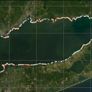
USGS Coastal Change Products Help the EPA Safeguard Long Island Sound Shorelines USGS Coastal Change Products Help the EPA Safeguard Long Island Sound Shorelines
The U.S. Environmental Protection Agency partnered with the USGS to expand and update the National Shoreline Change database and the Coastal Change Likelihood assessment for Long Island Sound. These products help improve understanding of past, present, and future shoreline and coastal landscape change that may impact communities, resources, and infrastructure along the Long Island Sound coast.
-
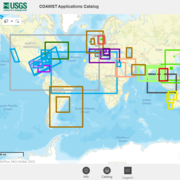
Explore Global Coastal Research Using the COAWST Applications Catalog Explore Global Coastal Research Using the COAWST Applications Catalog
Around the world, scientists are using the Coupled Ocean-Atmosphere-Waves-Sediment Transport (COAWST) Modeling System to better understand and forecast short-term changes in coastal conditions. To showcase the breadth of this work, the USGS developed the COAWST Applications Catalog—a collection of published COAWST-based studies spanning multiple countries, coastlines, and scientific questions.
-
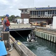
SEABOSS 3.0 Reaches New Milestone with Successful Testing SEABOSS 3.0 Reaches New Milestone with Successful Testing
The next generation of the Seabed Observation and Sampling System—SEABOSS 3.0—is steadily coming to life. Building on months of cross‑center planning and knowledge sharing, the Woods Hole Coastal and Marine Science Center team recently hosted Pacific Coastal and Marine Science Center ocean engineer Gerry Hatcher for a week of instrument assembly, refinement, and testing in Woods Hole, MA.
-
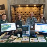
USGS Scientists at the 2026 Long Island Sound Research Conference USGS Scientists at the 2026 Long Island Sound Research Conference
The 2026 Long Island Sound Research Conference brings together researchers, managers, academia, and community partners to share the latest science and strengthen collaborations focused on the future of Long Island Sound. This year, the U.S. Geological Survey (USGS) highlighted a range of ocean, coastal, and watershed science needed to better understand the Sound today and prepare for tomorrow.
-
Sound Waves Newsletter: Summer 2026 Sound Waves Newsletter: Summer 2026
Read stories about tracking coastal change from Hurricanes Helene and Milton, beach nourishment morphodynamics, rising sea levels, and so much more.
Highlight: A Summer of Seafloor Mapping
Our seafloor mapping group had a productive summer filled with testing and fine-tuning new equipment, collecting sediment core samples from the ocean bottom, and conducting several mapping surveys throughout the Northeast, including a search for a fragments of a meteorite believed to have fallen into Cape Cod Bay.
Piston and Vibracoring
Researchers collected sediment cores from Buzzards Bay and the Gulf of Maine using piston and vibracoring tools. These samples provide a record of past environmental conditions and help scientists understand how coastal and offshore environments changed over time. The work was conducted aboard the R/V Tioga and the R/V Gulf Challenger in collaboration with partners from the USGS St. Petersburg Coastal and Marine Science Center, University of New Hampshire, and WHOI.
SEABOSS 3.0 and 2.1 Testing
The Sea Floor Mapping Group continued testing and refinement of the next-generation Seabed Observation and Sampling System (SEABOSS 3.0) while also evaluating upgrades to SEABOSS 2.1. Testing was conducted at the Woods Hole Oceanographic Institution (WHOI) dock, aboard the R/V Tioga in Vineyard Haven, and aboard the R/V Gulf Challenger in the Gulf of Maine. The improved system is designed to extend capabilities into deeper water (up to 500 meters), enhancing the collection of seafloor imagery and sediment samples used to characterize marine habitats and geologic environments.
Multibeam Sonar Surveys
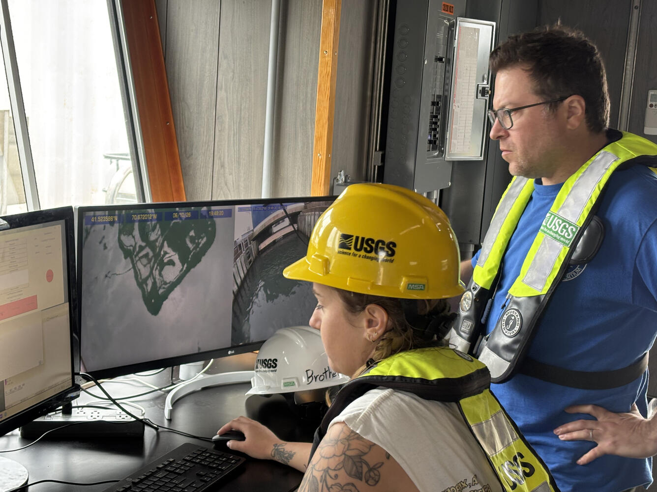
The group conducted multibeam sonar surveys in Vineyard Sound near Aquinnah, Massachusetts, and supported additional bathymetric mapping efforts throughout the summer. Multibeam sonar uses sound waves to create highly detailed maps of the seafloor, providing critical information for studies of marine geology, habitat characterization, sediment transport, coastal hazards, and resource management. The team also used multibeam technology to map the predicted Cape Cod Bay meteorite fall zone in an effort to identify seafloor features that may indicate meteorite fragments.
Search for a Fallen Meteorite
In September, USGS and WHOI scientists launched a marine survey in Cape Cod Bay to search for fragments from a meteorite that is believed to have entered the bay. Using multibeam sonar and existing geologic mapping datasets, the team compared newly collected seafloor data with earlier surveys to look for changes that could indicate the presence of meteorite fragments.
Subbottom Sonar Surveys
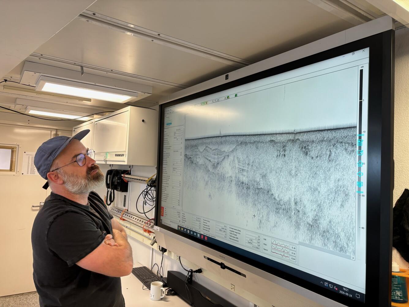
Subbottom sonar surveys in the Gulf of Maine helped scientists image sediments and geologic structures buried beneath the seafloor. Working aboard the R/V Gulf Surveyor, researchers collected data that will improve understanding of the region's geologic framework and support ongoing investigations of marine hazards, resources, and environmental change.
Publications & Data Releases
Publications
Ganju, N.K., Bales, R.D., Suttles, S.E., De Meo, O.A., Marsjanik, E.D., Teng, W., Miselis, J.L., and Smith, J.A.M., 2026, Salt marsh establishment controlled by sediment availability, landscape position, and anthropogenic history: Environmental Research Communications, v. 8, no. 6. https://doi.org/10.1088/2515-7620/ae7307.
ten Brink, U., Flores, C., Foster, D., Granja-Bruña, J.L., Baldwin, W., Harmon, N., Heller, S., and Han, S., 2026, Fault Sources of the 2020 Southern Puerto Rico Seismic Sequence and the Regional Tectonic Structure: Seismological Research Letters. https://doi.org/10.1785/0220250340.
Liu, M., Pohlman, J.W., Waite, W.F., Pohl, M., Jarvis, K., Atallah, C., Poston, J.A., Campbell, P., Collett, T.S., Myshakin, E., and Seol, Y., 2026, Oil in Alaska North Slope Gas Hydrate Reservoir: Micro-CT and Flow Simulation Insights into Permeability: Energy Fuels, 40 (26), 13879–13888. https://doi.org/10.1021/acs.energyfuels.5c04863.
Osland, M.J., Chivoiu, B., Buffington, K.J., Byrd, K.B., Carr, J.A., Drexler, J.Z., Enwright, N.M., Ganju, N.K., Grace, J.B., Grossman, E.E., Guntenspergen, G.R., Kowalski, K.P., Krauss, K.W., Lacy, J.R., Noe, G.B., Passeri, D.L., Romañach, S.S., Smith, C.G., Stagg, C.L., Thorne, K.M., and Keough, J.R., 2026, Loss and Transformation of Coastal Wetlands due to Global Change in the Conterminous United States: Past, Present, and Future. Wetlands, v. 46, no. 73. https://doi.org/10.1007/s13157-026-02087-y.
Naseri, K., Hummel, M.A., Befus, K.M., Smith, T., Eagle, M.J., and Kroeger, K.D., 2026, Ecogeomorphologic Response of a Tidally Restricted Salt Marsh to Tidal Restoration and Sea-Level Rise: Water Resources Research, v. 62, issue 7, e2025WR042112. https://doi.org/10.1029/2025WR042112.
Ayhan, B.U., Parlak, M.S., Warner, J.C., Kalra, T.S., and Safak, I., 2026, Impacts of Cross-Shore Winds, Waves, and Sand Ridges on Inner Shelf Circulation: Journal of Geophysical Research, v. 131, issue 9, e2025JC023593. https://doi.org/10.1029/2025JC023593.
Scholl, V. M., Cramer, J. M., Evans, A. D., Cox, E. M., and Kokaly, R. F., 2026, A Methods Framework for Evaluating Measurement Consistency Across Spectrometers for Multispectral Uncrewed Aerial System Vegetation Mapping Applications: Drones, v.10, issue 9, 674. https://doi.org/10.3390/drones10090674.
Ruppel, C., and Dalyander, P.A., comps., 2026, Coastal and Marine Hazards and Resources Program decadal science strategy 2020–2030: U.S. Geological Survey Circular 1569, 23 p., https://doi.org/10.3133/cir1569.
Phillips, S.C., Waite, W.F., Yoneda, J., Haines, S.S., Hiruta, A., Holland, M.E., Schultheiss, P.J., and Collett, T.S., Lithological Control of Gas Hydrate Saturation Determined by Pressure Core Analysis in Subpermafrost Reservoirs of the Alaska North Slope (HYDRATE-02 Geo Data Well): Energy Fuels, 40 (38): 21224–21240. https://doi.org/10.1021/acs.energyfuels.5c04960.
Pohlman, J.W., Casso, M., Boze, L., Waite, W.F., Phillips, S.C., Ruppel, C., Holland, M., Yoneda, J., Oshima, M., Hiruta, A., and Collett, T.S., 2026, Production of Secondary Microbial Methane from a Gas Hydrate-Bearing Reservoir at the HYDRATE P1 Production Test Well (PTW-1) on the Alaskan North Slope: Energy Fuels. https://doi.org/10.1021/acs.energyfuels.5c06364.
Data Releases
Millo, A., Brosnahan, S.M., Ackerman, S.D., Over, J.R., and Cramer, J.M., 2026, Topographic data, aerial imagery, and GPS data collected during uncrewed aircraft system (UAS) operations at Lower Darby Creek, Darby Township, Pennsylvania, March to August 2025 (ver. 2.0, September 2026): U.S. Geological Survey data release, https://doi.org/10.5066/P13TQ8E7.
Kratzmann, M.G., Farris, A.S., and Weber, K.M., 2026, National Shoreline Change—A GIS compilation of vector shorelines and associated shoreline change data from the 1800s to the 2020s for the coast of Alabama: U.S. Geological Survey data release, https://doi.org/10.5066/P1JE2KSO.
De Meo, O.A., Suttles, S.E., Marsjanik, E.D., and Sherwood, C.R., 2026, Meteorological data from Cape Cod National Seashore, Massachusetts: U.S. Geological Survey data release, https://doi.org/10.5066/P9C3GSO1.
Defne, Z., and Ganju, N.K., 2026, Wave power, erosion rates, and areal loss of marshes in Chesapeake Bay: U.S. Geological Survey data release, https://doi.org/10.5066/P14HQC7K.
Ackerman, K.V., Defne, Z., and Ganju, N.K., 2026, Geospatial characterization of New Hampshire salt marshes: U.S. Geological Survey data release, https://doi.org/10.5066/P1ZPM9EQ.
Ackerman, K.V., Defne, Z., Andrews, B.D., and Ganju, N.K., 2026, Marsh migration potential in response to sea-level rise in the northeastern United States: U.S. Geological Survey data release, https://doi.org/10.5066/P14EJ3LQ.
Warner, J.C., Carson, M., and Mason, R.A., 2026, U.S. Geological Survey simulations of waves and ocean dynamics during Hurricanes Ian (2022), Idalia (2023), and Helene (2024): U.S. Geological Survey data release, https://doi.org/10.5066/P13YBSFJ.
Kratzmann, M.G., Farris, A.S., and Weber, K.M., 2026, National Shoreline Change—A GIS compilation of vector shorelines and associated shoreline change data from the 1800s to the 2020s for the coast of Mississippi: U.S. Geological Survey data release, https://doi.org/10.5066/P143KMGS.
Ackerman, S.D., Worley, C.R., Munnelly, M.K., Conroy, C.W., Randolph, K., Zajac, R., Babb, I.G., Auster, P.J., Matassa, C.M., and O'Donnell, J., 2026, Sea-floor sediment and imagery data collected in Long Island Sound, Connecticut and New York, during LISMaRC-USGS survey 2023-008-FA: U.S. Geological Survey data release, https://doi.org/10.5066/P13HDQXG.
Cramer, J.M., Over, J.R., Millo, A., Brosnahan, S.M., Ackerman, S.D., and Eagle, M.J., 2026, Topographic data, aerial imagery, and GPS data collected during uncrewed aircraft system (UAS) operations at Laudholm Marsh, Wells, Maine, December 1, 2025: U.S. Geological Survey data release, https://doi.org/10.5066/P14UYWRM.
Curran, B.J., and Brothers, L.L., 2025, GeoPackage of seabed hazards for offshore infrastructure, U.S. Atlantic and Pacific continental shelves: U.S. Geological Survey data release, https://doi.org/10.5066/P1SLUTW9.