



Sound Waves Newsletter: Summer 2026
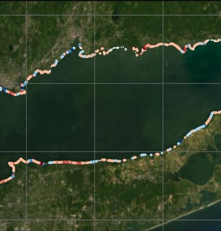
USGS Coastal Change Products Help the EPA Safeguard Long Island Sound Shorelines
The U.S. Environmental Protection Agency partnered with the USGS to expand and update the National Shoreline Change database and the Coastal Change Likelihood assessment for Long Island Sound. These products help improve understanding of past, present, and future shoreline and coastal landscape change that may impact communities, resources, and infrastructure along the Long Island Sound coast.
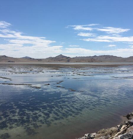
Great Salt Lake sediments record thousands of years of earthquake history
As the largest lake west of the Mississippi River with an average depth of around five meters (~16 feet), the Great Salt Lake offers an opportunity to explore acoustic and sedimentary archives of earthquake ruptures in a shallow terminal basin. A new USGS study addresses questions related to how Great Salt Lake sediments respond to surface rupture and earthquake shaking.
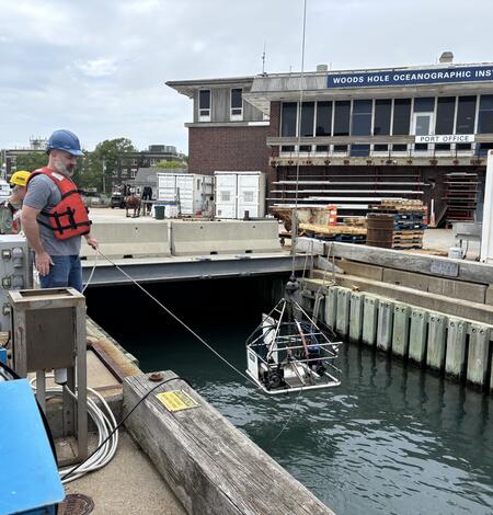
SEABOSS 3.0 Reaches New Milestone with Successful Testing
The next generation of the Seabed Observation and Sampling System—SEABOSS 3.0—is steadily coming to life. Building on months of cross‑center planning and knowledge sharing, the Woods Hole Coastal and Marine Science Center team recently hosted Pacific Coastal and Marine Science Center ocean engineer Gerry Hatcher for a week of instrument assembly, refinement, and testing in Woods Hole, MA.
USGS Remote Sensing Data Tracks Coastal Change from Hurricanes Helene and Milton

Beach nourishment morphodynamics at the Columbia River Mouth
Beach nourishment projects are often judged by how long newly placed sand remains on the beach. But new research suggests that even when nourishment appears to disappear quickly, it may continue providing important coastal benefits beneath the waves.
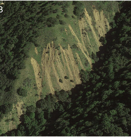
In SF Bay, even an exceptionally wet year can’t supply enough sediment to keep pace with rising seas, new study finds
Extreme rainfall can send huge amounts of sediment rushing off hillsides and into streams. But a new USGS study finds that even an exceptionally wet year may deliver only a small fraction of that sediment to San Francisco Bay—far short of what is needed to help coastal wetlands and shorelines keep pace with rising sea levels.
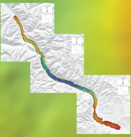
High-resolution bathymetry of Lake Chelan, Washington
In 2023, the U.S. Geological Survey completed a 3-week field operation in Lake Chelan, Washington, the third deepest lake in the conterminous United States, to acquire sediment cores, high-resolution bathymetry data, and chirp sub-bottom profiles.
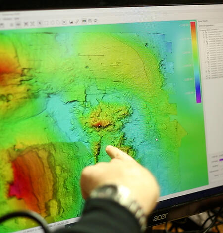
A mid-ocean ridge revealed by 3D magnetic modeling: New geologic map of Escanaba Trough
Nearly two hundred miles offshore of the Oregon/California border lies Escanaba Trough, a unique mid-ocean ridge covered in deep sediment up to 500 meters thick, dotted with active hydrothermal vent systems. Detailed study of its geologic structure has long been hindered by those thick layers of sediment—until now.
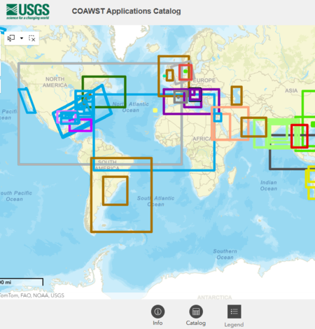
Explore Global Coastal Research Using the COAWST Applications Catalog
Around the world, scientists are using the Coupled Ocean-Atmosphere-Waves-Sediment Transport (COAWST) Modeling System to better understand and forecast short-term changes in coastal conditions. To showcase the breadth of this work, the USGS developed the COAWST Applications Catalog—a collection of published COAWST-based studies spanning multiple countries, coastlines, and scientific questions.
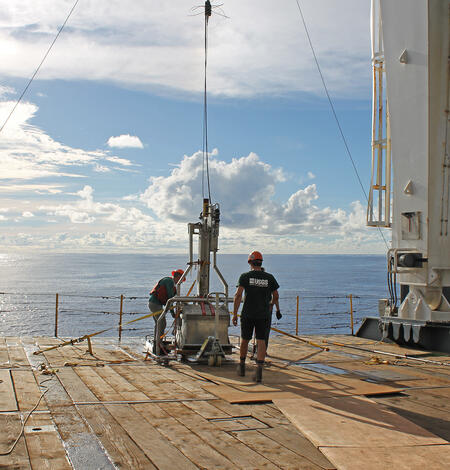
USGS Releases Expedition Report for Samoa Basin Box Coring Effort
On leg three of the American Samoa Mapping Project, an interagency-supported hydrograph survey project led by NOAA and in partnership with BOEM, USGS collected box cores and interdisciplinary datasets to inform prospectivity analyses throughout the region.
-
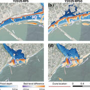
Morphodynamics of dune-based coastal flood mitigation under sea-level rise Morphodynamics of dune-based coastal flood mitigation under sea-level rise
Natural and engineered sand dunes serve as barriers to protect against storms. Engineered sand dunes, called "Nature-based Solutions", are increasingly being used for coastal protection, yet their effectiveness remains understudied. New research finds that dunes' flood protection benefits depend not only on the size of the storm, but also on how the dunes themselves change during the event.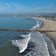
Decades of satellite imagery show how groins reshape California beaches Decades of satellite imagery show how groins reshape California beaches
Long-term satellite observations show how human-built coastal structures influence the movement and buildup of sand along three Southern California beaches: Ventura, Santa Monica and Newport Beach.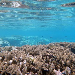
Waves, not just runoff, drive sediment buildup on American Samoa coral reefs Waves, not just runoff, drive sediment buildup on American Samoa coral reefs
Sediment washing into coral reefs from land has long been viewed as one of the biggest threats to reef health. But new research from USGS and collaborators indicates that what happens after sediment reaches the reef may be just as important as where it comes from.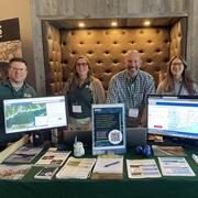
USGS Scientists at the 2026 Long Island Sound Research Conference USGS Scientists at the 2026 Long Island Sound Research Conference
The 2026 Long Island Sound Research Conference brings together researchers, managers, academia, and community partners to share the latest science and strengthen collaborations focused on the future of Long Island Sound. This year, the U.S. Geological Survey (USGS) highlighted a range of ocean, coastal, and watershed science needed to better understand the Sound today and prepare for tomorrow.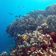
USGS Scientist Contributes to World Ocean Assessment USGS Scientist Contributes to World Ocean Assessment
USGS Research Geologist Curt Storlazzi is among more than 650 international scientists contributing to the United Nations' third World Ocean Assessment, now available in a dynamic, easy-to-navigate web format.
-
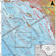
New high-resolution geophysics in the Outer California Borderland New high-resolution geophysics in the Outer California Borderland
A new study focused on the Cortes Basin, located within the Outer California Borderland offshore of southern California, presents detailed evidence of numerous stacked submarine landslides on and beneath the seafloor. The research provides new insights into how offshore fault systems and changing sea levels have shaped this region.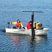
Woods Hole Coastal and Marine Science Center: 2025 Annual Report Woods Hole Coastal and Marine Science Center: 2025 Annual Report
This annual report summarizes the work of the U.S. Geological Survey (USGS) Woods Hole Coastal and Marine Science Center and highlights accomplishments from fiscal year 2025—October 1, 2024–December 1, 2025.