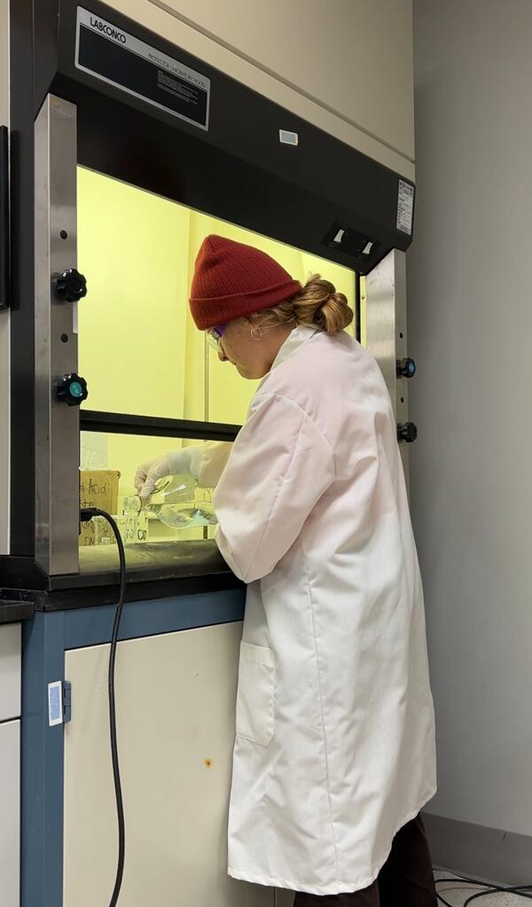
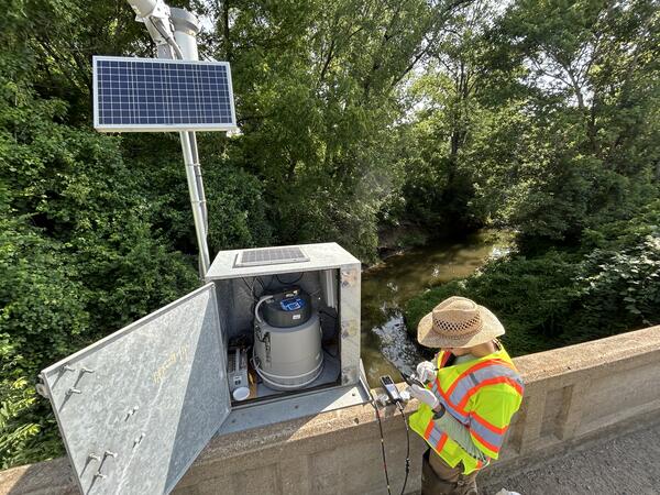
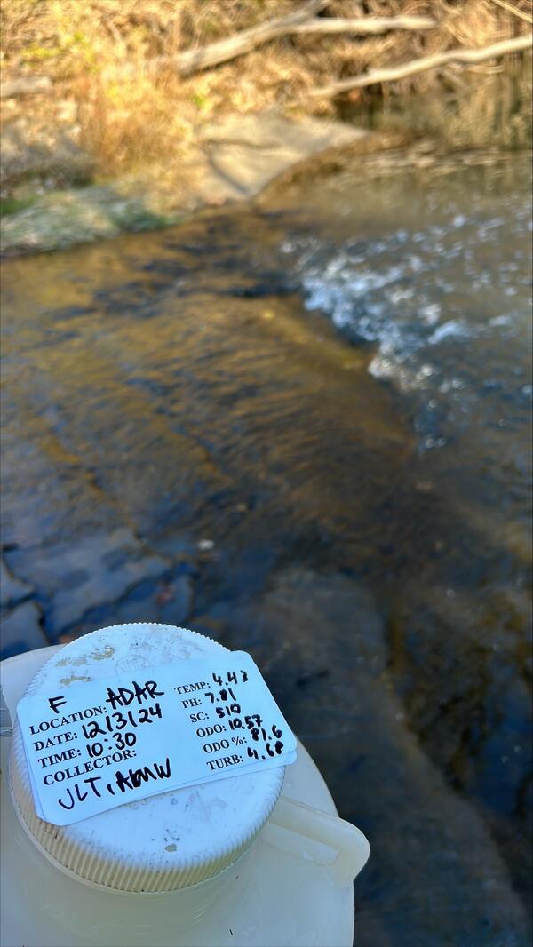
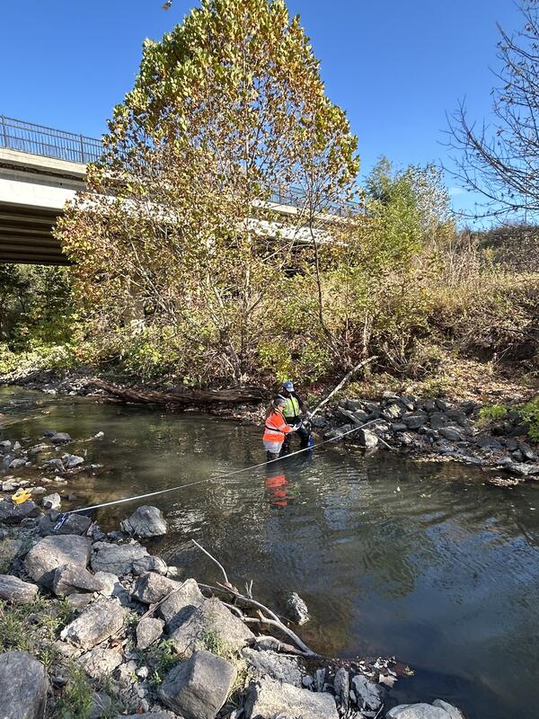
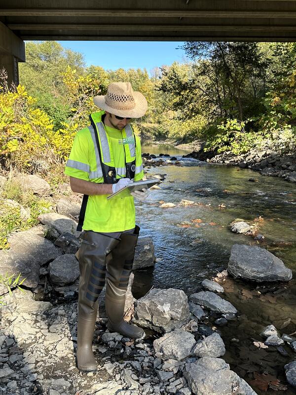
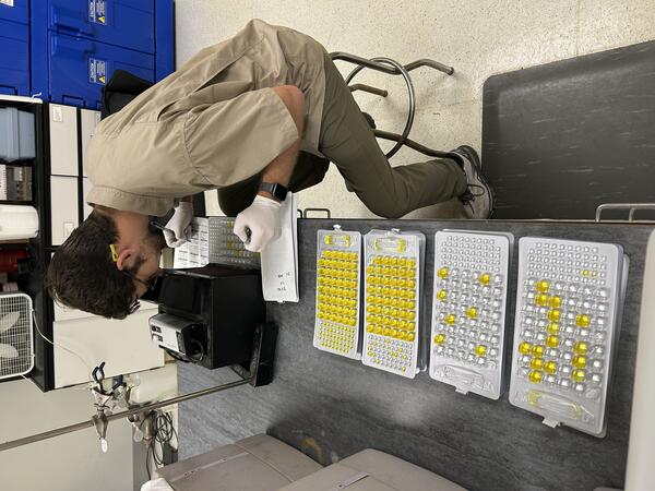
Randi Owens, a USGS hydrologic technician, prepares to lower an acoustic doppler current profiler device into the South Grand River in Urich, Missouri, to measure river flooding April 29. This device uses sound waves to measure streamflow. USGS photo by Chris Drummond.
Images
![A USGS hydrologic technician prepares to lift an orange streamflow measuring device onto the ledge of a bridge.](https://d9-wret.s3.us-west-2.amazonaws.com/assets/palladium/production/s3fs-public/styles/masonry/public/media/images/Media%20%285%29.jpg?itok=LdyWWndM)
Randi Owens, a USGS hydrologic technician, prepares to lower an acoustic doppler current profiler device into the South Grand River in Urich, Missouri, to measure river flooding April 29. This device uses sound waves to measure streamflow. USGS photo by Chris Drummond.
![A USGS hydrologic technician on a bridge guides an orange streamflow measuring device across a river to measure flooding](https://d9-wret.s3.us-west-2.amazonaws.com/assets/palladium/production/s3fs-public/styles/masonry/public/media/images/Media%20%281%29%20copy.jpg?itok=19vzb9Ja)
Randi Owens, a USGS hydrologic technician, guides an acoustic doppler current profiler device across the South Grand River in Urich, Missouri, to measure river flooding April 29. USGS photo by Chris Drummond.
Picture of Paul H Rydlund, new profile picture. Picture was taking on 12/21/2023.
At the USGS, we monitor our nation’s water. Our data informs many people, from kayakers to water managers. Gage Greatness allows any Twitter user to vote for their favorite gage (data collection station).
![Illinois River Basin Airborne Electromagnetic Study Area](https://d9-wret.s3.us-west-2.amazonaws.com/assets/palladium/production/s3fs-public/styles/masonry/public/media/images/IL_AEM_Map.png?itok=STZffBTc)
This map shows the airborne geophysical survey area and planned flight paths across the Illinois River Basin in Illinois and northwest Indiana. Surveys will not occur directly over areas that are populated. Planned flight lines and survey progress can be found online.
(USGS map)
This map shows the airborne geophysical survey area and planned flight paths across the Illinois River Basin in Illinois and northwest Indiana. Surveys will not occur directly over areas that are populated. Planned flight lines and survey progress can be found online.
(USGS map)
National Park Service Biological Technician Eileen Kramer harvests her first white-tailed deer in New York.
![Man and child in camouflage smiling for camera with hunted deer in foreground](https://d9-wret.s3.us-west-2.amazonaws.com/assets/palladium/production/s3fs-public/styles/masonry/public/media/images/whitetaildeerhighspringsflorida.jpg?itok=vBb4-U14)
USGS Research Biologist Nathan Johnson’s son Bryce harvests his first white-tailed deer on private property near High Springs, Florida.
![CMWSC Technician prepares to monitor lake bathymetric data.](https://d9-wret.s3.us-west-2.amazonaws.com/assets/palladium/production/s3fs-public/styles/masonry/public/media/images/CMWSC_Tech_on_the_Water.jpg?itok=DOiK62r1)
USGS, Central Midwest Water Science, Hydrologic Technician, Daniel Grant is preparing to monitor lake bathymetric data on a Cook County Illinois lake.
![Hydro technician prepares to sample bathymetric data](https://d9-wret.s3.us-west-2.amazonaws.com/assets/palladium/production/s3fs-public/styles/masonry/public/media/images/CMWSC_Bathy.png?itok=F-X9QEs1)
USGS Central Midwest Water Science Center hydrologic technician Josh Keele monitors lake bathymetric data as its collected from an Acoustic Doppler Current Profiler (ADCP) mounted on a tethered trimaran with real-time GPS positioning.
Connecting MBES data on Hazel Creek Lake near Kirksville MO. April 2021. Photo by Rick Huizinga (USGS).
The Ecomapper is an autonomous underwater vehicle (AUV) that is a specialized submersibile device that operates by propelling through a water body between points along a constant depth.
Fog Over Glacial Ridge National Wildlife Refuge
![Sandhill Cranes at Glacial Ridge National Wildlife Refuge](https://d9-wret.s3.us-west-2.amazonaws.com/assets/palladium/production/s3fs-public/styles/masonry/public/thumbnails/image/Sandhill%20cranes.jpg?itok=-waJ32ZM)
Sandhill Crane Pair in flight at Glacial Ridge National Wildlife Refuge
![Young Moose, Glacial Ridge National Wildlife Refuge](https://d9-wret.s3.us-west-2.amazonaws.com/assets/palladium/production/s3fs-public/styles/masonry/public/thumbnails/image/Young%20moose.jpg?itok=MJwc2Ceh)
Young moose near Benoit, Minnesota, Glacial Ridge National Wildlife Refuge
Ephemeral wetlands at Glacial Ridge National Wildlife Refuge
A well at a restored prairie on Lake Agassiz beach ridge, Glacial Ridge National Wildlife Refuge
USGS hydrologist Tim Cowdery titrates water alkalinity in a mobile sampling van using an electronic field form.
Beach-ridge prairie at Glacial Ridge National Wildlife Refuge
Morning fog over beach ridges at Glacial Ridge National Wildlife Refuge
![Prairie Dog, Glacial Ridge Refuge](https://d9-wret.s3.us-west-2.amazonaws.com/assets/palladium/production/s3fs-public/styles/masonry/public/thumbnails/image/Prairie%20dog.jpg?itok=6ac_5ziG)
Prairie Dog, Glacial Ridge National Wildlife Refuge
![Groundwater Sampling, Glacial Ridge Refuge](https://d9-wret.s3.us-west-2.amazonaws.com/assets/palladium/production/s3fs-public/styles/masonry/public/thumbnails/image/Technician%20sampling%20groundwater.jpg?itok=DJUKEcfN)
USGS technician Jody Hulne collects a groundwater nutrient sample at Glacial Ridge National Wildlife Refuge.