View from bridge at East Fork Little Blue River streamgage location.
https://waterdata.usgs.gov/monitoring-location/USGS-06893890/

Official websites use .gov
A .gov website belongs to an official government organization in the United States.
Secure .gov websites use HTTPS
A lock () or https:// means you’ve safely connected to the .gov website. Share sensitive information only on official, secure websites.
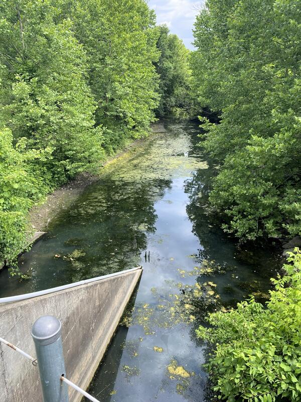
View from bridge at East Fork Little Blue River streamgage location.
https://waterdata.usgs.gov/monitoring-location/USGS-06893890/
View from bridge at East Fork Little Blue River streamgage location.
https://waterdata.usgs.gov/monitoring-location/USGS-06893890/

This map shows the airborne geophysical survey area and planned flight paths across the Illinois River Basin in Illinois and northwest Indiana. Surveys will not occur directly over areas that are populated. Planned flight lines and survey progress can be found online.
(USGS map)
This map shows the airborne geophysical survey area and planned flight paths across the Illinois River Basin in Illinois and northwest Indiana. Surveys will not occur directly over areas that are populated. Planned flight lines and survey progress can be found online.
(USGS map)

National Park Service Biological Technician Eileen Kramer harvests her first white-tailed deer in New York.
National Park Service Biological Technician Eileen Kramer harvests her first white-tailed deer in New York.
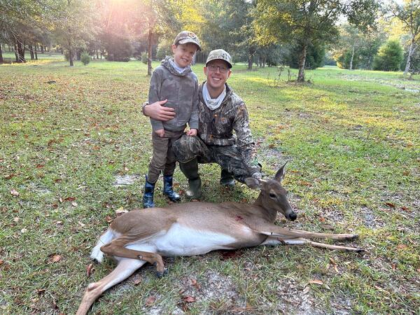
USGS Research Biologist Nathan Johnson’s son Bryce harvests his first white-tailed deer on private property near High Springs, Florida.
USGS Research Biologist Nathan Johnson’s son Bryce harvests his first white-tailed deer on private property near High Springs, Florida.

USGS, Central Midwest Water Science, Hydrologic Technician, Daniel Grant is preparing to monitor lake bathymetric data on a Cook County Illinois lake.
USGS, Central Midwest Water Science, Hydrologic Technician, Daniel Grant is preparing to monitor lake bathymetric data on a Cook County Illinois lake.

USGS Central Midwest Water Science Center hydrologic technician Josh Keele monitors lake bathymetric data as its collected from an Acoustic Doppler Current Profiler (ADCP) mounted on a tethered trimaran with real-time GPS positioning.
USGS Central Midwest Water Science Center hydrologic technician Josh Keele monitors lake bathymetric data as its collected from an Acoustic Doppler Current Profiler (ADCP) mounted on a tethered trimaran with real-time GPS positioning.

The Ecomapper is an autonomous underwater vehicle (AUV) that is a specialized submersibile device that operates by propelling through a water body between points along a constant depth.
The Ecomapper is an autonomous underwater vehicle (AUV) that is a specialized submersibile device that operates by propelling through a water body between points along a constant depth.

A well at a restored prairie on Lake Agassiz beach ridge, Glacial Ridge National Wildlife Refuge
A well at a restored prairie on Lake Agassiz beach ridge, Glacial Ridge National Wildlife Refuge

Morning fog over beach ridges at Glacial Ridge National Wildlife Refuge
Morning fog over beach ridges at Glacial Ridge National Wildlife Refuge

Prairie Dog, Glacial Ridge National Wildlife Refuge
Prairie Dog, Glacial Ridge National Wildlife Refuge
Fog Over Glacial Ridge National Wildlife Refuge
Fog Over Glacial Ridge National Wildlife Refuge

Sandhill Crane Pair in flight at Glacial Ridge National Wildlife Refuge
Sandhill Crane Pair in flight at Glacial Ridge National Wildlife Refuge

Young moose near Benoit, Minnesota, Glacial Ridge National Wildlife Refuge
Young moose near Benoit, Minnesota, Glacial Ridge National Wildlife Refuge

Ephemeral wetlands at Glacial Ridge National Wildlife Refuge
Ephemeral wetlands at Glacial Ridge National Wildlife Refuge

USGS hydrologist Tim Cowdery titrates water alkalinity in a mobile sampling van using an electronic field form.
USGS hydrologist Tim Cowdery titrates water alkalinity in a mobile sampling van using an electronic field form.

Beach-ridge prairie at Glacial Ridge National Wildlife Refuge
Beach-ridge prairie at Glacial Ridge National Wildlife Refuge

USGS technician Jody Hulne collects a groundwater nutrient sample at Glacial Ridge National Wildlife Refuge.
USGS technician Jody Hulne collects a groundwater nutrient sample at Glacial Ridge National Wildlife Refuge.

This photo was taken August 27, 2019, at a well in a Minneapolis suburb. Paul Bradley, Research Hydrologist/Ecologist, and Co-lead of the Environmental Health Program, Water and Wastewater Infrastructure Project, is the USGS Scientist pictured in the photograph.
This photo was taken August 27, 2019, at a well in a Minneapolis suburb. Paul Bradley, Research Hydrologist/Ecologist, and Co-lead of the Environmental Health Program, Water and Wastewater Infrastructure Project, is the USGS Scientist pictured in the photograph.

Entrance for the Urbana, IL office of the Central Midwest Water Science Center. Located in the North deck parking garage on the University of Illinois campus. Entrance is on east side of building; address 405 N Goodwin Ave, Urbana, IL 6180. Contact office for visitor parking information at 217-328-8747.
Entrance for the Urbana, IL office of the Central Midwest Water Science Center. Located in the North deck parking garage on the University of Illinois campus. Entrance is on east side of building; address 405 N Goodwin Ave, Urbana, IL 6180. Contact office for visitor parking information at 217-328-8747.

USGS hydrologist Taylor Dudunake assesses the rip-rap countermeasure along the pier of the Iowa State Route 76 bridge over the Upper Iowa River near Dorchester, Iowa. The assessment was part of a nationwide study of bridge scour countermeasures the USGS conducted on behalf of the Federal Highway Administration.
USGS hydrologist Taylor Dudunake assesses the rip-rap countermeasure along the pier of the Iowa State Route 76 bridge over the Upper Iowa River near Dorchester, Iowa. The assessment was part of a nationwide study of bridge scour countermeasures the USGS conducted on behalf of the Federal Highway Administration.
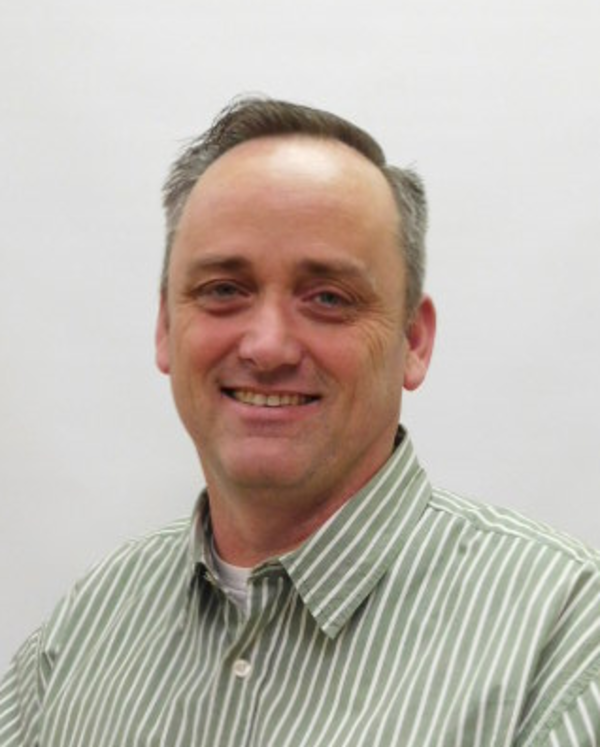
Vincent Delaney, dark hair with grey highlights, smiling, and wearing a collared shirt with green vertical pin stripes.
Vincent Delaney, dark hair with grey highlights, smiling, and wearing a collared shirt with green vertical pin stripes.