
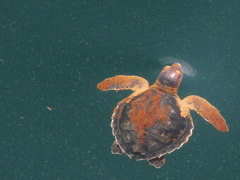
Crude oil or oil distilled product (e.g. gasoline, diesel fuels, jet fuels) spills can occur during oil exploration, production, and transportation activities. Environmental impacts of spills are complex and can be difficult to assess. The chemical makeup of oil and oil products is diverse which affects oil behavior (e.g. volatilization, sinking). Oil degradation and fate are also influenced by environmental factors such as salinity, temperature, and surface vs underground spills. Oil can impact living organisms both directly (dermal contact, inhalation, ingestion) and indirectly (bioaccumulation in food sources, disruption of recreational activities). USGS scientists have decades of experience supporting assessment and restoration activities for the largest oil spills in U.S history, Exxon Valdez Oil Spill and Deepwater Horizon Oil Spill. Examples include oil spill remote sensing, vegetation surveys, ecotoxicological impacts, marsh ecology impacts, sea turtle modelling, immunosuppression of oiled biota, coral ecology, and avian and mammalian injury and recovery.
To learn more about how USGS science supports the NRDAR program contact Jo Ellen Hinck, the USGS NRDAR Coordinator.
Return to USGS Science for DOI Natural Resource Damage Assessment and Restoration (NRDAR) Program
Browse USGS publications related to NRDAR oil spill cases.
Examples of assessment and restoration projects are below.
Assessment Projects
- Histopathology of Bird Carcasses
Principal Investigator - Julia Lankton
- Ambient Water Concentrations of PAHs at an Oil Spill Using Semi-Permeable Membrane Devices (SPMDs)
Principal Investigator - David Alvarez
- PAH Analysis in Bile from Fish Near an Oil Spill
Principal Investigator - David Alvarez
- Remote Sensing Estimation of Surface Oil Volume During the 2010 Deepwater Horizon Oil Blowout in the Gulf of Mexico
Principal Investigator - Gregg Swayze
Restoration Projects

- Population Dynamics Model for Least Bell's Vireo Restoration after the Santa Clara River Oil Spill
Principal Investigator - Barbara Kus
- Enhancing Prey Availability for Wintering and Migrating Surf Scoters Damaged by the Cosco Busan Oil Spill
Principal Investigator - Susan De La Cruz
- Marbled Murrelet at Sea Survey, Cosco Busan Oil Spill
Principal Investigator - Josh Adams
- Detecting and Inferring Cause of Change in an Alaska Nearshore Marine Ecosystem
Principal Investigator - James L Bodkin
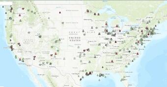
Explore the NRDAR Case Map and Document Library to learn more about individual cases.
Return to USGS Science for DOI Natural Resource Damage Assessment and Restoration (NRDAR) Program
Crude oil or oil distilled product (e.g. gasoline, diesel fuels, jet fuels) spills can occur during oil exploration, production, and transportation activities. Environmental impacts of spills are complex and can be difficult to assess. The chemical makeup of oil and oil products is diverse which affects oil behavior (e.g. volatilization, sinking). Oil degradation and fate are also influenced by environmental factors such as salinity, temperature, and surface vs underground spills. Oil can impact living organisms both directly (dermal contact, inhalation, ingestion) and indirectly (bioaccumulation in food sources, disruption of recreational activities). USGS scientists have decades of experience supporting assessment and restoration activities for the largest oil spills in U.S history, Exxon Valdez Oil Spill and Deepwater Horizon Oil Spill. Examples include oil spill remote sensing, vegetation surveys, ecotoxicological impacts, marsh ecology impacts, sea turtle modelling, immunosuppression of oiled biota, coral ecology, and avian and mammalian injury and recovery.
To learn more about how USGS science supports the NRDAR program contact Jo Ellen Hinck, the USGS NRDAR Coordinator.
Return to USGS Science for DOI Natural Resource Damage Assessment and Restoration (NRDAR) Program
Browse USGS publications related to NRDAR oil spill cases.
Examples of assessment and restoration projects are below.
Assessment Projects
- Histopathology of Bird Carcasses
Principal Investigator - Julia Lankton
- Ambient Water Concentrations of PAHs at an Oil Spill Using Semi-Permeable Membrane Devices (SPMDs)
Principal Investigator - David Alvarez
- PAH Analysis in Bile from Fish Near an Oil Spill
Principal Investigator - David Alvarez
- Remote Sensing Estimation of Surface Oil Volume During the 2010 Deepwater Horizon Oil Blowout in the Gulf of Mexico
Principal Investigator - Gregg Swayze
Restoration Projects
- Population Dynamics Model for Least Bell's Vireo Restoration after the Santa Clara River Oil Spill
Principal Investigator - Barbara Kus
- Enhancing Prey Availability for Wintering and Migrating Surf Scoters Damaged by the Cosco Busan Oil Spill
Principal Investigator - Susan De La Cruz
- Marbled Murrelet at Sea Survey, Cosco Busan Oil Spill
Principal Investigator - Josh Adams
- Detecting and Inferring Cause of Change in an Alaska Nearshore Marine Ecosystem
Principal Investigator - James L Bodkin
Explore the NRDAR Case Map and Document Library to learn more about individual cases.
Return to USGS Science for DOI Natural Resource Damage Assessment and Restoration (NRDAR) Program