
R. Greg Vaughan of the USGS Astrogeology Science Center does field work at Yellowstone National Park. Vaughan monitors thermal features in his role as the remote sensing lead for the Yellowstone Volcano Observatory. USGS photo
Images
Peruse our selection of remote sensing and Earth science imagery below.
Filter Total Items: 870
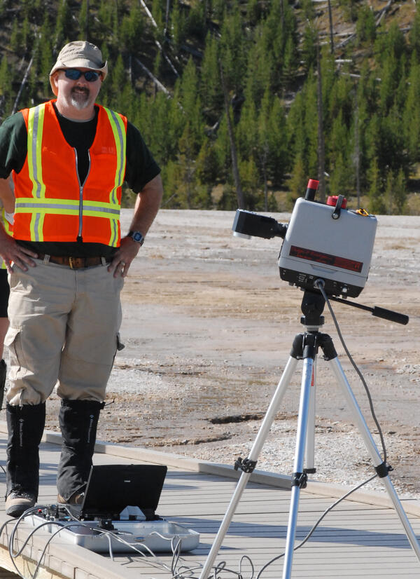
R. Greg Vaughan at Yellowstone National Park
R. Greg Vaughan of the USGS Astrogeology Science Center does field work at Yellowstone National Park. Vaughan monitors thermal features in his role as the remote sensing lead for the Yellowstone Volcano Observatory. USGS photo

No Man's Land
A study in shades of blue and brown is actually one of the harshest landscapes on Earth. This glimpse of Africa's Sahara Desert, located near where the borders of Mali, Niger, and Algeria converge, is truly a no man's land, a world of sand and rock without roads or settlements.
A study in shades of blue and brown is actually one of the harshest landscapes on Earth. This glimpse of Africa's Sahara Desert, located near where the borders of Mali, Niger, and Algeria converge, is truly a no man's land, a world of sand and rock without roads or settlements.

Algerian Sahara
This abstract in browns and grays from central Algeria shows that some parts of Africa's Sahara Desert contain much more than dunes of wind-blown sand. Barren ridges and fragmented mountains (lower right) border a vast expanse of arid plains etched with a complex system of dry streambeds.
This abstract in browns and grays from central Algeria shows that some parts of Africa's Sahara Desert contain much more than dunes of wind-blown sand. Barren ridges and fragmented mountains (lower right) border a vast expanse of arid plains etched with a complex system of dry streambeds.

Impact
Tin Bider is an ancient and eroded meteor crater on the Tin Rhert Plateau in the Algerian Sahara. Tin Bider is nearly 6 kilometers (3.7 miles) in diameter and was caused by a meteorite impact in this region of northern Africa roughly 70 million years ago. The other streaks near the crater are unrelated to the impact event.
Tin Bider is an ancient and eroded meteor crater on the Tin Rhert Plateau in the Algerian Sahara. Tin Bider is nearly 6 kilometers (3.7 miles) in diameter and was caused by a meteorite impact in this region of northern Africa roughly 70 million years ago. The other streaks near the crater are unrelated to the impact event.

Okavango Delta
Like a watercolor in which a brushstroke of dark green has bled into a damp spot on the paper, southern Africa's Okavango River spreads across the pale, parched landscape of northern Botswana to become the lush Okavango Delta.
Like a watercolor in which a brushstroke of dark green has bled into a damp spot on the paper, southern Africa's Okavango River spreads across the pale, parched landscape of northern Botswana to become the lush Okavango Delta.

Desert to Forest
In the American Southwest, transitions from one ecosystem to another can be dramatic and abrupt. This certainly is true in northern Arizona, USA, where the parched Painted Desert, shown here in a palette of purples, adjoins Sitgreaves National Forest (shades of green), a realm of pine woodlands with abundant wildlife.
In the American Southwest, transitions from one ecosystem to another can be dramatic and abrupt. This certainly is true in northern Arizona, USA, where the parched Painted Desert, shown here in a palette of purples, adjoins Sitgreaves National Forest (shades of green), a realm of pine woodlands with abundant wildlife.

Landsat: Mt. Redoubt
Landsat 5 image of the Mt. Redoubt area on March 26, 2009 at 1:07 PM AKDT. The false color image shows the large brown ash cloud extending over the Cook Inlet and the western Kenai peninsula (right sid of image). The image also shows a whiter steam and gas plume rising from the summit of Redoubt Volcano (near upper center).
Landsat 5 image of the Mt. Redoubt area on March 26, 2009 at 1:07 PM AKDT. The false color image shows the large brown ash cloud extending over the Cook Inlet and the western Kenai peninsula (right sid of image). The image also shows a whiter steam and gas plume rising from the summit of Redoubt Volcano (near upper center).
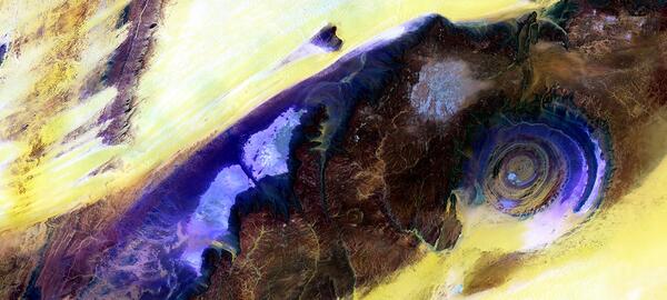
Richat Structure, Mauritania
Near the western edge of the Sahara Desert is a feature that resembles a large eye when viewed from space. The Eye of the Sahara, also known as the Richat Structure or Guelb er Richat, is a symmetrical dome of eroded sedimentary and volcanic rock. The outermost rings measure approximately 40 km (25 miles) across.
Near the western edge of the Sahara Desert is a feature that resembles a large eye when viewed from space. The Eye of the Sahara, also known as the Richat Structure or Guelb er Richat, is a symmetrical dome of eroded sedimentary and volcanic rock. The outermost rings measure approximately 40 km (25 miles) across.

Comparison of Aerial Photo and LiDAR Image
Comparison of color aerial photography with airborne light detection and ranging (LiDAR) imagery in an area west of Lake Tahoe, California. (A) Color aerial orthophoto for part of range front along eastern base of Mt. Tallac with geomorphic features obscured by dense forest cover. (B) Same scene, first-return LiDAR imagery.
Comparison of color aerial photography with airborne light detection and ranging (LiDAR) imagery in an area west of Lake Tahoe, California. (A) Color aerial orthophoto for part of range front along eastern base of Mt. Tallac with geomorphic features obscured by dense forest cover. (B) Same scene, first-return LiDAR imagery.

Roof of the World
Central Asia's Tibetan Plateau is justifiably nicknamed "the roof of the world"-its average elevation is more than 4,500 meters (14,764 feet). It is the world's highest and largest plateau, covering an area roughly four times the size of Texas. Tectonic forces have long shaped the Tibetan Plateau's crumpled and uplifted mountain ridges.
Central Asia's Tibetan Plateau is justifiably nicknamed "the roof of the world"-its average elevation is more than 4,500 meters (14,764 feet). It is the world's highest and largest plateau, covering an area roughly four times the size of Texas. Tectonic forces have long shaped the Tibetan Plateau's crumpled and uplifted mountain ridges.

Island Rebound
During the last ice age, Akimiski Island in Canada's James Bay lay beneath vast glaciers that pressed down with immense force. As the climate changed and the ice retreated, Akimiski began a gradual rebound.
During the last ice age, Akimiski Island in Canada's James Bay lay beneath vast glaciers that pressed down with immense force. As the climate changed and the ice retreated, Akimiski began a gradual rebound.

Remote Tundra
Skeletal extensions of land reach like bony fingers across a section of Liverpool Bay along the northern edge of Canada's Northwest Territories. Only small villages are thinly scattered in this remote and inhospitable region of Arctic tundra bordering the Beaufort Sea.
Skeletal extensions of land reach like bony fingers across a section of Liverpool Bay along the northern edge of Canada's Northwest Territories. Only small villages are thinly scattered in this remote and inhospitable region of Arctic tundra bordering the Beaufort Sea.
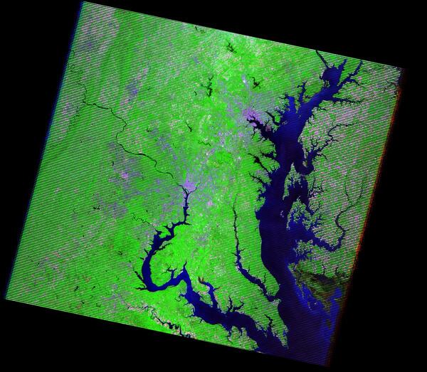
Landsat 7 Image of Washington DC and Baltimore area
Landsat 7 Image of Washington DC and Baltimore areaThis Landsat 7 image captures the Washington, D.C., and Baltimore, MD, areas. Washington, D.C., lies in the center of the image along the Potomac River. Baltimore, in the upper-right portion of the image, is located on the western shore of Chesapeake Bay.

San Luis, Argentina
Straight highways fan out like spokes on a wheel from the Argentine city of San Luis. To the right of the city are croplands that resemble colorful confetti. Founded in 1594, San Luis lies at the tip of the Sierra de San Luis and is largely surrounded by flat-to-rolling fertile plains.
Straight highways fan out like spokes on a wheel from the Argentine city of San Luis. To the right of the city are croplands that resemble colorful confetti. Founded in 1594, San Luis lies at the tip of the Sierra de San Luis and is largely surrounded by flat-to-rolling fertile plains.

West African Antelope
West African antelope
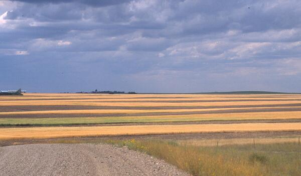
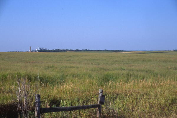
USGS Land Cover Trends photo of Montana cropland
A 2006 photo taken on a USGS Land Cover Trends trip in Montana showing strips of cropland with fallow land in between.
A 2006 photo taken on a USGS Land Cover Trends trip in Montana showing strips of cropland with fallow land in between.
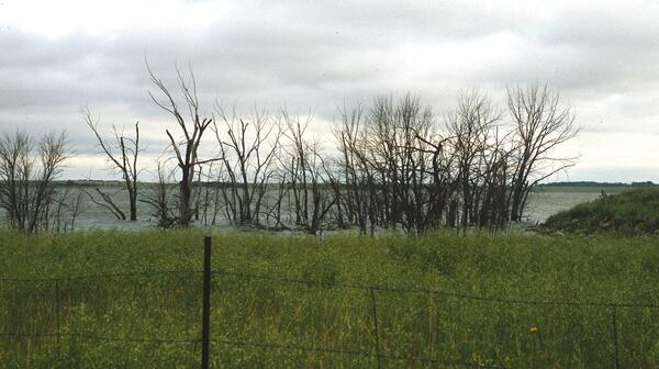
Lake with submerged trees in Day County, South Dakota
Lake with submerged trees in Day County, South DakotaA lake with submerged trees in Day County, South Dakota, part of the Prairie Pothole Region. 2006 photo from the USGS Land Cover Trends project
Lake with submerged trees in Day County, South Dakota
Lake with submerged trees in Day County, South DakotaA lake with submerged trees in Day County, South Dakota, part of the Prairie Pothole Region. 2006 photo from the USGS Land Cover Trends project
USGS Land Cover Trends photo in Montana
USGS Land Cover Trends photo in Montana in 2006 of land enrolled in the Conservation Reserve Program.
USGS Land Cover Trends photo in Montana in 2006 of land enrolled in the Conservation Reserve Program.
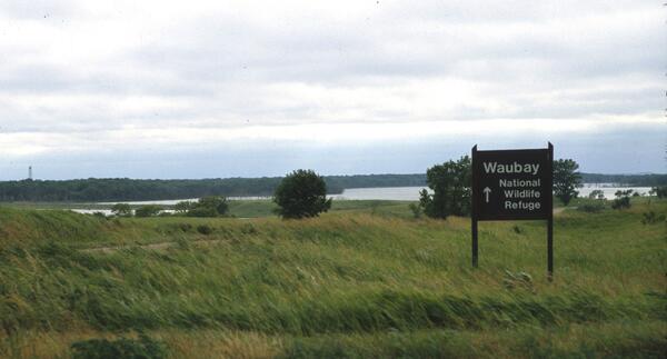
Waubay National Wildlife Refuge in Day County, South Dakota
Waubay National Wildlife Refuge in Day County, South DakotaThe Waubay National Wildlife Refuge in Day County, South Dakota, is in the Prairie Pothole Region and includes Waubay Lake. 2006 photo from the USGS Land Cover Trends project
Waubay National Wildlife Refuge in Day County, South Dakota
Waubay National Wildlife Refuge in Day County, South DakotaThe Waubay National Wildlife Refuge in Day County, South Dakota, is in the Prairie Pothole Region and includes Waubay Lake. 2006 photo from the USGS Land Cover Trends project
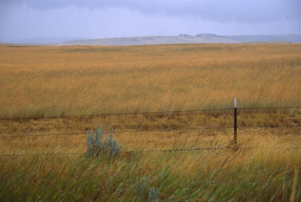
Montana grassland in a USGS Land Cover Trends photo
Montana grassland in a USGS Land Cover Trends photoMontana Conservation Reserve Program grassland in a 2006 USGS Land Cover Trends photo.
Montana grassland in a USGS Land Cover Trends photo
Montana grassland in a USGS Land Cover Trends photoMontana Conservation Reserve Program grassland in a 2006 USGS Land Cover Trends photo.

Sor Kaydak
The intricate lines angling and criss-crossing over the landscape are roads in extreme southwestern Kazakhstan. The turquoise areas to the left are salt flats and marshes, some parts of which are submerged (dark blue). The water body is Sor Kaydak, which was once a gulf of the Caspian Sea.
The intricate lines angling and criss-crossing over the landscape are roads in extreme southwestern Kazakhstan. The turquoise areas to the left are salt flats and marshes, some parts of which are submerged (dark blue). The water body is Sor Kaydak, which was once a gulf of the Caspian Sea.