
About
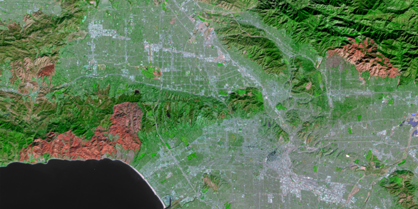
The USGS Earth Resources Observation and Science (EROS) Center conducts research to track and understand how Earth’s surface is changing. EROS manages one of the world’s largest archives of land imagery and operates the Landsat satellites, delivering data that supports science, resource management, and hazards response.

What USGS EROS Does
- Conducts scientific research and operational monitoring of land change, including:
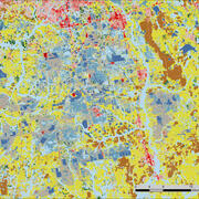
- Analyzing long-term trends in land use, land cover, and land condition
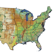
- Supporting natural resource assessments for agriculture, forestry, and water
- Developing methods for tracking environmental impacts and ecosystem change
- Producing data and tools to inform land-use planning and policy decisions
- Manages, distributes and archives over 80 years of remote-sensing data, including:
- Landsat satellite imagery - A continuous record of Earth’s surface since 1972
- Aerial photographs - Historic photos from 1930s - present
- Declassified imagery - Cold War-era satellite photos (1960-1984)
- Landsat day-to-day operations, including:
- Flight operations, mission planning, ground station coordination and data downlinks
- Data Processing, calibration, and validation for scientific use
- Distribution of Landsat data through multiple platforms and access tools
- Supports natural and environmental disaster response, including:
- FEWS NET - Helping monitor drought and food security in vulnerable regions around the world
- Fire Science - Vegetation mapping and fuel modeling to support wildfire response and planning
- Emergency Operations - Delivering rapid imagery and data for floods, hurricanes, earthquakes, and other hazard events
Our Impact
Science and Natural Resource Assessment: Supports land and water resources by tracking changes in agriculture, forest health, surface water, and land condition. These insights guide land-use planning, conservation policy, energy sighting, and economic development.
Disaster Response & Resilience: Provides rapid, reliable imagery to assess floods, wildfires, droughts, and other hazards.
Future-forward: Through AI, cloud-based access, and next-generation satellite missions, EROS is advancing the future of Earth science to meet tomorrow’s challenges.
Science Products Science Products
Data Discovery Data Discovery

Data Access Data Access

Visit Us Visit Us
