U.S. flag

An official website of the United States government

Education

The resources at USGS EROS Center are not just for professional scientists! Everyone is welcome to study how land changes over time through satellite imagery. Here, you will find kid-friendly lessons and games, dazzling snapshots of our planet, and the latest news about EROS. You can also learn about onsite options including tours and our one-of-a-kind library.

long hallway with rotating globe in the center
The EROS Center has a long hallway with a rotating globe in the center. Along the walls there are descriptions about the role of Landsat.

Explore the World of Remote Sensing

Teachers and parents can always find something to intrigue their students in our library of educational resources! Learn how remote sensing scientists use Landsat satellite data to track changes to the Earth’s surface over the years. Study up in the Remote Sensing Classroom, where interactive lessons teach you to think like our scientists.

Test your new remote sensing skills with our puzzles and games. Engaging activities allow students of all ages to look at satellite imagery and perform the same analysis as the scientists at the EROS Center. 

Discover New Places with Earthshots

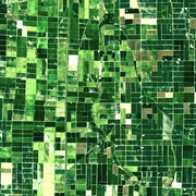
Landsat satellites have been imaging the Earth's land area for over 50 years. Each Earthshot location features a fascinating story of environmental transformation. These images reveal how people and nature change the landscape over time. Explore a variety of topics including glacial change, forest fire recovery, agriculture harvests, natural disasters, and wildlife impacts.

Find Landsat Benefits in Your Area

From mapping wildfires and permafrost thaw in Alaska to tracking algal blooms and spongy moth invasions in Ohio, the Landsat Program offers a long list of benefits across all 50 States. State-specific fact sheets pinpoint Landsat’s continuing contribution to the health and well-being of the nation’s land resources. Check out some benefits to your State!


EROS Classroom

EROS Classroom

Puzzles and Games

Puzzles and Games

Earthshots

Earthshots

Landsat State Factsheets

Landsat State Factsheets

Eyes on Earth podcast graphic

Stay Tuned with Current Events

The center’s Communications & Outreach team produces news articles and publications that spotlight the work of remote sensing scientists at EROS.

Many satellite images are simply intriguing to look at.  In the Earth as Art galleries, see the mesmerizing beauty of river deltas, mountains, and other sandy, salty, and icy landscapes.

In our Image of the Week gallery, videos highlight recent events in satellite images that feature striking changes to the Earth’s surface. Our images are actual scenes from around the world collected by remote lens, often filtered by specialized sensors in pursuit of science.”

Eyes on Earth is a podcast on remote sensing, Earth observation, land change and science brought to you by EROS. Look for a new episode every other week!


Earth as Art

Earth as Art

Image of the Week

Image of the Week

Eyes on Earth

Eyes on Earth

EROS News

EROS News

Front of EROS building

Visit Us in South Dakota

Visitors to any number of community events in the area of Sioux Falls, South Dakota, may see EROS staff sharing the work of the USGS and guiding adults and children through hands-on learning activities.

EROS is open Monday through Friday, excluding Federal holidays, from 8 a.m. to 4 p.m. Staff-guided tours are available at 10 a.m. and 2 p.m. Self-guided tours are welcome anytime.  Group tours and larger gatherings are welcome with notice. 

Please call 605-594-6511 with any questions about your guided visit. Further information can be found on this webpage about visiting the science center. We look forward to seeing you soon!


Visit EROS

Visit EROS

Don Lee Kulow Memorial Library

Don Lee Kulow Memorial Library

Careers at EROS

Careers at EROS

Connect

Connect

Filter Total Items: 79

Landsat's Everyday Benefits

Landsat data improve people's quality of life!

The Landsat Program and satellite data archive provide roughly $3.45 billion in economic benefit to the United States and international communities according to a November 2019, USGS report.

link

Landsat's Everyday Benefits

Landsat data improve people's quality of life!

The Landsat Program and satellite data archive provide roughly $3.45 billion in economic benefit to the United States and international communities according to a November 2019, USGS report.

Learn More

Landsat Fact Sheets

Landsat Factsheets present a high-level overview of various concepts. Choose a factsheet to learn more about a topic.

link

Landsat Fact Sheets

Landsat Factsheets present a high-level overview of various concepts. Choose a factsheet to learn more about a topic.

Learn More

Careers at the U.S. Geological Survey

The U.S. Geological Survey (USGS) EROS Center is government-owned/directed and contractor-operated. The work of EROS is carried out through mission-support contracts with industry.

link

Careers at the U.S. Geological Survey

The U.S. Geological Survey (USGS) EROS Center is government-owned/directed and contractor-operated. The work of EROS is carried out through mission-support contracts with industry.

Learn More

The Don Lee Kulow Memorial Library

The Don Lee Kulow Memorial Library (EROS Library) provides support for staff at EROS. Expansive information on remote sensing, environmental sciences, systems engineering, and other topics is available.


link

The Don Lee Kulow Memorial Library

The Don Lee Kulow Memorial Library (EROS Library) provides support for staff at EROS. Expansive information on remote sensing, environmental sciences, systems engineering, and other topics is available.


Learn More

Concept to Reality USGS Land Change Monitoring Assessment and Projection Pushes Boundaries

More than a decade ago, Tom Loveland sat down to sketch out a few thoughts on land change and the Landsat archive.

The archive was and remains rich with history, adding new observations of the entire planet every eight days. But at that point, Landsat-based land change research was about comparing points in time – this year versus five years ago, to 10 years ago, and so on.

link

Concept to Reality USGS Land Change Monitoring Assessment and Projection Pushes Boundaries

More than a decade ago, Tom Loveland sat down to sketch out a few thoughts on land change and the Landsat archive.

The archive was and remains rich with history, adding new observations of the entire planet every eight days. But at that point, Landsat-based land change research was about comparing points in time – this year versus five years ago, to 10 years ago, and so on.

Learn More

Tracking Change Across Time and Space

The U.S. Geological Survey took a bold step toward documenting change across the landscape with the launch of the first Landsat satellite in 1972. Since then, the orbiters have collected nearly five decades of imagery.

link

Tracking Change Across Time and Space

The U.S. Geological Survey took a bold step toward documenting change across the landscape with the launch of the first Landsat satellite in 1972. Since then, the orbiters have collected nearly five decades of imagery.

Learn More

Eyes on Earth Episode 71 – Blue Oak Forests of California

Eyes on Earth is a podcast on remote sensing, Earth observation, land change and science, brought to you by the USGS Earth Resources Observation and Science (EROS) Center. In this episode, we learn how Landsat-based data products have been used to study forest change in California.

link

Eyes on Earth Episode 71 – Blue Oak Forests of California

Eyes on Earth is a podcast on remote sensing, Earth observation, land change and science, brought to you by the USGS Earth Resources Observation and Science (EROS) Center. In this episode, we learn how Landsat-based data products have been used to study forest change in California.

Learn More

Eyes on Earth Episode 69 - Thirty Years of Land Change in the U.S.

Eyes on Earth is a podcast on remote sensing, Earth observation, land change and science, brought to you by the USGS Earth Resources Observation and Science (EROS) Center. In this episode, we learn how the landscapes of the U.S. have changed since 1985.

link

Eyes on Earth Episode 69 - Thirty Years of Land Change in the U.S.

Eyes on Earth is a podcast on remote sensing, Earth observation, land change and science, brought to you by the USGS Earth Resources Observation and Science (EROS) Center. In this episode, we learn how the landscapes of the U.S. have changed since 1985.

Learn More

Eyes on Earth Episode 62 – Landsat 9 Launch Part 3

Eyes on Earth is a podcast on remote sensing, Earth observation, land change and science, brought to you by the USGS Earth Resources Observation and Science (EROS) Center. In this episode, we hear from a pioneer in remote sensing.

link

Eyes on Earth Episode 62 – Landsat 9 Launch Part 3

Eyes on Earth is a podcast on remote sensing, Earth observation, land change and science, brought to you by the USGS Earth Resources Observation and Science (EROS) Center. In this episode, we hear from a pioneer in remote sensing.

Learn More

Eyes on Earth Episode 61 – Landsat 9 Launch Part 2

Eyes on Earth is a podcast on remote sensing, Earth observation, land change and science, brought to you by the USGS Earth Resources Observation and Science (EROS) Center. In this episode, we hear interviews with international partners on the day of the Landsat 9 launch.

link

Eyes on Earth Episode 61 – Landsat 9 Launch Part 2

Eyes on Earth is a podcast on remote sensing, Earth observation, land change and science, brought to you by the USGS Earth Resources Observation and Science (EROS) Center. In this episode, we hear interviews with international partners on the day of the Landsat 9 launch.

Learn More

Eyes on Earth Episode 60 – Landsat 9 Launch Part 1

Eyes on Earth is a podcast on remote sensing, Earth observation, land change and science, brought to you by the USGS Earth Resources Observation and Science (EROS) Center. In this episode, we hear interviews with some of the various agency officials gathered before the Landsat 9 launch.

link

Eyes on Earth Episode 60 – Landsat 9 Launch Part 1

Eyes on Earth is a podcast on remote sensing, Earth observation, land change and science, brought to you by the USGS Earth Resources Observation and Science (EROS) Center. In this episode, we hear interviews with some of the various agency officials gathered before the Landsat 9 launch.

Learn More

Eyes on Earth Episode 59 – Landsat 9 Ground System

Eyes on Earth is a podcast on remote sensing, Earth observation, land change and science, brought to you by the USGS Earth Resources Observation and Science (EROS) Center. In this episode, we hear how the USGS prepared for the launch of Landsat 9.

link

Eyes on Earth Episode 59 – Landsat 9 Ground System

Eyes on Earth is a podcast on remote sensing, Earth observation, land change and science, brought to you by the USGS Earth Resources Observation and Science (EROS) Center. In this episode, we hear how the USGS prepared for the launch of Landsat 9.

Learn More