
View of Owyhee Reservoir in Oregon. Water samples collected from this reservoir are used to validate satellite remote sensing of water quality.
Tyler King
Dr. Tyler King is a supervisory research hydrologist with the Advanced Analytics Team in the Hydrologic Remote Sensing Branch of the Water Resources Mission Area, and is based in Boise, ID.
Tyler King is a research scientist focused on advancing the production of scientific data products to improve hydrologic monitoring. His research has focused on remote sensing of aquatic chlorophyll, quantifying the accuracy of low-cost discharge measurement methods, development of methods for operationally retrieving water quality estimates from satellite imagery, advancing fundamental understanding of the factors that link temperature regimes of Arctic rivers to their environment, remotely sensing river discharge by coupling aerial imagery with hydraulic models, quantifying the impact of reservoir operation on downstream river temperature, and identifying algal taxa from hyperspectral satellite imagery. With each of these foci, Tyler aims to translate scientific advances into application driven datasets and tools to assist decision makers and the public in natural resource management.
Science and Products

Assessing the Water Quality of the Lower Boise River and Selected Tributaries
For decades, the lower Boise River downstream of Lucky Peak Reservoir has been highly enriched with phosphorus. Too much of a good thing, the high concentrations of phosphorus create a cycle of excessive plant growth, decreased oxygen for fish, and even algal blooms.

Monitoring Streamflow in Remote Headwater Streams
Remote headwater streams are important sources of water that are not well understood. Working with other USGS science centers across the country, we are developing methods for estimating streamflow in these environments. Data from these efforts will contribute to improving our understanding of water availability and how drought may be affecting these stream ecosystems.

Satellite Monitoring of Algal Blooms in Idaho Waterbodies
Harmful algal blooms (HABs) are an increasing concern in Idaho. Within the past few years, Idaho agencies have issued at least 57 HAB notices on 29 waterbodies throughout the state. Toxins produced by HABs pose risks to human and animal health. Local economies may also be adversely affected when algal blooms discourage outdoor recreation. Routinely monitoring the state's many waterbodies is too...

Automated Sampling for Phosphorus in the Lower Boise River
For decades, the lower Boise River downstream of Lucky Peak Reservoir has been highly enriched with phosphorus. Too much of a good thing, the high concentrations of phosphorus create a cycle of excessive plant growth, decreased oxygen for fish, and even algal blooms.
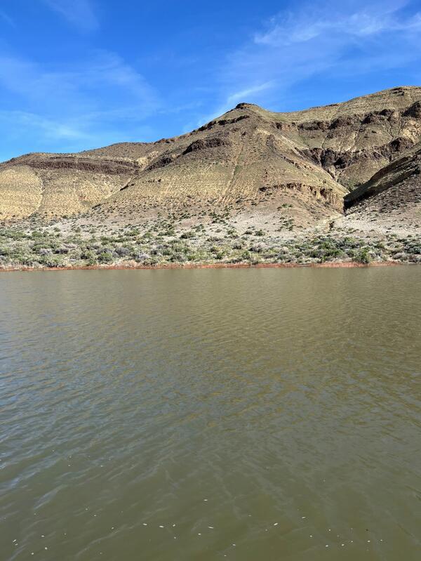
Owyhee Reservoir in Oregon
View of Owyhee Reservoir in Oregon. Water samples collected from this reservoir are used to validate satellite remote sensing of water quality.

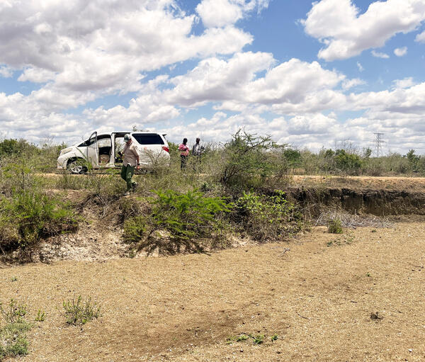
Trainees in the remote sensing class in Mombasa Kenya
Trainees in the remote sensing class in Mombasa KenyaTrainees in the remote sensing class working to develop potential groundwater maps from multiple satellite data sources.
Trainees in the remote sensing class in Mombasa Kenya
Trainees in the remote sensing class in Mombasa KenyaTrainees in the remote sensing class working to develop potential groundwater maps from multiple satellite data sources.
Dry riverbed near Samburu in Kwale County, Kenya
Dry riverbeds like this one are common in arid and semi arid regions in Kenya in the dry seasons and highlight the need for access to groundwater.
Dry riverbeds like this one are common in arid and semi arid regions in Kenya in the dry seasons and highlight the need for access to groundwater.

Rural water distribution center in Kwale County, Kenya
Rural water distribution center in Kwale County, KenyaRural water distribution center near Maji Ya Chumvi in Kwale County, Kenya. Note water tank on roof.
Rural water distribution center in Kwale County, Kenya
Rural water distribution center in Kwale County, KenyaRural water distribution center near Maji Ya Chumvi in Kwale County, Kenya. Note water tank on roof.

Benthic macroinvertebrate sampling in the Snake River near Murtaugh, Idaho
Benthic macroinvertebrate sampling in the Snake River near Murtaugh, IdahoUSGS hydrologist Kenneth Skinner (left) and biologist Christopher Mebane collect macroinvertebrate samples for analysis as part of a study examining the health of Snake River benthic communities before and after the application of a copper treatment to eradicate invasive quagga mussels.
Science and Products
Assessing the Water Quality of the Lower Boise River and Selected Tributaries
For decades, the lower Boise River downstream of Lucky Peak Reservoir has been highly enriched with phosphorus. Too much of a good thing, the high concentrations of phosphorus create a cycle of excessive plant growth, decreased oxygen for fish, and even algal blooms.
Monitoring Streamflow in Remote Headwater Streams
Remote headwater streams are important sources of water that are not well understood. Working with other USGS science centers across the country, we are developing methods for estimating streamflow in these environments. Data from these efforts will contribute to improving our understanding of water availability and how drought may be affecting these stream ecosystems.
Satellite Monitoring of Algal Blooms in Idaho Waterbodies
Harmful algal blooms (HABs) are an increasing concern in Idaho. Within the past few years, Idaho agencies have issued at least 57 HAB notices on 29 waterbodies throughout the state. Toxins produced by HABs pose risks to human and animal health. Local economies may also be adversely affected when algal blooms discourage outdoor recreation. Routinely monitoring the state's many waterbodies is too...
Automated Sampling for Phosphorus in the Lower Boise River
For decades, the lower Boise River downstream of Lucky Peak Reservoir has been highly enriched with phosphorus. Too much of a good thing, the high concentrations of phosphorus create a cycle of excessive plant growth, decreased oxygen for fish, and even algal blooms.
Owyhee Reservoir in Oregon
View of Owyhee Reservoir in Oregon. Water samples collected from this reservoir are used to validate satellite remote sensing of water quality.
View of Owyhee Reservoir in Oregon. Water samples collected from this reservoir are used to validate satellite remote sensing of water quality.
Trainees in the remote sensing class in Mombasa Kenya
Trainees in the remote sensing class in Mombasa KenyaTrainees in the remote sensing class working to develop potential groundwater maps from multiple satellite data sources.
Trainees in the remote sensing class in Mombasa Kenya
Trainees in the remote sensing class in Mombasa KenyaTrainees in the remote sensing class working to develop potential groundwater maps from multiple satellite data sources.
Dry riverbed near Samburu in Kwale County, Kenya
Dry riverbeds like this one are common in arid and semi arid regions in Kenya in the dry seasons and highlight the need for access to groundwater.
Dry riverbeds like this one are common in arid and semi arid regions in Kenya in the dry seasons and highlight the need for access to groundwater.
Rural water distribution center in Kwale County, Kenya
Rural water distribution center in Kwale County, KenyaRural water distribution center near Maji Ya Chumvi in Kwale County, Kenya. Note water tank on roof.
Rural water distribution center in Kwale County, Kenya
Rural water distribution center in Kwale County, KenyaRural water distribution center near Maji Ya Chumvi in Kwale County, Kenya. Note water tank on roof.
Benthic macroinvertebrate sampling in the Snake River near Murtaugh, Idaho
Benthic macroinvertebrate sampling in the Snake River near Murtaugh, IdahoUSGS hydrologist Kenneth Skinner (left) and biologist Christopher Mebane collect macroinvertebrate samples for analysis as part of a study examining the health of Snake River benthic communities before and after the application of a copper treatment to eradicate invasive quagga mussels.
*Disclaimer: Listing outside positions with professional scientific organizations on this Staff Profile are for informational purposes only and do not constitute an endorsement of those professional scientific organizations or their activities by the USGS, Department of the Interior, or U.S. Government