



Surface Water Quality
Surface Water Quality
Filter Total Items: 24
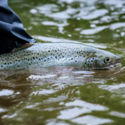
Thermal Imaging to Detect Cold-Water Habitat for Atlantic Salmon and Brook Trout at Katahdin Woods and Waters National Monument
The U.S. Geological Survey (USGS), in cooperation with the National Park Service (NPS), is using airborne thermal infrared remote sensing to characterize cold-water habitat for the federally designated endangered species Atlantic salmon ( Salmo salar) and wild brook trout ( Salvelinus fontinalis) in the East Branch of the Penobscot River system within Katahdin Woods and Waters National Monument...

Applied Hydrology Branch
The Applied Hydrology Branch provides hydrologic data, research, and tools to water resource managers, stakeholders and policy makers that inform critical water management decisions throughout New England. This branch is divided into the Hydrology and Hydraulics Section, Water Quality Networks Section, Connecticut Water Quality Monitoring Section, and Massachusetts/Rhode Island Water Quality...

USGS Assessment of Water Resources near Hanscom Air Force Base
The United States Geological Survey (USGS) New England Water Science Center is expanding its scientific investigation to better understand the water resources at, and in the vicinity of, Hanscom Air Force Base (AFB) and the potential impacts from historical base operations and other sources.

Water Quality Monitoring in the Cambridge Drinking-Water Source Area, Massachusetts
The Cambridge Water Department supplies approximately 13 million gallons per day of drinking water to more than 100,000 customers. Raw water is obtained from a serial system of three primary storage reservoirs—Cambridge Reservoir (also known as the Hobbs Brook Reservoir), Stony Brook Reservoir, and Fresh Pond Reservoir—in parts of Cambridge, Lexington, Lincoln, Waltham, and Weston, Massachusetts...

Environmental streamflows in the United States: historical patterns and predictions
The term environmental streamflows refers to the magnitude, frequency, seasonal timing, duration, and rate of change of streamflows needed to sustain freshwater and estuary ecosystems and human wellbeing. It is important that environmental streamflow assessments by water managers consider changes in climate, land use, and water management; this cannot be done effectively without understanding...

Water Quality Monitoring of Merrimack River Watershed
The U.S. Geological Survey, in cooperation with the Massachusetts Department of Environmental Protection (MassDEP), is currently conducting a 4-year water-quality investigation in the lower portion of the Merrimack River watershed, April 2020 – October 2024.

Water Quality Sampling in the Tributaries of the Long Island Sound
Coastal estuaries in southern New England and New York show the effects of excess nutrients and coastal eutrophication. These include excessive growth of macroalgae, excessive blooms of phytoplankton, oxygen depletion, hypoxia and deteriorated substrates. State and Federal regulators have responded to these nutrient-caused impairments by requiring more stringent permit limits for National...

Chloride Data for Streams in Connecticut, Massachusetts, and Rhode Island
As part of water-quality data collection activities in New England, water samples are analyzed for chloride in monitoring networks and projects across Connecticut, Massachusetts, and Rhode Island. Chloride is of interest because high concentrations may affect aquatic life in streams or affect water quality of reservoirs and aquifers used for drinking water.

Transportation-Related Water Projects in New England
The New England Water Science Center collects data and does interpretive studies on hydrology, hydraulics, and water quality in cooperation with the Federal Highway Administration and State Departments of Transportation (DOTs) in New England and other states.

Water Quality Monitoring in the Scituate Reservoir Drainage Area, Rhode Island
The Scituate Reservoir system is the largest inland body of water in Rhode Island and the principal drinking-water supply for more than 60 percent of the State’s population. The system includes the Scituate Reservoir and five tributary reservoirs with a maximum storage capacity of 37 billion gallons. The drainage basin that contributes water to the reservoir extends across 93 square miles in...

Assessment of Nutrient Transport and Discharge to Coastal Embayments, Wickford, Rhode Island
In 2020, the USGS began a partnership with the U.S. Environmental Protection Agency (EPA) Region 1 Southeast New England Program for Coastal Watershed Restoration (SNEP) and EPA Office of Research and Development (ORD), Atlantic Coastal Sciences Division, Narragansett, RI in support of water-quality and ecological monitoring being conducted by ORD in the coastal waters around Wickford, RI. The...

Sleepers River Research Watershed
The Sleepers River Research Watershed in Danville, Vermont has been the site of active hydrologic research since 1959, when the Agricultural Research Service (ARS) of the U.S. Department of Agriculture (USDA) established a research program in the watershed. The Sleepers River site is now operated by the USGS, in cooperation with several other Federal agencies and universities.