
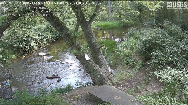
Looking at the control at Streamgage 01463620 Assunpink Creek near Clarksville, NJ
Images
Images intro.
Filter Total Items: 291
Clarksville Webcam
Looking at the control at Streamgage 01463620 Assunpink Creek near Clarksville, NJ

Blackwells Mills Webcam
Looking down river from atop the gage at Streamgage 01402000 Millstone River at Blackwells Mills, NJ
Looking down river from atop the gage at Streamgage 01402000 Millstone River at Blackwells Mills, NJ
near_Morristown Webcam
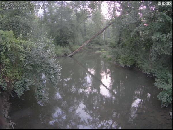
Streamgage 01381400 Whippany River near Morristown, NJ, looking down river towards a fallen tree
Streamgage 01381400 Whippany River near Morristown, NJ, looking down river towards a fallen tree
Elizabeth Webcam
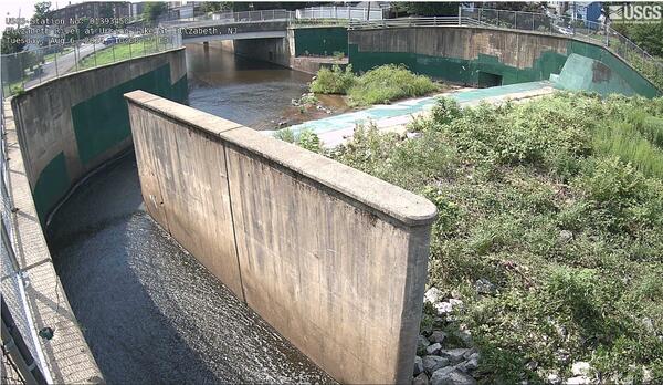
the dam and river at Streamgage 01393450 Elizabeth River at Ursino Lake at Elizabeth, NJ
the dam and river at Streamgage 01393450 Elizabeth River at Ursino Lake at Elizabeth, NJ
Little Falls Webcam
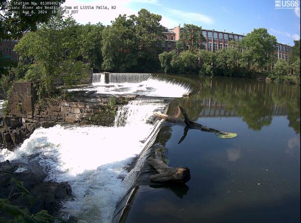
Looking across the falls at Streamgage 1389492 Passaic River abv Beatties Dam at Little Falls, NJ
Looking across the falls at Streamgage 1389492 Passaic River abv Beatties Dam at Little Falls, NJ
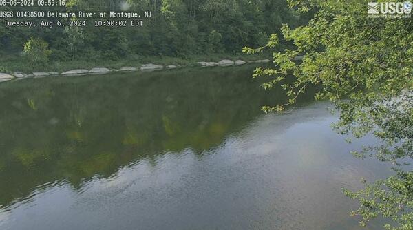
Montague Webcam
The Delaware river spread out below the Streamgage 01438500 Delaware River at Montague, NJ
The Delaware river spread out below the Streamgage 01438500 Delaware River at Montague, NJ

Rahway Webcam
Webcam at USGS Streamgage 01395000 Rahway River at Rahway, NJ
Visit Water Data for the Nation to get current data for this site.
Webcam at USGS Streamgage 01395000 Rahway River at Rahway, NJ
Visit Water Data for the Nation to get current data for this site.
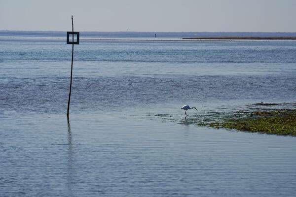
Bay markers 1
Looking out upon the Little Egg Inlet from the channel markers near 01409335 Little Egg Inlet near Tuckerton, New Jersey gage
Looking out upon the Little Egg Inlet from the channel markers near 01409335 Little Egg Inlet near Tuckerton, New Jersey gage

Spruce Run Webcam
Wecam image for the 403859074555201 Spruce Run Reservoir, New Jersey observation gage
Wecam image for the 403859074555201 Spruce Run Reservoir, New Jersey observation gage

Manville Webcam
Looking at the Raritan River from the gage at the top of the bridge at 01400500 Raritan River at Manville, New Jersey
Looking at the Raritan River from the gage at the top of the bridge at 01400500 Raritan River at Manville, New Jersey

Belmar Webcam
Looking out on a Shark River marina from high above at the 01407770 Shark River at Belmar, New Jersey
Looking out on a Shark River marina from high above at the 01407770 Shark River at Belmar, New Jersey

Sandy Hook Poster page 2
Summary of Study design and data collected at Sandy Hook Gateway National Recreation Area, New jersey, Page 2
Summary of Study design and data collected at Sandy Hook Gateway National Recreation Area, New jersey, Page 2

Sandy Hook Poster page 1
Summary of Study design and data collected at Sandy Hook Gateway National Recreation Area, New Jersey, Page 1
Summary of Study design and data collected at Sandy Hook Gateway National Recreation Area, New Jersey, Page 1

CP_RASA
Map showing the New Jersey Coastal Plain model grid area for the 1980 to 2013 model.
Map showing the New Jersey Coastal Plain model grid area for the 1980 to 2013 model.
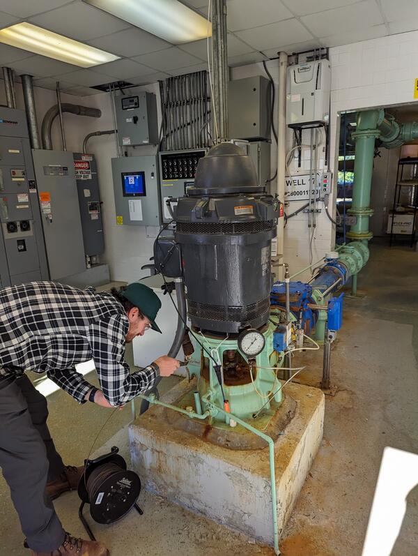
Measuring Groundwater Level
USGS Scientist lowers a tape to measure the groundwater level into a production well in Sayerville, New Jersey
USGS Scientist lowers a tape to measure the groundwater level into a production well in Sayerville, New Jersey

Hances Brook IR1
Infrared imaging camera looking at the differences in ground and water temperatures along Hances Brook near Hackettstown, a small tributary to the Musconetcong River in New Jersey. In the image on the camera, the blue color indicates colder water being discharged into the stream coming from an undercut in the bank.
Infrared imaging camera looking at the differences in ground and water temperatures along Hances Brook near Hackettstown, a small tributary to the Musconetcong River in New Jersey. In the image on the camera, the blue color indicates colder water being discharged into the stream coming from an undercut in the bank.

Musconetcong Imaging1
Infrared imaging camera pointed at stream bank looking for temperature differences in ground and surface water temperatures along the Musconetcong River in New Jersey
Infrared imaging camera pointed at stream bank looking for temperature differences in ground and surface water temperatures along the Musconetcong River in New Jersey

Hacketstown Temp Sample 1
USGS Scientist Martin Briggs taking ground temperature reading for reference use with the Infrared Camera imaging on Bower’s Brook in Hackettstown, New Jersey. This location was chosen for further investigation due to the orange-yellow deposits on the lower edge of the bank.
USGS Scientist Martin Briggs taking ground temperature reading for reference use with the Infrared Camera imaging on Bower’s Brook in Hackettstown, New Jersey. This location was chosen for further investigation due to the orange-yellow deposits on the lower edge of the bank.

Bowers Brook Probe 1
USGS Scientists Pam Reilly and Liam Kineffic recording several water parameters including temperature with a high accuracy probe at a suspected groundwater input along Bower’s Brook in Hackettstown, a tributary to the Musconetcong River.
USGS Scientists Pam Reilly and Liam Kineffic recording several water parameters including temperature with a high accuracy probe at a suspected groundwater input along Bower’s Brook in Hackettstown, a tributary to the Musconetcong River.

CPFIM comparison map
Side-by-side comparisons of USGS tide gages in Cape May area with a flood inundation map output
Side-by-side comparisons of USGS tide gages in Cape May area with a flood inundation map output

CPFIM output Map
Four side-by-side images showing the progression of a coastal flooding model in New Jersey.
Four side-by-side images showing the progression of a coastal flooding model in New Jersey.