
Close up of fine-grained seafloor massive sulfide containing the primary minerals pyrrhotite, sphalerite, and barite. Weathering has produced secondary minerals, including iron oxide and possibly jarosite.
Images
Pacific Coastal and Marine Science Center images.
Filter Total Items: 1361

Fine-grained seafloor massive sulfide
Close up of fine-grained seafloor massive sulfide containing the primary minerals pyrrhotite, sphalerite, and barite. Weathering has produced secondary minerals, including iron oxide and possibly jarosite.

ROV collecting a mineral sample
Woods Hole Oceanographic Institute's remotely operated vehicle Jason gathers a mineral sample from the seafloor at Escanaba Trough.
Woods Hole Oceanographic Institute's remotely operated vehicle Jason gathers a mineral sample from the seafloor at Escanaba Trough.

Escanaba Trough location map
Escanaba Trough is the only oceanic spreading center within the U.S. Exclusive Economic Zone. Hundreds of meters of continental sediment have accumulated in the trough, and the combination of sediments and hydrothermal fluids has resulted in a unique hydrothermal system and potentially extensive sulfide mineral precipitation.
Escanaba Trough is the only oceanic spreading center within the U.S. Exclusive Economic Zone. Hundreds of meters of continental sediment have accumulated in the trough, and the combination of sediments and hydrothermal fluids has resulted in a unique hydrothermal system and potentially extensive sulfide mineral precipitation.
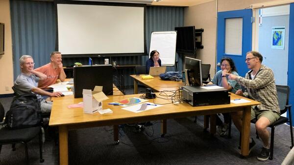
Seafloor Structure-from-Motion (SfM) ad-hoc workshop in St. Petersburg, Florida
Seafloor Structure-from-Motion (SfM) ad-hoc workshop in St. Petersburg, FloridaThe USGS Processes Impacting Seafloor Change and Ecosystem Services (PISCES) project team meeting at the St. Petersburg Coastal and Marine Science Center in May 2022 to coordinate Structure-from-motion (SfM) Quantitative Underwater Imaging Device with 5 cameras (SQUID-5) and diver-based SfM data acquisition and processing for field work.

USGS Ocean Research
Our coasts, the most familiar part of the ocean are the gateway to the larger deeper ocean world. USGS studies processes and hazards in the coastal zone and how they affect people, wildlife, and ecosystems.
Our coasts, the most familiar part of the ocean are the gateway to the larger deeper ocean world. USGS studies processes and hazards in the coastal zone and how they affect people, wildlife, and ecosystems.

SQUID-5 test near the St. Pete Pier
The SQUID-5, or Structure-from-motion (SfM) Quantitative Underwater Imaging Device with 5 cameras test in Tampa Bay.
The SQUID-5, or Structure-from-motion (SfM) Quantitative Underwater Imaging Device with 5 cameras test in Tampa Bay.

SQUID-5 deployment in Tampa Bay
The SQUID-5, or Structure-from-motion (SfM) Quantitative Underwater Imaging Device with 5 cameras, being deployed by Mitch Lemon (SPCMSC, on the left) and Gerry Hatcher (PCMSC, on the right) in Tampa Bay for testing.
The SQUID-5, or Structure-from-motion (SfM) Quantitative Underwater Imaging Device with 5 cameras, being deployed by Mitch Lemon (SPCMSC, on the left) and Gerry Hatcher (PCMSC, on the right) in Tampa Bay for testing.

SQUID-5 being prepped for a test run
The SQUID-5, or Structure-from-motion (SfM) Quantitative Underwater Imaging Device with 5 cameras, shown being staged for a test run at the St. Petersburg Coastal and Marine Science Center. In the background, Andy Farmer (SPCMSC) and Gerry Hatcher (PCMSC) prep the R/V Sallenger, the vessel being used to tow the device.
The SQUID-5, or Structure-from-motion (SfM) Quantitative Underwater Imaging Device with 5 cameras, shown being staged for a test run at the St. Petersburg Coastal and Marine Science Center. In the background, Andy Farmer (SPCMSC) and Gerry Hatcher (PCMSC) prep the R/V Sallenger, the vessel being used to tow the device.

Animated gif of ocean waves
Gif of ocean waves. The ocean holds great cultural and economic value and hosts numerous ecosystems that support life on Earth and produce valuable resources. USGS science focuses on improved understanding of many aspects of our world’s interconnected oceanic system, from the continental shelf to the deep sea.
Gif of ocean waves. The ocean holds great cultural and economic value and hosts numerous ecosystems that support life on Earth and produce valuable resources. USGS science focuses on improved understanding of many aspects of our world’s interconnected oceanic system, from the continental shelf to the deep sea.

Idealized animation of tsunamis in the Kingdom of Tonga
Idealized animation of tsunamis in the Kingdom of TongaIdealized animation of tsunamis produced by the 15 January 2022 eruption of Hunga Tonga-Hunga Ha‛apai volcano in the Kingdom of Tonga. View to the southeast.
Idealized animation of tsunamis in the Kingdom of Tonga
Idealized animation of tsunamis in the Kingdom of TongaIdealized animation of tsunamis produced by the 15 January 2022 eruption of Hunga Tonga-Hunga Ha‛apai volcano in the Kingdom of Tonga. View to the southeast.

Idealized animation of tsunamis in the Kingdom of Tonga looking north-northeast
Idealized animation of tsunamis in the Kingdom of Tonga looking north-northeastIdealized animation of tsunamis produced by the 15 January 2022 eruption of Hunga Tonga-Hunga Ha‛apai volcano in the Kingdom of Tonga. View to the north-northeast.

Screenshot of a simulated tsunami animation
Screenshot of an idealized animation of tsunamis produced by the 15 January 2022 eruption of Hunga Tonga-Hunga Haʻapai volcano in the Kingdom of Tonga. View to the north-northeast. The fastest water wave to radiate away from the eruption is being pushed by an atmospheric wave triggered by the explosion.
Screenshot of an idealized animation of tsunamis produced by the 15 January 2022 eruption of Hunga Tonga-Hunga Haʻapai volcano in the Kingdom of Tonga. View to the north-northeast. The fastest water wave to radiate away from the eruption is being pushed by an atmospheric wave triggered by the explosion.

Bathymetric digital elevation model (DEM) of Eastern Dry Rocks coral reef, Florida, 2021
Bathymetric digital elevation model (DEM) of Eastern Dry Rocks coral reef, Florida, 2021A digital elevation model (DEM) was created from underwater images collected at Eastern Dry Rocks coral reef near Key West, Florida, in May 2021 using the SQUID-5 camera system. The underwater images were processed using Structure-from-Motion (SfM) photogrammetry techniques into a classified two-class ('unclassified' and 'low noise') 3D point cloud.

Cover image for Climate Science Champions series
Screenshot of introduction episode of the Climate Science Champions video series.
Screenshot of introduction episode of the Climate Science Champions video series.

Jumbo Piston Corer
Deep water camera and light installed in the head weight of the upgraded USGS jumbo piston corer. In the background, USGS Marine Engineering Technician Daniel Powers is preparing the core liner for sediment collection.
By
Coastal and Marine Hazards and Resources Program, Pacific Coastal and Marine Science Center, Woods Hole Coastal and Marine Science Center, 3-D CT Core Imaging Laboratory, Core Preparation and Analysis Laboratory and Sample Repositories, Multi-Sensor Core Logger Laboratory, Deep Sea Exploration, Mapping and Characterization

Jumbo Piston Corer
Pete Dal Ferro, USGS Marine Engineering Technician and lead fabricator on the JPC upgrade, monitors the testing of the coring system on R/V Hugh R. Sharp in March 2022.
Pete Dal Ferro, USGS Marine Engineering Technician and lead fabricator on the JPC upgrade, monitors the testing of the coring system on R/V Hugh R. Sharp in March 2022.

Global Marine Mineral Resources Group
Global Marine Mineral Resources Group. From left to right, USGS Research Oceanographer Amy Gartman, visiting scientist Mariana Benites from University São Paolo, USGS Physical Scientist Denise Payan, graduate student Noemi Ortega Dominguez, student contractor Manda Au, and USGS Research Oceanographer Kira Mizell.
Global Marine Mineral Resources Group. From left to right, USGS Research Oceanographer Amy Gartman, visiting scientist Mariana Benites from University São Paolo, USGS Physical Scientist Denise Payan, graduate student Noemi Ortega Dominguez, student contractor Manda Au, and USGS Research Oceanographer Kira Mizell.

Fire plus Flood equals Beach
Triptych of images showing wildfire, roadside flooding, and the Big Sur coastline in California.
Triptych of images showing wildfire, roadside flooding, and the Big Sur coastline in California.

The wee strand, Loch Indaal, Scotland
The wee strand is a beach along the head of of Loch Indaal, Scotland. Loch Indaal is an ocean bay on Islay, the southernmost island of the Hebrides, off the west coast of Scotland.
The wee strand is a beach along the head of of Loch Indaal, Scotland. Loch Indaal is an ocean bay on Islay, the southernmost island of the Hebrides, off the west coast of Scotland.

Jumbo Piston Corer
Upgraded USGS jumbo piston corer being readied for deployment off the research vessel Hugh R. Sharp in April 2022.
Upgraded USGS jumbo piston corer being readied for deployment off the research vessel Hugh R. Sharp in April 2022.

USGS ocean current drifter disk
None the worse for wear, a plastic, ocean current drifter disk, originally released off Barter Island in Alaska, was discovered on the coast of Scotland 37 years after its initial release into the ocean.
None the worse for wear, a plastic, ocean current drifter disk, originally released off Barter Island in Alaska, was discovered on the coast of Scotland 37 years after its initial release into the ocean.