Water Availability and Use
Featured Science | Assessing Baseflow in Scatter Creek
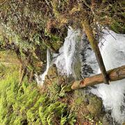
We are studying where and when Scatter Creek goes dry, as well as where and how much of its water is lost to the ground.
Featured Science | Streamflow Permanence in the Pacific Northwest
We are gathering data, developing new models, and providing data visualization and outreach tools.
Featured Science | Southeast Sound Groundwater Flow Model
Major aquifer study including the construction and calibration of a numerical groundwater flow model.
We research water availability so that the public knows how much water is available now and into the future. Our research focuses on determining the quantity, quality, and timing of water. In addition to conducting extensive monitoring, we develop detailed models to aid in addressing these complex topics.
Water Budgets
Water budgets are detailed accounts of water systems. They summarize the ins and outs, and sometimes the timing of water exchanges. Our work to develop water budgets helps water resource managers and communities make informed decisions about how they are using water.
Groundwater - Surface Water Interactions
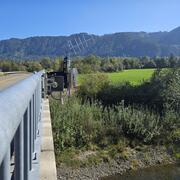
In most areas of Washington, groundwater is hydraulically connected to nearby rivers, lakes, and wetlands. We study the groundwater – surface water interface to better understand how much water is moving from above and below ground. Knowledge of ground and surface water exchange helps managers protect these interconnected resources.
Hydrogeology
Our hydrogeologic studies focus on regional groundwater assessments, aquifer delineation, and inter-agency science support. We specialize in estimating aquifer properties, mapping 3-D hydrogeologic frameworks, determining flow rates and directions, and conducting tracer analyses.
PROSPER Puget Sound - Modeling Streamflow Permanence
Groundwater/surface-water interaction within the South Fork Nooksack River Basin

Assessment of groundwater-surface water exchange to support Scatter Creek, Washington baseflow

Streamflow Permanence in the Pacific Northwest

Mapping ecohydrological headwater refugia

Water temperature modeling in Mount Rainier National Park

Osoyoos Ice Jam

Evaluation of Groundwater Resources in the White River Watershed

Water Availability for Tribal Treaty Rights in Western Washington

A cell-by-cell water budget output from USGS Kitsap Peninsula groundwater model for VELMA
Simulated groundwater flow paths and travel times near Joint Base Lewis–McChord, Washington