
Land and Water Resource Change
Land and Water Resource Change
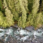
We live in a changing world where land and water are connected. This research focuses on how climate and land use change affect all parts of the hydrologic system including snow and ice, rivers, and groundwater.
Filter Total Items: 27
Watersheds and Fluvial Systems Team
The Watersheds and Fluvial Systems Team at the Washington Water Science Center provides reliable science to understand how watersheds, rivers, and streams function—and how they respond to a changing world. We aim to build partnerships that foster informed decision-making and effective resource management throughout the Pacific Northwest region and across the U.S.
Green River Sediment Monitoring
The Issue: Management efforts on the lower Green River to reduce flood hazards and improve habitat conditions are inherently interconnected with sediment transport and channel change dynamics. Those dynamics are, in turn, driven by a mix of interacting geologic, anthropogenic, and hydrologic factors. However, there have been no recent watershed-scale analyses of sediment dynamics in the Green...
Carbon in Urban River Biogeochemistry Project
The Issue: In aquatic ecosystems, dissolved organic carbon represents the largest flux of carbon in streams and it is a primary energy source in aquatic food webs. There is limited understanding of how human activities related to urban development influence the timing and scale of carbon cycling in aquatic ecosystems. How USGS will help: The USGS is working with university partners to assess how...

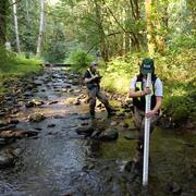
Streamflow Permanence in the Pacific Northwest
Not all rivers and streams flow year-round. Understanding when and where streams flow or go dry is critical for managing land use, water quality, and water availability on landscapes. The USGS and partners are studying streamflow permanence in the Pacific Northwest. We are gathering data, developing new models, and providing data visualization and outreach tools.

Integration of Urban Stormwater Infrastructure in Modeling Water Quality Patterns in Small Urban Streams
The Issue: Stormwater can quickly run off impervious surfaces delivering potentially polluted water to streams and rivers in the Puget Sound region. Runoff from impervious surfaces can either be directly connected to streams through stormwater pipes or indirectly connected if runoff is routed to some other surface such as grass or a feature like a stormwater management structure. It is currently...

Mapping ecohydrological headwater refugia
The Issue: Forests in the Pacific Northwest have changed substantially over the past hundred years because of logging, changing forest management methods, and climate change. These forests contain a dense network of small headwater streams that supply cold, clean water and support 52 amphibian species. These amphibians live both in the cold streams and in the cool, moist areas nearby. Natural...

Understanding the Effects of Stormwater Management Practices on Water Quality and Flow
Urban development can have detrimental impacts on streams including altering hydrology, increasing nutrient, sediment, and pollutant loadings, and degrading biological integrity. Stormwater Best Management Practices (BMPs) can be used to mitigate the effects of urban development by retaining large volumes of stormwater runoff and treating runoff to remove pollutants. This project focuses on...

Hoh geomorphology
The Issue: Glaciers in the Hoh River watershed are expected to largely disappear by 2050, while flooding is expected to become more intense. Understanding if or how this will impact sediment transport and channel change in the watershed is relevant for salmon habitat, restoration efforts, and flood hazard management. However, there is relatively little information about historical channel...

Bolt Creek Wildfire Sediment Runoff and Water Quality
The Issue: Scientists and water-resource managers recognize the increasing impact of wildfires on water supply in the western U.S. The increasing frequency and severity of wildfires are linked to changes in snowpack, warmer temperatures, and drought. Sedimentation following wildfire can impact aquatic habitat, reservoir storage capacity, water quality, and thus public drinking water supplies...
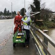
Stormwater Action Monitoring (SAM)
The issue: Stormwater runoff often carries pollutants that degrade water quality in receiving waters. A regional-scale monitoring program is necessary to objectively measure and track progress in reducing stormwater impacts on environmental health. How USGS will help: Scientists from the U.S. Geological Survey (USGS) are monitoring water quality and watershed health for urban and urbanizing areas...

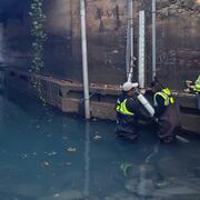
Hydrogeologic Framework for the Duwamish River Valley to the Lake Washington Ship Canal, Washington
The Issue: King County has over 30 miles of coastline on the Puget Sound where coastal sea level rise and high tides can cause flooding. Many coastal areas have low elevations and are prone to flooding during high tides, extreme rainfall, and high streamflow. In addition, groundwater inundation—localized coastal flooding due to a rise of the groundwater table with global sea-level rise—may...

Channel Change and Sediment Transport in the Puyallup River Watershed
The Issue: Sediment loads in the Puyallup River and its major tributaries, the White River and Carbon River, are high and river channels are dynamic. While there is a relatively rich history of sediment transport and channel change studies in the Puyallup River and its tributaries, there has not been an integrated assessment of channel-elevation trends in nearly a decade. This lack of up-to-date...