
Water flows over pavement into a storm drain.
Images
Below are images associated with the Washington Water Science Center's science and staff. Images appear according to the year they were taken. To search, type a keyword or select a year from the dropdown menu. Or, click through the pages using the arrows at the bottom of the page.
Filter Total Items: 254

Storm drain
Water flows over pavement into a storm drain.
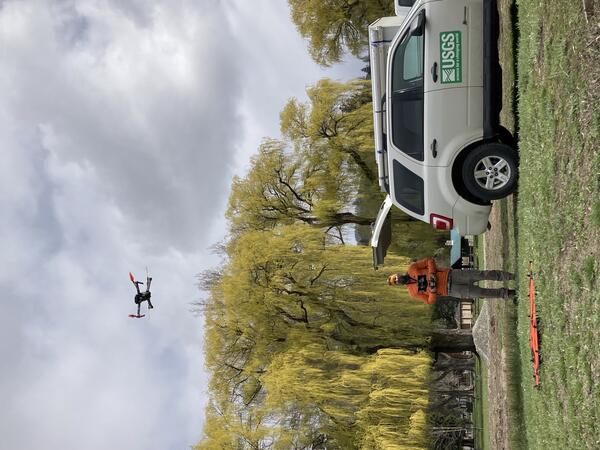
UAS takeoff
USGS scientist launches a UAS system for collecting detailed imagery in support of water science.
USGS scientist launches a UAS system for collecting detailed imagery in support of water science.
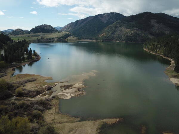
Delta on the Conconully Reservoir, Washington
Aerial view of the Conconully Reservoir in Washington State, with a delta visible at the lake inflow to the left.
Aerial view of the Conconully Reservoir in Washington State, with a delta visible at the lake inflow to the left.

Large wood movement in the Nooksack River
Large logs and root balls float downstream during a high flow event on the Nooksack River near Everson.
Large logs and root balls float downstream during a high flow event on the Nooksack River near Everson.

Measuring streamflow in the Pend Oreille River, WA
Measuring streamflow in the Pend Oreille River, WAA hydrologic technician uses a cableway to measure streamflow in the Pend Oreille River on a winter day. On-shore, a computer shows streamflow data in real-time, allowing the team to monitor their progress.

Pond sediment sample
Particulate sample collected from the Clarks Creek watershed, Washington. The murky material consists of sediment and organics.
Particulate sample collected from the Clarks Creek watershed, Washington. The murky material consists of sediment and organics.
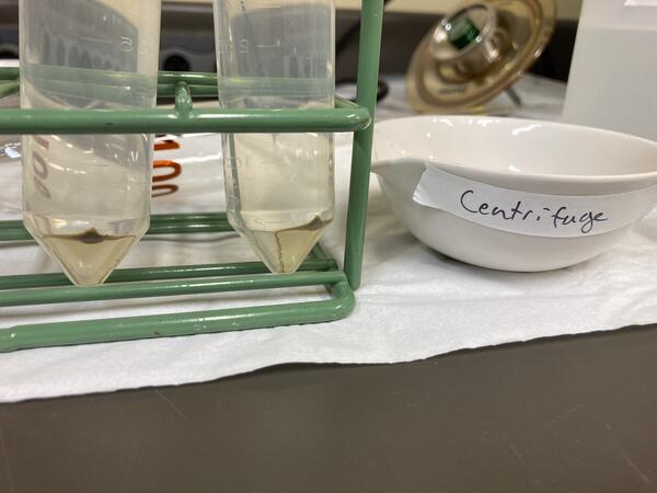
Centrifuged Solids
USGS scientists have developed a novel technique for collecting particulate samples via continuous flow centrifugation.
USGS scientists have developed a novel technique for collecting particulate samples via continuous flow centrifugation.
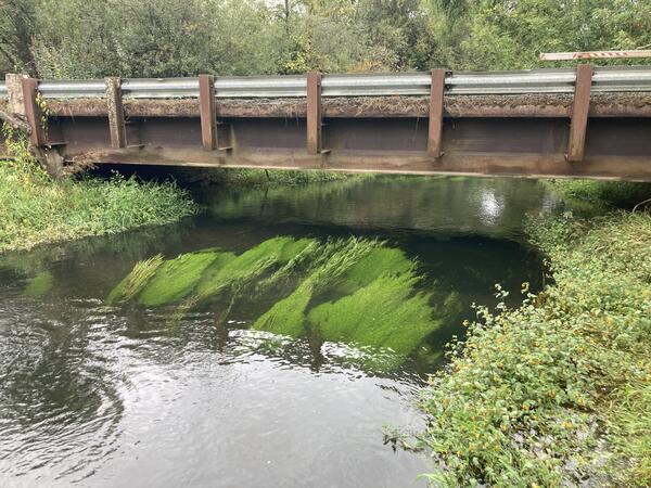
Elodea growth in Washington stream
Elodea and other aquatic plants grow in a thick clump in Clarks Creek, WA. Plants growing in streams may change the water chemistry as well as how quickly water can flow through the stream. USGS scientists study these dynamics.
Elodea and other aquatic plants grow in a thick clump in Clarks Creek, WA. Plants growing in streams may change the water chemistry as well as how quickly water can flow through the stream. USGS scientists study these dynamics.

Hydrologic technician measures streamflow in Tokul Creek
Hydrologic technician measures streamflow in Tokul CreekUSGS Hydrologic Technician Katie Johnson measures streamflow in Tokul Creek near Snoqualmie, WA (12145000).
Hydrologic technician measures streamflow in Tokul Creek
Hydrologic technician measures streamflow in Tokul CreekUSGS Hydrologic Technician Katie Johnson measures streamflow in Tokul Creek near Snoqualmie, WA (12145000).

River rapids
Water rushes over boulders to form rapids. Photo is from a river in western Washington State.
Water rushes over boulders to form rapids. Photo is from a river in western Washington State.

Moclips River Stormwater Assessment Site
Stormwater assessment site on the Moclips River Near Moclips, WA on the Quinault Indian Nation Tribal land.
Stormwater assessment site on the Moclips River Near Moclips, WA on the Quinault Indian Nation Tribal land.

Pacific Lamprey Habitat
Type 1 Pacific lamprey habitat on the Klickitat River near Glenwood, WA. Type I (preferred) lamprey habitat that consists of a mixed substrate of silt, clay, organic matter, and sand.
Type 1 Pacific lamprey habitat on the Klickitat River near Glenwood, WA. Type I (preferred) lamprey habitat that consists of a mixed substrate of silt, clay, organic matter, and sand.
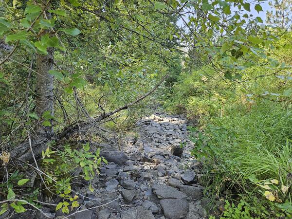
Dry Stream near Blewett Pass, Washington
A small stream near Blewett Pass, Washington is dry in late summer. Scientists visited to record streamflow conditions with the FLOwPER mobile field form.
A small stream near Blewett Pass, Washington is dry in late summer. Scientists visited to record streamflow conditions with the FLOwPER mobile field form.
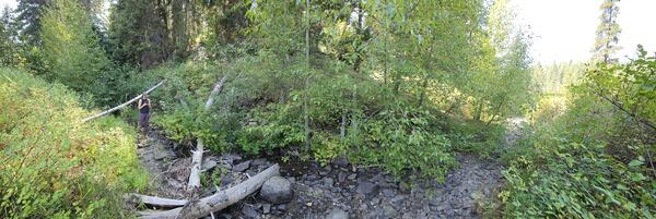
Streamflow Permanence Data Collection
A USGS hydrologist uses the FLOwPER mobile application to record an observation of streamflow conditions.
A USGS hydrologist uses the FLOwPER mobile application to record an observation of streamflow conditions.
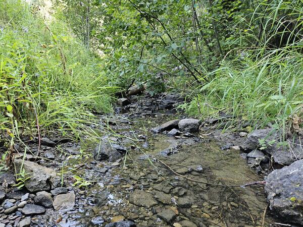
Wet Stream near Blewett Pass, Washington
A small stream near Blewett Pass, Washington has water flowing in late summer. Scientists visited to record streamflow conditions with the FLOwPER mobile field form.
A small stream near Blewett Pass, Washington has water flowing in late summer. Scientists visited to record streamflow conditions with the FLOwPER mobile field form.
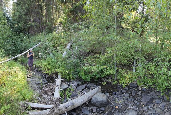
Streamflow Permanence Data Collection in Washington
Streamflow Permanence Data Collection in WashingtonA USGS hydrologist uses the FLOwPER mobile application to record an observation of streamflow conditions.
Streamflow Permanence Data Collection in Washington
Streamflow Permanence Data Collection in WashingtonA USGS hydrologist uses the FLOwPER mobile application to record an observation of streamflow conditions.

Tidal flux measurement in Sinclair Inlet
Scientists demonstrate equipment used to measure fluxes between groundwater and surface water. These interactions are particularly complex in tidally influenced shorelines such as Sinclair Inlet, WA.
Scientists demonstrate equipment used to measure fluxes between groundwater and surface water. These interactions are particularly complex in tidally influenced shorelines such as Sinclair Inlet, WA.

Tidal seepage measurement
A seepage meter implanted in the sediment-water interface of a tidal beach. The meter allows scientists to measure interactions between groundwater and surface water.
A seepage meter implanted in the sediment-water interface of a tidal beach. The meter allows scientists to measure interactions between groundwater and surface water.

Low tide at Sinclair Inlet
Scientists prepare for a geophysical survey of the shoreline at Sinclair Inlet, WA. The survey will provide information about the interactions between groundwater and surface water in this complex tidal system.
Scientists prepare for a geophysical survey of the shoreline at Sinclair Inlet, WA. The survey will provide information about the interactions between groundwater and surface water in this complex tidal system.

Water Quality Sampling in the Lower Stillaguamish Estuary
Water Quality Sampling in the Lower Stillaguamish EstuaryUSGS Ecologist Julia David collects water quality data in the lower Stillaguamish Estuary near Stanwood, WA. Data will support a baseline assessment of PAH concentrations in fish in the Stillaguamish River, WA.

USGS Hydrologic Technicians prepare to take measurement from cableway
USGS Hydrologic Technicians prepare to take measurement from cablewayUSGS Hydrologic Technicians David Bess, Kim Cesal, and Joe Gilbert prepare to make a discharge measurement with an ADCP from a cableway over a large river in Washington State.