A USGS technician surveys the seafloor bathymetry using a personal watercraft outfitted with global positioning systems (GPS) and echo sounders.
Location: Santa Cruz, California (near Wharf).

Official websites use .gov
A .gov website belongs to an official government organization in the United States.
Secure .gov websites use HTTPS
A lock () or https:// means you’ve safely connected to the .gov website. Share sensitive information only on official, secure websites.
Images

A USGS technician surveys the seafloor bathymetry using a personal watercraft outfitted with global positioning systems (GPS) and echo sounders.
Location: Santa Cruz, California (near Wharf).
A USGS technician surveys the seafloor bathymetry using a personal watercraft outfitted with global positioning systems (GPS) and echo sounders.
Location: Santa Cruz, California (near Wharf).

A USGS technician surveys the seafloor bathymetry using a personal watercraft outfitted with global positioning systems (GPS) and echo sounders.
Location: Santa Cruz, California (near Steamers Lane).
A USGS technician surveys the seafloor bathymetry using a personal watercraft outfitted with global positioning systems (GPS) and echo sounders.
Location: Santa Cruz, California (near Steamers Lane).

Photograph of a USGS technician on a USGS coastal survey vessel that maps seafloor bathymetry using global positioning systems (GPS) and echo sounders.
Location:Santa Cruz, California (near Wharf).
Photograph of a USGS technician on a USGS coastal survey vessel that maps seafloor bathymetry using global positioning systems (GPS) and echo sounders.
Location:Santa Cruz, California (near Wharf).

A USGS technician surveys the seafloor bathymetry using a personal watercraft outfitted with global positioning systems (GPS) and echo sounders.
Location:Santa Cruz, California (near Santa Cruz Boardwalk).
A USGS technician surveys the seafloor bathymetry using a personal watercraft outfitted with global positioning systems (GPS) and echo sounders.
Location:Santa Cruz, California (near Santa Cruz Boardwalk).

A pink granite monument at the Lyndon Baines Johnson Memorial Grove on the Potomac. It was hewn from a quarry in the Texas Hill Country, where Johnson was born and raised.
A pink granite monument at the Lyndon Baines Johnson Memorial Grove on the Potomac. It was hewn from a quarry in the Texas Hill Country, where Johnson was born and raised.

A pink granite monument at the Lyndon Baines Johnson Memorial Grove on the Potomac. It was hewn from a quarry in the Texas Hill Country, where Johnson was born and raised.
A pink granite monument at the Lyndon Baines Johnson Memorial Grove on the Potomac. It was hewn from a quarry in the Texas Hill Country, where Johnson was born and raised.
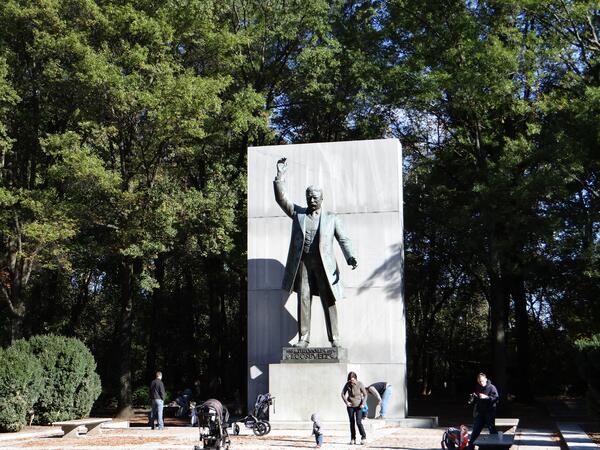
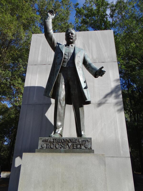
A statue of Theodore Roosevelt on Theodore Roosevelt Island.
A statue of Theodore Roosevelt on Theodore Roosevelt Island.
A statue of Theodore Roosevelt on Theodore Roosevelt Island.
A statue of Theodore Roosevelt on Theodore Roosevelt Island.
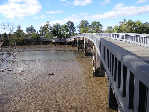
Footbridge over the Boundary Channel of the Potomac River, which forms the boundary between the District of Columbia and the Commonwealth of Virginia. The Footbridge connects the parking lots of the Pentagon to the Lyndon Baines Johnson Memorial Grove on the Potomac.
Footbridge over the Boundary Channel of the Potomac River, which forms the boundary between the District of Columbia and the Commonwealth of Virginia. The Footbridge connects the parking lots of the Pentagon to the Lyndon Baines Johnson Memorial Grove on the Potomac.
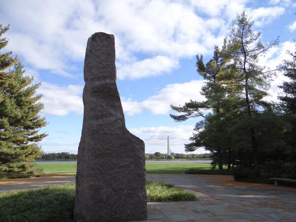
A pink granite monument at the Lyndon Baines Johnson Memorial Grove on the Potomac. It was hewn from a quarry in the Texas Hill Country, where Johnson was born and raised. The Washington Monument is in the background.
A pink granite monument at the Lyndon Baines Johnson Memorial Grove on the Potomac. It was hewn from a quarry in the Texas Hill Country, where Johnson was born and raised. The Washington Monument is in the background.
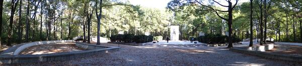
A panorama of the Boundary Channel of the Potomac River, which forms the boundary between the District of Columbia and the Commonwealth of Virginia. On the right of the image is the Lyndon Baines Johnson Memorial Grove on the Potomac.
A panorama of the Boundary Channel of the Potomac River, which forms the boundary between the District of Columbia and the Commonwealth of Virginia. On the right of the image is the Lyndon Baines Johnson Memorial Grove on the Potomac.
Hiking trails on Theodore Roosevelt Island, in Washington, DC.
Hiking trails on Theodore Roosevelt Island, in Washington, DC.
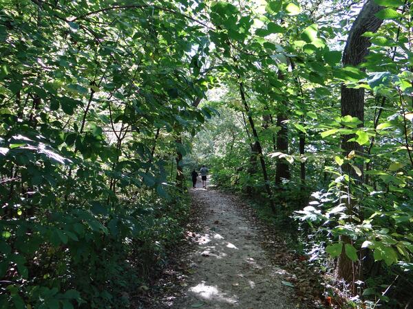
Hiking trails on Theodore Roosevelt Island, in Washington, DC.
Hiking trails on Theodore Roosevelt Island, in Washington, DC.
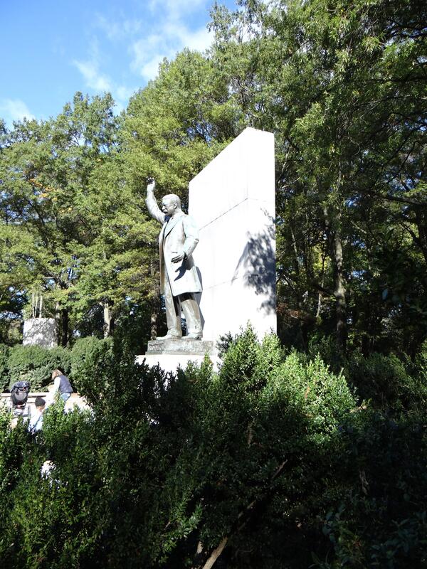
A panorama of the Theodore Roosevelt Monument on Theodore Roosevelt Island. In the center can be seen a statue of Theodore Roosevelt.
A panorama of the Theodore Roosevelt Monument on Theodore Roosevelt Island. In the center can be seen a statue of Theodore Roosevelt.
A statue of Theodore Roosevelt on Theodore Roosevelt Island.
A statue of Theodore Roosevelt on Theodore Roosevelt Island.

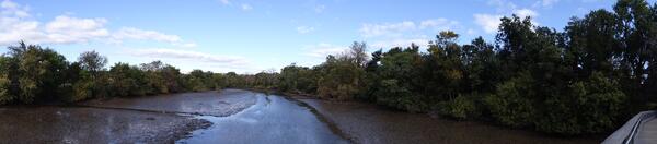
An image of the Potomac River between the Theodore Roosevelt Island of Washington, DC, and the city of Rosslyn, Virginia. To the north can be seen the Francis Scott Key Bridge, which connects Rosslyn, VA, with Georgetown, Washington, DC. It is the oldest surviving bridge over the Potomac in Washington, DC.
An image of the Potomac River between the Theodore Roosevelt Island of Washington, DC, and the city of Rosslyn, Virginia. To the north can be seen the Francis Scott Key Bridge, which connects Rosslyn, VA, with Georgetown, Washington, DC. It is the oldest surviving bridge over the Potomac in Washington, DC.
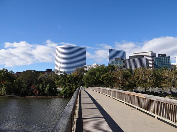
A view of Rosslyn, VA, from the footbridge that connects Theodore Roosevelt Island to the Commonwealth of Virginia.
A view of Rosslyn, VA, from the footbridge that connects Theodore Roosevelt Island to the Commonwealth of Virginia.
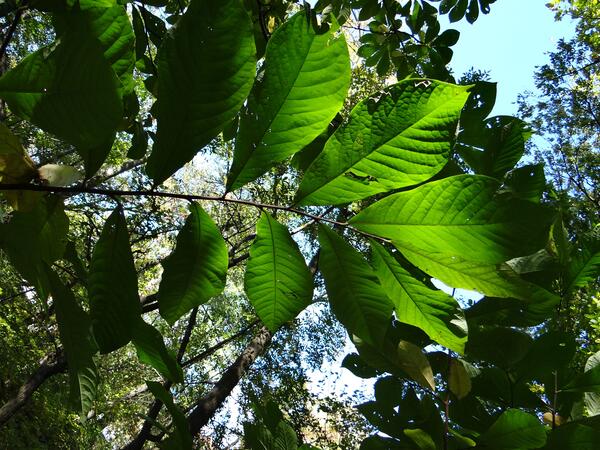
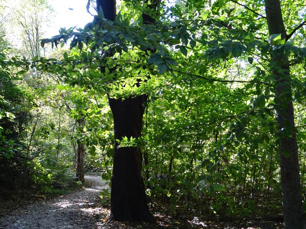
Sunlight glints through the leaves of a Paw Paw tree on Theodore Roosevelt Island in Washington, DC.
Sunlight glints through the leaves of a Paw Paw tree on Theodore Roosevelt Island in Washington, DC.
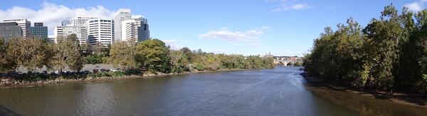
A panorama of the Potomac River at Rosslyn, Virginia. On the right can be seen the Theodore Roosevelt Island of Washington, DC. On the left are the office buildings in Rosslyn.
A panorama of the Potomac River at Rosslyn, Virginia. On the right can be seen the Theodore Roosevelt Island of Washington, DC. On the left are the office buildings in Rosslyn.
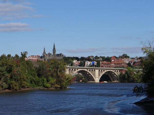
A view of the Francis Scott Key Bridge that connects Rosslyn, VA, with Georgetown, Washington, DC. In the background can be seen the spires of Georgetown University.
A view of the Francis Scott Key Bridge that connects Rosslyn, VA, with Georgetown, Washington, DC. In the background can be seen the spires of Georgetown University.
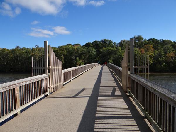
The footbridge that spans the Potomac River and connects the Theodore Roosevelt Island to the Commonwealth of Virginia.
The footbridge that spans the Potomac River and connects the Theodore Roosevelt Island to the Commonwealth of Virginia.