Oceanographic Research Vessel METEOR. Photo courtesy of Ferdinand Oberle.
Location: NW Iberian Shelf, Atlantic Ocean

Official websites use .gov
A .gov website belongs to an official government organization in the United States.
Secure .gov websites use HTTPS
A lock () or https:// means you’ve safely connected to the .gov website. Share sensitive information only on official, secure websites.
Images

Oceanographic Research Vessel METEOR. Photo courtesy of Ferdinand Oberle.
Location: NW Iberian Shelf, Atlantic Ocean
Oceanographic Research Vessel METEOR. Photo courtesy of Ferdinand Oberle.
Location: NW Iberian Shelf, Atlantic Ocean

Oceanographic Research Vessel METEOR.
Location: NW Iberian Shelf, Atlantic Ocean
Oceanographic Research Vessel METEOR.
Location: NW Iberian Shelf, Atlantic Ocean

One of the many passing bottom trawlers on the NW Iberian Shelf as seen from Research Vessel METEOR.
Location: NW Iberian Shelf, Atlantic Ocean
One of the many passing bottom trawlers on the NW Iberian Shelf as seen from Research Vessel METEOR.
Location: NW Iberian Shelf, Atlantic Ocean

Deployment of Scientific Research Equipment (Tripod) from ship, RV Meteor
Location: NW Iberian Shelf, Atlantic Ocean
Deployment of Scientific Research Equipment (Tripod) from ship, RV Meteor
Location: NW Iberian Shelf, Atlantic Ocean

Oil-well pads dotting the landscape of typical badland topography. Thousands of new wells are drilled into the Bakken and Three Forks annually, making this one of the most productive plays in the Nation.
Oil-well pads dotting the landscape of typical badland topography. Thousands of new wells are drilled into the Bakken and Three Forks annually, making this one of the most productive plays in the Nation.

During August 2013, the Beaver Creek wildfire burned more than 114,000 acres near the south-central Idaho communities of Sun Valley, Ketchum, and Hailey. Partnering with Blaine County, the USGS installed a network of real-time precipitation gages in the burn area.
During August 2013, the Beaver Creek wildfire burned more than 114,000 acres near the south-central Idaho communities of Sun Valley, Ketchum, and Hailey. Partnering with Blaine County, the USGS installed a network of real-time precipitation gages in the burn area.

Collected eggs and extracted milt mixed with water and stirred with a feather to stimulate fertilization.
Collected eggs and extracted milt mixed with water and stirred with a feather to stimulate fertilization.

Milt being collected from a male Pallid Sturgeon.
Milt being collected from a male Pallid Sturgeon.

USGS Image Drylands of Southern Utah - April 28, 2014
USGS Image Drylands of Southern Utah - April 28, 2014

Researchers at the Columbia Environmental Research Center will use experimental streams with sand, gravel or cobble bottoms to help to determine the influence of the different substrates on hatch and initiation of dispersal of pallid sturgeon free-embryos.
Researchers at the Columbia Environmental Research Center will use experimental streams with sand, gravel or cobble bottoms to help to determine the influence of the different substrates on hatch and initiation of dispersal of pallid sturgeon free-embryos.

Weekly sturgeon free embryo efforts were initiated on April 15, 2014 near the confluence of the Platte and Missouri Rivers. Pictured is biologist Jeff Beasley preparing to deploy a sampling net into the Missouri River.
Weekly sturgeon free embryo efforts were initiated on April 15, 2014 near the confluence of the Platte and Missouri Rivers. Pictured is biologist Jeff Beasley preparing to deploy a sampling net into the Missouri River.

Field crew on Bob Allen Key in Florida Bay, Everglades National Park, April 14, 2014, conferring on next steps near core sites marked with orange flags. The mangroves that form the islands’ perimeter are to the left and in the background.
Field crew on Bob Allen Key in Florida Bay, Everglades National Park, April 14, 2014, conferring on next steps near core sites marked with orange flags. The mangroves that form the islands’ perimeter are to the left and in the background.

Photo of restoration structures in the Deer Island restoration site, Missouri River, during April 2014.
Photo of restoration structures in the Deer Island restoration site, Missouri River, during April 2014.
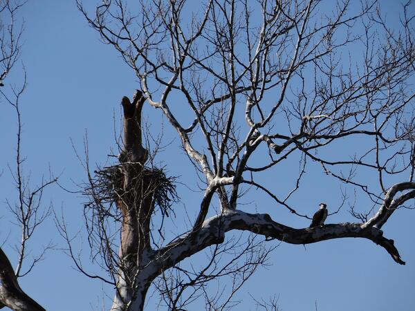
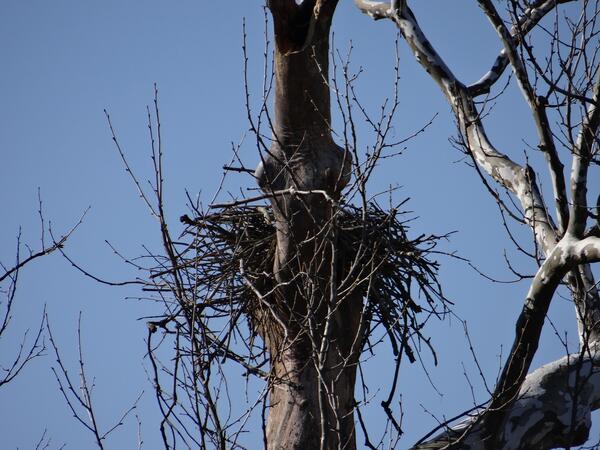
An osprey's nest in Piscataway Park, just south of the District of Columbia. The osprey sits just to the right of the nest.
An osprey's nest in Piscataway Park, just south of the District of Columbia. The osprey sits just to the right of the nest.
A small creek drains into the Potomac River in Piscataway Park, south of the District of Columbia.
A small creek drains into the Potomac River in Piscataway Park, south of the District of Columbia.
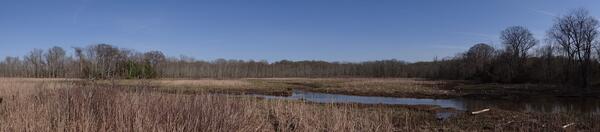
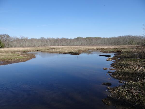
A panorama of Accokeek Creek in Piscataway Park, south of the District of Columbia.
A panorama of Accokeek Creek in Piscataway Park, south of the District of Columbia.
Driftwood along the banks of the Potomac River in Piscataway Park, south of the District of Columbia.
Driftwood along the banks of the Potomac River in Piscataway Park, south of the District of Columbia.
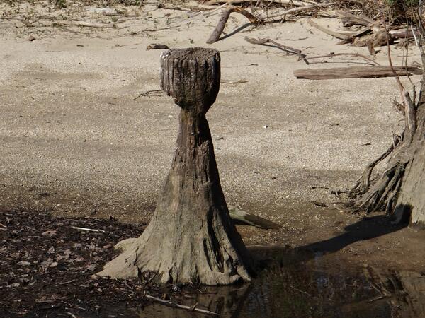
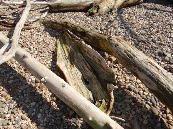
A tree stump has been weathered away by tidal action into this unique shape. The stump lies on the shores of the Potomac River in Piscataway Park, just south of the District of Columbia.
A tree stump has been weathered away by tidal action into this unique shape. The stump lies on the shores of the Potomac River in Piscataway Park, just south of the District of Columbia.
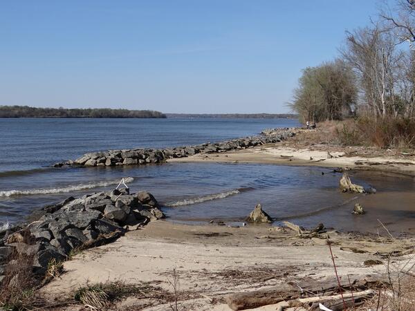
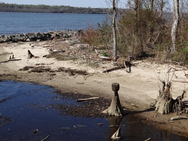
The mouth of Accokeek Creek as it empties into the Potomac River in Piscataway Park, south of the District of Columbia.
The mouth of Accokeek Creek as it empties into the Potomac River in Piscataway Park, south of the District of Columbia.
A small creek drains into the Potomac River in Piscataway Park, south of the District of Columbia.
A small creek drains into the Potomac River in Piscataway Park, south of the District of Columbia.
An osprey's nest in Piscataway Park, just south of the District of Columbia.
An osprey's nest in Piscataway Park, just south of the District of Columbia.