
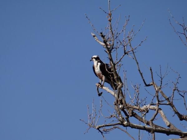
An osprey sits in a tree near its nest in Piscataway Park, just south of the District of Columbia
Images
Images
Filter Total Items: 9448

Driftwood along the Potomac
Driftwood along the banks of the Potomac River in Piscataway Park, south of the District of Columbia.
Driftwood along the banks of the Potomac River in Piscataway Park, south of the District of Columbia.

Hydrologist Measuring Streamflow
USGS hydrologist Greg Clark measures streamflow on Government Gulch Creek, a tributarty to the Coeur d'Alene River in northern Idaho. Streamflow data collected are included in the Coeur d'Alene Basin Environmental Monitoring Program the USGS conducts in cooperation with the Environmental Protection Agency.
USGS hydrologist Greg Clark measures streamflow on Government Gulch Creek, a tributarty to the Coeur d'Alene River in northern Idaho. Streamflow data collected are included in the Coeur d'Alene Basin Environmental Monitoring Program the USGS conducts in cooperation with the Environmental Protection Agency.

USGS scientist measuring flow downstream of Comal Springs
USGS scientist measuring flow downstream of Comal SpringsUSGS scientist Vidal Mendoza measures flow downstream of the Comal Springs, Texas.
A new website now provides important information about streamflow in the Comal and San Marcos Rivers and springflow at Comal and San Marcos Springs.

Cableway Measurement
On April 10, 2014 hydrologic technicians Nick Stasulis and Anthony Underwood visited the USGS gaging station on Grand Lake Stream at Grand Lake Stream, Maine. The cableway was used to make a discharge measurement with an acoustic Doppler current profiler (ADCP).
On April 10, 2014 hydrologic technicians Nick Stasulis and Anthony Underwood visited the USGS gaging station on Grand Lake Stream at Grand Lake Stream, Maine. The cableway was used to make a discharge measurement with an acoustic Doppler current profiler (ADCP).

Rising River
On April 9, 2014 a visit to the USGS gaging station on Libby Brook near Northfield, Maine showed that while runoff had caused a large rise in the small brook, there still remained a significant snowpack in the area.
On April 9, 2014 a visit to the USGS gaging station on Libby Brook near Northfield, Maine showed that while runoff had caused a large rise in the small brook, there still remained a significant snowpack in the area.

Traveling Hydrographer
Spring in Maine introduces significant challenges for hydrographers when it comes to accessing remote stations. In this photo, hydrologic technician Anthony Underwood is prepared to visit the USGS gaging station on Libby Brook near Northfield, Maine.
Spring in Maine introduces significant challenges for hydrographers when it comes to accessing remote stations. In this photo, hydrologic technician Anthony Underwood is prepared to visit the USGS gaging station on Libby Brook near Northfield, Maine.
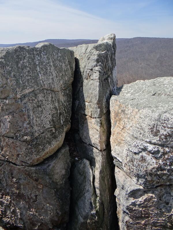
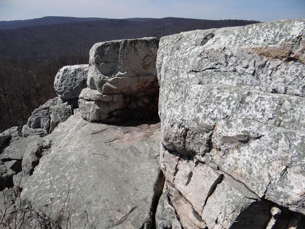
Chimney Rock Formation
The Chimney Rock formation with Catoctin Moutain Park. Catoctin Mountain is part of the Blue Ridge Mountains. Chimney Rock is mostly made of quartzite, a metamorphic mineral.
The Chimney Rock formation with Catoctin Moutain Park. Catoctin Mountain is part of the Blue Ridge Mountains. Chimney Rock is mostly made of quartzite, a metamorphic mineral.
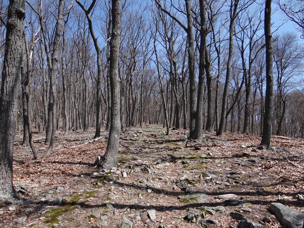
Mountain Trail through Catoctin Mountain Park
A hiking trail winds through the woods of Catoctin Mountain Park towards the Chimney Rock formation. Catoctin Mountain is part of the Blue Ridge Mountains.
A hiking trail winds through the woods of Catoctin Mountain Park towards the Chimney Rock formation. Catoctin Mountain is part of the Blue Ridge Mountains.
Chimney Rock Formation
The Chimney Rock formation with Catoctin Moutain Park. Catoctin Mountain is part of the Blue Ridge Mountains. Chimney Rock is mostly made of quartzite, a metamorphic mineral.
The Chimney Rock formation with Catoctin Moutain Park. Catoctin Mountain is part of the Blue Ridge Mountains. Chimney Rock is mostly made of quartzite, a metamorphic mineral.

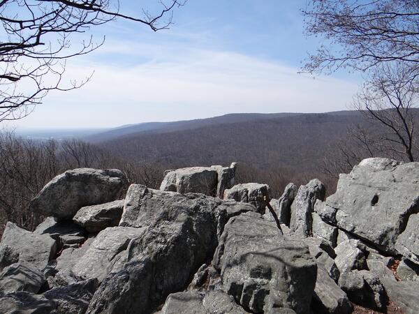
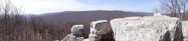
Chimney Rock Panorama
A panorama of the Chimney Rock formation with Catoctin Moutain Park. Catoctin Mountain is part of the Blue Ridge Mountains. Chimney Rock is mostly made of quartzite, a metamorphic mineral.
A panorama of the Chimney Rock formation with Catoctin Moutain Park. Catoctin Mountain is part of the Blue Ridge Mountains. Chimney Rock is mostly made of quartzite, a metamorphic mineral.

Ashumet Pond, Cape Cod
View looking west from Fishermans Cove, across Ashumet Pond, Cape Cod, Massachusetts. The small sticks in the lake are a small-scale sampling grid.
View looking west from Fishermans Cove, across Ashumet Pond, Cape Cod, Massachusetts. The small sticks in the lake are a small-scale sampling grid.

Catastrophic landslide near Oso, WA, Mar. 22, 2014.
Catastrophic landslide near Oso, WA, Mar. 22, 2014.Catastrophic landslide near Oso, Washington, March 22, 2014.
Catastrophic landslide near Oso, WA, Mar. 22, 2014.
Catastrophic landslide near Oso, WA, Mar. 22, 2014.Catastrophic landslide near Oso, Washington, March 22, 2014.

A USGS streamflow gauge station in the lower Trinity River, Texas.
A USGS streamflow gauge station in the lower Trinity River, Texas.A USGS streamflow gauge station in the lower Trinity River, Texas.
A USGS streamflow gauge station in the lower Trinity River, Texas.
A USGS streamflow gauge station in the lower Trinity River, Texas.A USGS streamflow gauge station in the lower Trinity River, Texas.

A USGS streamflow gauge station in the lower Trinity River, Texas.
A USGS streamflow gauge station in the lower Trinity River, Texas.A USGS streamflow gauge station in the lower Trinity River, Texas.
A USGS streamflow gauge station in the lower Trinity River, Texas.
A USGS streamflow gauge station in the lower Trinity River, Texas.A USGS streamflow gauge station in the lower Trinity River, Texas.

Spider Unit and 2014 Washington Landslide

Pallid Sturgeon Holding Tanks
Biologists work together to conduct reproductive assessments on pallid sturgeon held in study ponds.
Biologists work together to conduct reproductive assessments on pallid sturgeon held in study ponds.

Pallid Sturgeon in Dip Net
Biologists work together to conduct reproductive assessments on pallid sturgeon held in study ponds.
Biologists work together to conduct reproductive assessments on pallid sturgeon held in study ponds.

Spider Unit & 2014 Washington Landslide
The photograph shows a spider unit, which is being used to help study the landslide that occurred in northwest Washington on March 22, 2014. Spiders are portable instrumentation packages that contain high-precision GPS units for detecting landslide movement as well as geophones for detecting small vibrations. The spiders can be emplaced by hovering helicopters.
The photograph shows a spider unit, which is being used to help study the landslide that occurred in northwest Washington on March 22, 2014. Spiders are portable instrumentation packages that contain high-precision GPS units for detecting landslide movement as well as geophones for detecting small vibrations. The spiders can be emplaced by hovering helicopters.