
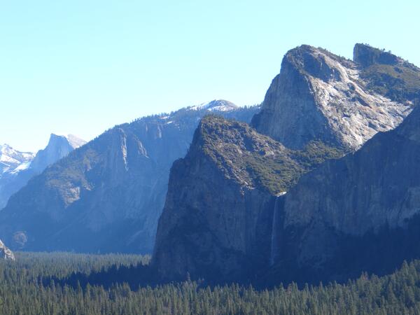
In this image, Bridalveil Fall can be seen from Tunnel View in Yosemite National Park. The waterfall is 617 ft (188 m) in height and is one of the most well-known of Yosemite National Park's waterfalls.
Images
Images
Filter Total Items: 9448
Bridalveil Fall
In this image, Bridalveil Fall can be seen from Tunnel View in Yosemite National Park. The waterfall is 617 ft (188 m) in height and is one of the most well-known of Yosemite National Park's waterfalls.

Fire Damage in Yosemite National Park
The sequoia forests of Yosemite National Park rely on a fire ecology-based ecosystem. Periodic forest fires clear out underbrush and shade-tolerant trees like white fir trees, allowing sequoia seedlings to reach adulthood.
The sequoia forests of Yosemite National Park rely on a fire ecology-based ecosystem. Periodic forest fires clear out underbrush and shade-tolerant trees like white fir trees, allowing sequoia seedlings to reach adulthood.
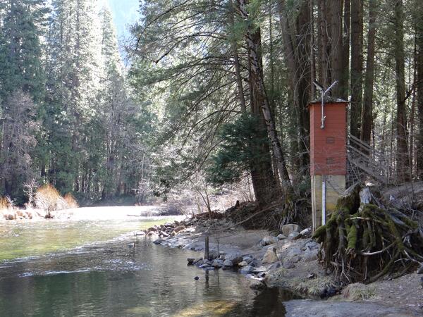
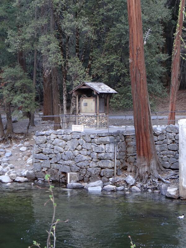
USGS Streamgage on Merced River at Pohono Bridge
The USGS streamgage on the Merced River located at Pohono Bridge within Yosemite National Park. It measures the daily discharge of water in cubic feet per second. Data from the streamgage may be accessed online.
The USGS streamgage on the Merced River located at Pohono Bridge within Yosemite National Park. It measures the daily discharge of water in cubic feet per second. Data from the streamgage may be accessed online.
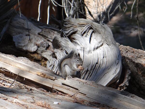
Western Gray Squirrel
A western gray squirrel chews on a giant sequoia pinecone. Squirrels are an important method of seed dispersal for giant sequoias. As they chew on the pinecone, seeds fall out and can take root.
A western gray squirrel chews on a giant sequoia pinecone. Squirrels are an important method of seed dispersal for giant sequoias. As they chew on the pinecone, seeds fall out and can take root.
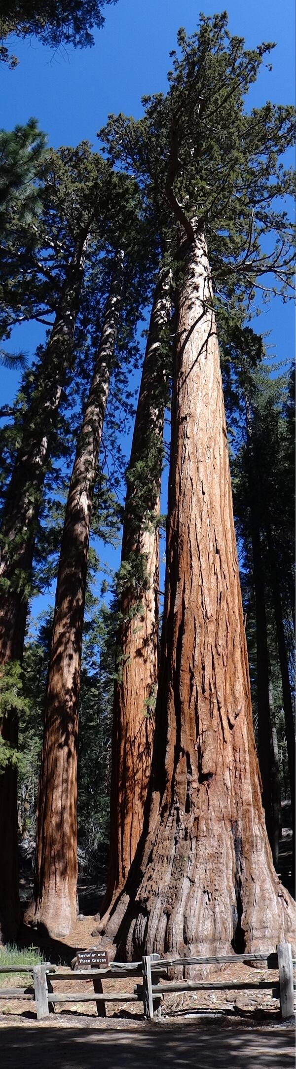
Bachelor and the Three Graces
This stand of giant sequoia trees is known as the Bachelor and Three Graces. They are located within the Mariposa Grove of Big Trees in Yosemite National Park.
This stand of giant sequoia trees is known as the Bachelor and Three Graces. They are located within the Mariposa Grove of Big Trees in Yosemite National Park.
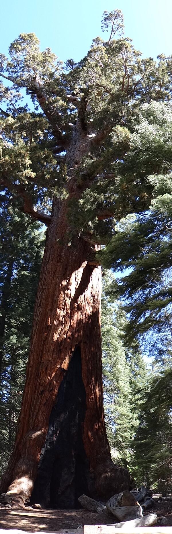
Grizzly Giant Tree
This giant sequoia is named the Grizzly Giant, the oldest sequoia tree in the Mariposa Grove of Big Trees, located within Yosemite National Park. It is believed to be between 1,900 and 2,400 years old.
This giant sequoia is named the Grizzly Giant, the oldest sequoia tree in the Mariposa Grove of Big Trees, located within Yosemite National Park. It is believed to be between 1,900 and 2,400 years old.
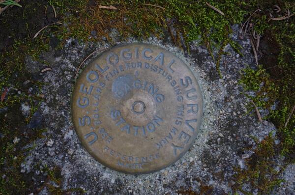
Yosemite Valley Benchmark
This benchmark is located adjacent to the USGS streamgage on the Merced River located at Pohono Bridge within Yosemite National Park.
This benchmark is located adjacent to the USGS streamgage on the Merced River located at Pohono Bridge within Yosemite National Park.
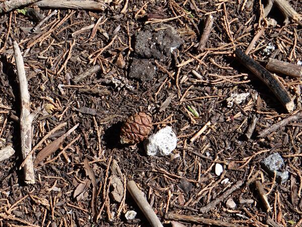
Giant Sequoia Pinecone
A pinecone of a giant sequoia rests on the forest floor. A large sequoia tree can have several thousand pinecones at a time. Although giant sequoia trees are among the largest trees in the world, their pinecones are comparatively small, usually only 2 inches or so.
A pinecone of a giant sequoia rests on the forest floor. A large sequoia tree can have several thousand pinecones at a time. Although giant sequoia trees are among the largest trees in the world, their pinecones are comparatively small, usually only 2 inches or so.
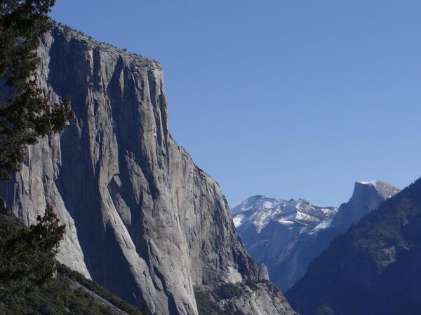
El Capitan
In this image, the west face of El Capitan may be seen from Tunnel View. El Capitan is a granite monolith that rises about 3,000 ft (900 m) from the valley floor and is one of Yosemite National Park's most famous landmarks.
In this image, the west face of El Capitan may be seen from Tunnel View. El Capitan is a granite monolith that rises about 3,000 ft (900 m) from the valley floor and is one of Yosemite National Park's most famous landmarks.
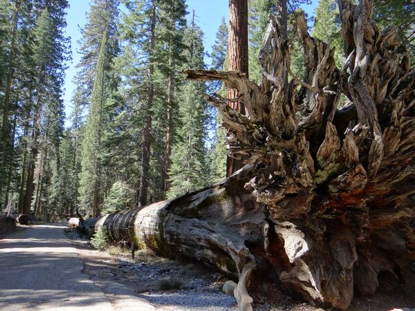
Fallen Monarch Tree
This tree is known as the Fallen Monarch Tree. It fell roughly 300 years ago. Because of the high level of tannins in their bark, giant sequoias are resistant to decay.
This tree is known as the Fallen Monarch Tree. It fell roughly 300 years ago. Because of the high level of tannins in their bark, giant sequoias are resistant to decay.
USGS Streamgage on Merced River at Pohono Bridge
The USGS streamgage on the Merced River located at Pohono Bridge within Yosemite National Park. It measures the daily discharge of water in cubic feet per second. Data from the streamgage may be accessed online.
The USGS streamgage on the Merced River located at Pohono Bridge within Yosemite National Park. It measures the daily discharge of water in cubic feet per second. Data from the streamgage may be accessed online.
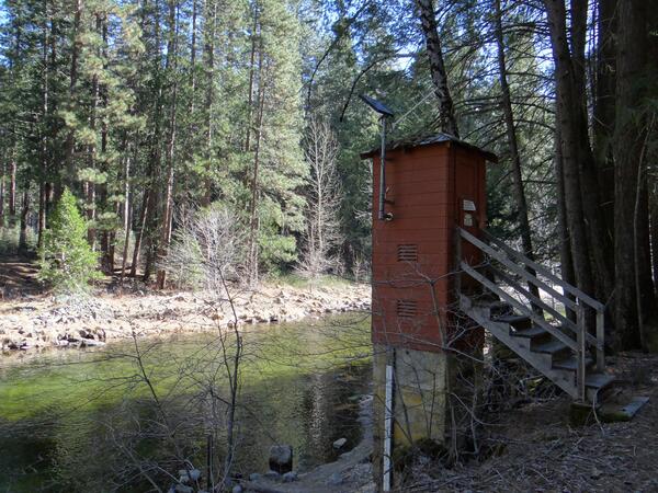
Former Yosemite Hydrologic Benchmark Streamgage
In this image, the former USGS Hydrologic Benchmark Streamgage on the Merced River in Yosemite Valley can be seen. Hydrologic Benchmark streamgages are those at which no human development exists upstream of the streamgage.
In this image, the former USGS Hydrologic Benchmark Streamgage on the Merced River in Yosemite Valley can be seen. Hydrologic Benchmark streamgages are those at which no human development exists upstream of the streamgage.
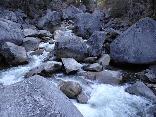
Merced River
In this image, the Merced River can be seen just upstream of Happy Isles and the USGS Benchmark Streamgage in Yosemite National Park. The Merced River is a 145 mile (233 km) long tributary of the San Joaquin River. It drains a large section of the Sierra Nevadas, including Yosemite Valley.
In this image, the Merced River can be seen just upstream of Happy Isles and the USGS Benchmark Streamgage in Yosemite National Park. The Merced River is a 145 mile (233 km) long tributary of the San Joaquin River. It drains a large section of the Sierra Nevadas, including Yosemite Valley.
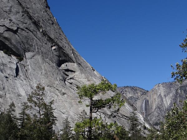
Yosemite Falls behind Illilouette Ridge
Uppder Yosemite Falls is visible on the right side of this image, taken behind Illilouette Ridge. Upper Yosemite Falls is 1,430 ft (440 m) tall. It is one of the most famous waterfalls in Yosemite National Park.
Uppder Yosemite Falls is visible on the right side of this image, taken behind Illilouette Ridge. Upper Yosemite Falls is 1,430 ft (440 m) tall. It is one of the most famous waterfalls in Yosemite National Park.
Merced River
In this image, the Merced River can be seen just upstream of Happy Isles and the USGS Benchmark Streamgage in Yosemite National Park. The Merced River is a 145 mile (233 km) long tributary of the San Joaquin River. It drains a large section of the Sierra Nevadas, including Yosemite Valley.
In this image, the Merced River can be seen just upstream of Happy Isles and the USGS Benchmark Streamgage in Yosemite National Park. The Merced River is a 145 mile (233 km) long tributary of the San Joaquin River. It drains a large section of the Sierra Nevadas, including Yosemite Valley.
Former Yosemite Hydrologic Benchmark Streamgage
In this image, the former USGS Hydrologic Benchmark Streamgage on the Merced River in Yosemite Valley can be seen. Hydrologic Benchmark streamgages are those at which no human development exists upstream of the streamgage.
In this image, the former USGS Hydrologic Benchmark Streamgage on the Merced River in Yosemite Valley can be seen. Hydrologic Benchmark streamgages are those at which no human development exists upstream of the streamgage.
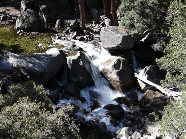
Illilouette Falls Detail
In this image, Illilouettea Falls, a tributary of the Merced River can be seen just upstream of Happy Isles and the USGS Benchmark Streamgage in Yosemite National Park. The Merced River is a 145 mile (233 km) long tributary of the San Joaquin River. It drains a large section of the Sierra Nevadas, including Yosemite Valley.
In this image, Illilouettea Falls, a tributary of the Merced River can be seen just upstream of Happy Isles and the USGS Benchmark Streamgage in Yosemite National Park. The Merced River is a 145 mile (233 km) long tributary of the San Joaquin River. It drains a large section of the Sierra Nevadas, including Yosemite Valley.
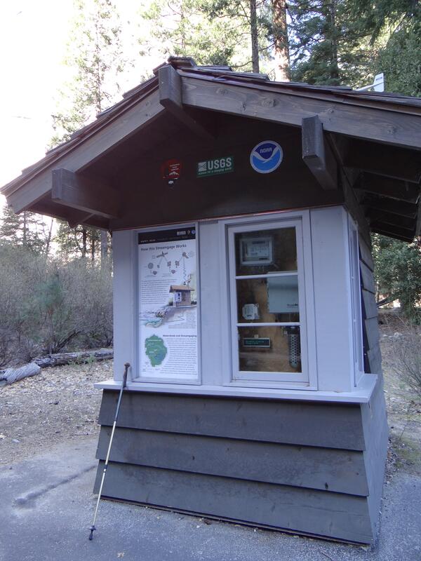
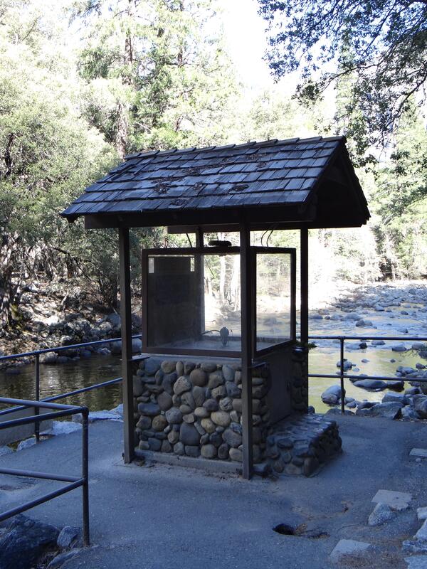
USGS Yosemite Benchmark Streamgage
In this image, the USGS Hydrologic Benchmark Streamgage on the Merced River in Yosemite Valley can be seen. Hydrologic Benchmark streamgages are those at which no human development exists upstream of the streamgage. This streamgage is a cooperation between the National Park Service, National Oceanic and Atmospheric Administration and USGS.
In this image, the USGS Hydrologic Benchmark Streamgage on the Merced River in Yosemite Valley can be seen. Hydrologic Benchmark streamgages are those at which no human development exists upstream of the streamgage. This streamgage is a cooperation between the National Park Service, National Oceanic and Atmospheric Administration and USGS.
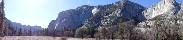
Panorama of Yosemite Valley Floor
In this panorama image of Yosemite Valley Floor, the east side of El Capitan may be seen prominently. El Capitan is a granite monolith, rising about 3,000 ft (900 m) from the valley floor. It is part of the Sierra Nevada batholith and one of the most famous landmarks of Yosemite National Park.
In this panorama image of Yosemite Valley Floor, the east side of El Capitan may be seen prominently. El Capitan is a granite monolith, rising about 3,000 ft (900 m) from the valley floor. It is part of the Sierra Nevada batholith and one of the most famous landmarks of Yosemite National Park.
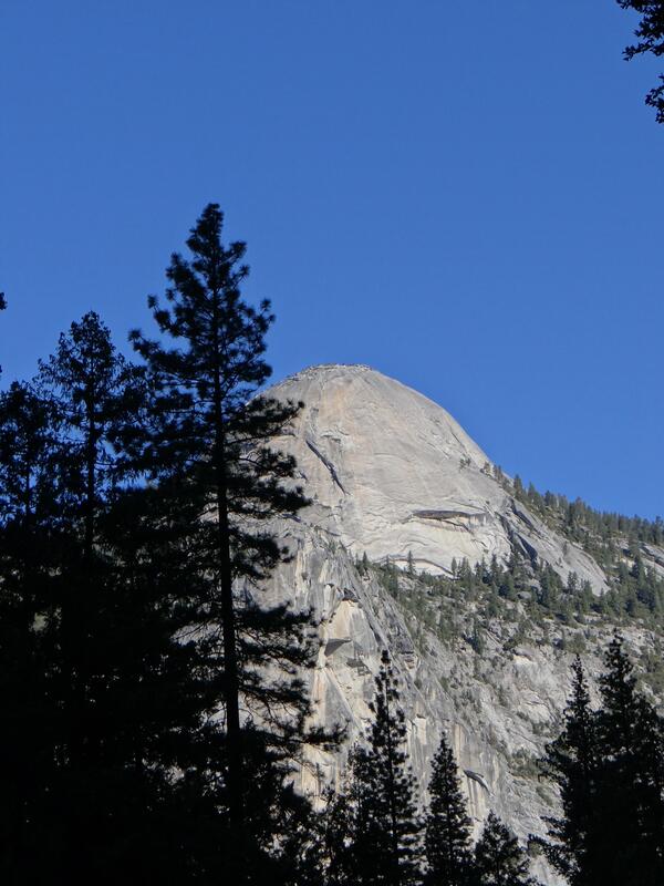
Basket Dome
In this image, Basket Dome can be seen. Basket Dome is a granite dome in Yosemite Valley within Yosemite National Park, located opposite Half Dome and adjacent to North Dome. It is part of the Sierra Nevada batholith.
In this image, Basket Dome can be seen. Basket Dome is a granite dome in Yosemite Valley within Yosemite National Park, located opposite Half Dome and adjacent to North Dome. It is part of the Sierra Nevada batholith.
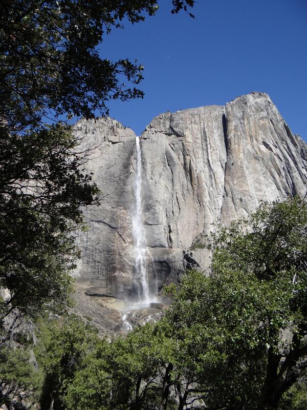
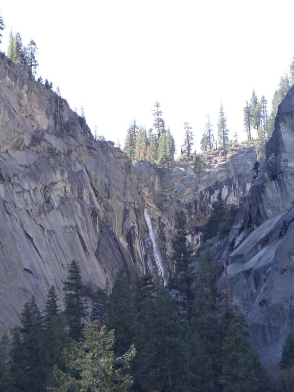
Upper Yosemite Falls
In this image, Upper Yosemite Falls may be seen from the Yosemite Falls Trail. Upper Yosemite Falls has a total plunge of 1,430 ft (440 m). Yosemite Falls is one of the most famous waterfalls within Yosemite National Park.
In this image, Upper Yosemite Falls may be seen from the Yosemite Falls Trail. Upper Yosemite Falls has a total plunge of 1,430 ft (440 m). Yosemite Falls is one of the most famous waterfalls within Yosemite National Park.