
Starting around July 10, 2013, an airplane operating under contract to the USGS will be making low-level flights over a 1400-square-mile area in the New Madrid Seismic Zone. This airplane is a Cessna-180, specially modified for low-altitude geophysical surveys.
Images
Images
Filter Total Items: 9448

Low-Flying Airplane Maps New Madrid Zone
Starting around July 10, 2013, an airplane operating under contract to the USGS will be making low-level flights over a 1400-square-mile area in the New Madrid Seismic Zone. This airplane is a Cessna-180, specially modified for low-altitude geophysical surveys.
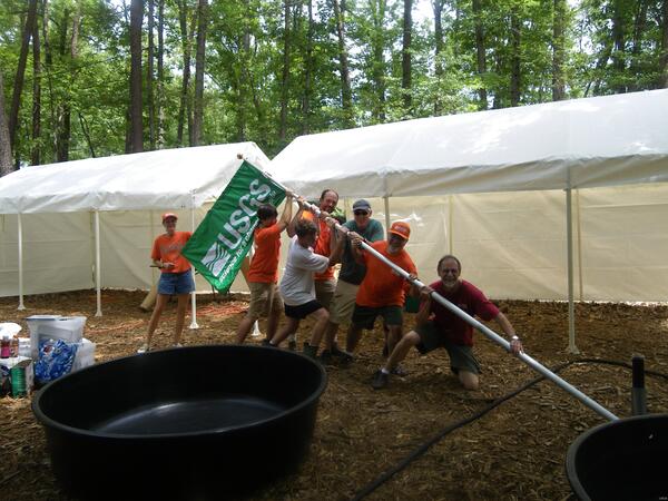
Celebrating the 100th Anniversary of the National Scouting Association
Celebrating the 100th Anniversary of the National Scouting AssociationSetting up for the National Scouting Jamboree at Fort A. P. Hill, Virginia.
Celebrating the 100th Anniversary of the National Scouting Association
Celebrating the 100th Anniversary of the National Scouting AssociationSetting up for the National Scouting Jamboree at Fort A. P. Hill, Virginia.

Souris River Flooding
The Souris River near Foxholm, North Dakota. USGS personnel were there to measure the streamflow. Streamflow was approximately 16,900 cubic feet per second.
The Souris River near Foxholm, North Dakota. USGS personnel were there to measure the streamflow. Streamflow was approximately 16,900 cubic feet per second.

Grazing Lawn
Low elevation tundra along the Smith River in the Teshekpuk Lake Special Area of the National Petroleum Reserve – Alaska. On left is low biomass, high-quality goose forage. On right is typical high biomass, low quality vegetation.
Low elevation tundra along the Smith River in the Teshekpuk Lake Special Area of the National Petroleum Reserve – Alaska. On left is low biomass, high-quality goose forage. On right is typical high biomass, low quality vegetation.

Permafrost
Coastal erosion reveals the extent of ice-rich permafrost underlying active layer on the Arctic Coastal Plain in the Teshekpuk Lake Special Area of the National Petroleum Reserve - Alaska.
Coastal erosion reveals the extent of ice-rich permafrost underlying active layer on the Arctic Coastal Plain in the Teshekpuk Lake Special Area of the National Petroleum Reserve - Alaska.

Flooding in Northwest Colorado
High floodwaters partially submerge a USGS streamgaging station in Slater Fork, CO.
High floodwaters partially submerge a USGS streamgaging station in Slater Fork, CO.

Souris River Flooding
The Souris River near Foxholm, North Dakota. USGS personnel were there to measure the streamflow. Streamflow was approximately 18,600 cubic feet per second.
The Souris River near Foxholm, North Dakota. USGS personnel were there to measure the streamflow. Streamflow was approximately 18,600 cubic feet per second.

flooded Vegetation
Flooded vegetation along the Missouri River. Water is just over bank full, potentially providing young sturgeon access to floodplain habitats.
Flooded vegetation along the Missouri River. Water is just over bank full, potentially providing young sturgeon access to floodplain habitats.

Barrow Geomagnetic Observatory
A field magnetometer.

Fredericksburg Geomagnetic Observatory
Main and auxiliary absolutes piers with Zeiss-Jena 010B Theodolites.
Main and auxiliary absolutes piers with Zeiss-Jena 010B Theodolites.

This Lizard Is This Big…
Children react with delight as ecologist Carlton Rochester of the USGS Western Ecological Research Center shows off his reptile expertise at a San Diego Zoo festival.
Children react with delight as ecologist Carlton Rochester of the USGS Western Ecological Research Center shows off his reptile expertise at a San Diego Zoo festival.

Flooded Gage House
The Souris River gage house 05116000 near Foxholm, North Dakota. USGS personnel were there to measure the streamflow. Streamflow was approximately 18,600 cubic feet per second.
The Souris River gage house 05116000 near Foxholm, North Dakota. USGS personnel were there to measure the streamflow. Streamflow was approximately 18,600 cubic feet per second.

Souris River near Foxholm Gage House
Souris River gage house 05116000 near Foxholm, North Dakota. USGS personnel were there to measure the streamflow. Streamflow was approximately 18,600 cubic feet per second.
Souris River gage house 05116000 near Foxholm, North Dakota. USGS personnel were there to measure the streamflow. Streamflow was approximately 18,600 cubic feet per second.

Upper Souris River National Wildlife Refuge
The Upper Souris River NAitonal Wildlife Refuge and Bakers Bridge, North Dakota. USGS personnel were there to measure the streamflow. Streamflow was approximately 18,600 cubic feet per second.
The Upper Souris River NAitonal Wildlife Refuge and Bakers Bridge, North Dakota. USGS personnel were there to measure the streamflow. Streamflow was approximately 18,600 cubic feet per second.

Lake Darling
Lake Darling near Foxholm, North Dakota.
Lake Darling near Foxholm, North Dakota.
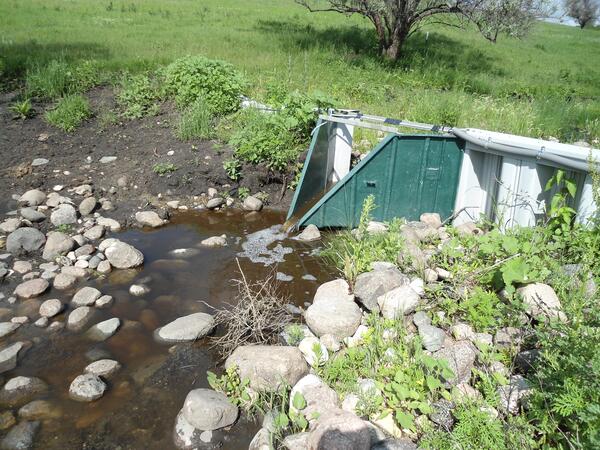
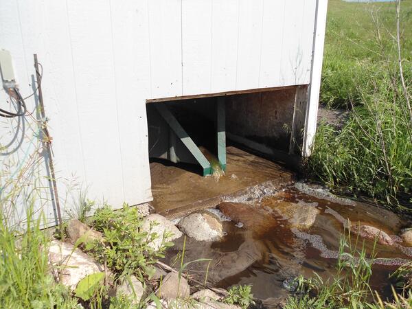
Dazey Waterway Site
North Dakota Discovery Farm Dazey waterway site 3 located southeast of Dazey, North Dakota. Dazey waterway saite 3 is the most downstream data shelter at farm- added larger 2.5 foot flume and reinforced metal weir after 2009 spring runoff flow damaged site.
North Dakota Discovery Farm Dazey waterway site 3 located southeast of Dazey, North Dakota. Dazey waterway saite 3 is the most downstream data shelter at farm- added larger 2.5 foot flume and reinforced metal weir after 2009 spring runoff flow damaged site.
ND Discovery Farms Dazey Waterway
Looking down at North Dakota Discovery Farms Dazey waterway site 3.
Looking down at North Dakota Discovery Farms Dazey waterway site 3.

Dazey Waterway Sites
North Dakota Discovery Farm Dazey waterway sites 1 and 2, located southeast of Dazey, North Dakota. In 2008, Dazey Farm became the second farm in the North Dakota Discovery Farms project.
North Dakota Discovery Farm Dazey waterway sites 1 and 2, located southeast of Dazey, North Dakota. In 2008, Dazey Farm became the second farm in the North Dakota Discovery Farms project.
Baldhill Creek
Baldhill Creek below the Dazey Discovery Farm waterway site 3 located southeast of Dazey, North Dakota. Dazey 3 is hidden in the trees.
Baldhill Creek below the Dazey Discovery Farm waterway site 3 located southeast of Dazey, North Dakota. Dazey 3 is hidden in the trees.
Dazey Waterway
North Dakota Discovery Farms Dazey waterway site 1 located southeast of Dazey, ND.
North Dakota Discovery Farms Dazey waterway site 1 located southeast of Dazey, ND.

Agassiz's Desert Tortoise
An Agassiz's desert tortoise hides in a burrow; a radio transmitter is attached to its shell as part of a USGS study.
An Agassiz's desert tortoise hides in a burrow; a radio transmitter is attached to its shell as part of a USGS study.