
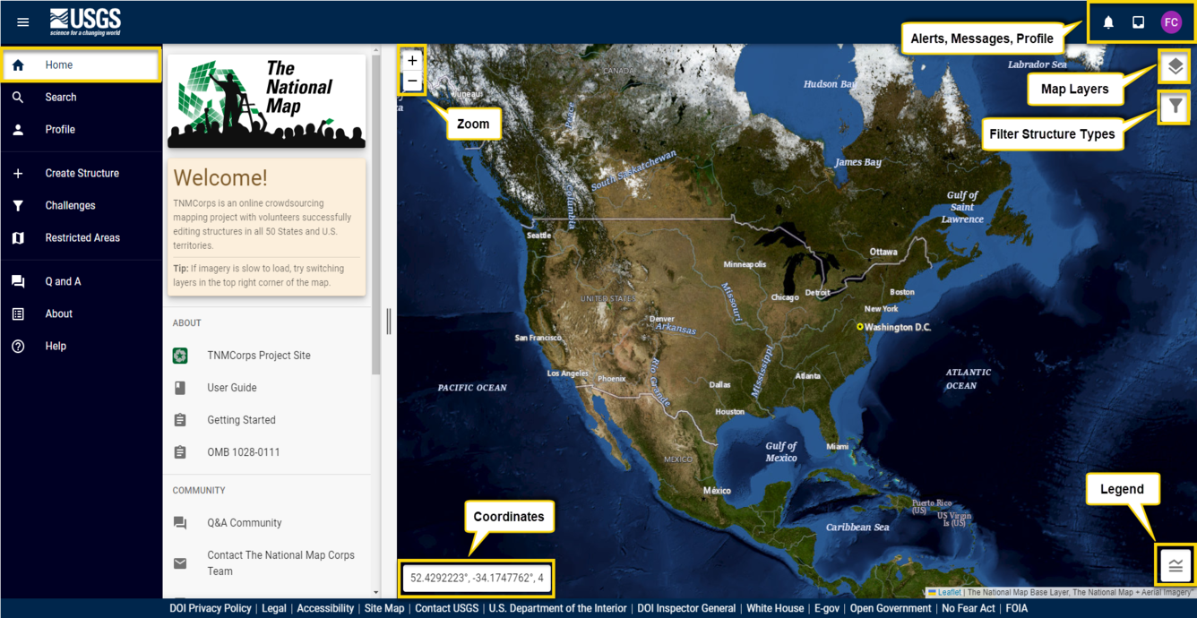
Overview of the Map Editor
This section will introduce you to each element of the web-based map editor.
Back to: User Guide | Previous Topic: Getting Started | Next Topic: Editing
Media
Sources/Usage: Public Domain. View Media Details
-

Home Tab Home Tab
Click on the Home tab to find helpful links, important news, and the Twitter/X feed!
-
-
Search Tab Search Tab
Click on the Search tab to search for the name or type of a structure, another volunteer’s username, or navigate to a location using an address, place name, or set of coordinates.
-
-
Sign In / Profile Tab Sign In / Profile Tab
Click on the SIGN IN tab to log in to the TNMCorps editor.
-
-
Create Structure Tab Create Structure Tab
If you notice that a structure collected by TNMCorps isn’t yet represented by a point on the map, then you can create one via the Create Structure tab.
-
-
Challenges Tab Challenges Tab
The Challenges tab will open a window listing each active mapping challenge focused on either a specific editing task, or area of interest.
-
-
Restricted Areas Tab Restricted Areas Tab
The Restricted Areas tab displays a list of federal lands (NFS, NPS, USFWS, BLM) on which certain structures data cannot be edited (created, updated, or deleted).
-
-
Q & A Tab Q & A Tab
The TNMCorps Q&A community is a forum for volunteers to ask and answer each other’s questions about TNMCorps related topics.
-
-
About Tab About Tab
The About tab contains links to all TNMCorps documentation.
-
-
Help Tab Help Tab
The Help tab opens the TNMCorps User Guide.