A view looking across the Connecticut River from a USGS streamgage in Suffield, Connecticut.

Official websites use .gov
A .gov website belongs to an official government organization in the United States.
Secure .gov websites use HTTPS
A lock () or https:// means you’ve safely connected to the .gov website. Share sensitive information only on official, secure websites.
Multimedia for the New England Water Science Center.
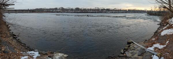
A view looking across the Connecticut River from a USGS streamgage in Suffield, Connecticut.
A view looking across the Connecticut River from a USGS streamgage in Suffield, Connecticut.
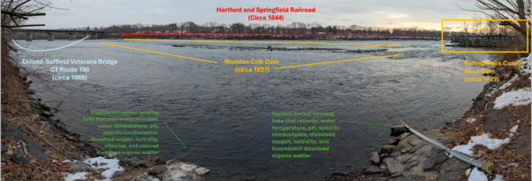
A view looking across the Connecticut River from a USGS streamgage in Suffield, Connecticut.
A view looking across the Connecticut River from a USGS streamgage in Suffield, Connecticut.
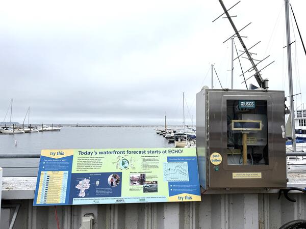
The USGS New England Water Science Center operates a streamgage on Lake Champlain in Burlington, Vermont.
The USGS New England Water Science Center operates a streamgage on Lake Champlain in Burlington, Vermont.
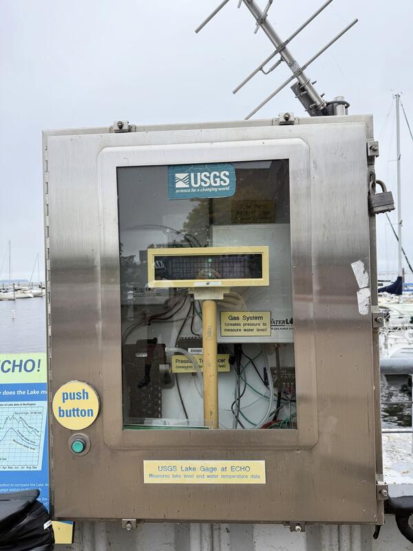
The USGS streamgage on Lake Champlain in Burlington, Vermont, is near the ECHO Leahy Center, Vermont’s Science and Nature Museum.
The USGS streamgage on Lake Champlain in Burlington, Vermont, is near the ECHO Leahy Center, Vermont’s Science and Nature Museum.
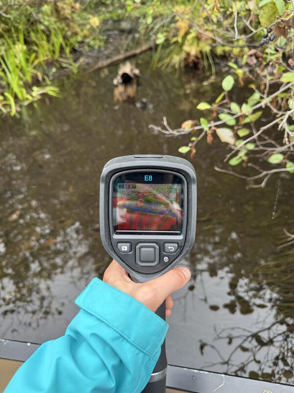
Cold groundwater seep identified using a handheld thermal infrared camera (FLIR E8) on the upper Namekagon River near Cable, Wisconsin. The groundwater discharge area was about 7-8 degrees cooler than the main channel of the Namekagon.
Cold groundwater seep identified using a handheld thermal infrared camera (FLIR E8) on the upper Namekagon River near Cable, Wisconsin. The groundwater discharge area was about 7-8 degrees cooler than the main channel of the Namekagon.
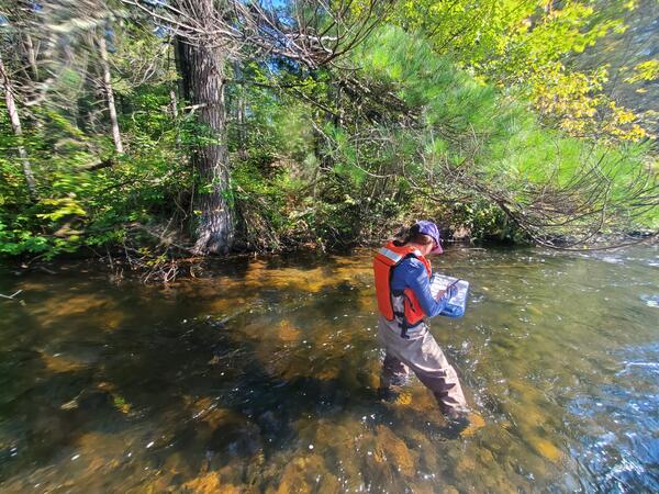
USGS New England Water Science Center physical scientist Shannon Fisher documenting the location of a groundwater seep under a pine tree on the Namekagon River near Cable, Wisconsin.
USGS New England Water Science Center physical scientist Shannon Fisher documenting the location of a groundwater seep under a pine tree on the Namekagon River near Cable, Wisconsin.

USGS hydrologic technician Virginia Stanley is towing an acoustic doppler current profiler (ADCP) behind a kayak on the Quinebaug River in Putnam, Connecticut, to capture streamflow measurements.
USGS hydrologic technician Virginia Stanley is towing an acoustic doppler current profiler (ADCP) behind a kayak on the Quinebaug River in Putnam, Connecticut, to capture streamflow measurements.

The USGS New England Water Science Center studies the quality and movement of the water that sustains our communities and environment and communicates that information with the public.
The USGS New England Water Science Center studies the quality and movement of the water that sustains our communities and environment and communicates that information with the public.

The U.S. Geological Survey and the University of Massachusetts at Amherst (UMass Amherst), in cooperation with the Massachusetts Department of Environmental Protection (MassDEP), began a series of studies in 2019 to develop a web-based statewide hydraulic modeling tool to provide preliminary culvert designs for stream-crossing projects in Massachusetts.
The U.S. Geological Survey and the University of Massachusetts at Amherst (UMass Amherst), in cooperation with the Massachusetts Department of Environmental Protection (MassDEP), began a series of studies in 2019 to develop a web-based statewide hydraulic modeling tool to provide preliminary culvert designs for stream-crossing projects in Massachusetts.

The U.S. Geological Survey (USGS), in cooperation with the Massachusetts Department of Environmental Protection and the University of Massachusetts at Amherst, have developed a GIS-based hydraulic modeling tool for Massachusetts stream crossing replacement projects.
The U.S. Geological Survey (USGS), in cooperation with the Massachusetts Department of Environmental Protection and the University of Massachusetts at Amherst, have developed a GIS-based hydraulic modeling tool for Massachusetts stream crossing replacement projects.

USGS has studied the hydrology of Cape Cod and the Islands and demonstrated our science to the public for more than four decades. Many visitor groups from government agencies, universities, nonprofit organizations, and local communities have learned about our groundwater and surface water research in southeastern Massachusetts.
USGS has studied the hydrology of Cape Cod and the Islands and demonstrated our science to the public for more than four decades. Many visitor groups from government agencies, universities, nonprofit organizations, and local communities have learned about our groundwater and surface water research in southeastern Massachusetts.

This video is an overview of the USGS New England Water Science Center's research and monitoring efforts to support the water issue needs of New England and the Nation.
This video is an overview of the USGS New England Water Science Center's research and monitoring efforts to support the water issue needs of New England and the Nation.

Quonopaug Brook at Rt 116 near North Scituate, Rhode Island. Monitoring location 01115183 is a tributary to the Scituate Reservoir in Providence County, Rhode Island. Current conditions of discharge and gage height are available.
Quonopaug Brook at Rt 116 near North Scituate, Rhode Island. Monitoring location 01115183 is a tributary to the Scituate Reservoir in Providence County, Rhode Island. Current conditions of discharge and gage height are available.
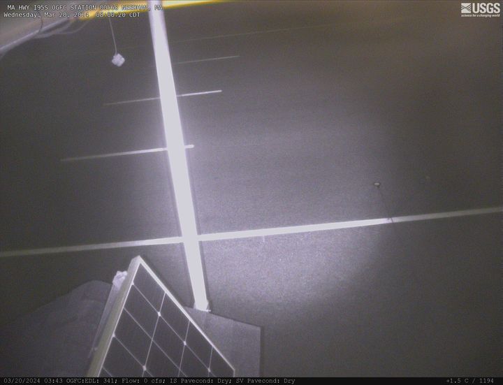
MA-HWY-I95S-HMA-STATION 00567 Needham, MA. The highway monitoring station 421650071120401 is located along Interstate 95 in Norfolk County, Massachusetts.
MA-HWY-I95S-HMA-STATION 00567 Needham, MA. The highway monitoring station 421650071120401 is located along Interstate 95 in Norfolk County, Massachusetts.
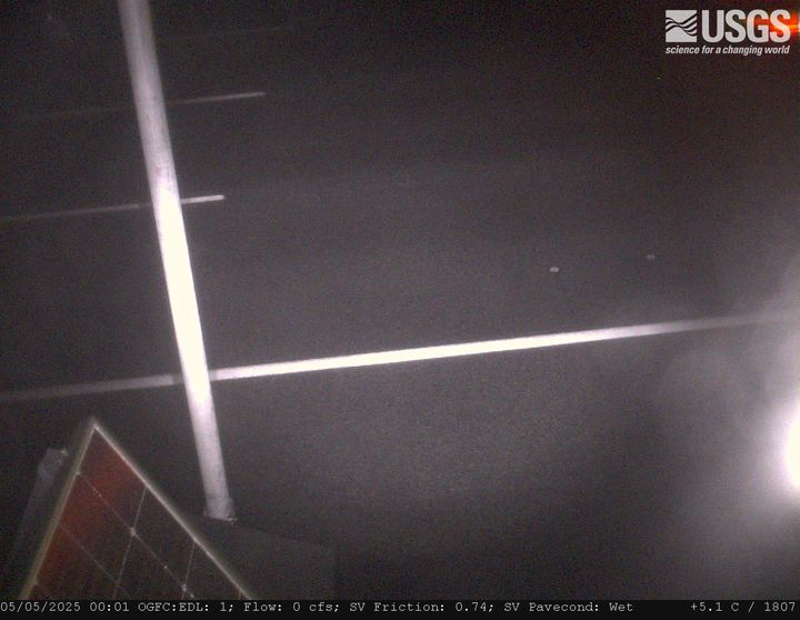
MA-HWY-I95S-OGFC-STATION 00568 Needham, MA. The highway monitoring station 421652071120601 is located along Interstate 95 in Norfolk County, Massachusetts.
MA-HWY-I95S-OGFC-STATION 00568 Needham, MA. The highway monitoring station 421652071120601 is located along Interstate 95 in Norfolk County, Massachusetts.
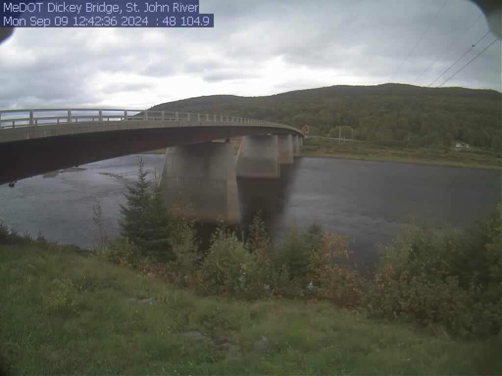
View of the St. John River from the webcam located at St. John River at Dickey, Maine (01037050)
View of the St. John River from the webcam located at St. John River at Dickey, Maine (01037050)
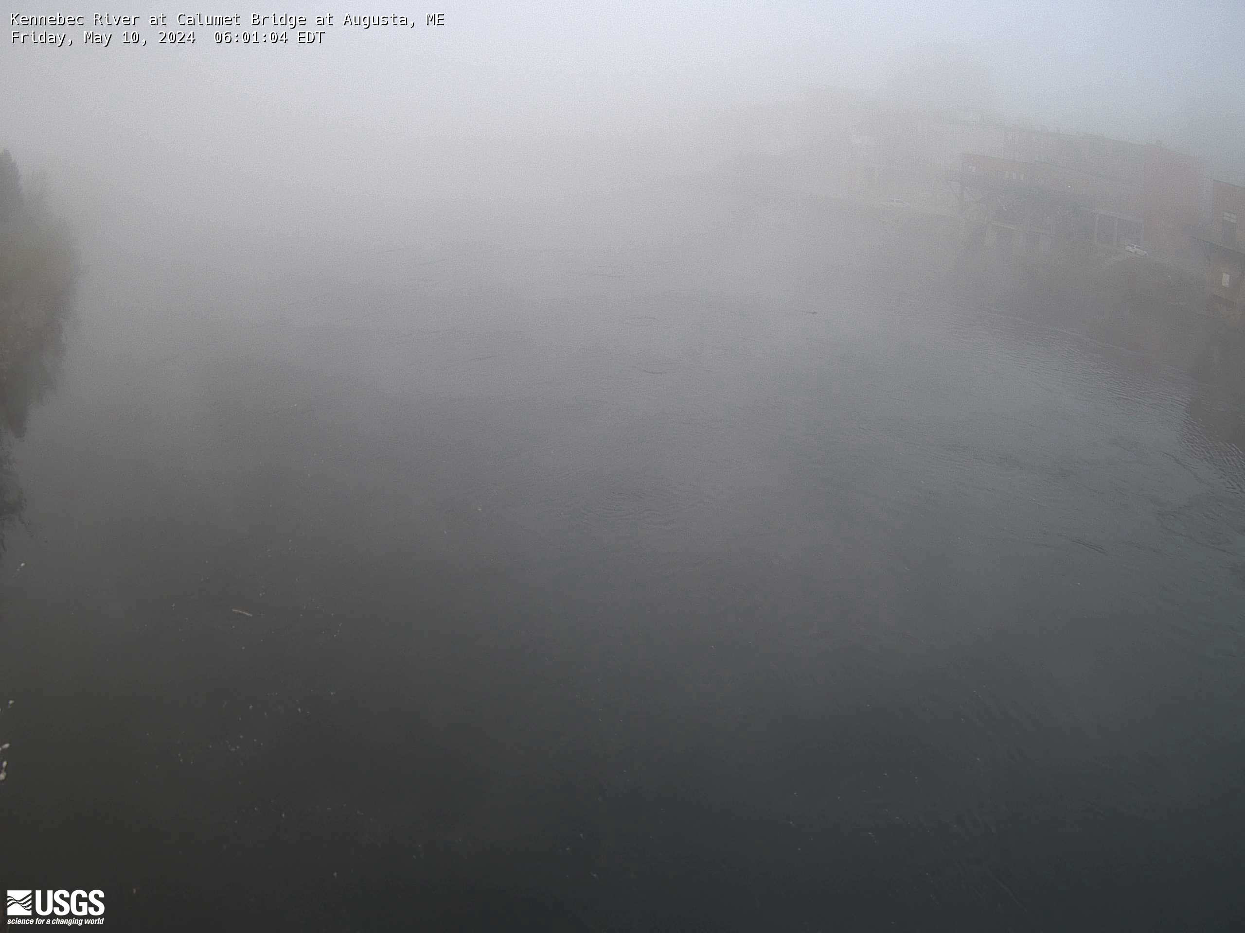
Kennebec River at Calumet Bridge at Augusta, Maine (01049320)
Station operated in cooperation with the Maine Emergency Management Agency and the Maine River Flow Advisory Commission.
Kennebec River at Calumet Bridge at Augusta, Maine (01049320)
Station operated in cooperation with the Maine Emergency Management Agency and the Maine River Flow Advisory Commission.