U.S. flag

An official website of the United States government

Images

Below are images associated with SBSC's science and staff. Images appear according to the year they were taken. To search, type a keyword or select a year from the dropdown menu. Or, click through the pages using the arrows at the bottom of the page. 

Filter Total Items: 641
Claudia Dimartini holds a long camelthorn rhizomes exposed in a wash at Wupatki National Monument
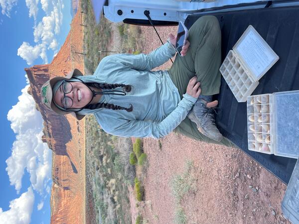
Long camelthorn rhizomes exposed in a wash at Wupatki National Monument

USGS Biological Science Technician Claudia Dimartini poses with a long camelthorn (Alhagi maurorum) rhizome (underground root structure from which new plants can propagate that was exposed in a wash at the Deadman Wash Confluence Area. Photo by Laura Shriver (USGS).

USGS Biological Science Technician Claudia Dimartini poses with a long camelthorn (Alhagi maurorum) rhizome (underground root structure from which new plants can propagate that was exposed in a wash at the Deadman Wash Confluence Area. Photo by Laura Shriver (USGS).

A person smiles while collecting soil stability data in southern Utah
Collecting soil stability data

Sarah Costanzo (USGS) collects soil stability data prior to installing RestoreNet version 2.0 treatments at Canyonlands Research Center near Moab, UT. Photo by Laura Shriver (USGS).

Sarah Costanzo (USGS) collects soil stability data prior to installing RestoreNet version 2.0 treatments at Canyonlands Research Center near Moab, UT. Photo by Laura Shriver (USGS).

Kat Cooney smiles as she runs an alkalinity titration in a mobile lab
Kat Cooney runs an alkalinity titration in a mobile lab

Kat Cooney of the Arizona Water Science Center (AZWSC) runs an alkalinity titration in a mobile lab. Photo courtesy of Kat Cooney, USGS.

Laura Shriver at the soil and restoration science booth at the USGS Flagstaff Science Center Open House.
Soil and restoration science booth at USGS Flagstaff Science Center Open House

Laura Shriver at the soil and restoration science booth at the USGS Flagstaff Science Center Open House. The booth included native seeds, biocrusts, a soil texturing activity, and science brief handouts.

A research boat navigates high rapids in the brown sediment-filled Colorado River during a storm
A boat navigates Dubendorff Rapids during a flash flood at Galloway Canyon, Colorado River, during a rainstorm
Rocks and mud flow down a canyon watershed in Grand Canyon during a flash flood
Rocks and sediment flow down Galloway Canyon during a flash flood along the Colorado River

Rocks and sediment flow down Galloway Canyon during a flash flood along the bank and into Dubendorff Rapids, Colorado River, Grand Canyon. Photo by Larkin Carey.

A river trip group watches a flash flood from the opposite bank of the Colorado River as it rushes down a canyon
A river trip watches a flash flood across from Galloway Canyon into Dubendorff Rapids from the opposite bank of the Colorado River
Muddy floodwaters rush down a canyon into the Colorado River, Grand Canyon, during a flash flood event
Muddy floodwaters rush down Galloway Canyon into the Colorado River during a flash flood event at Dubendorff Rapids
A flash flood moves rapidly down a canyon carrying sediment and debris into the Colorado River during a storm
A flash flood down Galloway Canyon into Dubendorff Rapids, Colorado River

A flash flood carries sediment and debris down Galloway Canyon into Dubendorff Rapids, Colorado River, Grand Canyon. Photo by Larkin Carey.

Two boats navigate high rapids in the muddy sediment-filled Colorado River during a rainstorm
Two boats navigate Dubendorff Rapids during a flash flood from Galloway Canyon, Colorado River, during a rainstorm
Muddy flash flood waters rush down a desert canyon during a rainstorm
A flash flood through Galloway Canyon into the Colorado River, at Dubendorff Rapids

A flash flood through Galloway Canyon into the Colorado River at the beginning of Dubendorff Rapids in Grand Canyon during a rainstorm. Photo by Larkin Carey.

A lightning bolt from a dark and stormy sky strikes a red rock plateau, with green grass fields in the foreground
Thunderstorm at Indian Creek, San Juan County, Utah

A lightening bolt strikes the plateau during a thunderstorm at Indian Creek, San Juan County, Utah. Photo by Mike Duniway, USGS.

Rock Corral Canyon, Tumacacori Mountains, southern Arizona
Western yellow-billed cuckoo habitat - Rock Corral Canyon, Tumacacori Mountains, southern Arizona

Rock Corral Canyon, a dry oak woodland in a drainage of the Tumacacori Mountains, a "Sky Island" in southern Arizona. This area is habitat used by threatened western yellow-billed cuckoos. Photo by Charles Drost, USGS, SBSC.

A rainstorm downburst moves across the top of mountains with pine trees in the foreground and a yellow sunset in the distance
A monsoon rainstorm at the north rim of the Grand Canyon

A monsoon rainstorm moves across the north rim of the Grand Canyon during sunset, August 2024. Photo by Tom Gushue, USGS.

A group of fish swim just under the surface of the blue-green water near a red canyon wall
Humpback chub in the Colorado River

Humpback chub in the Colorado River. Photo by David Herasimtschuk, Freshwaters Illustrated. 

Ancestral Lands Conservation Corps Grand Canyon Youth at Dinosaur Camp on the Colorado River, Grand Canyon

Ancestral Lands Conservation Corps Grand Canyon Youth cool down in the water before dinner after a day of science studies, at Dinosaur Camp on the Colorado River, Grand Canyon. Photo by John Napier, Grand Canyon Youth.

A USGS hydrologist and Ancestral Lands Conservation Corps Grand Canyon Youth make print blocks on a Colorado River trip
Making print blocks on an Ancestral Lands Conservation Corps Grand Canyon Youth Colorado River trip

USGS hydrologist Shannon Sartain and Ancestral Lands Conservation Corps Grand Canyon Youth Hopi crewmembers carving, inking, and printing linoleum block prints on a hot July afternoon on a Colorado River trip.

Ancestral Lands Conservation Corps Grand Canyon Youth having dinner at sunset on a Colorado River trip
The entire Ancestral Lands Conservation Corps Grand Canyon Youth trip jumps for joy at Redwall Canyon on the Colorado River
The entire Ancestral Lands Conservation Corps Grand Canyon Youth trip jumps for joy at Redwall Canyon, Colorado River

The entire Ancestral Lands Conservation Corps / Grand Canyon Youth / Partners in Science trip jumps for joy after enjoying lunch in the shade of Redwall Cavern, July 2024. Photo courtesy of Chris Kotalik, USGS.
 

A view of the Colorado River with a rainstorm in the distance over canyon cliffs lit by late afternoon sun
A rainstorm at North Wash on the Colorado River, at the end of Cataract Canyon upstream of Lake Powell

A rainstorm at North Wash at the tail end of the Cataract Canyon on the Colorado River as it enters Lake Powell in June 2024. USGS Southwest Biological Science Center, Grand Canyon Monitoring Research Center were conducting multibeam sonar work in collaboration with the 'Returning Rapids' project. At this spot, the river is no longer in its original channel.

A rainstorm at North Wash at the tail end of the Cataract Canyon on the Colorado River as it enters Lake Powell in June 2024. USGS Southwest Biological Science Center, Grand Canyon Monitoring Research Center were conducting multibeam sonar work in collaboration with the 'Returning Rapids' project. At this spot, the river is no longer in its original channel.

Desert bighorn sheep walk across a rocky hillside in the Sonoran Desert
Desert bighorn sheep in Cabeza Prieta National Wildlife Refuge

Desert bighorn sheep traverse a rocky hillside in Cabeza Prieta National Wildlife Refuge in southern Arizona, on their way to drink at a water catchment called a tinaja. Video by Ron Finney, North Woods Productions.

Desert bighorn sheep traverse a rocky hillside in Cabeza Prieta National Wildlife Refuge in southern Arizona, on their way to drink at a water catchment called a tinaja. Video by Ron Finney, North Woods Productions.

Was this page helpful?