U.S. flag

An official website of the United States government

Urban Studies

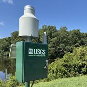
Water is everywhere, including in our cities and suburbs. Urban streams are often impacted by human activities, and are also common candidates for restoration. Stormwater systems divert floodwaters away from cities, but may also carry contaminants with them downstream. Many urban areas in Virginia have partnered with the USGS to establish monitoring programs. Browse studies by location below.

Filter Total Items: 11

Henrico County Hydrologic Monitoring Network

The USGS Virginia and West Virginia Water Science Center has established a comprehensive network of hydrologic monitoring stations throughout Henrico County. Precipitation and water-level data collected from these stations are used to inform floodplain management, reduce the risk of flooding, and inform emergency management. On this page, you can access our data and learn more about the Henrico...
Henrico County Hydrologic Monitoring Network

Henrico County Hydrologic Monitoring Network

The USGS Virginia and West Virginia Water Science Center has established a comprehensive network of hydrologic monitoring stations throughout Henrico County. Precipitation and water-level data collected from these stations are used to inform floodplain management, reduce the risk of flooding, and inform emergency management. On this page, you can access our data and learn more about the Henrico...
Learn More

USGS Publications Summarize Water-Quality Trends and Drivers in Urban Streams After 10 Years of Monitoring in Fairfax County, Virginia

Issue: Degraded water quality and ecology in urban streams has been widely documented, but explanations of changing conditions over time are often unavailable. A 15-year collaborative urban stream monitoring effort between the Fairfax County Stormwater Planning Division and the U.S. Geological Survey (USGS) is ongoing and has begun to shed light on this complex issue. In a new USGS report by...
USGS Publications Summarize Water-Quality Trends and Drivers in Urban Streams After 10 Years of Monitoring in Fairfax County, Virginia

USGS Publications Summarize Water-Quality Trends and Drivers in Urban Streams After 10 Years of Monitoring in Fairfax County, Virginia

Issue: Degraded water quality and ecology in urban streams has been widely documented, but explanations of changing conditions over time are often unavailable. A 15-year collaborative urban stream monitoring effort between the Fairfax County Stormwater Planning Division and the U.S. Geological Survey (USGS) is ongoing and has begun to shed light on this complex issue. In a new USGS report by...
Learn More

Source Water Monitoring on the Roanoke River in Salem, Virginia

The Roanoke River is the primary source of the City of Salem's drinking water. Threats to water quality in rivers like the Roanoke have increased in recent years, and water authorities as well as residents are concerned about preventing source water contamination. Realtime water quality monitoring is a valuable tool in alerting water authorities such as Salem Water when there are anomalous...
Source Water Monitoring on the Roanoke River in Salem, Virginia

Source Water Monitoring on the Roanoke River in Salem, Virginia

The Roanoke River is the primary source of the City of Salem's drinking water. Threats to water quality in rivers like the Roanoke have increased in recent years, and water authorities as well as residents are concerned about preventing source water contamination. Realtime water quality monitoring is a valuable tool in alerting water authorities such as Salem Water when there are anomalous...
Learn More

Hydrologic, Water-Quality, and Ecological Monitoring and Analysis to Support Stream Restoration Research in Reston, Virginia

The U.S. Geological Survey, in cooperation with Resource Protection Group, Inc. is partnering with Reston Association to monitor the hydrology, water-quality, and ecology of two restored urban streams in Reston, Virginia – Snakeden Branch and The Glade. A combination of continuous and discrete hydrologic and water-quality data are collected to evaluate stream conditions and estimate sediment and...
Hydrologic, Water-Quality, and Ecological Monitoring and Analysis to Support Stream Restoration Research in Reston, Virginia

Hydrologic, Water-Quality, and Ecological Monitoring and Analysis to Support Stream Restoration Research in Reston, Virginia

The U.S. Geological Survey, in cooperation with Resource Protection Group, Inc. is partnering with Reston Association to monitor the hydrology, water-quality, and ecology of two restored urban streams in Reston, Virginia – Snakeden Branch and The Glade. A combination of continuous and discrete hydrologic and water-quality data are collected to evaluate stream conditions and estimate sediment and...
Learn More

Hampton Roads Benchmark Monitoring Network

The southern Chesapeake Bay region is experiencing land subsidence along with rising sea levels, both of which can contribute to coastal flooding. The rates at which these two processes are occurring are not exactly known. Mapping of land elevation change requires ground-truth survey data at multiple locations that are accurate and precise. With the exception of a few CORS sites that have...
Hampton Roads Benchmark Monitoring Network

Hampton Roads Benchmark Monitoring Network

The southern Chesapeake Bay region is experiencing land subsidence along with rising sea levels, both of which can contribute to coastal flooding. The rates at which these two processes are occurring are not exactly known. Mapping of land elevation change requires ground-truth survey data at multiple locations that are accurate and precise. With the exception of a few CORS sites that have...
Learn More

Hydrologic Monitoring and Analysis to Support Water Resource Management in the City of Roanoke

The U.S. Geological Survey, partnering with the City of Roanoke and Virginia Tech, are working to monitor the water volume and quality in streams throughout the City of Roanoke. There are currently six monitoring stations within the city. Water-quality data are collected at five stations through real-time monitors. The overall objective of the study is to quantify the amount of sediment delivered...
Hydrologic Monitoring and Analysis to Support Water Resource Management in the City of Roanoke

Hydrologic Monitoring and Analysis to Support Water Resource Management in the City of Roanoke

The U.S. Geological Survey, partnering with the City of Roanoke and Virginia Tech, are working to monitor the water volume and quality in streams throughout the City of Roanoke. There are currently six monitoring stations within the city. Water-quality data are collected at five stations through real-time monitors. The overall objective of the study is to quantify the amount of sediment delivered...
Learn More

Fairfax County Water Resources Monitoring Network

In recent years, hundreds of millions of dollars have been invested into the implementation of Best Management Practices in Fairfax County, Virginia, with the goal of improving water quality. Research has demonstrated that best management practices are effective at smaller scales, but less information is available to document the effectiveness of these best management practices at the watershed...
Fairfax County Water Resources Monitoring Network

Fairfax County Water Resources Monitoring Network

In recent years, hundreds of millions of dollars have been invested into the implementation of Best Management Practices in Fairfax County, Virginia, with the goal of improving water quality. Research has demonstrated that best management practices are effective at smaller scales, but less information is available to document the effectiveness of these best management practices at the watershed...
Learn More

Hampton Roads Regional Water Quality Monitoring Program

In 2015, the U.S. Geological Survey partnered with the Hampton Roads Sanitation District (HRSD) in cooperation with the Hampton Roads Planning District Commission to implement a water-quality monitoring program in six major cities across the Hampton Roads region. This long-term monitoring program consists of a network of 12 water-quality monitoring stations, 2 per jurisdiction, across the cities...
Hampton Roads Regional Water Quality Monitoring Program

Hampton Roads Regional Water Quality Monitoring Program

In 2015, the U.S. Geological Survey partnered with the Hampton Roads Sanitation District (HRSD) in cooperation with the Hampton Roads Planning District Commission to implement a water-quality monitoring program in six major cities across the Hampton Roads region. This long-term monitoring program consists of a network of 12 water-quality monitoring stations, 2 per jurisdiction, across the cities...
Learn More

Continuous Water-Quality Monitoring for the Roanoke River Flood Reduction Project

This project: (1) initiates a continuous water-quality monitoring study for the Roanoke River in the area upstream and downstream of the RRFRP project area; (2) provides a mechanism for detecting short- and long-term changes in Roanoke River suspended sediment water quality during and after the RRFRP implementation; and (3) assesses trends in suspended sediment water quality in this section of the...
Continuous Water-Quality Monitoring for the Roanoke River Flood Reduction Project

Continuous Water-Quality Monitoring for the Roanoke River Flood Reduction Project

This project: (1) initiates a continuous water-quality monitoring study for the Roanoke River in the area upstream and downstream of the RRFRP project area; (2) provides a mechanism for detecting short- and long-term changes in Roanoke River suspended sediment water quality during and after the RRFRP implementation; and (3) assesses trends in suspended sediment water quality in this section of the...
Learn More

Roanoke River Study

The U.S. Army Corps of Engineers (USACE), Wilmington District and the City of Roanoke, Virginia began construction of a congressionally authorized Roanoke River Flood Reduction Project (RRFRP) in 2005. RRFRP implementation activities include: construction activities, stream bank vegetation changes, and floodplain geometry changes which are occurring in a complicated urban river system. These...
Roanoke River Study

Roanoke River Study

The U.S. Army Corps of Engineers (USACE), Wilmington District and the City of Roanoke, Virginia began construction of a congressionally authorized Roanoke River Flood Reduction Project (RRFRP) in 2005. RRFRP implementation activities include: construction activities, stream bank vegetation changes, and floodplain geometry changes which are occurring in a complicated urban river system. These...
Learn More

Virginia Beach Shallow Groundwater Resources

The purpose of the Virginia Beach shallow aquifer study is to better understand the distribution of fresh groundwater, its susceptibility to contamination, and its sustainability as a long-term water supply. Virginia Beach is a growing city in southeastern Virginia with a limited supply of fresh water. Most of the city’s drinking water, up to 45 million gallons per day, comes from Lake Gaston. The...
Virginia Beach Shallow Groundwater Resources

Virginia Beach Shallow Groundwater Resources

The purpose of the Virginia Beach shallow aquifer study is to better understand the distribution of fresh groundwater, its susceptibility to contamination, and its sustainability as a long-term water supply. Virginia Beach is a growing city in southeastern Virginia with a limited supply of fresh water. Most of the city’s drinking water, up to 45 million gallons per day, comes from Lake Gaston. The...
Learn More
Was this page helpful?