U.S. flag

An official website of the United States government

Species Biology

USGS WARC science plays a critical role in informing listing decisions related to the Endangered Species Act. Our work provides insight into the life history, population dynamics, and resource needs of species considered at risk or of management concern, including aquatic mammals, reptiles, amphibians, birds, bats, and fishes.

Filter Total Items: 128

Multi-year Burmese Python Vital Rate Research Collaborative in the Greater Everglades

USGS researchers will track juvenile Burmese python within Big Cypress National Preserve (BICY) and collect data on snake growth, habitat use, and causes of mortality. Known-fate models will be used to estimate survival and better understand factors that influence survival.
link

Multi-year Burmese Python Vital Rate Research Collaborative in the Greater Everglades

USGS researchers will track juvenile Burmese python within Big Cypress National Preserve (BICY) and collect data on snake growth, habitat use, and causes of mortality. Known-fate models will be used to estimate survival and better understand factors that influence survival.
Learn More

Characterization of Benthic Habitats on the Pacific Margin: Assessing the Connectivity of Hard Substrates, Seeps and Canyon Communities

USGS researchers will characterize the ecology of benthic invertebrates associated with deep-sea environments and broader food-web dynamics within hardground features, seeps, and adjacent soft sediments. This project will provide important information regarding deepwater benthic habitats, such as chemosynthetic communities and deep-sea corals, that could be affected by offshore wind development.
link

Characterization of Benthic Habitats on the Pacific Margin: Assessing the Connectivity of Hard Substrates, Seeps and Canyon Communities

USGS researchers will characterize the ecology of benthic invertebrates associated with deep-sea environments and broader food-web dynamics within hardground features, seeps, and adjacent soft sediments. This project will provide important information regarding deepwater benthic habitats, such as chemosynthetic communities and deep-sea corals, that could be affected by offshore wind development.
Learn More
link

USGS National Vision for Native Freshwater Mussel Research: Completing a Bureau-wide Ecosystems Mission Area-led Science Strategy

USGS is collaborating with partners to develop a scientific vision for freshwater Mussel research.
Learn More

Mesophotic and Deep Benthic Communities: Coral Propagation Technique (CPT) Development Project

Through a collaborative effort with other federal agencies and academic and research institutions, the USGS is working to inform and enhance the protection and management of coral communities in mesophotic and deep benthic areas of the Gulf of Mexico.
link

Mesophotic and Deep Benthic Communities: Coral Propagation Technique (CPT) Development Project

Through a collaborative effort with other federal agencies and academic and research institutions, the USGS is working to inform and enhance the protection and management of coral communities in mesophotic and deep benthic areas of the Gulf of Mexico.
Learn More

Population Monitoring of the Federally Threatened Okaloosa Darter at Eglin Air Force Base

USGS' and Loyola University New Orleans' innovative research techniques played a role in the decision to downlist the Okaloosa Darter, a freshwater fish endemic to northwest Florida, from Endangered to Threatened in 2011, and the removal of the fish from the U.S. Endangered Species Act in 2023.
link

Population Monitoring of the Federally Threatened Okaloosa Darter at Eglin Air Force Base

USGS' and Loyola University New Orleans' innovative research techniques played a role in the decision to downlist the Okaloosa Darter, a freshwater fish endemic to northwest Florida, from Endangered to Threatened in 2011, and the removal of the fish from the U.S. Endangered Species Act in 2023.
Learn More

Use of Portable Radar to Monitor Flying Animals in the Offshore Environment

USGS will deploy a small, portable radar aboard a National Oceanic and Atmospheric Administration research vessel to measure the abundance, geographic distribution, and flight altitude of birds migrating across the continental shelf of the northern Gulf.
link

Use of Portable Radar to Monitor Flying Animals in the Offshore Environment

USGS will deploy a small, portable radar aboard a National Oceanic and Atmospheric Administration research vessel to measure the abundance, geographic distribution, and flight altitude of birds migrating across the continental shelf of the northern Gulf.
Learn More

Ecology of the Diamondback Terrapin: Demographics, Movements, and Habitat Use

In response to declining populations, researchers at WARC are collecting data on demographics, movement patterns and habitat use, ecological niche and foraging ecology, and nesting ecology of diamondback terrapins.
link

Ecology of the Diamondback Terrapin: Demographics, Movements, and Habitat Use

In response to declining populations, researchers at WARC are collecting data on demographics, movement patterns and habitat use, ecological niche and foraging ecology, and nesting ecology of diamondback terrapins.
Learn More

Beach Compaction and the Impacts of Tilling on Nesting Sea Turtles and Foraging Shorebirds

Researchers are investigating beach compaction, the incubation environment for turtle nests, and shorebird nest abundance at beaches throughout the southeastern United States to better understand the impacts of beach compaction to nesting turtles and foraging seabirds.
link

Beach Compaction and the Impacts of Tilling on Nesting Sea Turtles and Foraging Shorebirds

Researchers are investigating beach compaction, the incubation environment for turtle nests, and shorebird nest abundance at beaches throughout the southeastern United States to better understand the impacts of beach compaction to nesting turtles and foraging seabirds.
Learn More

Non-breeding Habitat Use of Flooded Agricultural Fields by Shorebirds within the Mississippi Delta

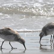
Researchers are capturing and banding birds within flooded agricultural sites to understand habitat use of these artificial wetland habitats.
link

Non-breeding Habitat Use of Flooded Agricultural Fields by Shorebirds within the Mississippi Delta

Researchers are capturing and banding birds within flooded agricultural sites to understand habitat use of these artificial wetland habitats.
Learn More

Management of Gopher Tortoise (Gopherus polyphemus) Using Coastal Habitats

USGS researchers will conduct research on St. Vincent National Wildlife Refuge and throughout coastal habitat in Northwest Florida to inform future management decisions in the Refuge and contribute to the growing knowledge of the ecology of gopher tortoises using coastal habitats.
link

Management of Gopher Tortoise (Gopherus polyphemus) Using Coastal Habitats

USGS researchers will conduct research on St. Vincent National Wildlife Refuge and throughout coastal habitat in Northwest Florida to inform future management decisions in the Refuge and contribute to the growing knowledge of the ecology of gopher tortoises using coastal habitats.
Learn More

Sturgeon Occurrence and Behavior in the Outer Continental Shelf

A new study aims to collect information on sturgeon temporal and spatial distribution to inform offshore wind energy and sand leasing operations.
link

Sturgeon Occurrence and Behavior in the Outer Continental Shelf

A new study aims to collect information on sturgeon temporal and spatial distribution to inform offshore wind energy and sand leasing operations.
Learn More

Puget Sound Marine Benthic Index and Graphical Causal Model

USGS scientists are working with partners at the Puget Sound Partnership and the State of Washington’s Department of Ecology to develop two new tools to help us understand how human disturbance affects life at the top of Puget Sound: a Marine Benthic Index and a graphical causal model.
link

Puget Sound Marine Benthic Index and Graphical Causal Model

USGS scientists are working with partners at the Puget Sound Partnership and the State of Washington’s Department of Ecology to develop two new tools to help us understand how human disturbance affects life at the top of Puget Sound: a Marine Benthic Index and a graphical causal model.
Learn More
Was this page helpful?