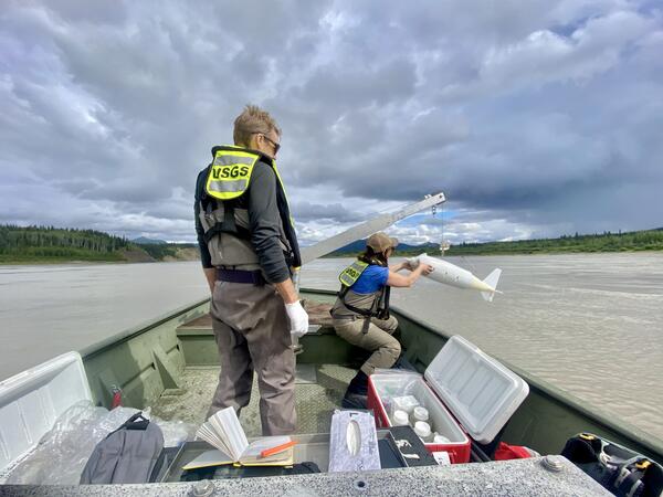
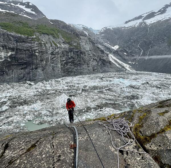
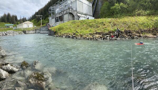
USGS staff inspecting monitoring equipment in Suicide Basin. Suicide Basin is a side basin of the Mendenhall Glacier above Juneau, Alaska.
Jeff Conaway
Surface-water modeling, sediment transport, acoustic Doppler current profilers
Professional Experience
2018 - Present Associate Center Director for Water, Ice, and Landscape Dynamics, USGS Alaska Science Center
2000 - 2018 Hydrologist, USGS Alaska Science Center
Education and Certifications
M.S. 2000 Portland State University Geology
B.S. 1996 University of Alaska Fairbanks Geology
Science and Products
Community Outreach and Engagement Community Outreach and Engagement
Alaska Streamflow Statistics
Q&A: USGS Ecosystems Provides Objective Science to Manage Lands, Fish, and Wildlife
Q&A: The Role of USGS Ecosystems Science in Alaska
Q&A: USGS Ecosystems Science Provides Information on Subsistence and Hunter-Harvested Food Resources in Alaska
Q&A: USGS and the 2025 Anchorage Bike to Work Day
USGS Alaska Streamgage Datum to North American Vertical Datum of 1988 Conversion Table
Natural Resources Preservation Program
Exploring Alaska Through Our Science
Outer Continental Shelf Program
Science Support Program and Quick Response Program
USGS Transboundary River Monitoring in Southeast Alaska
Water Surfaces Elevations from Pressure Transducers on the Tanana River near Fairbanks, Alaska, 2016 Water Surfaces Elevations from Pressure Transducers on the Tanana River near Fairbanks, Alaska, 2016
Digital orthophotos and field measurements of flow velocity from the Tanana and Nenana Rivers, Alaska, from August 2021 (ver. 2.0, June 2024) Digital orthophotos and field measurements of flow velocity from the Tanana and Nenana Rivers, Alaska, from August 2021 (ver. 2.0, June 2024)
Copper River and Knik River Bathymetric Surveys at Select Alaska Highway Bridges near Flag Point and Butte, Alaska, 2020 Copper River and Knik River Bathymetric Surveys at Select Alaska Highway Bridges near Flag Point and Butte, Alaska, 2020
USGS staff inspecting monitoring equipment in Suicide Basin. Suicide Basin is a side basin of the Mendenhall Glacier above Juneau, Alaska.

Timelapse of Anchor River at Anchor Point in Alaska
Timelapse of Anchor River at Anchor Point in AlaskaTwo cameras were installed in December of 2024 on the Anchor River to monitor flooding associated with river ice. Traditional hydrologic monitoring is often ineffective when rivers freeze and break up and the cameras provide information needed by our partners to verify water levels and issue flood forecasts.

USGS staff collecting water quality samples on the Yukon River at Eagle
USGS staff collecting water quality samples on the Yukon River at EagleUSGS staff sample the Yukon River for cyanide after a heap leach failure occurred upstream at the Eagle Gold Mine in the Yukon, Canada.
USGS staff collecting water quality samples on the Yukon River at Eagle
USGS staff collecting water quality samples on the Yukon River at EagleUSGS staff sample the Yukon River for cyanide after a heap leach failure occurred upstream at the Eagle Gold Mine in the Yukon, Canada.
Wolverine tracks in the snow on Crescent Lake near the Moose Pass Alaska. The wolverine is the largest terrestrial member of the family Mustelidae and is a relative of the mink and weasel.
Wolverine tracks in the snow on Crescent Lake near the Moose Pass Alaska. The wolverine is the largest terrestrial member of the family Mustelidae and is a relative of the mink and weasel.

Streamflow discharge measurement at Solomon Gulch Tailrace, Valdez, Alaska
Streamflow discharge measurement at Solomon Gulch Tailrace, Valdez, AlaskaUSGS staff measuring streamflow at the Solomon Gulch Tailrace with a tethered Acoustic Doppler Current Profiler. This is one of 12 streamgages that the USGS Alaska Science Center operates in cooperation with hydropower providers across Alaska. Data are used for operation, regulation, and planning purposes.
USGS staff measuring discharge at the Solomon Gulch Hydropower tailrace, Valdez Alaska.
USGS staff measuring discharge at the Solomon Gulch Hydropower tailrace, Valdez Alaska.

An aerial view of McKinley Lake, outside of Cordova, Alaska
An aerial view of McKinley Lake, outside of Cordova, AlaskaMcKinley Lake, outside of Cordova, Alaska. This is the site of deployment of limnocorrals for an Elodea spp. experiment.
An aerial view of McKinley Lake, outside of Cordova, Alaska
An aerial view of McKinley Lake, outside of Cordova, AlaskaMcKinley Lake, outside of Cordova, Alaska. This is the site of deployment of limnocorrals for an Elodea spp. experiment.

USGS Station streamgage 15905100 at the Atigun River, Alaska
USGS Station streamgage 15905100 at the Atigun River, AlaskaStreamgage number 15905100 at the Atigun River, Alaska. The Alyeska oil pipeline is in the background.
USGS Station streamgage 15905100 at the Atigun River, Alaska
USGS Station streamgage 15905100 at the Atigun River, AlaskaStreamgage number 15905100 at the Atigun River, Alaska. The Alyeska oil pipeline is in the background.
Sounding weight on the Copper River Delta, Alaska
Sounding weight on the Copper River Delta, Alaska
A comparison of contemporary and historical hydrology and water quality in the foothills and coastal plain of the Arctic National Wildlife Refuge, Arctic Slope, northern Alaska A comparison of contemporary and historical hydrology and water quality in the foothills and coastal plain of the Arctic National Wildlife Refuge, Arctic Slope, northern Alaska
Moving Aircraft River Velocimetry (MARV): Framework and proof-of-concept on the Tanana River Moving Aircraft River Velocimetry (MARV): Framework and proof-of-concept on the Tanana River
Comparison of historical water temperature measurements with landsat analysis ready data provisional surface temperature estimates for the Yukon River in Alaska Comparison of historical water temperature measurements with landsat analysis ready data provisional surface temperature estimates for the Yukon River in Alaska
QCam: sUAS-based doppler radar for measuring river discharge QCam: sUAS-based doppler radar for measuring river discharge
Deglacierization of a marginal basin and implications for outburst floods, Mendenhall Glacier, Alaska Deglacierization of a marginal basin and implications for outburst floods, Mendenhall Glacier, Alaska
Near-field remote sensing of Alaskan Rivers Near-field remote sensing of Alaskan Rivers
Remote sensing of river flow in Alaska—New technology to improve safety and expand coverage of USGS streamgaging Remote sensing of river flow in Alaska—New technology to improve safety and expand coverage of USGS streamgaging
Measurement of long-term channel change through repeated cross-section surveys at bridge crossings in Alaska Measurement of long-term channel change through repeated cross-section surveys at bridge crossings in Alaska
Using remotely sensed data to estimate river characteristics including water-surface velocity and discharge Using remotely sensed data to estimate river characteristics including water-surface velocity and discharge
Remote measurement of surface-water velocity using infrared videography and PIV: a proof-of-concept for Alaskan rivers Remote measurement of surface-water velocity using infrared videography and PIV: a proof-of-concept for Alaskan rivers
Evaluation of streambed scour at bridges over tidal waterways in Alaska Evaluation of streambed scour at bridges over tidal waterways in Alaska
Oceanographic gradients and seabird prey community dynamics in glacial fjords Oceanographic gradients and seabird prey community dynamics in glacial fjords
Science and Products
Community Outreach and Engagement Community Outreach and Engagement
Alaska Streamflow Statistics
Q&A: USGS Ecosystems Provides Objective Science to Manage Lands, Fish, and Wildlife
Q&A: The Role of USGS Ecosystems Science in Alaska
Q&A: USGS Ecosystems Science Provides Information on Subsistence and Hunter-Harvested Food Resources in Alaska
Q&A: USGS and the 2025 Anchorage Bike to Work Day
USGS Alaska Streamgage Datum to North American Vertical Datum of 1988 Conversion Table
Natural Resources Preservation Program
Exploring Alaska Through Our Science
Outer Continental Shelf Program
Science Support Program and Quick Response Program
USGS Transboundary River Monitoring in Southeast Alaska
Water Surfaces Elevations from Pressure Transducers on the Tanana River near Fairbanks, Alaska, 2016 Water Surfaces Elevations from Pressure Transducers on the Tanana River near Fairbanks, Alaska, 2016
Digital orthophotos and field measurements of flow velocity from the Tanana and Nenana Rivers, Alaska, from August 2021 (ver. 2.0, June 2024) Digital orthophotos and field measurements of flow velocity from the Tanana and Nenana Rivers, Alaska, from August 2021 (ver. 2.0, June 2024)
Copper River and Knik River Bathymetric Surveys at Select Alaska Highway Bridges near Flag Point and Butte, Alaska, 2020 Copper River and Knik River Bathymetric Surveys at Select Alaska Highway Bridges near Flag Point and Butte, Alaska, 2020
USGS staff inspecting monitoring equipment in Suicide Basin. Suicide Basin is a side basin of the Mendenhall Glacier above Juneau, Alaska.
USGS staff inspecting monitoring equipment in Suicide Basin. Suicide Basin is a side basin of the Mendenhall Glacier above Juneau, Alaska.

Timelapse of Anchor River at Anchor Point in Alaska
Timelapse of Anchor River at Anchor Point in AlaskaTwo cameras were installed in December of 2024 on the Anchor River to monitor flooding associated with river ice. Traditional hydrologic monitoring is often ineffective when rivers freeze and break up and the cameras provide information needed by our partners to verify water levels and issue flood forecasts.

USGS staff collecting water quality samples on the Yukon River at Eagle
USGS staff collecting water quality samples on the Yukon River at EagleUSGS staff sample the Yukon River for cyanide after a heap leach failure occurred upstream at the Eagle Gold Mine in the Yukon, Canada.
USGS staff collecting water quality samples on the Yukon River at Eagle
USGS staff collecting water quality samples on the Yukon River at EagleUSGS staff sample the Yukon River for cyanide after a heap leach failure occurred upstream at the Eagle Gold Mine in the Yukon, Canada.
Wolverine tracks in the snow on Crescent Lake near the Moose Pass Alaska. The wolverine is the largest terrestrial member of the family Mustelidae and is a relative of the mink and weasel.
Wolverine tracks in the snow on Crescent Lake near the Moose Pass Alaska. The wolverine is the largest terrestrial member of the family Mustelidae and is a relative of the mink and weasel.

Streamflow discharge measurement at Solomon Gulch Tailrace, Valdez, Alaska
Streamflow discharge measurement at Solomon Gulch Tailrace, Valdez, AlaskaUSGS staff measuring streamflow at the Solomon Gulch Tailrace with a tethered Acoustic Doppler Current Profiler. This is one of 12 streamgages that the USGS Alaska Science Center operates in cooperation with hydropower providers across Alaska. Data are used for operation, regulation, and planning purposes.
USGS staff measuring discharge at the Solomon Gulch Hydropower tailrace, Valdez Alaska.
USGS staff measuring discharge at the Solomon Gulch Hydropower tailrace, Valdez Alaska.

An aerial view of McKinley Lake, outside of Cordova, Alaska
An aerial view of McKinley Lake, outside of Cordova, AlaskaMcKinley Lake, outside of Cordova, Alaska. This is the site of deployment of limnocorrals for an Elodea spp. experiment.
An aerial view of McKinley Lake, outside of Cordova, Alaska
An aerial view of McKinley Lake, outside of Cordova, AlaskaMcKinley Lake, outside of Cordova, Alaska. This is the site of deployment of limnocorrals for an Elodea spp. experiment.

USGS Station streamgage 15905100 at the Atigun River, Alaska
USGS Station streamgage 15905100 at the Atigun River, AlaskaStreamgage number 15905100 at the Atigun River, Alaska. The Alyeska oil pipeline is in the background.
USGS Station streamgage 15905100 at the Atigun River, Alaska
USGS Station streamgage 15905100 at the Atigun River, AlaskaStreamgage number 15905100 at the Atigun River, Alaska. The Alyeska oil pipeline is in the background.
Sounding weight on the Copper River Delta, Alaska
Sounding weight on the Copper River Delta, Alaska


