
2024 in Review: Highlighting the Best of Landsat
In 2024, Landsat proved its worth once again with new land cover products and science contributions—and was validated by a report estimating the mission's economic value at $25.6 billion USD! That progress includes preparing for our upcoming mission, Landsat Next, through agreements with international partners. This year, we also reminisced about Landsat 7 as its mission came to a close.
The Impacts of Landsat
What makes Landsat so valuable is its unmatched record, with more than 50 years of data about Earth’s land surface. And it’s all open to the public at no cost. This vital resource continues to monitor change in the world’s land masses and water resources.
This year, international reports echoed the message that Landsat is among the most impactful, quality-driven Earth observation imaging programs. Scroll down to read about two such reports.
Landsat ranks in the top 4 sources in agriculture and forestry report
A United States Group on Earth Observations (USGEO) report focusing on agriculture and forestry initiatives ranked Landsat and other USGS observing systems in the top 10% of the most impactful Earth observation inputs. Landsat ranks in the top 4 sources in the report for agriculture and forestry on a list that includes data from space sensors, airborne sources, field work and other sources.

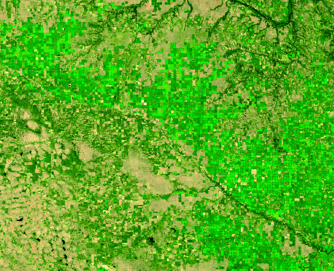
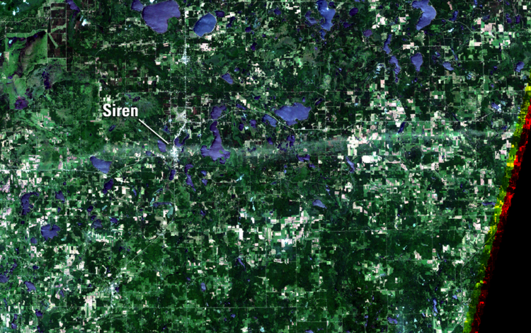
Background: This Landsat 9 image displays circles from irrigation systems in cropland in northeast Nebraska during the 2024 growing season.
Landsat's value surges
A study titled “Economic Valuation of Landsat and Landsat Next 2023” highlights Landsat's estimated economic value at \$25.6 billion — more than 7 times the reported amount just six years prior — and the fact that the impacts and benefits of Landsat are felt worldwide. Predictions reach Landsat’s value over \$33 billion after the launch of Landsat Next in the early 2030s.
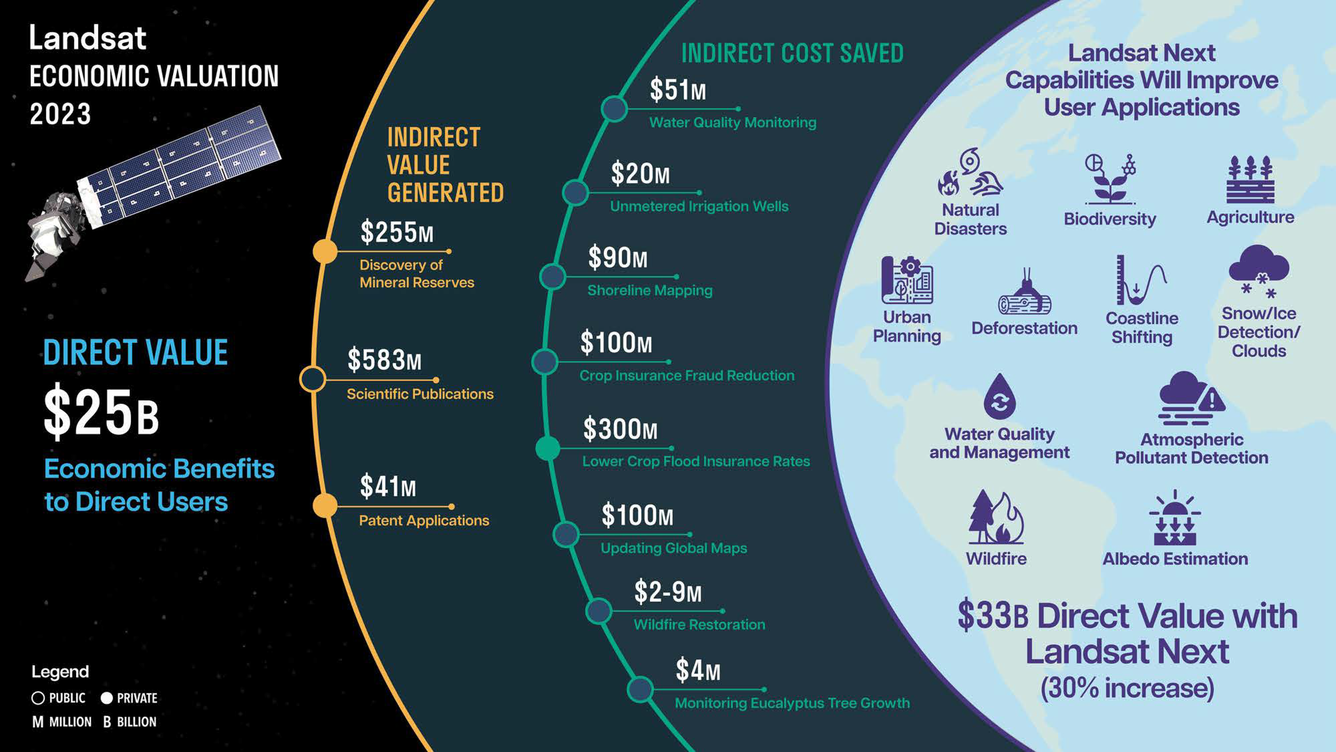
To understand the full impact of how Landsat data are used to benefit the United States and the world, the report’s authors compiled examples that add up to cost savings of well over a billion dollars:
- Flood Insurance Savings: The U.S. Department of Agriculture saves \$300 million annually in flood insurance premiums for farmers through better mapping.
- Water Quality Monitoring: Using Landsat to monitor water quality for chlorophyll saves \$51 million annually in lab costs.
- Water Usage Monitoring: The Idaho Department of Water Resources saves nearly \$20 million annually by using Landsat to estimate water usage from unmetered wells.
- Post-Wildfire Restoration: The U.S. Forest Service and Bureau of Land Management save between \$2 million to \$9 million annually using Landsat for post-wildfire restoration activities.
- Crop Insurance Fraud Prevention: Landsat data is used to prevent crop insurance fraud, saving the U.S. government \$100 million annually.
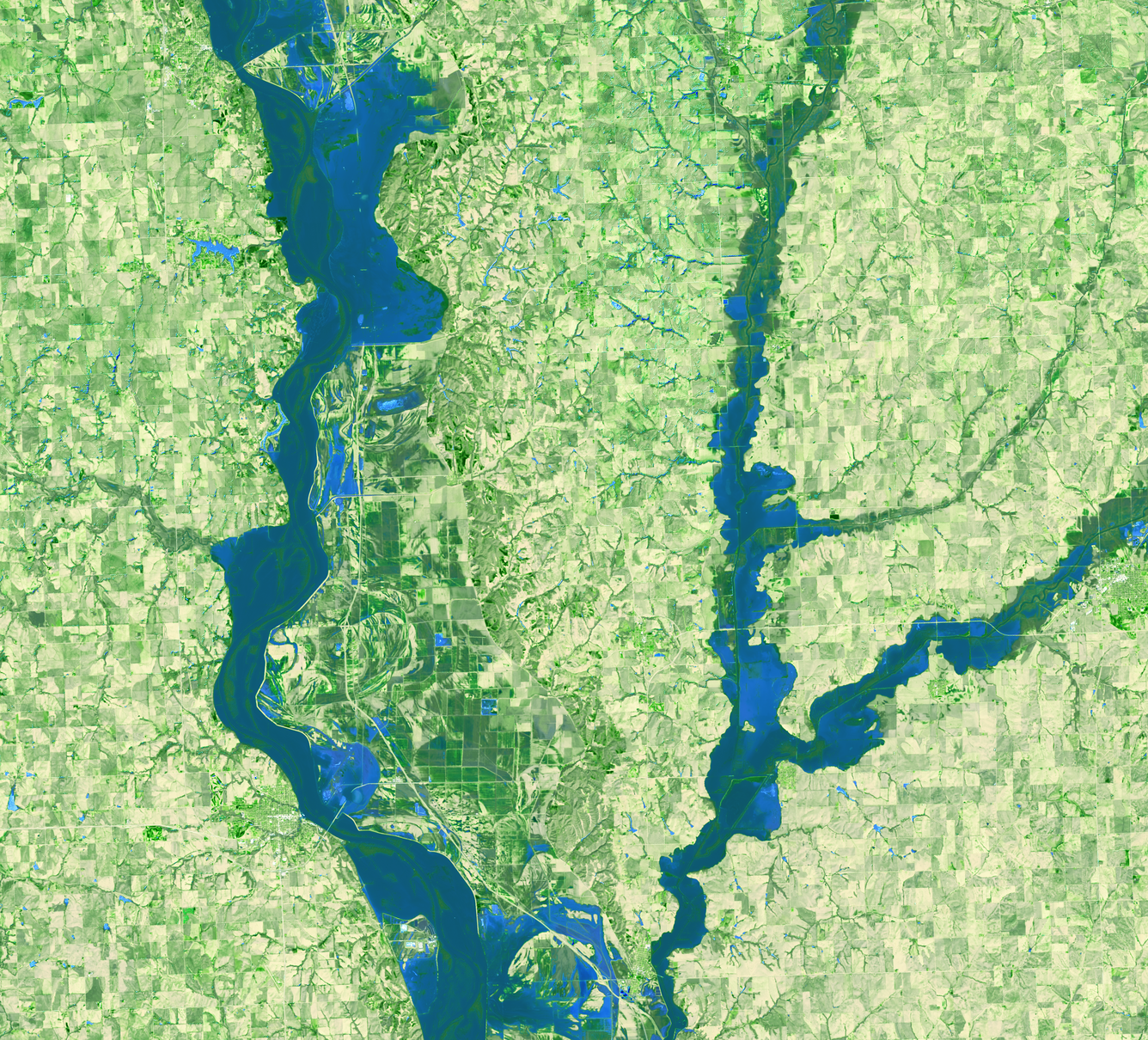
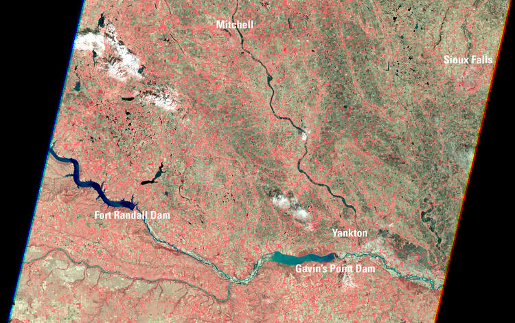
Background: This Landsat 8 image shows flooding along the Missouri River in early March, 2019.
The Substance and Science of Landsat
Landsat data has long provided opportunities for improved monitoring and management of all of Earth’s landforms and ecosystems. From delicate mangroves and freshwater wetlands to mountainous forests damaged by fire and landmasses and ice sheets from pole to pole. Landsat is an invaluable resource, helping land managers and scientists evaluate the changes to land surfaces, and then determine the best step forward to mitigate or influence future land change.
Scroll through the stories below to learn how applying Landsat data enabled scientists to advance research in 2024.
Mapping land cover
The widely used National Land Cover Database (NLCD) receives a makeover that makes more use of the deep Landsat archive.
Imaging at the poles
A special data collection program acquires Landsat data of Earth's polar regions of Antarctica, Greenland, and the Arctic Sea during twilight. This effort allows for new science applications and more routine climate monitoring of the polar regions.
Providing wildland fire data
LANDFIRE (Landscape Fire and Resource Management Planning Tools) marks 20 years since it was officially chartered in response to increasing concern about the number, severity, and size of wildland fires in the United States.
Estimating water depth
A new method introduces techniques that enhance the usability and accuracy of satellite data such as Landsat for estimating water depth in areas close to shore.
Revealing remote fires
Scientists highlight the usefulness of the long-term Landsat archive to help fill in historical fire-record gaps in the tundra of northern Alaska.
The color of water
Researchers take an old data technique in freshwater science—physically sampling lake water—and reinvent it using satellite technology to study water quality in lakes across the United States
Creating a fire atlas in Utah
A university researcher travels back in time with the Landsat record to track medium-sized fires.
International Partnerships
Landsat's reputation for top quality Earth observation capabilities helps strengthen the partnerships the USGS maintains with longstanding international collaborators. This year, important new agreements were signed relating to the future of Earth observation and the next Landsat mission. These partnerships are made possible by the Landsat 2030 International Partnership Initiative that was announced in late 2023.
Scroll down to read more about the new agreements, see highlights from a visiting international ambassador, and learn how international cooperators and their ground station operators keep informed about Landsat.
Australia
Australia signs an agreement to continue a nearly 50-year partnership in the Landsat program through its Earth science agency, Geoscience Australia (GA). Through this partnership, USGS and GA collaborators aim to enhance the GA satellite ground station facilities and support advanced new data processing and analytics. This priority is to prepare for the increase of data from the three Landsat Next satellites.
Background photo: Alison Rose, Chief of Space Division, Geoscience Australia, and Darcee Killpack, acting Associate Director, Core Science Systems, United States Geological Survey, signing the Memorandum of Understanding formally operationalizing the Landsat Next partnership.
Germany

The German Aerospace Center (Deutsches Zentrum für Luft-und Raumfahrt or DLR) signs an agreement to continue its longstanding partnership with the USGS for the upcoming Landsat Next satellite mission and receive data at its ground station in Neustrelitz.
Norwegian visit

A visit to the USGS EROS Center from the Norwegian Ambassador to the United States further highlights the importance of the international partnerships. The Svalbard satellite station, located on the Norwegian archipelago of Svalbard, plays an integral role in the Landsat 8 and Landsat 9 missions as a Landsat Ground Network Station, while also serving many other polar orbiting satellite missions.
Read the full story to learn more about her visit.
Visit the EROS 2024 Year in Review story to read more about the many milestones and highlights from the EROS Center!
Global cooperation
A global mission requires global cooperation. Many of the international agencies that are part of the Landsat International Cooperators Network have supported Landsat missions for several years. Biannual Landsat Technical Working Group and Landsat Ground Station Operators Working Group meetings bring together representatives from ground stations around the world to discuss ground station operations and to foster advancements and improvements in collecting Landsat data.
Check out the Landsat International Cooperators Interactive Map.

Landsat Next Mission Planning Advances
The new Landsat Next mission will help unlock new opportunities for research studies relating to water quality, crop production and plant stress, climate and snow dynamics, soil health and other essential environmental variables.
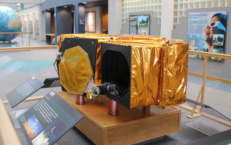
A significant milestone for the Landsat Next mission this year is the selection of a contractor to design, build, test, and deliver the sensors that will be on board the Landsat Next mission’s constellation of 3 identical satellites. Each sensor will collect Earth observation data in 26 spectral bands with high resolution. Overall, the constellation will collect about 20 times more data than Landsat 8 or Landsat 9.
Visit the links below to hear a podcast and view webpages to learn more about the Landsat Next mission.
What is the Landsat Next Mission? A Podcast
Landsat Next Instrument Contractor Selected
Landsat Next USGS Webpage
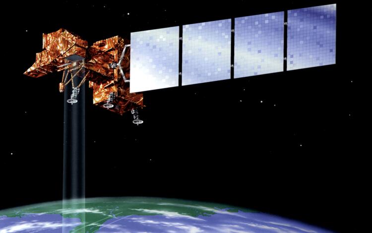
Landsat 7 Mission Reaches Retirement
After 25 years of orbiting around the Earth more than 132,000 times, the Landsat 7 mission is nothing short of legendary. The Enhanced Thematic Mapper Plus sensor onboard the satellite captured over 3.3 million images. Move the slider back and forth on the image below to see the massive growth of the Las Vegas area from 1999 to 2024. The 2024 image marks the satellite’s 25th anniversary and stands as a tribute to Landsat 7's quarter-century legacy of Earth observation.


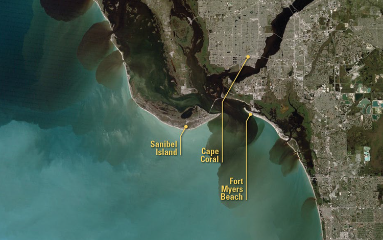
Landsat 7 satellite images continue to support studies of how land is used and how it has changed across urban, agriculture, forest, snow, and ice-covered areas around the globe, as well as natural and manmade disasters.
The magnitude and impact that Landsat 7 brought to scientists and those interested in studying the Earth's landmasses are summarized in this graphic.
Read the USGS News release about the Landsat 7 mission.
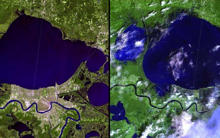
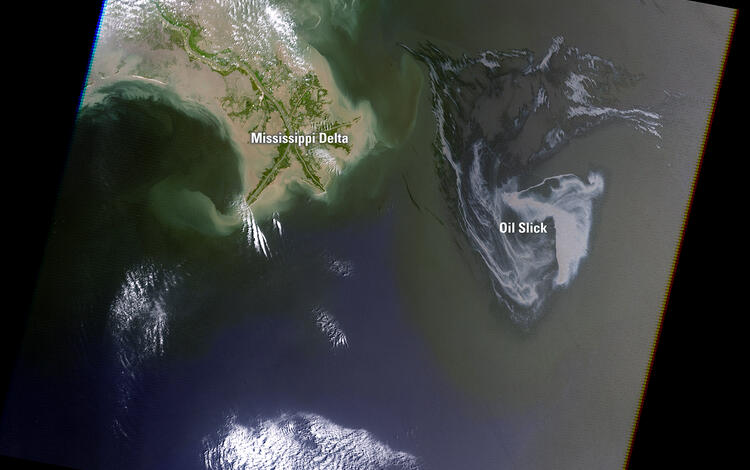
Events captured by Landsat 7
Landsat 7 witnessed events that changed the landscape on Earth slowly, such as the expanding Las Vegas urban sprawl shown above. Some of the significant events that changed the Earth much faster include the 2001 World Trade Center attack, the aftermath of Hurricane Katrina in 2005, and the Deepwater Horizon Oil Slick in the Gulf of America in 2010.
The images and podcasts linked below provide just a glimpse into the 25 years of Landsat 7. From its launch in 1999 to sending down its final science mission data in 2024, this historic mission helped us appreciate and better understand Earth's land surfaces.


Looking ahead to 2025
As we look to the new year, we anticipate new developments, challenges, and exciting advancements in the world of Landsat. The legacy continues!
