



Welcome to the Washington Water Science Center
Washington Water Science Center
The USGS Washington Water Science Center provides water resource information. You’ll find information about Washington’s rivers and streams, as well as groundwater, water quality, and cutting-edge water research. We welcome you to explore our data and scientific research.
Current Washington Water Conditions
Current Washington Water Conditions

Explore real-time Washington streamflow, groundwater, and water-quality conditions and access data with our new interactive map application.
View current water conditions
View current water conditions
Uncrewed Aviation Systems Program
Uncrewed Aviation Systems Program

Data collection provided by uncrewed aviation systems (UAS) enhances the Washington Water Science Center’s (WAWSC) ability to monitor dynamic environmental systems, respond to natural hazards, analyze the impacts of climate change, and assess landscape change.
News
Sediment contaminants in Puget Sound: Implications for ecosystem health and remediation
Sediment contaminants in Puget Sound: Implications for ecosystem health and remediation
Washington Waters Newsletter - Spring 2025
Washington Waters Newsletter - Spring 2025
New data products now available in StreamStats
New data products now available in StreamStats
Publications
Sediment vulnerability ranking for river basins across the contiguous U.S. using integrated biophysical and social-ecological data Sediment vulnerability ranking for river basins across the contiguous U.S. using integrated biophysical and social-ecological data
Nearly half of streams and rivers in the United States (U.S.) have fair to poor conditions for aquatic ecosystem health as declared by the U.S. Environmental Protection Agency, and sediment was identified as a primary factor impairing these waterbodies. We rank sediment vulnerability using physical, ecological, and socioeconomic datasets in 163 4-digit Hydrologic Unit Codes within 18...
Emergent headwater types for watershed monitoring, research, and planning Emergent headwater types for watershed monitoring, research, and planning
Headwaters—that is headwater streams and the watersheds they drain—strongly influence water quality, ecosystem services, and hydrologic connectivity, yet remain poorly mapped, monitored, and understood at large spatial scales. Using available spatial data to classify headwater “types” could therefore enhance the utility of sparse monitoring data to advance research and watershed planning...
As above, so below? A framework for integrating long-term water quantity trends reveals divergent patterns in groundwater and low streamflow across the United States As above, so below? A framework for integrating long-term water quantity trends reveals divergent patterns in groundwater and low streamflow across the United States
Climate, land-use, and disturbance drive long-term global trends in groundwater levels and streamflow. At large scales, these trends are typically considered separately, despite the well-established concept that groundwater and surface water comprise a single resource. Joint trend assessment at national scales is challenging because it requires pairing and aggregating data from spatially...
Science
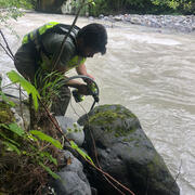
Assessment of bedload monitoring methods
The Issue: The Washington State Department of Transportation (WSDOT) maintains many roads and bridges that either abut or cross dynamic gravel-bedded rivers. The design and maintenance of these structures often requires assessing sediment transport and river channel dynamics. However, the transport of sand and gravel as bedload, and the channel change that results from that transport, remains...
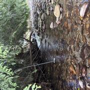
Skagit River Tributary Drying
The Issue: Salmon and steelhead habitats in Skagit River tributaries face threats from stream drying, low flows, and high water temperatures. How USGS will help: USGS will identify vulnerable stream reaches using modeled data and field campaigns to inform conservation and restoration priorities.
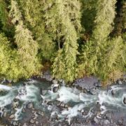
Watersheds and Fluvial Systems Team
The Watersheds and Fluvial Systems Team at the Washington Water Science Center provides reliable science to understand how watersheds, rivers, and streams function—and how they respond to a changing world. We aim to build partnerships that foster informed decision-making and effective resource management throughout the Pacific Northwest region and across the U.S.