



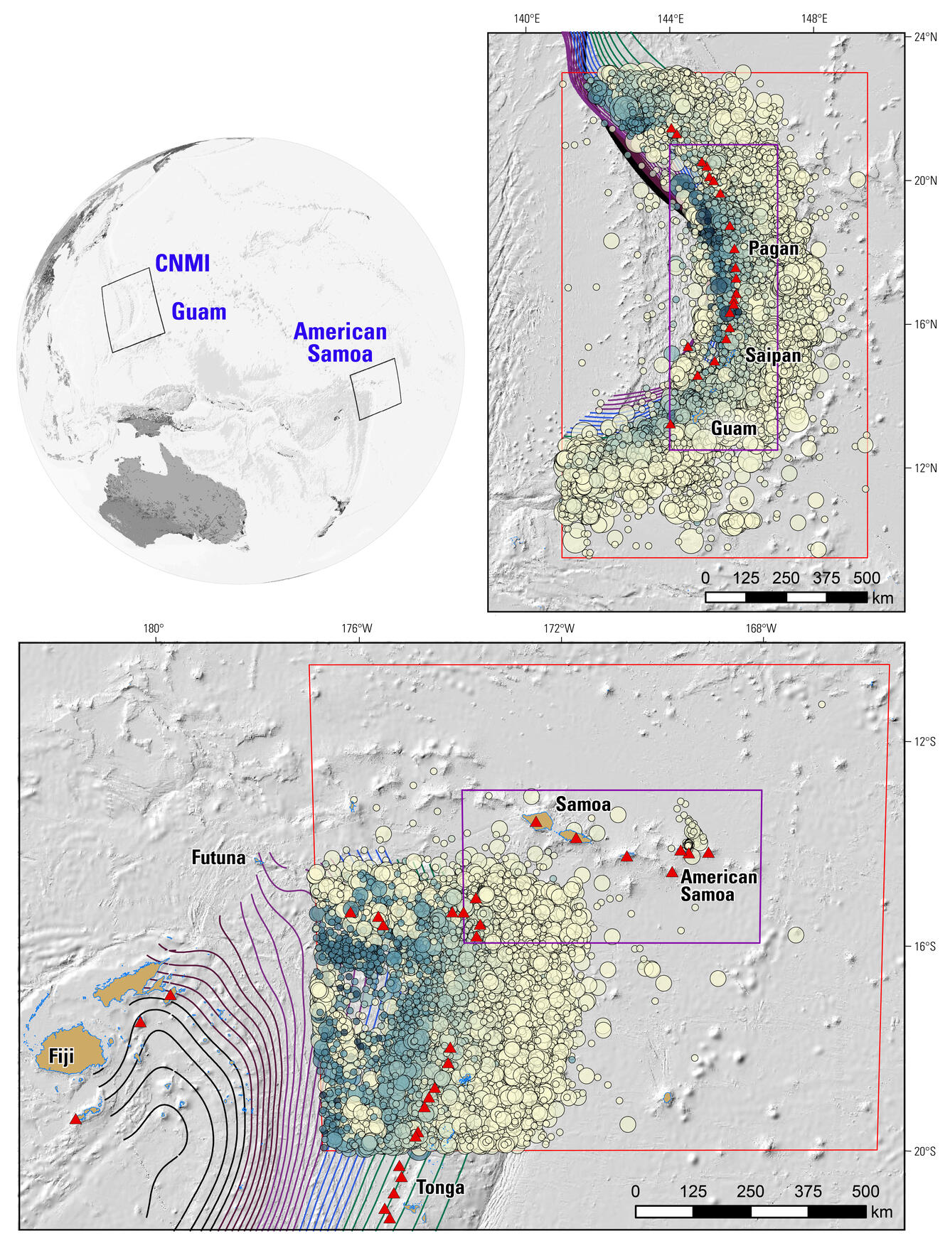
Map of tectonic setting for NSHM27 of Guam, Northern Mariana Islands, and American Samoa


Detailed Description
This location map and inset maps of the National Seismic Hazard Model (NSHM) show areas of interest for the populated Pacific Territories of the United States. The inset maps highlight Guam and the Commonwealth of the Northern Mariana Islands (GNMI) and American Samoa (AmSam), two large regions assessed for seismic hazards in the NSHM of 2027.
The red rectangles show the extents considered for the seismic catalog; the purple rectangles are the extents for hazard calculations. Earthquake epicenters are taken from the USGS ANSS Comcat catalog and show a yellow-to-blue color ranges for shallow-to-deep locations; the Slab2 linework is shown for depths ranging from deep-to-shallow (black-purple-blue-green series). Local islands are labeled and Holocene volcanic centers (red triangles) are shown.
Sources/Usage
Public Domain.
Related

2027 Long-term National Seismic Hazard Models for the U.S. Territories of Guam, Commonwealth of the Northern Mariana Islands, and American Samoa

Volcanoes in American Samoa

Volcanic Eruptions and Hazards in American Samoa

Introduction to the National Seismic Hazard Models

Probabilistic Forecasting of Earthquakes, Tsunamis, and Earthquake Effects in the Coastal Zone

Tsunami and Earthquake Research

Tsunami Field Studies

Earthquake Data
Related
2027 Long-term National Seismic Hazard Models for the U.S. Territories of Guam, Commonwealth of the Northern Mariana Islands, and American Samoa
Volcanoes in American Samoa
Volcanic Eruptions and Hazards in American Samoa
Introduction to the National Seismic Hazard Models
Probabilistic Forecasting of Earthquakes, Tsunamis, and Earthquake Effects in the Coastal Zone
Tsunami and Earthquake Research
Tsunami Field Studies