
Great American Waterways
Celebrating America's Waterways!
For generations, the U.S. Geological Survey has led the way in researching the nation’s waterways from rivers and streams to lakes, wetlands, bays, and coastal oceans. This long‑standing commitment helps provide critical insights into water quality, availability, and ecosystem health across diverse environments. This year, we’re celebrating some of America’s greatest waterways.
Great American Waterway Posters
This year, to celebrate some of America’s most iconic waterways, we’ve created a series of posters showcasing some of the most beautiful spots along these historic places.
Read below to learn more about these waterways.


Great America Waterways Competition
Sixteen iconic waterways that shaped our nation’s history and culture went head‑to‑head in a championship‑style contest. From legendary rivers to breathtaking bays, these waterways represent the lifeblood of America’s past and future.
But only ONE waterway could rise above the rest, and this year, the champion is the Columbia River! In 2026, the Columbia surged ahead to claim the title of Great American Waterway, standing out for its deep cultural significance, powerful working waters, and vital role in the Pacific Northwest.
Explore all 16 competitors below
How did this competition play out?
Multiple rounds of matchups occurred between late-March and early April! Winners from each round advanced until we crowned a champion. Voting took place on USGS Water Instagram.
Follow us on instagram up to keep up with our featured waterways! @USGS_Water
Meet the Waterways
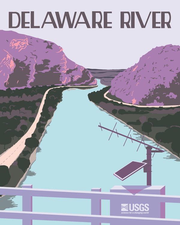
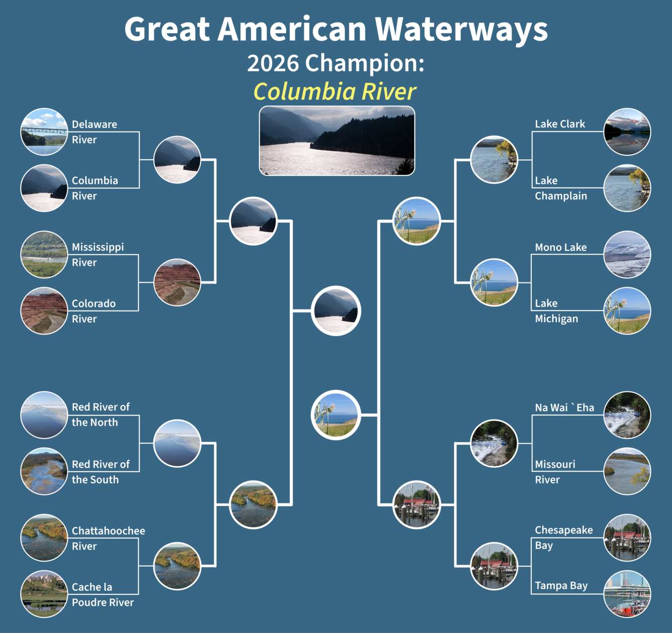
Delaware River
Significance: The Delaware River is rich in history, ecologically diverse, and critical to the regional economy. The Delaware River Basin covers 13,500 square miles in parts of four States (New York, New Jersey, Pennsylvania, and Delaware). Drinking water supply is a major use of the DRB’s waters, both within the basin and outside of the basin through diversions, supporting daily water needs for over 15 million people. To learn more visit Water Science and Management in the Delaware River Basin.
History: The Delaware River has been central to the nation’s development for centuries. It served as a vital artery for trade and transportation during colonial times, shaping the growth of cities like Philadelphia. Its most iconic moment came on the freezing night of December 25, 1776, when George Washington led the Continental Army across its icy waters in a daring surprise attack at Trenton. This bold move reversed the tide of the Revolutionary War, restoring morale and keeping the fight for independence alive.
Science Highlight: Next Generation Water Observing System: Delaware River Basin
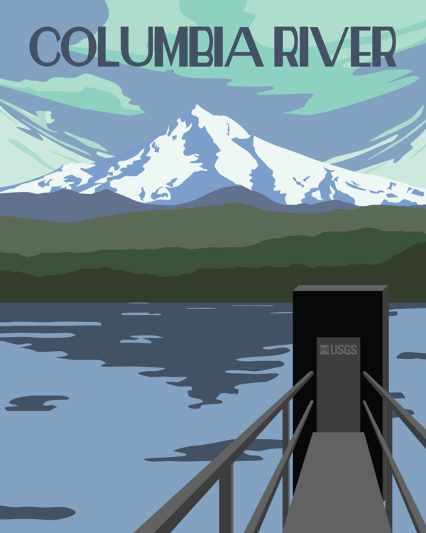
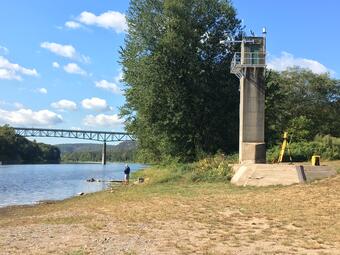
Columbia River
Significance: The Columbia River is one of North America’s great working rivers, powering the continent’s largest hydropower system and providing electricity across the Pacific Northwest. Its waters support navigation, agriculture, and communities, carrying barges hundreds of miles inland and irrigating millions of acres of farmland. The river also sustains iconic salmon runs that hold deep cultural importance for Tribal Nations and remain vital to regional ecosystems.
History: The Columbia River has shaped human history in the Pacific Northwest for thousands of years. Indigenous communities along the river developed thriving trade networks, fisheries, and deep cultural traditions centered on its waters.
In the early 1800s, the Columbia became a defining route of the Lewis and Clark Expedition, opening the West to new waves of American exploration and settlement. Throughout the 19th and 20th centuries, the river served as a commercial backbone for timber, agriculture, and river‑based trade.
The 20th‑century construction of major dams transformed the Columbia into one of the nation’s most significant hydropower sources, powering wartime industry during World War II and fueling economic growth across the Northwest.
Science Highlight: Columbia River Research Laboratory (CRRL)
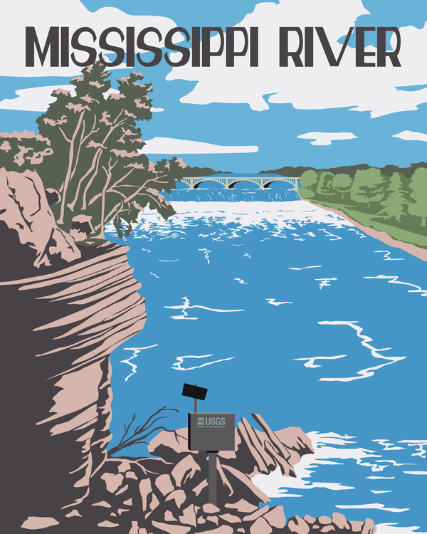
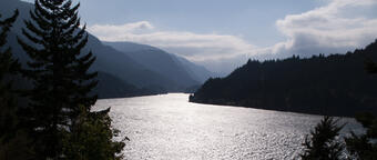
Mississippi River
Significance: The Mississippi River is one of the most iconic waterways in North America, forming the backbone of the nation’s river transport network. Stretching over 2,300 miles from Minnesota to the Gulf of America, it drains 41% of the continental United States, an area known as the Mississippi River Basin. Its waters support agriculture, industry, navigation, and ecosystems across the central U.S., carrying freight that fuels the national economy and sustaining wetlands that are vital for wildlife and flood mitigation. Millions rely on the river and its tributaries for drinking water, irrigation, and recreation.
History: For thousands of years, the Mississippi River supported the cultures and economies of Indigenous communities. Later, it played an important role in the development of the United States by enabling transportation, trade, and settlement in the 18th and 19th centuries. Steamboat travel in the 1800s helped river towns grow quickly. During the Civil War, control of the Mississippi River was a strategic priority because it served as an important military waterway, transporting goods and soldiers. Over time, the river has become a defining element of American history, culture, and geography.
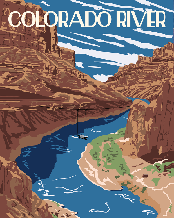
Colorado River
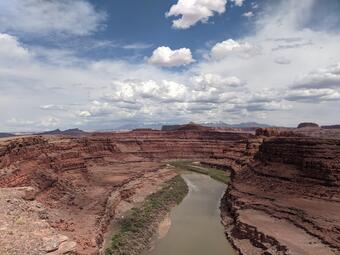
Significance: The Colorado River is one of North America’s most vital waterways, supporting communities, agriculture, ecosystems, and economies from the Rocky Mountains to the Gulf of California. Across its 246,000‑square‑mile basin, the river provides water to nearly 40 million people in the United States and Mexico and sustains about 5.5 million acres of agricultural land. From high‑elevation headwaters that supply much of the basin’s flow to the cities and farms downstream, the river connects diverse landscapes and regions. Reservoirs throughout the basin offer essential water storage and hydroelectric power, helping support growing communities throughout the West.
History: People have relied on the Colorado River for thousands of years, developing cultures, technologies, and land‑use practices deeply tied to its waters. Indigenous communities engineered extensive irrigation systems and built vibrant settlements along the river and its tributaries. As the West expanded, the Colorado River became a foundation for agriculture, transportation, and regional development. Engineering achievements, including major reservoirs and hydropower facilities helped to create water supply that support cities, farms, and recreation across both the Upper and Lower Basin, contributing to the long‑term stability and prosperity of the region. Managing the Colorado River’s water supply is inherently complex, shaped by the basin’s vast geography, diverse demands, and the shared responsibilities of multiple parties.
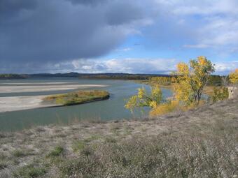
Red River of the North
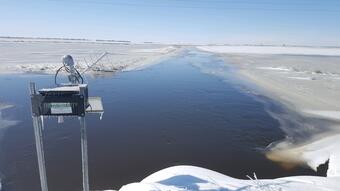
Significance: The Red River of the North flows northward from Minnesota into North Dakota and continues into Manitoba, Canada, where it eventually reaches Lake Winnipeg. The river forms an important part of the regional water system, supporting agriculture, municipal water supply, and ecosystems across the Red River Basin. Its flat basin topography makes the region highly susceptible to flooding, prompting extensive monitoring and management efforts. USGS streamgages in the basin provide essential real‑time data for forecasting and decision‑making.
History: Communities along the Red River of the North have relied on its waters for thousands of years. The river shaped settlement, trade, and agriculture throughout the region. Its periodic floods, have influenced infrastructure planning, emergency response, and long‑term watershed management. The river continues to play a key role in the cultural and economic life of the U.S.–Canada border region.
Red River of the South
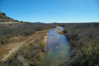
Significance: The Red River of the South flows through Texas, Oklahoma, Arkansas, and Louisiana before joining the Atchafalaya and Mississippi River systems. The river supports agriculture, municipal water supply, navigation, and diverse ecosystems across the southern Great Plains and Lower Mississippi Valley. Its basin is an important source of water for communities and industries throughout the region.
History: The Red River of the South has shaped the development of the south‑central United States for centuries. One of the most defining features in its history was the Great Raft, an enormous logjam system that stretched for roughly 150 miles along the river over many centuries. The Great Raft restricted navigation, altered the river’s course, created a series of natural lakes, and influenced where communities could develop. In the 1830s and 1840s, large‑scale engineering efforts led by the U.S. Army Corps of Engineers removed major portions of the Raft, opening the river to steamboat travel and reshaping settlement and commerce in the region. The river has continued to play a significant role in regional agriculture, transportation, and the formation of state boundaries.
Chattahoochee River
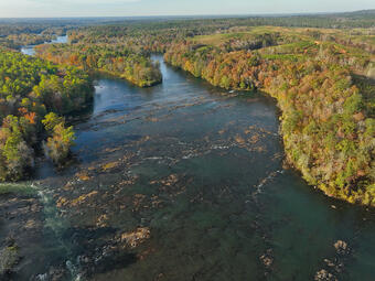
Significance: The Chattahoochee River begins in the Blue Ridge Mountains of northern Georgia and flows southwest through Atlanta before forming much of the border between Georgia and Alabama. The river is a major source of drinking water for the Atlanta metropolitan area and supports hydropower generation, agriculture, recreation, and diverse ecosystems. Its watershed plays a central role in regional water planning and multistate water‑management efforts.
History: During the 19th century, the river became increasingly important for navigation, water supply, and hydropower development. In the Civil War, the river served as a defensive line for Confederate forces until Union troops crossed it in 1864 during the Atlanta Campaign, a key step leading to the fall of Atlanta. As the region grew, the Chattahoochee River remained central to water‑supply planning and ongoing interstate water management discussions involving Georgia, Alabama, and Florida. It continues to shape the cultural, economic, and ecological landscape of the southeastern United States.
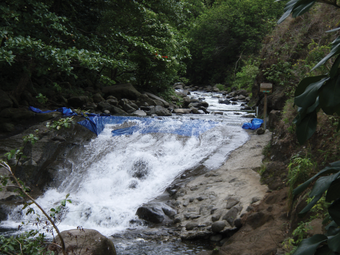
Cache La Poudre River
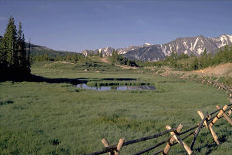
Significance: The Cache La Poudre River is a waterway along Colorado’s northern Front Range. Originating in the Rocky Mountains, it flows east through Poudre Canyon and the cities of Fort Collins and Greeley before joining the South Platte River. The river is an essential source of municipal water, agriculture, and recreation, and its watershed supports diverse ecosystems from high‑elevation forests to prairie plains. It is designated by Congress as a National Heritage Area, recognizing its major role in the development of western water management. The Cache La Poudre is also central to Colorado’s system of water management and interstate water agreements.
History: The river’s name, French for “hide the powder”, comes from an 1836 incident in which French trappers reportedly buried gunpowder along its banks during a winter storm. As European‑American settlement expanded, the Cache La Poudre became central to irrigation development, leading to some of the earliest water‑rights systems in the western United States. These innovations helped shape Colorado’s approach to water allocation and influenced water law across the region.
Lake Clark
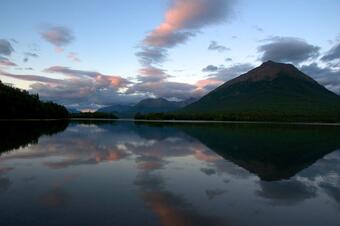
Significance: Lake Clark is a central feature of Lake Clark National Park and Preserve in southwest Alaska. The lake supports ecologically intact northern landscapes, including salmon-bearing rivers, diverse wildlife habitat, and a watershed that contributes to significant regional fisheries. Its remoteness and relatively undisturbed condition make it an important location for environmental monitoring and long‑term ecological research.
History: For thousands of years, the Dena’ina people have lived, traveled, and fished along Lake Clark’s shores, building a cultural tradition deeply tied to the land and water. The area was formally protected in 1980 through the Alaska National Interest Lands Conservation Act, recognizing both its ecological value and its rich cultural legacy. Today, it remains a place where Indigenous history and ongoing environmental stewardship converge.
Lake Champlain
Significance: Lake Champlain stretches across New York, Vermont, and Québec, serving as a major freshwater resource for communities, agriculture, recreation, and diverse ecological systems. Its basin supports drinking water supplies, fisheries, and important migratory bird habitat. Its long, narrow orientation also influences local weather and plays a key role in regional environmental management and watershed science.
History: Indigenous peoples used the lake for travel and subsistence long European arrival. In the 18th century, Lake Champlain became a strategic waterway during both the French and Indian War and the American Revolutionary War, hosting key battles and military routes. Its waterways later supported navigation, trade, and the growth of towns and forts along its shoreline, shaping the cultural history of the Northeast.
Mono Lake
Significance: Mono Lake is one of North America’s oldest lakes, known for its tufa formations and hypersaline waters that support huge populations of brine shrimp and alkali flies. These in turn sustain tens of thousands of migratory birds each year, making the lake a globally important stopover in the Pacific Flyway. Its unique chemistry and desert mountain setting also make it a focus of geological, ecological, and climate research.
History: In the mid‑20th century, water diversions by Los Angeles dramatically lowered the lake level, triggering ecological decline and air‑quality issues from exposed lakebed. The resulting public and scientific mobilization led to landmark environmental court decisions in the 1980s and 1990s. These rulings reshaped California water‑management practices and launched ongoing restoration efforts that continue to stabilize lake levels and protect critical habitats.
Lake Michigan

Significance: Lake Michigan, the only Great Lake entirely within the United States, is a central freshwater resource for millions of people. It influences regional climate, supports major commercial shipping routes, and sustains fisheries, beaches, industry, and recreation across the Midwest. Its immense size and interconnected ecosystems make it a focus of monitoring for coastal change, invasive species, hydrology, and habitat restoration.
History: By the 19th century, Lake Michigan became a major hub of shipping, trade, and industrial growth, driving the rise of cities such as Chicago and Milwaukee. Expanding port infrastructure, canals, and connecting waterways helped shape national transportation and commercial networks, supporting agriculture, lumber, and manufacturing throughout the region. Over time, these developments brought both economic opportunity and environmental strain. Today, coordinated restoration efforts work to address pollution, invasive species, and shoreline change as communities continue to rely on the lake’s vast natural and economic resources.
Nā Wai ʻEhā
Significance: Nā Wai ʻEhā, “The Four Great Waters” of Maui is one of Hawaiʻi’s most culturally rich and historically important freshwater systems. These streams have nourished fertile valley lands for centuries, supporting extensive taro cultivation and sustaining vibrant communities in the island’s heartland. Known for their exceptional productivity, the waters of Nā Wai ʻEhā embody the deep relationship between freshwater, food security, and cultural heritage in Hawaiʻi. Their restored flows continue to support traditional agriculture, local ecosystems, and the cultural practices that have shaped the region for generations.
History: For hundreds of years, Nā Wai ʻEhā formed one of the largest and most prosperous wetland taro‑growing complexes in the islands. Abundant, steady streamflow made the region a center of innovation in loʻi kalo (taro terrace) engineering, with irrigation systems that exemplified sustainable Hawaiian water management. In modern times, Nā Wai ʻEhā became the focus of a landmark water‑rights case that successfully restored streamflows, affirming the importance of protecting both traditional practices and ecological health. This restoration is widely celebrated as a model of community‑driven stewardship and the enduring resilience of Hawaiian water culture.
Missouri River
Significance: The Missouri River is the longest river in North America and flows more than 2,300 miles from the Rocky Mountains of western Montana to its meeting point with the Mississippi River near St. Louis. The river drains a large portion of the central United States and supports agriculture, navigation, hydropower, and ecosystems across the Great Plains and the Midwest. Its basin includes mountains, grasslands, and major cities, and it plays an important role in water supply, irrigation, and flood management.
History: For thousands of years the Missouri River supported Indigenous nations who relied on its waters for food, travel, and cultural traditions. In the eighteenth and nineteenth centuries, the river became an important route for exploration, trade, and westward expansion. The Lewis and Clark Expedition traveled along the river from 1804 to 1806 and provided the first major United States documentation of the region. Throughout the nineteenth century the Missouri supported settlement, steamboat travel, and development across the frontier. Its history continues to shape communities from Montana through the Dakotas, Nebraska, Iowa, Kansas, and Missouri.
Chesapeake Bay
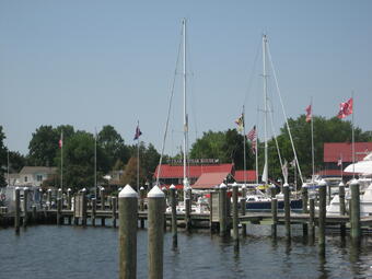
Significance: The Chesapeake Bay is the largest estuary in the United States, receiving water from a watershed that extends across six states and the District of Columbia. Its intricate network of rivers and streams supports one of the most productive estuarine ecosystems in the world, including extensive wetlands, tidal rivers, and oyster reefs that provide natural water filtration and coastal resilience. The Chesapeake Bay sustains major fisheries, including the blue crab fishery that contributes significantly to regional comerce and ecosystem health. Adddtonally it supports navigation and supplies water and recreation for millions of people. USGS science plays a central role in understanding watershed connections, water quality, sediment transport, and ecosystem response across this vast system.
History: The Chesapeake Bay has been a center of settlement, trade, and maritime activity since the seventeenth century. The Bay’s deep natural harbors and access to the Atlantic Ocean helped establish early port cities such as Annapolis, Norfolk, and Baltimore as major economic hubs. Over the 18th and 19th centuries, widespread agriculture and timber harvesting throughout the watershed accelerated erosion, introducing large volumes of sediment into the Bay. Scientific work in the region has shown that floodplain and channel deposits still contain material from colonial and industrial eras, including contaminants like mercury and lead. These long term landscape changes shaped the modern condition of the Bay and prompted some of the earliest coordinated watershed‑scale restoration efforts in the country.
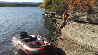
Tampa Bay
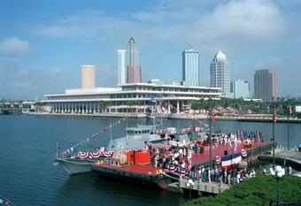
Significance: Tampa Bay is a highly productive estuary on Florida’s Gulf Coast, supporting thriving populations of fish, shorebirds, and marine mammals. Extensive mangrove forests line much of the shoreline and help protect nearby communities from storm surge. The Bay’s broad seagrass meadows sustain prized sport fisheries such as snook, redfish, and tarpon, which draw anglers from across the country. Tampa Bay also contributes to regional and national interests through its major deep water port and the presence of an active Air Force base. In winter months, warm water outflows from a powerplant on the northwestern shore create an important refuge for manatees when temperatures drop.
History: The Bay has long been central to the growth of the Tampa-St. Petersburg region. Its natural harbor supported early shipping and commercial activity, and twentieth‑century development reshaped much of the shoreline through dredging, navigation improvements, and coastal construction. These changes, combined with population growth, led to substantial declines in water quality and habitat through the mid‑1900s.
Beginning in the late twentieth century, local governments, scientists, and community organizations launched coordinated restoration efforts that improved seagrass coverage and overall Bay health. Tampa Bay’s history is also tied to major coastal storms, and USGS scientists have documented events in which hurricanes caused dramatic shifts in Bay water levels.
Science Highlight: Tampa Bay Hard Clam Growth Study