
Groundwater/Surface-Water Interactions
Groundwater/Surface-Water Interactions
Filter Total Items: 39

Saltwater Intrusion
Saltwater intrusion has occurred to some degree in many of the coastal aquifers of the United States. Since saltwater cannot be used to irrigate crops or be consumed by people, saltwater intrusion can be very problematic to coastal communities that rely on fresh groundwater supplies for the livelihood. The USGS studies how excessive groundwater pumping, sea level rise, and other factors contribute...

Regional Groundwater Availability Studies
Regional groundwater availability studies enable information about groundwater to be integrated and consistent, so that this resource can be analyzed and understood on an aquifer–wide scale. These studies provide decision–makers with a better understanding of the status and trends in the Nation's groundwater availability.

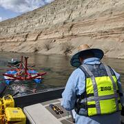
Red River Focus Area Study
The USGS is undertaking a 3-year study of water use, availability, and change in the Red River basin, which covers more than 93,000 square miles in New Mexico, Texas, Oklahoma, Arkansas, and Louisiana. Water resources are being stressed by increasing water demands and increasingly severe droughts, and a comprehensive water-resource assessment of the basin is needed to enable sustainable water use.

Apalachicola-Chattahoochee-Flint River Basin Focus Area Study
As one of several National Focus Area Studies within the USGS National Water Census (NWC) the USGS completed a 3-year study of water availability and use in the Apalachicola-Chattahoochee-Flint (ACF) River Basin.

Upper Rio Grande Basin Focus Area Study
USGS is undertaking a 3-year study of water use, availability, and change in the Upper Rio Grande Basin. This study area runs 670 miles from its headwaters in Colorado through New Mexico and northern Mexico to Texas, and will compile existing information and add new scientific data and interpretation to help stakeholders face current and future water issues.

Rapid Fluctuations in Groundwater Quality
We think of groundwater as moving slowly, and groundwater quality as changing slowly—over decades or even centuries. But in some parts of some aquifers, groundwater quality can fluctuate rapidly, sometimes over just a few hours. Are such changes part of a long-term trend, or just part of a short-term cycle? And what does that mean for suitability for drinking?

Factors Affecting Vulnerability of Public-Supply Wells to Contamination
More than 100 million people in the United States—about 35 percent of the population—receive their drinking water from public-supply wells. These systems can be vulnerable to contamination from naturally occurring constituents, such as radon, uranium and arsenic, and from commonly used manmade chemicals, such as fertilizers, pesticides, solvents, and gasoline hydrocarbons. Learn about the...

Urban Waters Federal Partnership—Bronx and Harlem River Watersheds (New York, N.Y.)
The Harlem and Bronx Rivers provide ecological and social resources in an intensively urban area. Connecting people to rivers requires clean water—the USGS is helping to assess the efficacy of green infrastructure to improve the quality of stormwater that flows into the rivers.

Thermal Imaging Cameras for Studying Groundwater/Surface-Water Exchange
USGS scientists are using high-resolution handheld and airborne thermal imaging cameras in groundwater/surface-water exchange studies and other investigations where surface temperature contrasts indicate various hydrological processes. These cameras are used to quickly locate and characterize thermal (temperature) anomalies along streams, lakes, wetlands, estuaries, and across the landscape...

What does groundwater have to do with ice in Alaska?
USGS scientists are working alongside university researchers in Alaska to understand how groundwater and permafrost conditions change over time due to seasonal variations and climate change. Changes in permafrost can pose a threat to built infrastructure (like roads, homes, and pipelines) and to valued ecological resources that provide important habitats for wildlife.

Fiber-Optic Distributed Temperature Sensing Technology for Surface-Water and Groundwater Studies
Fiber-optic distributed temperature sensing (FO-DTS) technology can be used for characterizing estuary-aquifer and stream-aquifer interaction and for identifying transmissive fractures in bedrock boreholes.
Geophysics for USGS Groundwater/Surface Water Exchange Studies
Locating and quantifying exchanges of groundwater and surface water, along with characterizing geologic structure, is essential to water-resource managers and hydrologists for the development of effective water-resource policy, protection, and management. The USGS conducts applied research to evaluate the use of new or emerging hydrogeophysical tools and methods to improve our understanding of...