Kīlauea summit eruption reference maps over the past year
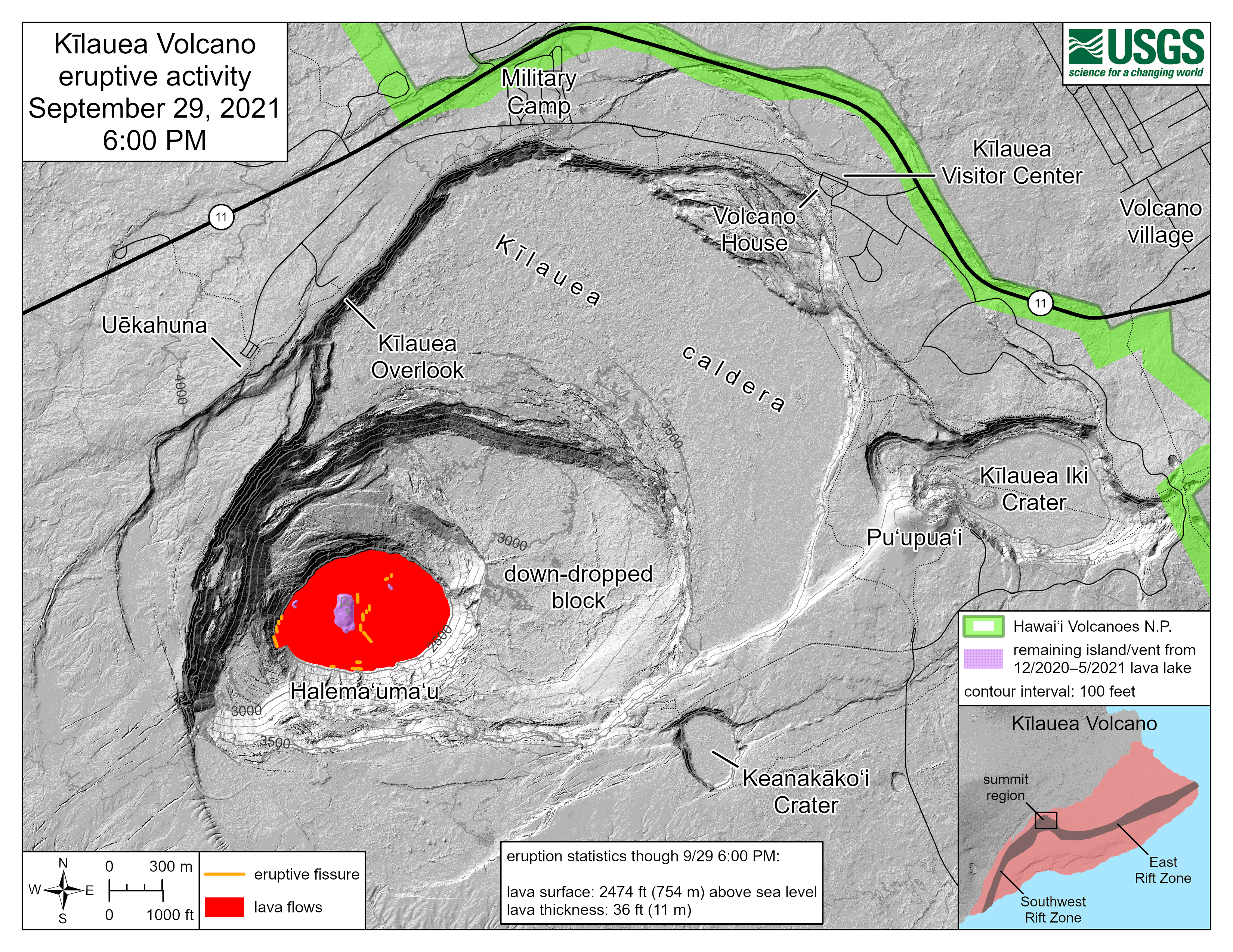
Kīlauea summit eruption reference maps over the past yearThis animated gif shows one year of reference maps depicting the ongoing Kīlauea summit eruption, which began on September 29, 2021. The animated gif shows how the active lava lake has decreased in area over the past year, while the crater floor has grown in area.