
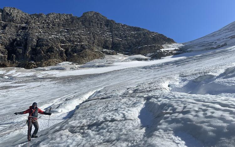
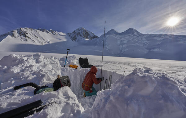
USGS scientist Louis Sass assesses an on-glacier weather station on the Kahiltna Glacier in Denali National Park, Alaska. This weather station is located at Kahiltna Base Camp, where climbers attempting to summit Denali begin their ascent. Sultana (Mt. Foraker) is visible in the background.
2025 USGS Benchmark Glaciers Executive Summary
Active
By Ecosystems Land Change Science Program
April 15, 2026
2025 Data Now Available: Explore how the USGS Benchmark Glaciers have changed in 2025
Return to Glaciers and Landscape Change
Explore the USGS Benchmark Glaciers mass balance methods for measuring glacier change
2025 Benchmark Glacier Results
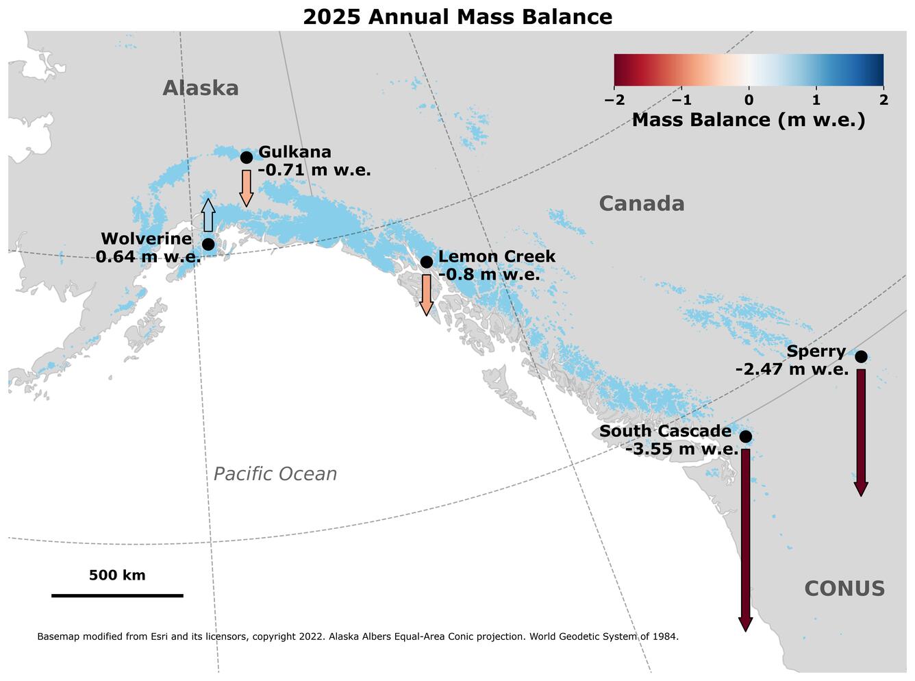
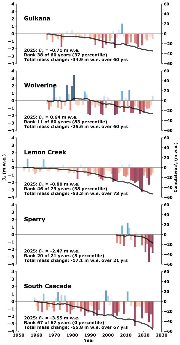
Benchmark Glaciers in Alaska had variable (and modest) mass gains and losses (Fig. 1).
- Wolverine Glacier gained mass in 2025, the first time since 2012.
- Gulkana and Lemon Creek Glaciers lost mass for the 17th and 13th consecutive years, respectively.
Benchmark Glaciers in the contiguous states had record and near record mass losses
- Glacier mass loss at South Cascade Glacier (Washington) was the highest on record.
- Mass loss at Sperry Glacier (Montana) was the second highest on record.
Overall, 2025 USGS Benchmark Glacier mass change was characterized by glacier mass loss driven primarily by warm summer conditions, with Wolverine Glacier as a notable exception.
Media
Sources/Usage: Public Domain. View Media Details
How did 2025 annual mass balances compare to previous years?
In Alaska, Gulkana and Lemon Creek glaciers experienced moderate mass loss, marking their 17th and 13th consecutive years of negative annual mass balance, respectively. Conversely, Wolverine Glacier experienced moderate mass gain — its first positive annual mass balance since 2012, ending a 12-year streak of negative balances. In the contiguous United States, Sperry Glacier in Glacier National Park, Montanna saw its second highest mass loss year since measurements began in 2005. South Cascade Glacier in the Cascade Mountains of Washington underwent the greatest mass loss year since measurements began in 1958 (Fig. 2.).
Media
Sources/Usage: Public Domain. View Media Details
How did winter snowfall contribute to each glacier's mass balance?
At Wolverine Glacier, winter precipitation exceeded normal levels beginning in November and remained above average throughout the remainder of the 2024 – 25 accumulation season. Lemon Creek Glacier experienced near-normal winter precipitation through the accumulation season. At Sperry Glacier, precipitation began accumulating approximately one month later than the 1991-2020 mean. Gulkana, Sperry, and South Cascade glaciers all ended the 2024 – 25 accumulation season with below-average winter precipitation (Fig. 3.).
Media
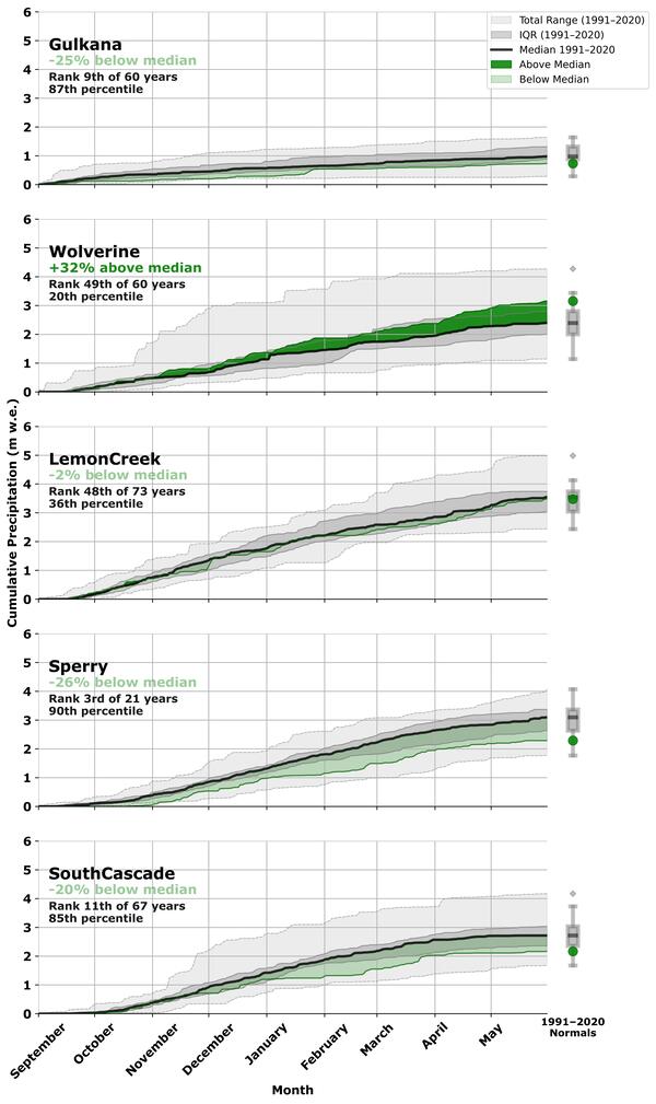
Fig. 3. Cumulative 2024 – 25 accumulation season precipitation (m w.e.), Sept. 1–May 30th, at the median elevation of each USGS Benchmark glacier, based on local weather station data (O'Neel et al., 2019; https://doi.org/10.5066/F7HD7SRF). The bold black line shows the 1991–2020 median, with dark gray shading indicating the interquartile range and light gray shading the total historical range for the reference period. Dark green shading indicates periods where 2025 accumulation exceeded the 1991–2020 median; light green shading indicates periods where it fell below. Boxplots at right summarize the full period-of-record distribution of seasonal precipitation totals for each glacier, with the box spanning the interquartile range, the internal line marking the median, whiskers extending to the total range, and the colored dot indicating the 2025 seasonal value. Rank and percentile are reported relative to each glacier's individual period of record. Total winter precipitation ranks are reported from lowest (driest) to highest (wettest).
Sources/Usage: Public Domain. View Media Details
How did summer temperatures contribute to each glacier's mass balance?
All three Alaska glaciers experienced cooler than average temperatures during the first half of summer, limiting melt. Wolverine and Gulkana Glaciers had a delayed start to the ablation season. At Wolverine Glacier remained cooler than average through the end of summer, contributing to its positive mass balance. Gulkana and Lemon Creek glaciers ended the summer moderately warmer than average, offsetting some of the effects of the cool early season. In the contiguous United States, both Sperry and South Cascade glaciers experienced significantly warmer than average temperatures throughout the summer, driving the exceptional mass loss observed at both sites (Fig. 4.).
Media
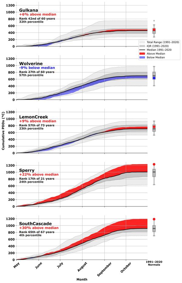
Fig. 4. Cumulative 2025 ablation season positive degree days (sum of daily mean temperatures >0°C, when the glacier is melting), May 1–Oct. 30th, at each USGS Benchmark glacier’s median elevation based on local weather station data (O'Neel et al., 2019; https://doi.org/10.5066/F7HD7SRF). The bold black line shows the 1991–2020 median, with dark gray shading indicating the interquartile range and light gray shading the total historical range for the reference period. Red shading indicates periods where 2025 accumulation exceeded the 1991–2020 median; blue shading indicates periods where it fell below. Boxplots at right summarize the full period-of-record distribution of seasonal PDD totals for each glacier, with the box spanning the interquartile range, the internal line marking the median, whiskers extending to the total range, and the colored dot indicating the 2025 seasonal value. Rank and percentile are reported relative to each glacier's individual period of record. Ablation season ranks are reported from lowest (coolest) to highest (warmest).
Sources/Usage: Public Domain. View Media Details
Explore the USGS Benchmark Glaciers in context of global glacier studies

Glaciers and Landscape Change
Mountain glaciers are dynamic reservoirs of frozen water, deeply interconnected with their surrounding ecosystems. Glacier change in North America has major societal impacts, including to water resources, natural hazard risk, tourism disruption, fisheries, and global sea level change. Understanding and quantifying precise connections between changing glaciers, the surrounding landscape and climate...

Mass Balance Methods: Measuring Glacier Change
Nearly all of Earth's alpine glaciers are losing mass, with consequences for freshwater resources, landscape stability, regional ecosystems, and global sea level. Rates of glacier mass loss in Western North America and Alaska are among the highest on Earth (The GlaMBIE Team, 2025).

Additional Research Glaciers
The USGS Glacier Project has conducted research beyond the Benchmark Glaciers, both past and present. This work has focused on infrastructure hazards, rapid glacier change, landscape destabilization, and glacier dynamics and processes not captured by the Benchmark Glacier network. These glaciers include Black Rapids, Kahiltna, Kennicott, Columbia, Hubbard, and Taku.

Wolverine Glacier
Wolverine Glacier is located in the high-latitude maritime climate regime of Alaska’s Kenai Mountains. Glacier observations began at this site in 1966.

Gulkana Glacier
Gulkana Glacier is located in the high-latitude continental climate regime of Alaska’s Delta Mountains. Glacier observations began at this site in 1966 and continue through present as the northern most USGS Benchmark Glacier.
Lemon Creek Glacier
Lemon Creek Glacier is located in the high-latitude maritime region of Alaska, at the southernmost tip of the Juneau Icefield. Glacier observations began at this site in 1953.
South Cascade Glacier
South Cascade Glacier is located in the midlatitude maritime climate of the North Cascade Mountains of Washington State. Glacier observations began at this site in 1958.

Sperry Glacier
Sperry Glacier is located along the Continental Divide within Glacier National Park, Montana. It represents the midlatitude continental or transitional climate. Glacier observations began at this site in 2005.
Aerial photographs of South Cascade Glacier represent 57 years of change
Aerial photograph of South Cascade Glacier, WA taken August 13th, 1958 (before image) and October 14th, 2015 (after image).
Filter Total Items: 77

Weather station on Kahiltna Glacier
USGS scientist Louis Sass assesses an on-glacier weather station on the Kahiltna Glacier in Denali National Park, Alaska. This weather station is located at Kahiltna Base Camp, where climbers attempting to summit Denali begin their ascent. Sultana (Mt. Foraker) is visible in the background.
Sampling a snow pit on Kahiltna Glacier
Emily Baker (USGS) sampling a snow-pit on Kahiltna Glacier at 3,055 m (10,023 feet).
Emily Baker (USGS) sampling a snow-pit on Kahiltna Glacier at 3,055 m (10,023 feet).
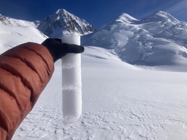
Internal accumulation layers on Kahiltna Glacier
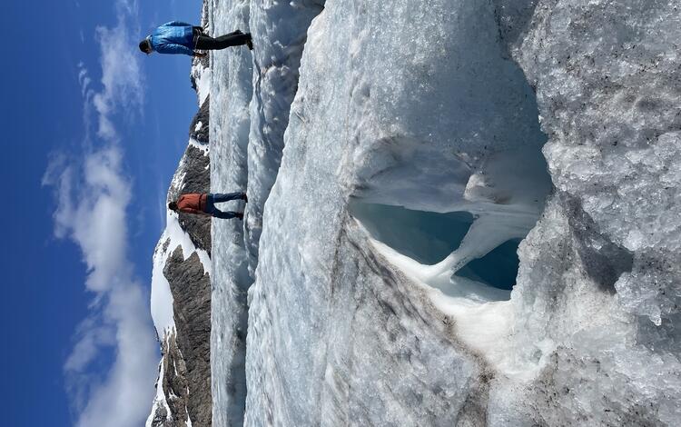
A core section from Kahiltna Glacier at 3,055 m (10,023 feet) on September 30, 2024, showing ice layers in finegrained snow. These "internal accumulation" layers form when water from surface melt percolates into the snowpack and refreezes.
A core section from Kahiltna Glacier at 3,055 m (10,023 feet) on September 30, 2024, showing ice layers in finegrained snow. These "internal accumulation" layers form when water from surface melt percolates into the snowpack and refreezes.
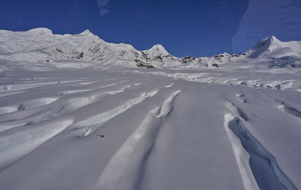
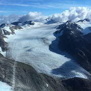
Flying over Kennicott Glacier
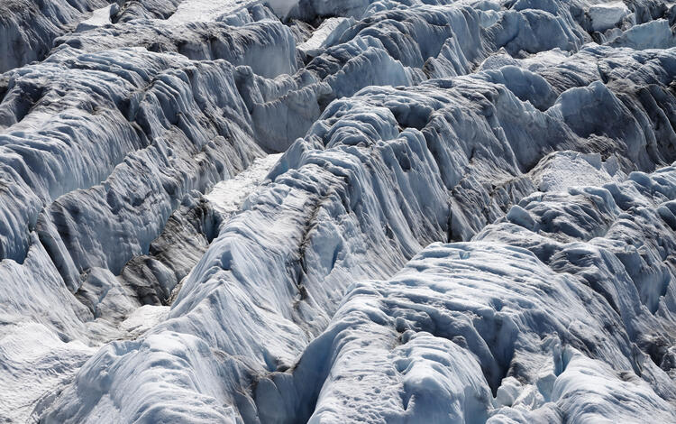
These are large glaciers, and even with a helicopter they make you feel very small. Here the scale of the crevasses is illustrated by the small helicopter shadow. This is typical of the complicated topography and significant relief that is common on larger glaciers in Alaska.
These are large glaciers, and even with a helicopter they make you feel very small. Here the scale of the crevasses is illustrated by the small helicopter shadow. This is typical of the complicated topography and significant relief that is common on larger glaciers in Alaska.

South Cascade Glacier area change, 1970 - 2021
South Cascade Glacier area change, 1970 - 2021. South Cascade Glacier located in a north-northwest facing valley near the crest of the Cascade Range in northwest Washington state.
South Cascade Glacier area change, 1970 - 2021. South Cascade Glacier located in a north-northwest facing valley near the crest of the Cascade Range in northwest Washington state.

Gulkana Glacier area change, 1957 - 2021
Gulkana Glacier area change, from 1957 - 2021. Gulkana Glacier is located along the south flank of the eastern Alaska Range.
Gulkana Glacier area change, from 1957 - 2021. Gulkana Glacier is located along the south flank of the eastern Alaska Range.

Lemon Creek Glacier area change, 1948 - 2021
Lemon Creek Glacier area change, 1948 - 2021. Lemon Creek Glacier is located at the southernmost tip of the Juneau Icefield in Southeast Alaska, USA, approximately 6.5 km northeast of the city of Juneau
Lemon Creek Glacier area change, 1948 - 2021. Lemon Creek Glacier is located at the southernmost tip of the Juneau Icefield in Southeast Alaska, USA, approximately 6.5 km northeast of the city of Juneau

Wolverine Glacier area change, 1950 - 2020
Wolverine Glacier area change, 1950 - 2020. Wolverine Glacier is in the Kenai Mountains on the coast of south-central Alaska.
Wolverine Glacier area change, 1950 - 2020. Wolverine Glacier is in the Kenai Mountains on the coast of south-central Alaska.

Timelapse imagery from Wolverine Glacier, Alaska (2012 - 2022)
Timelapse imagery from Wolverine Glacier, Alaska (2012 - 2022)The timelapse imagery provided here shows the lower half of Wolverine Glacier from 2012 to 2022. This imagery gives an intuitive view of the scale of change happening at glaciers across Alaska.
Snow core to measure accumulation on Kahiltna Glacier
Snow core to measure accumulation on Kahiltna GlacierThis is a 16 m (52.5-foot) core from Kahiltna Glacier at 3,055 m (10,023 feet), May 26, 2023. Kakiko Ramos-Leon (NPS, on the left) is standing where the core intersected the surface. Eric Ridington (pilot, in the middle) is pointing to the melt layers from summer 2022. The melt layers barely visible as grey stripes in the foreground are from summer 2021.

South Cascade Glacier, Washington
The surface of South Cascade Glacier, Washington is mostly exposed ice at the end of summer melt season.
The surface of South Cascade Glacier, Washington is mostly exposed ice at the end of summer melt season.

Sun setting on weather station at Wolverine Glacier
Sun setting on weather station at Wolverine GlacierRemote weather stations, like this one at Wolverine Glacier, collect data near each glacier so scientists can understand regional climate influence on the glaciers.
Sun setting on weather station at Wolverine Glacier
Sun setting on weather station at Wolverine GlacierRemote weather stations, like this one at Wolverine Glacier, collect data near each glacier so scientists can understand regional climate influence on the glaciers.

Scientist working on Sperry Glacier in Glacier National Park, Montana
Scientist working on Sperry Glacier in Glacier National Park, MontanaScientist working on Sperry Glacier in Glacier National Park, Montana. Sperry Glacier occupies a broad, shallow cirque situated just beneath and west of the Continental Divide in the Lewis Mountain Range of Glacier National Park, Montana. Due to its position on the Continental Divide the glacier is influenced by both maritime and continental air masses.

Lemon Creek Glacier
Researchers walk amid the glacial ice and crevasses left bare by summer melt on Lemon Creek Glacier, AK.
Researchers walk amid the glacial ice and crevasses left bare by summer melt on Lemon Creek Glacier, AK.

Lemon Creek Glacier
Two USGS scientists walk across the surface of Lemon Creek Glacier near the end of the melt season surrounded by green hills and barren rock.
Two USGS scientists walk across the surface of Lemon Creek Glacier near the end of the melt season surrounded by green hills and barren rock.

A researcher gazes across Wolverine Glacier and the surrounding snow-covered mountains
A researcher gazes across Wolverine Glacier and the surrounding snow-covered mountainsA researcher gazes across Wolverine Glacier and the surrounding snow-covered mountains during an early spring visit to collect mass balance data.

Sperry Glacier in about 1930 and 2008
Sperry Glacier: circa 1930, MJ Elrod, U of M Library – 9/17/2008, L McKeon, USGS
Repeating this photo from the same photo point was impossible since the historic photo was shot from the elevated perspective of the glacier’s surface.
Sperry Glacier: circa 1930, MJ Elrod, U of M Library – 9/17/2008, L McKeon, USGS
Repeating this photo from the same photo point was impossible since the historic photo was shot from the elevated perspective of the glacier’s surface.

Aerial view of Wolverine Glacier icefall
An aerial view of the upper cracks in the Wolverine Glacier icefall as sunset approaches.
An aerial view of the upper cracks in the Wolverine Glacier icefall as sunset approaches.

Measuring South Cascade Glacier
A scientist takes field notes on glacier mass change after measuring an ablation stake installed on the surface of South Cascade Glacier, Washington.
A scientist takes field notes on glacier mass change after measuring an ablation stake installed on the surface of South Cascade Glacier, Washington.

Upgraded Wolverine Glacier weather station, Alaska
Upgraded Wolverine Glacier weather station, AlaskaThe Wolverine Glacier weather station was installed in 1968, and at 3250 ft is the highest elevation long-term weather record on the Kenai Peninsula. In Ocotober 2020, USGS scientists upgraded the power system to a Lithium battery bank and installed a radar-based precipitation sensor (Lufft WS-100) to compare with the weighing based precipitation gage. The

Wolverine Glacier weather station on the Kenai Peninsula, Alaska
Wolverine Glacier weather station on the Kenai Peninsula, AlaskaThe Wolverine Glacier weather station was installed in 1968, and at 3250 ft is the highest elevation long-term weather record on the Kenai Peninsula.
Wolverine Glacier weather station on the Kenai Peninsula, Alaska
Wolverine Glacier weather station on the Kenai Peninsula, AlaskaThe Wolverine Glacier weather station was installed in 1968, and at 3250 ft is the highest elevation long-term weather record on the Kenai Peninsula.
2025 Data Now Available: Explore how the USGS Benchmark Glaciers have changed in 2025
Return to Glaciers and Landscape Change
Explore the USGS Benchmark Glaciers mass balance methods for measuring glacier change
2025 Benchmark Glacier Results
Benchmark Glaciers in Alaska had variable (and modest) mass gains and losses (Fig. 1).
- Wolverine Glacier gained mass in 2025, the first time since 2012.
- Gulkana and Lemon Creek Glaciers lost mass for the 17th and 13th consecutive years, respectively.
Benchmark Glaciers in the contiguous states had record and near record mass losses
- Glacier mass loss at South Cascade Glacier (Washington) was the highest on record.
- Mass loss at Sperry Glacier (Montana) was the second highest on record.
Overall, 2025 USGS Benchmark Glacier mass change was characterized by glacier mass loss driven primarily by warm summer conditions, with Wolverine Glacier as a notable exception.
Media
Sources/Usage: Public Domain. View Media Details
How did 2025 annual mass balances compare to previous years?
In Alaska, Gulkana and Lemon Creek glaciers experienced moderate mass loss, marking their 17th and 13th consecutive years of negative annual mass balance, respectively. Conversely, Wolverine Glacier experienced moderate mass gain — its first positive annual mass balance since 2012, ending a 12-year streak of negative balances. In the contiguous United States, Sperry Glacier in Glacier National Park, Montanna saw its second highest mass loss year since measurements began in 2005. South Cascade Glacier in the Cascade Mountains of Washington underwent the greatest mass loss year since measurements began in 1958 (Fig. 2.).
Media
Sources/Usage: Public Domain. View Media Details
How did winter snowfall contribute to each glacier's mass balance?
At Wolverine Glacier, winter precipitation exceeded normal levels beginning in November and remained above average throughout the remainder of the 2024 – 25 accumulation season. Lemon Creek Glacier experienced near-normal winter precipitation through the accumulation season. At Sperry Glacier, precipitation began accumulating approximately one month later than the 1991-2020 mean. Gulkana, Sperry, and South Cascade glaciers all ended the 2024 – 25 accumulation season with below-average winter precipitation (Fig. 3.).
Media
Fig. 3. Cumulative 2024 – 25 accumulation season precipitation (m w.e.), Sept. 1–May 30th, at the median elevation of each USGS Benchmark glacier, based on local weather station data (O'Neel et al., 2019; https://doi.org/10.5066/F7HD7SRF). The bold black line shows the 1991–2020 median, with dark gray shading indicating the interquartile range and light gray shading the total historical range for the reference period. Dark green shading indicates periods where 2025 accumulation exceeded the 1991–2020 median; light green shading indicates periods where it fell below. Boxplots at right summarize the full period-of-record distribution of seasonal precipitation totals for each glacier, with the box spanning the interquartile range, the internal line marking the median, whiskers extending to the total range, and the colored dot indicating the 2025 seasonal value. Rank and percentile are reported relative to each glacier's individual period of record. Total winter precipitation ranks are reported from lowest (driest) to highest (wettest).
Sources/Usage: Public Domain. View Media Details
How did summer temperatures contribute to each glacier's mass balance?
All three Alaska glaciers experienced cooler than average temperatures during the first half of summer, limiting melt. Wolverine and Gulkana Glaciers had a delayed start to the ablation season. At Wolverine Glacier remained cooler than average through the end of summer, contributing to its positive mass balance. Gulkana and Lemon Creek glaciers ended the summer moderately warmer than average, offsetting some of the effects of the cool early season. In the contiguous United States, both Sperry and South Cascade glaciers experienced significantly warmer than average temperatures throughout the summer, driving the exceptional mass loss observed at both sites (Fig. 4.).
Media
Fig. 4. Cumulative 2025 ablation season positive degree days (sum of daily mean temperatures >0°C, when the glacier is melting), May 1–Oct. 30th, at each USGS Benchmark glacier’s median elevation based on local weather station data (O'Neel et al., 2019; https://doi.org/10.5066/F7HD7SRF). The bold black line shows the 1991–2020 median, with dark gray shading indicating the interquartile range and light gray shading the total historical range for the reference period. Red shading indicates periods where 2025 accumulation exceeded the 1991–2020 median; blue shading indicates periods where it fell below. Boxplots at right summarize the full period-of-record distribution of seasonal PDD totals for each glacier, with the box spanning the interquartile range, the internal line marking the median, whiskers extending to the total range, and the colored dot indicating the 2025 seasonal value. Rank and percentile are reported relative to each glacier's individual period of record. Ablation season ranks are reported from lowest (coolest) to highest (warmest).
Sources/Usage: Public Domain. View Media Details
Explore the USGS Benchmark Glaciers in context of global glacier studies
Glaciers and Landscape Change
Mountain glaciers are dynamic reservoirs of frozen water, deeply interconnected with their surrounding ecosystems. Glacier change in North America has major societal impacts, including to water resources, natural hazard risk, tourism disruption, fisheries, and global sea level change. Understanding and quantifying precise connections between changing glaciers, the surrounding landscape and climate...
Mass Balance Methods: Measuring Glacier Change
Nearly all of Earth's alpine glaciers are losing mass, with consequences for freshwater resources, landscape stability, regional ecosystems, and global sea level. Rates of glacier mass loss in Western North America and Alaska are among the highest on Earth (The GlaMBIE Team, 2025).
Additional Research Glaciers
The USGS Glacier Project has conducted research beyond the Benchmark Glaciers, both past and present. This work has focused on infrastructure hazards, rapid glacier change, landscape destabilization, and glacier dynamics and processes not captured by the Benchmark Glacier network. These glaciers include Black Rapids, Kahiltna, Kennicott, Columbia, Hubbard, and Taku.
Wolverine Glacier
Wolverine Glacier is located in the high-latitude maritime climate regime of Alaska’s Kenai Mountains. Glacier observations began at this site in 1966.
Gulkana Glacier
Gulkana Glacier is located in the high-latitude continental climate regime of Alaska’s Delta Mountains. Glacier observations began at this site in 1966 and continue through present as the northern most USGS Benchmark Glacier.
Lemon Creek Glacier
Lemon Creek Glacier is located in the high-latitude maritime region of Alaska, at the southernmost tip of the Juneau Icefield. Glacier observations began at this site in 1953.
South Cascade Glacier
South Cascade Glacier is located in the midlatitude maritime climate of the North Cascade Mountains of Washington State. Glacier observations began at this site in 1958.
Sperry Glacier
Sperry Glacier is located along the Continental Divide within Glacier National Park, Montana. It represents the midlatitude continental or transitional climate. Glacier observations began at this site in 2005.
Aerial photographs of South Cascade Glacier represent 57 years of change
Aerial photograph of South Cascade Glacier, WA taken August 13th, 1958 (before image) and October 14th, 2015 (after image).
Filter Total Items: 77
Weather station on Kahiltna Glacier
USGS scientist Louis Sass assesses an on-glacier weather station on the Kahiltna Glacier in Denali National Park, Alaska. This weather station is located at Kahiltna Base Camp, where climbers attempting to summit Denali begin their ascent. Sultana (Mt. Foraker) is visible in the background.
USGS scientist Louis Sass assesses an on-glacier weather station on the Kahiltna Glacier in Denali National Park, Alaska. This weather station is located at Kahiltna Base Camp, where climbers attempting to summit Denali begin their ascent. Sultana (Mt. Foraker) is visible in the background.
Sampling a snow pit on Kahiltna Glacier
Emily Baker (USGS) sampling a snow-pit on Kahiltna Glacier at 3,055 m (10,023 feet).
Emily Baker (USGS) sampling a snow-pit on Kahiltna Glacier at 3,055 m (10,023 feet).
Internal accumulation layers on Kahiltna Glacier
A core section from Kahiltna Glacier at 3,055 m (10,023 feet) on September 30, 2024, showing ice layers in finegrained snow. These "internal accumulation" layers form when water from surface melt percolates into the snowpack and refreezes.
A core section from Kahiltna Glacier at 3,055 m (10,023 feet) on September 30, 2024, showing ice layers in finegrained snow. These "internal accumulation" layers form when water from surface melt percolates into the snowpack and refreezes.
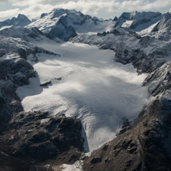
Flying over Kennicott Glacier
These are large glaciers, and even with a helicopter they make you feel very small. Here the scale of the crevasses is illustrated by the small helicopter shadow. This is typical of the complicated topography and significant relief that is common on larger glaciers in Alaska.
These are large glaciers, and even with a helicopter they make you feel very small. Here the scale of the crevasses is illustrated by the small helicopter shadow. This is typical of the complicated topography and significant relief that is common on larger glaciers in Alaska.
South Cascade Glacier area change, 1970 - 2021
South Cascade Glacier area change, 1970 - 2021. South Cascade Glacier located in a north-northwest facing valley near the crest of the Cascade Range in northwest Washington state.
South Cascade Glacier area change, 1970 - 2021. South Cascade Glacier located in a north-northwest facing valley near the crest of the Cascade Range in northwest Washington state.
Gulkana Glacier area change, 1957 - 2021
Gulkana Glacier area change, from 1957 - 2021. Gulkana Glacier is located along the south flank of the eastern Alaska Range.
Gulkana Glacier area change, from 1957 - 2021. Gulkana Glacier is located along the south flank of the eastern Alaska Range.
Lemon Creek Glacier area change, 1948 - 2021
Lemon Creek Glacier area change, 1948 - 2021. Lemon Creek Glacier is located at the southernmost tip of the Juneau Icefield in Southeast Alaska, USA, approximately 6.5 km northeast of the city of Juneau
Lemon Creek Glacier area change, 1948 - 2021. Lemon Creek Glacier is located at the southernmost tip of the Juneau Icefield in Southeast Alaska, USA, approximately 6.5 km northeast of the city of Juneau
Wolverine Glacier area change, 1950 - 2020
Wolverine Glacier area change, 1950 - 2020. Wolverine Glacier is in the Kenai Mountains on the coast of south-central Alaska.
Wolverine Glacier area change, 1950 - 2020. Wolverine Glacier is in the Kenai Mountains on the coast of south-central Alaska.
Timelapse imagery from Wolverine Glacier, Alaska (2012 - 2022)
Timelapse imagery from Wolverine Glacier, Alaska (2012 - 2022)The timelapse imagery provided here shows the lower half of Wolverine Glacier from 2012 to 2022. This imagery gives an intuitive view of the scale of change happening at glaciers across Alaska.
Snow core to measure accumulation on Kahiltna Glacier
Snow core to measure accumulation on Kahiltna GlacierThis is a 16 m (52.5-foot) core from Kahiltna Glacier at 3,055 m (10,023 feet), May 26, 2023. Kakiko Ramos-Leon (NPS, on the left) is standing where the core intersected the surface. Eric Ridington (pilot, in the middle) is pointing to the melt layers from summer 2022. The melt layers barely visible as grey stripes in the foreground are from summer 2021.
South Cascade Glacier, Washington
The surface of South Cascade Glacier, Washington is mostly exposed ice at the end of summer melt season.
The surface of South Cascade Glacier, Washington is mostly exposed ice at the end of summer melt season.
Sun setting on weather station at Wolverine Glacier
Sun setting on weather station at Wolverine GlacierRemote weather stations, like this one at Wolverine Glacier, collect data near each glacier so scientists can understand regional climate influence on the glaciers.
Sun setting on weather station at Wolverine Glacier
Sun setting on weather station at Wolverine GlacierRemote weather stations, like this one at Wolverine Glacier, collect data near each glacier so scientists can understand regional climate influence on the glaciers.
Scientist working on Sperry Glacier in Glacier National Park, Montana
Scientist working on Sperry Glacier in Glacier National Park, MontanaScientist working on Sperry Glacier in Glacier National Park, Montana. Sperry Glacier occupies a broad, shallow cirque situated just beneath and west of the Continental Divide in the Lewis Mountain Range of Glacier National Park, Montana. Due to its position on the Continental Divide the glacier is influenced by both maritime and continental air masses.
Lemon Creek Glacier
Researchers walk amid the glacial ice and crevasses left bare by summer melt on Lemon Creek Glacier, AK.
Researchers walk amid the glacial ice and crevasses left bare by summer melt on Lemon Creek Glacier, AK.
Lemon Creek Glacier
Two USGS scientists walk across the surface of Lemon Creek Glacier near the end of the melt season surrounded by green hills and barren rock.
Two USGS scientists walk across the surface of Lemon Creek Glacier near the end of the melt season surrounded by green hills and barren rock.
A researcher gazes across Wolverine Glacier and the surrounding snow-covered mountains
A researcher gazes across Wolverine Glacier and the surrounding snow-covered mountainsA researcher gazes across Wolverine Glacier and the surrounding snow-covered mountains during an early spring visit to collect mass balance data.
Sperry Glacier in about 1930 and 2008
Sperry Glacier: circa 1930, MJ Elrod, U of M Library – 9/17/2008, L McKeon, USGS
Repeating this photo from the same photo point was impossible since the historic photo was shot from the elevated perspective of the glacier’s surface.
Sperry Glacier: circa 1930, MJ Elrod, U of M Library – 9/17/2008, L McKeon, USGS
Repeating this photo from the same photo point was impossible since the historic photo was shot from the elevated perspective of the glacier’s surface.
Aerial view of Wolverine Glacier icefall
An aerial view of the upper cracks in the Wolverine Glacier icefall as sunset approaches.
An aerial view of the upper cracks in the Wolverine Glacier icefall as sunset approaches.
Measuring South Cascade Glacier
A scientist takes field notes on glacier mass change after measuring an ablation stake installed on the surface of South Cascade Glacier, Washington.
A scientist takes field notes on glacier mass change after measuring an ablation stake installed on the surface of South Cascade Glacier, Washington.
Upgraded Wolverine Glacier weather station, Alaska
Upgraded Wolverine Glacier weather station, AlaskaThe Wolverine Glacier weather station was installed in 1968, and at 3250 ft is the highest elevation long-term weather record on the Kenai Peninsula. In Ocotober 2020, USGS scientists upgraded the power system to a Lithium battery bank and installed a radar-based precipitation sensor (Lufft WS-100) to compare with the weighing based precipitation gage. The
Wolverine Glacier weather station on the Kenai Peninsula, Alaska
Wolverine Glacier weather station on the Kenai Peninsula, AlaskaThe Wolverine Glacier weather station was installed in 1968, and at 3250 ft is the highest elevation long-term weather record on the Kenai Peninsula.
Wolverine Glacier weather station on the Kenai Peninsula, Alaska
Wolverine Glacier weather station on the Kenai Peninsula, AlaskaThe Wolverine Glacier weather station was installed in 1968, and at 3250 ft is the highest elevation long-term weather record on the Kenai Peninsula.