Images of multiple oceanside beaches and dunes at Fire Island New York
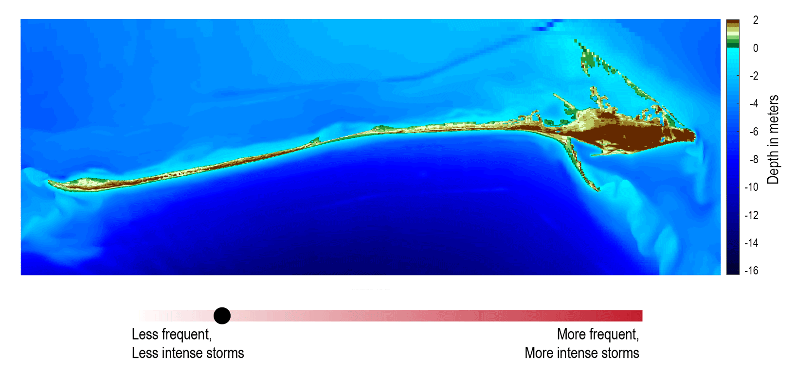
Images of multiple oceanside beaches and dunes at Fire Island New YorkFor more than 15 years, the USGS has actively studied natural and human changes to the shoreline, beaches, and dunes at Fire Island.