



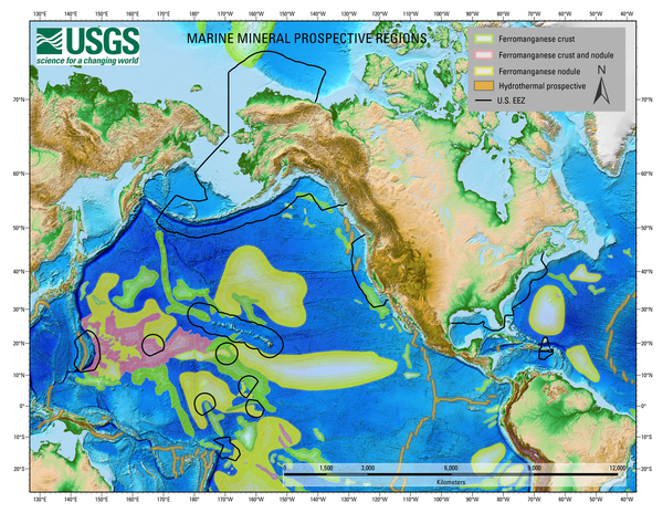
A map showing Global Marine Mineral Prospective Regions, including those that occur within the United States Exclusive Economic Zone.
Images
Coastal and Marine Hazards and Resources Program images.
Filter Total Items: 2490
Global Marine Mineral Prospective Regions map
A map showing Global Marine Mineral Prospective Regions, including those that occur within the United States Exclusive Economic Zone.
A remotely operated vehicle collects a polymetallic sulfide sample from Escanaba Trough
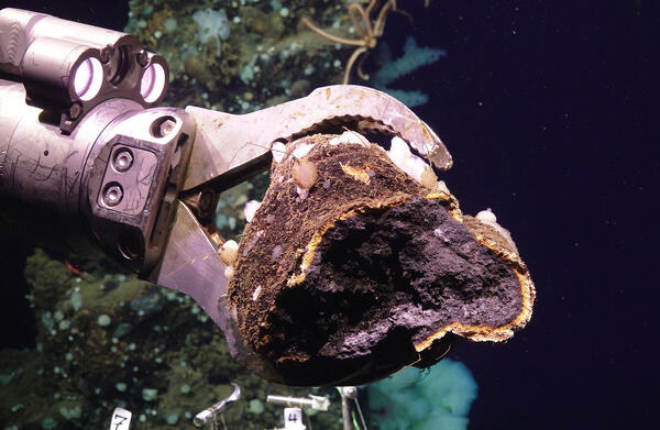
A remotely operated vehicle collects a polymetallic sulfide sample from Escanaba TroughA remotely operated vehicle collects a polymetallic sulfide sample from Escanaba Trough.
A remotely operated vehicle collects a polymetallic sulfide sample from Escanaba Trough
A remotely operated vehicle collects a polymetallic sulfide sample from Escanaba TroughA remotely operated vehicle collects a polymetallic sulfide sample from Escanaba Trough.

A seafloor massive sulfide at Escanaba Trough
A seafloor massive sulfide at Escanaba Trough covered with sponges, shrimp, squat lobsters, and other deep-sea fauna.
A seafloor massive sulfide at Escanaba Trough covered with sponges, shrimp, squat lobsters, and other deep-sea fauna.
Long Island satellite shoreline study area
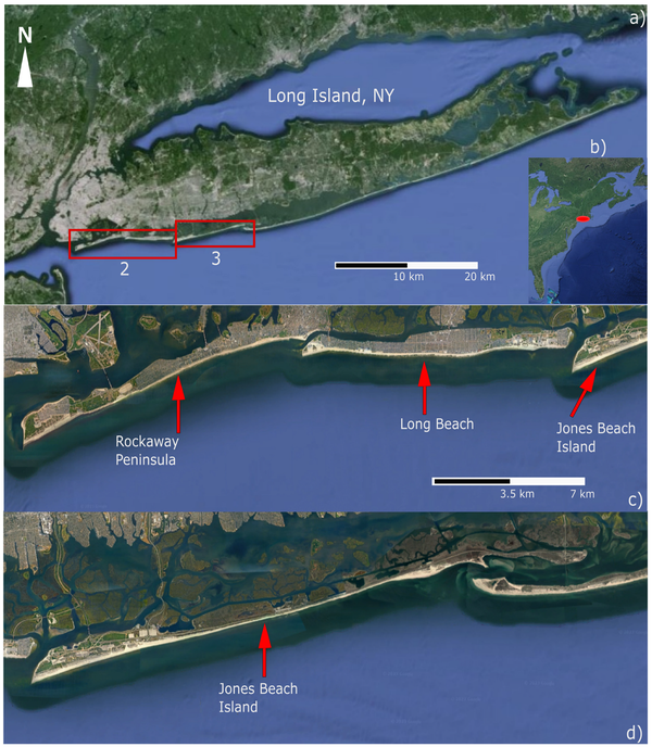
The Long Island study area, including (a,b) the overall location of Long Island with respect to New York and the greater U.S.
The Long Island study area, including (a,b) the overall location of Long Island with respect to New York and the greater U.S.
Long Island satellite derived shorelines by year
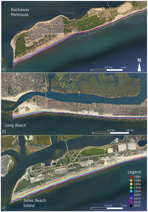
Western ends of each site showing the overall accretion using QGIS. See legend for color corresponding dates. The first continuous shoreline for each respective year was used for the visualization. (a) Rockaway Peninsula, (b) Long Beach, (c) Jones Beach Island.
Western ends of each site showing the overall accretion using QGIS. See legend for color corresponding dates. The first continuous shoreline for each respective year was used for the visualization. (a) Rockaway Peninsula, (b) Long Beach, (c) Jones Beach Island.
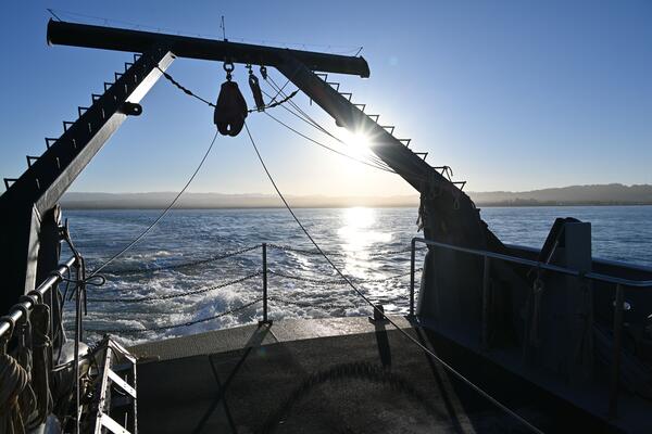
Mendocino RROBS Retrieval
A magnitude 7.0 earthquake ruptured the Mendocino Transform Fault offshore Northern California on December 5, 2024. The USGS and colleagues from the Woods Hole Oceanographic Institution’s Ocean Bottom Seismic Instrument Center deployed our new fleet of rapid response ocean bottom seismographs just 11 days later—the fastest response in U.S. history.
A magnitude 7.0 earthquake ruptured the Mendocino Transform Fault offshore Northern California on December 5, 2024. The USGS and colleagues from the Woods Hole Oceanographic Institution’s Ocean Bottom Seismic Instrument Center deployed our new fleet of rapid response ocean bottom seismographs just 11 days later—the fastest response in U.S. history.
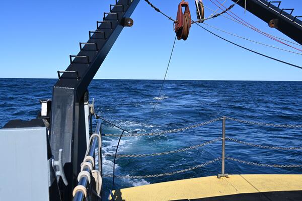
Mendocino RROBS Retrieval
A magnitude 7.0 earthquake ruptured the Mendocino Transform Fault offshore Northern California on December 5, 2024. The USGS and colleagues from the Woods Hole Oceanographic Institution’s Ocean Bottom Seismic Instrument Center deployed our new fleet of rapid response ocean bottom seismographs just 11 days later—the fastest response in U.S. history.
A magnitude 7.0 earthquake ruptured the Mendocino Transform Fault offshore Northern California on December 5, 2024. The USGS and colleagues from the Woods Hole Oceanographic Institution’s Ocean Bottom Seismic Instrument Center deployed our new fleet of rapid response ocean bottom seismographs just 11 days later—the fastest response in U.S. history.
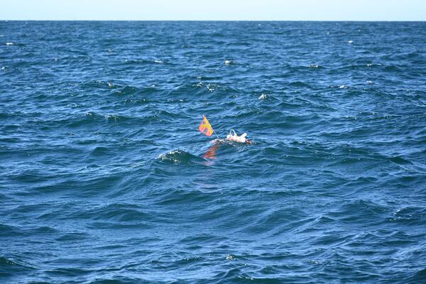
Mendocino RROBS Retrieval
A magnitude 7.0 earthquake ruptured the Mendocino Transform Fault offshore Northern California on December 5, 2024. The USGS and colleagues from the Woods Hole Oceanographic Institution’s Ocean Bottom Seismic Instrument Center deployed our new fleet of rapid response ocean bottom seismographs just 11 days later—the fastest response in U.S. history.
A magnitude 7.0 earthquake ruptured the Mendocino Transform Fault offshore Northern California on December 5, 2024. The USGS and colleagues from the Woods Hole Oceanographic Institution’s Ocean Bottom Seismic Instrument Center deployed our new fleet of rapid response ocean bottom seismographs just 11 days later—the fastest response in U.S. history.

Mendocino RROBS Retrieval
A magnitude 7.0 earthquake ruptured the Mendocino Transform Fault offshore Northern California on December 5, 2024. The USGS and colleagues from the Woods Hole Oceanographic Institution’s Ocean Bottom Seismic Instrument Center deployed our new fleet of rapid response ocean bottom seismographs just 11 days later—the fastest response in U.S. history.
A magnitude 7.0 earthquake ruptured the Mendocino Transform Fault offshore Northern California on December 5, 2024. The USGS and colleagues from the Woods Hole Oceanographic Institution’s Ocean Bottom Seismic Instrument Center deployed our new fleet of rapid response ocean bottom seismographs just 11 days later—the fastest response in U.S. history.

Viewing BOBSled
Scientists and technicians from the Woods Hole Coastal and Marine Science Center (WHCMSC) in Woods Hole, Massachusetts traveled to the Pacific Coastal and Marine Science Center (PCMSC) in Santa Cruz, California to learn about their seafloor imaging and sampling instrument—the Benthic Observation camera Sled, or BOBSled.
Scientists and technicians from the Woods Hole Coastal and Marine Science Center (WHCMSC) in Woods Hole, Massachusetts traveled to the Pacific Coastal and Marine Science Center (PCMSC) in Santa Cruz, California to learn about their seafloor imaging and sampling instrument—the Benthic Observation camera Sled, or BOBSled.

Mendocino RROBS Retrieval
A magnitude 7.0 earthquake ruptured the Mendocino Transform Fault offshore Northern California on December 5, 2024. The USGS and colleagues from the Woods Hole Oceanographic Institution’s Ocean Bottom Seismic Instrument Center deployed our new fleet of rapid response ocean bottom seismographs just 11 days later—the fastest response in U.S. history.
A magnitude 7.0 earthquake ruptured the Mendocino Transform Fault offshore Northern California on December 5, 2024. The USGS and colleagues from the Woods Hole Oceanographic Institution’s Ocean Bottom Seismic Instrument Center deployed our new fleet of rapid response ocean bottom seismographs just 11 days later—the fastest response in U.S. history.

Mendocino RROBS Retrieval
A magnitude 7.0 earthquake ruptured the Mendocino Transform Fault offshore Northern California on December 5, 2024. The USGS and colleagues from the Woods Hole Oceanographic Institution’s Ocean Bottom Seismic Instrument Center deployed our new fleet of rapid response ocean bottom seismographs just 11 days later—the fastest response in U.S. history.
A magnitude 7.0 earthquake ruptured the Mendocino Transform Fault offshore Northern California on December 5, 2024. The USGS and colleagues from the Woods Hole Oceanographic Institution’s Ocean Bottom Seismic Instrument Center deployed our new fleet of rapid response ocean bottom seismographs just 11 days later—the fastest response in U.S. history.

Mendocino RROBS Retrieval
A magnitude 7.0 earthquake ruptured the Mendocino Transform Fault offshore Northern California on December 5, 2024. The USGS and colleagues from the Woods Hole Oceanographic Institution’s Ocean Bottom Seismic Instrument Center deployed our new fleet of rapid response ocean bottom seismographs just 11 days later—the fastest response in U.S. history.
A magnitude 7.0 earthquake ruptured the Mendocino Transform Fault offshore Northern California on December 5, 2024. The USGS and colleagues from the Woods Hole Oceanographic Institution’s Ocean Bottom Seismic Instrument Center deployed our new fleet of rapid response ocean bottom seismographs just 11 days later—the fastest response in U.S. history.
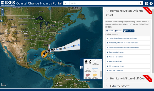
CCH Portal - Hurricane Milton
Coastal Change Hazards Portal showing the trajectory of Hurricane Milton and the various data users could explore on the map.
Coastal Change Hazards Portal showing the trajectory of Hurricane Milton and the various data users could explore on the map.
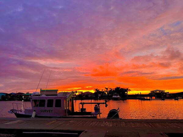
MRDF Geophysical Survey
The USGS has a long history of studying seafloor instability in the Mississippi River Delta Front, beginning in the 1970s.
As part of the OASIS project, we play a leading role in seafloor mapping, geophysical imaging, and interpreting the processes that shape this important region.
The USGS has a long history of studying seafloor instability in the Mississippi River Delta Front, beginning in the 1970s.
As part of the OASIS project, we play a leading role in seafloor mapping, geophysical imaging, and interpreting the processes that shape this important region.
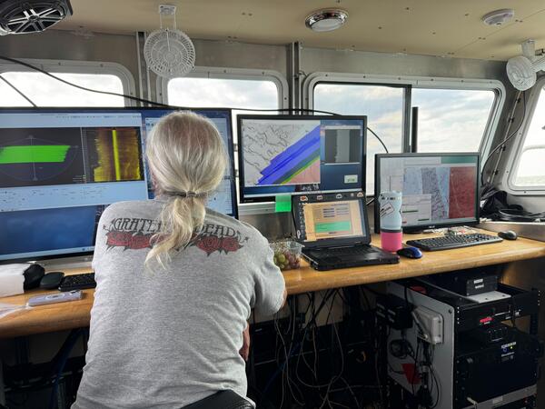
MRDF Geophysical Survey
The USGS has a long history of studying seafloor instability in the Mississippi River Delta Front, beginning in the 1970s.
As part of the OASIS project, we play a leading role in seafloor mapping, geophysical imaging, and interpreting the processes that shape this important region.
The USGS has a long history of studying seafloor instability in the Mississippi River Delta Front, beginning in the 1970s.
As part of the OASIS project, we play a leading role in seafloor mapping, geophysical imaging, and interpreting the processes that shape this important region.
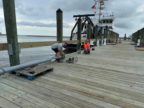
MRDF Coring
The USGS has a long history of studying seafloor instability in the Mississippi River Delta Front, beginning in the 1970s.
As part of the OASIS project, we play a leading role in seafloor mapping, geophysical imaging, and interpreting the processes that shape this important region.
The USGS has a long history of studying seafloor instability in the Mississippi River Delta Front, beginning in the 1970s.
As part of the OASIS project, we play a leading role in seafloor mapping, geophysical imaging, and interpreting the processes that shape this important region.
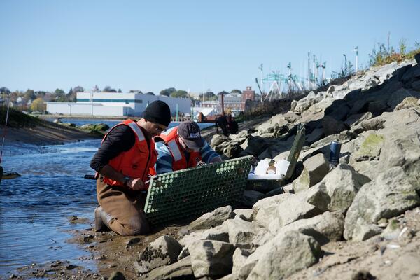
Estuarine Processes, Hazards, and Ecosystems
Estuaries are dynamic environments where complex interactions take place between the atmosphere, ocean, watershed, ecosystems, and human infrastructure. They serve as valuable ecological habitat and provide numerous benefits to our society.
Estuaries are dynamic environments where complex interactions take place between the atmosphere, ocean, watershed, ecosystems, and human infrastructure. They serve as valuable ecological habitat and provide numerous benefits to our society.
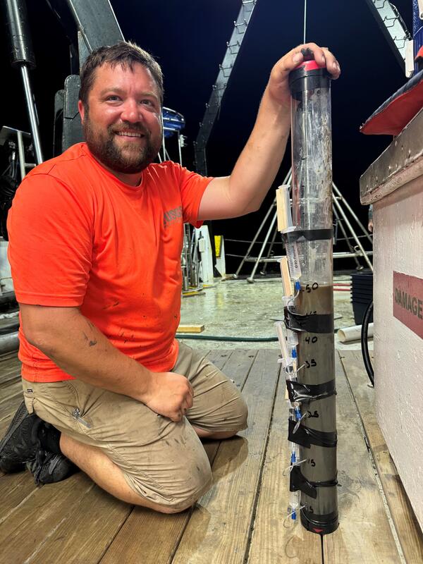
MRDF Mega Multi Coring
The USGS has a long history of studying seafloor instability in the Mississippi River Delta Front, beginning in the 1970s.
As part of the OASIS project, we play a leading role in seafloor mapping, geophysical imaging, and interpreting the processes that shape this important region.
The USGS has a long history of studying seafloor instability in the Mississippi River Delta Front, beginning in the 1970s.
As part of the OASIS project, we play a leading role in seafloor mapping, geophysical imaging, and interpreting the processes that shape this important region.
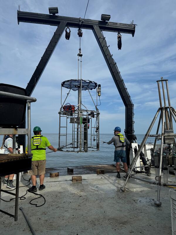
MRDF Coring
The USGS has a long history of studying seafloor instability in the Mississippi River Delta Front, beginning in the 1970s.
As part of the OASIS project, we play a leading role in seafloor mapping, geophysical imaging, and interpreting the processes that shape this important region.
The USGS has a long history of studying seafloor instability in the Mississippi River Delta Front, beginning in the 1970s.
As part of the OASIS project, we play a leading role in seafloor mapping, geophysical imaging, and interpreting the processes that shape this important region.
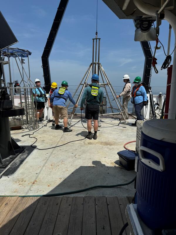
MFDF Coring
The USGS has a long history of studying seafloor instability in the Mississippi River Delta Front, beginning in the 1970s.
As part of the OASIS project, we play a leading role in seafloor mapping, geophysical imaging, and interpreting the processes that shape this important region.
The USGS has a long history of studying seafloor instability in the Mississippi River Delta Front, beginning in the 1970s.
As part of the OASIS project, we play a leading role in seafloor mapping, geophysical imaging, and interpreting the processes that shape this important region.