
Sea-Level Rise
Sea-Level Rise
Filter Total Items: 30

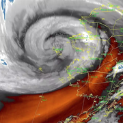
COAWST: A Coupled-Ocean-Atmosphere-Wave-Sediment Transport Modeling System
Understanding the processes responsible for coastal change is important for managing both our natural and economic coastal resources. Storms are one of the primary driving forces causing coastal change from a coupling of wave- and wind-driven flows. To better understand storm impacts and their effects on our coastlines, there is an international need to better predict storm paths and intensities...
Typhoon Merbok Disaster Recovery Project: Accomplishments
Supported by Title VII of Division N of the Consolidated Appropriations Act, 2023, the Typhoon Merbok Disaster Emergency Recovery Efforts project addresses critical data and capacity gaps in coastal Alaska by generating high resolution environmental datasets, hazard analyses, and monitoring tools needed to quantify erosion, flooding, and permafrost-related risks at the community scale.

USGS CoastCams
The U.S. Geological Survey (USGS) uses a nationwide network of coastal observing cameras, or CoastCams, to monitor coastal conditions in near real-time and support research by the USGS and its partners into a variety of coastal processes and hazards. The most recent CoastCam images are made publicly available within minutes of data collection and can be accessed using the links below or by...

Coral Reef Project
Explore the fascinating undersea world of coral reefs. Learn how we map, monitor, and model coral reefs so we can better understand, protect, and preserve our Nation's reefs.

Coastal Climate Impacts
The impacts of climate change and sea-level rise around the Pacific and Arctic Oceans can vary tremendously. Thus far the vast majority of national and international impact assessments and models of coastal climate change have focused on low-relief coastlines that are not near seismically active zones. Furthermore, the degree to which extreme waves and wind will add further stress to coastal...

Role of Reefs in Coastal Protection
We are combining ocean, engineering, ecologic, social, and economic modeling to provide a high-resolution, rigorous, spatially-explicit valuation of the coastal flood protection benefits provided by coral reefs and the cost effectiveness of reef restoration for enhancing those benefits.

The Impact of Sea-Level Rise and Climate Change on Pacific Ocean Atolls
Providing basic understanding and specific information on storm-wave inundation of atoll islands that house Department of Defense installations, and assessing the resulting impact of sea-level rise and storm-wave inundation on infrastructure and freshwater availability under a variety of sea-level rise and climatic scenarios.

Coastal Storm Modeling System (CoSMoS)
The Coastal Storm Modeling System (CoSMoS) makes detailed predictions of storm-induced coastal flooding, erosion, and cliff failures over large geographic scales. CoSMoS was developed for hindcast studies, operational applications and future climate scenarios to provide emergency responders and coastal planners with critical storm-hazards information that can be used to increase public safety...

Woods Hole Coastal and Marine Science Center 2020 Annual Report
The U.S. Geological Survey (USGS) Woods Hole Coastal and Marine Science Center in Woods Hole, Massachusetts, is one of three centers serving the mission of the USGS Coastal/Marine Hazards and Resources Program (CMHRP). Since its authorization by Congress in 1962, the CMHRP has served as the primary Federal program for marine geology and physical science research.

Massachusetts Integrated Coastal Studies (MICS)
Coastal erosion, intense storm events and sea-level rise pose threats to coastal communities and infrastructure. Managers and scientists often lack the high-resolution data needed to improve estimates of sediment abundance and movement, shoreline change, and seabed characteristics that influence coastal vulnerability. To address these and other needs the U.S. Geological Survey, in partnership with...

Estuaries and large river deltas in the Pacific Northwest
Essential habitat for wild salmon and other wildlife borders river deltas and estuaries in the Pacific Northwest. These estuaries also support industry, agriculture, and a large human population that’s expected to double by the year 2060, but each could suffer from more severe river floods, higher sea level, and storm surges caused by climate change.

Circulation and Sediment, Nutrient, Contaminant, and Larval Dynamics on Reefs
The overall objective of this research effort is to better understand how circulation and sediment processes impact coral reefs.