
Soil Disturbance Can Increase Stream Salinity in Semiarid Watersheds
White Crusts of Natural Salts Along a Tributary to Muddy Creek, WY
A Comparison of Streamflow and Specific Conductance in Muddy Creek, WY
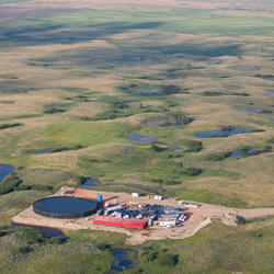
Soil disturbance from construction of roads, pipelines, and well pads on naturally salt-rich soils was determined to be a potential factor resulting in increased salinity in a southern Wyoming stream. Construction can expose salt-rich soils in the subsurface to increased contact with rain and snow, thus mobilizing salts through runoff or water percolating into soils.

The Study
In 2005, the U.S. Geological Survey (USGS) began a study to understand the factors that influence salinity in Muddy Creek, south central Wyoming. Scientists used a tiered approach to understand the primary factors influencing salinity concentrations in Muddy Creek. Scientists measured streamflow, specific conductance (a surrogate for salinity), and major ions from Muddy Creek above its confluence with the Little Snake River. Samples were collected before and after an increase in natural gas development (increase in roads, pipelines, well pads, and well installations). The scientists first identified all processes within the watershed with the potential to increase stream salinity and then determined which processes best described the salinity patterns in Muddy Creek.

The Results
Stream salinity in semiarid climates generally goes down with increased streamflow and up with decreased streamflow. This type of predictable relation was determined for Muddy Creek during 2005–8. In 2009–12, the broad relation remained, but salinity increased 33 percent during the high flows of spring runoff and increased 53 to 71 percent during late summer, low flows. The additional salinity had a chemical profile dominated by calcium, magnesium, and sulfate, similar to natural salts present in soils that form on top of marine shales within the watershed.
The scientists' goal was to identify candidate factors resulting in salinity increases in Muddy Creek, which has a relatively narrow range of land uses (grazing and oil and gas development) in the watershed. Numerous factors including soil disturbance, cattle grazing, irrigation return flow, groundwater discharge, reservoir discharge, stream morphology manipulation, evapotranspiration, regional climate fluctuation, and disposal of oil and gas coproduced waters can affect stream salinity. The scientists determined that soil disturbance due to construction is a reasonable explanation for the salinity increase. The results of the study suggest that soil disturbance, regardless of cause, should be considered a potential source of increased stream salinity in other settings where soils contain substantial qualities of native salts.
Environmental Health Implications
Excessive salinity in streams and rivers can make the water unsuitable for domestic and agricultural use and for wildlife. Salinization is a threat around the world, but it can have many causes. Certain rock types, like marine shales, are more likely to develop salt-rich soils, and such soils exist in many semiarid and arid environments worldwide. The potential for construction disturbance to mobilize subsurface salts deserves consideration as development of all types is managed in dry environments.
This research was funded by the USGS Ecosystems Mission Area’s Environmental Health Program (Contaminant Biology and Toxic Substances Hydrology) and the USGS Mineral Resources Program, Bureau of Land Management, and Wyoming Landscapes Conservation Initiative.
Below are other science projects associated with this project.

Wyoming Landscape Conservation Initiative (WLCI) research at NOROCK
Energy Resources Life Cycle Integrated Science Team
Soil disturbance from construction of roads, pipelines, and well pads on naturally salt-rich soils was determined to be a potential factor resulting in increased salinity in a southern Wyoming stream. Construction can expose salt-rich soils in the subsurface to increased contact with rain and snow, thus mobilizing salts through runoff or water percolating into soils.
The Study
In 2005, the U.S. Geological Survey (USGS) began a study to understand the factors that influence salinity in Muddy Creek, south central Wyoming. Scientists used a tiered approach to understand the primary factors influencing salinity concentrations in Muddy Creek. Scientists measured streamflow, specific conductance (a surrogate for salinity), and major ions from Muddy Creek above its confluence with the Little Snake River. Samples were collected before and after an increase in natural gas development (increase in roads, pipelines, well pads, and well installations). The scientists first identified all processes within the watershed with the potential to increase stream salinity and then determined which processes best described the salinity patterns in Muddy Creek.
The Results
Stream salinity in semiarid climates generally goes down with increased streamflow and up with decreased streamflow. This type of predictable relation was determined for Muddy Creek during 2005–8. In 2009–12, the broad relation remained, but salinity increased 33 percent during the high flows of spring runoff and increased 53 to 71 percent during late summer, low flows. The additional salinity had a chemical profile dominated by calcium, magnesium, and sulfate, similar to natural salts present in soils that form on top of marine shales within the watershed.
The scientists' goal was to identify candidate factors resulting in salinity increases in Muddy Creek, which has a relatively narrow range of land uses (grazing and oil and gas development) in the watershed. Numerous factors including soil disturbance, cattle grazing, irrigation return flow, groundwater discharge, reservoir discharge, stream morphology manipulation, evapotranspiration, regional climate fluctuation, and disposal of oil and gas coproduced waters can affect stream salinity. The scientists determined that soil disturbance due to construction is a reasonable explanation for the salinity increase. The results of the study suggest that soil disturbance, regardless of cause, should be considered a potential source of increased stream salinity in other settings where soils contain substantial qualities of native salts.
Environmental Health Implications
Excessive salinity in streams and rivers can make the water unsuitable for domestic and agricultural use and for wildlife. Salinization is a threat around the world, but it can have many causes. Certain rock types, like marine shales, are more likely to develop salt-rich soils, and such soils exist in many semiarid and arid environments worldwide. The potential for construction disturbance to mobilize subsurface salts deserves consideration as development of all types is managed in dry environments.
This research was funded by the USGS Ecosystems Mission Area’s Environmental Health Program (Contaminant Biology and Toxic Substances Hydrology) and the USGS Mineral Resources Program, Bureau of Land Management, and Wyoming Landscapes Conservation Initiative.
Below are other science projects associated with this project.
Wyoming Landscape Conservation Initiative (WLCI) research at NOROCK