
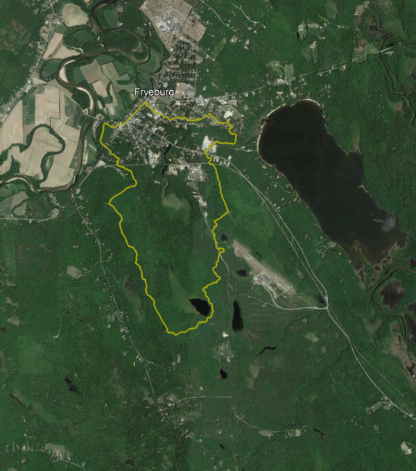
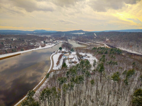
This is an aerial image of Fryeburg, Maine, a study area for a USGS project monitoring groundwater withdrawals.
Images
Images below come from a wide variety of USGS science activities in the Northeast Region. Science Center staff showcase what we do, who we are, and where we work conducting science that inform decision makers and addresses societal needs.
Filter Total Items: 2050
Satellite Image of Fryeburg, Maine
This is an aerial image of Fryeburg, Maine, a study area for a USGS project monitoring groundwater withdrawals.
Mule Deer
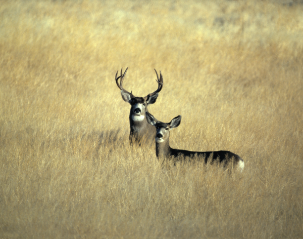
Mule deer are named for their large, mule-like ears that move independently and frequently, scanning the environment for sounds of predators such as mountain lions, coyotes, wolves and bobcats. California; Clear Lake highlands; buck; doe;
Mule deer are named for their large, mule-like ears that move independently and frequently, scanning the environment for sounds of predators such as mountain lions, coyotes, wolves and bobcats. California; Clear Lake highlands; buck; doe;
Katahdin Woods and Waters National Monument Map
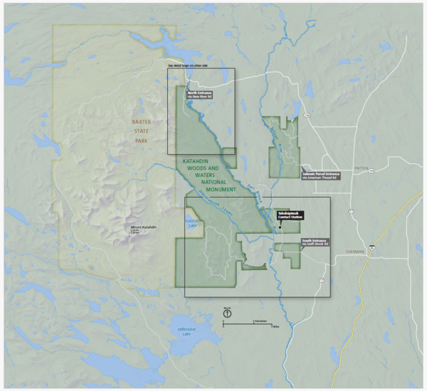
A map of the Katahdin Woods and Waters National Monument in Maine.
A map of the Katahdin Woods and Waters National Monument in Maine.

Anthony Good Profile.png
Economist Anthony Good staff profile photo
Economist Anthony Good staff profile photo
Nicholas E Powell gives a thumbs up in front of lab equipment
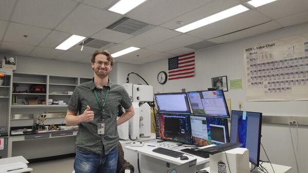
Nicholas E Powell gives a thumbs up in front of lab equipmentNicholas E Powell stands in a lab in Florence Bascom Geoscience Center, showing a thumbs up, in front of lab equipment and multiple monitors
Nicholas E Powell gives a thumbs up in front of lab equipment
Nicholas E Powell gives a thumbs up in front of lab equipmentNicholas E Powell stands in a lab in Florence Bascom Geoscience Center, showing a thumbs up, in front of lab equipment and multiple monitors

Tony Headshot.jpg
Anthony Good Economist profile photo
Anthony Good Economist profile photo
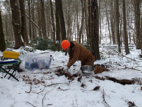
Hydrologist Collects Shallow Soil from a Site in Goshen, Connecticut
Hydrologist Collects Shallow Soil from a Site in Goshen, ConnecticutA USGS hydrologist collects a shallow soil sample from a site in Goshen, Connecticut. This soil sample collection is part of a larger investigation in the state of Connecticut for the occurrence of per- and polyfluoroalkyl substances (PFAS) in soils and shallow groundwater.
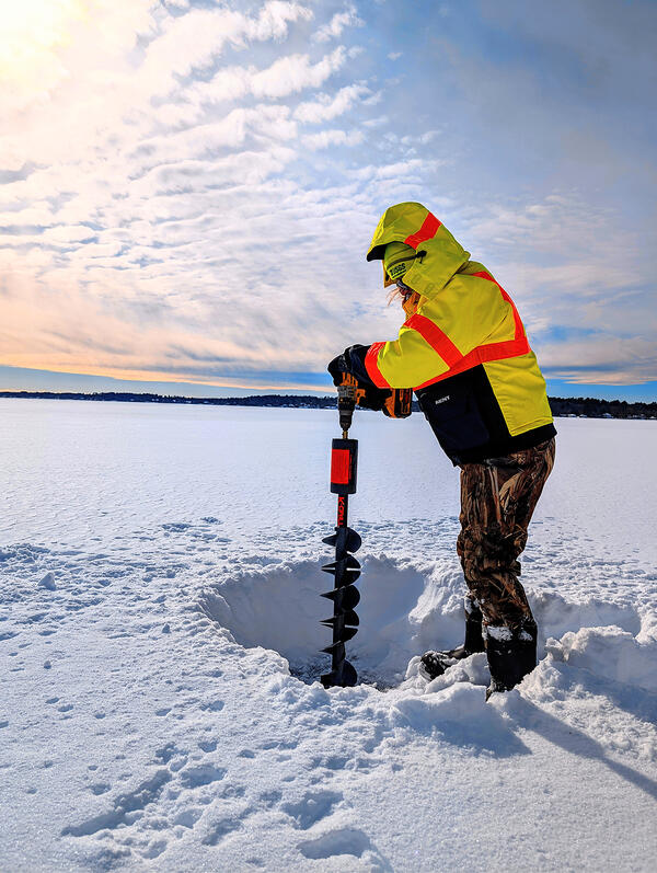
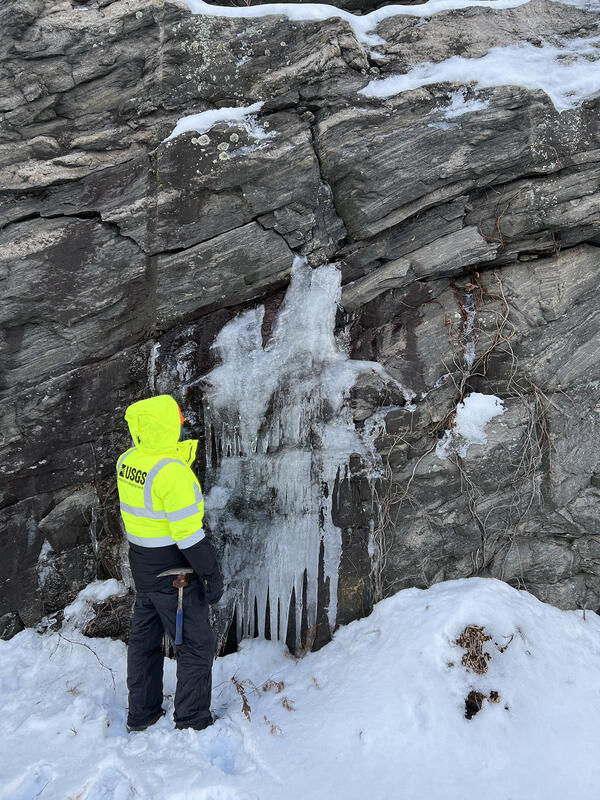
Frozen sample
U.S. Geological Survey Hydrological Technician, Meghan Santos, bores a hole in a frozen lake to take water quality samples on Long Pond, Lakeville, MA.
Winter 2026 Photo Contest Winer: Phillip Woodford, People Category
U.S. Geological Survey Hydrological Technician, Meghan Santos, bores a hole in a frozen lake to take water quality samples on Long Pond, Lakeville, MA.
Winter 2026 Photo Contest Winer: Phillip Woodford, People Category
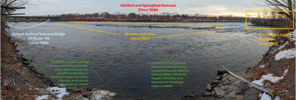
USGS Streamgage on the Connecticut River with Infrastructure
USGS Streamgage on the Connecticut River with InfrastructureA view looking across the Connecticut River from a USGS streamgage in Suffield, Connecticut.
USGS Streamgage on the Connecticut River with Infrastructure
USGS Streamgage on the Connecticut River with InfrastructureA view looking across the Connecticut River from a USGS streamgage in Suffield, Connecticut.
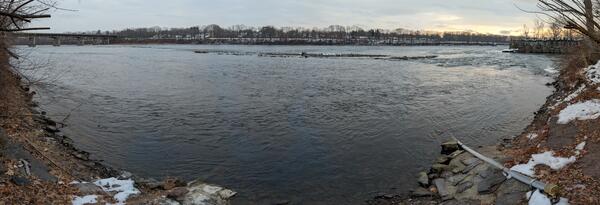
USGS Streamgage on the Connecticut River
A view looking across the Connecticut River from a USGS streamgage in Suffield, Connecticut.
A view looking across the Connecticut River from a USGS streamgage in Suffield, Connecticut.
Geologic mapping
U.S. Geological Survey Geologist, Mercer Parker, examines water bearing fractures in gneiss rock while conducting geologic mapping in Amherst, NH.
Winter 2026 Photo Contest Winner: Greg Walsh, USGS at Work
U.S. Geological Survey Geologist, Mercer Parker, examines water bearing fractures in gneiss rock while conducting geologic mapping in Amherst, NH.
Winter 2026 Photo Contest Winner: Greg Walsh, USGS at Work
The Coakley Landfill Superfund Site
A view of the nort-facing slope of the Coakley Landfill Superfund Site in Northampton, New Hampshire. Pipes used to vent landfill gases can be seen in the distance.
A view of the nort-facing slope of the Coakley Landfill Superfund Site in Northampton, New Hampshire. Pipes used to vent landfill gases can be seen in the distance.
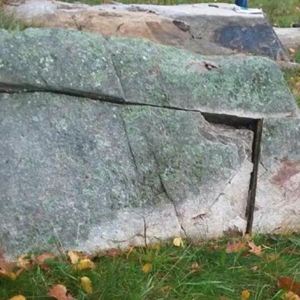
Fractures in the Breakfast Hill granite of the Rye Complex
Fractures in the Breakfast Hill granite of the Rye ComplexA fracture in granite within New Hampshire's Rye Complex, one of two lithotectonic belts in the state's coastal region.
Fractures in the Breakfast Hill granite of the Rye Complex
Fractures in the Breakfast Hill granite of the Rye ComplexA fracture in granite within New Hampshire's Rye Complex, one of two lithotectonic belts in the state's coastal region.
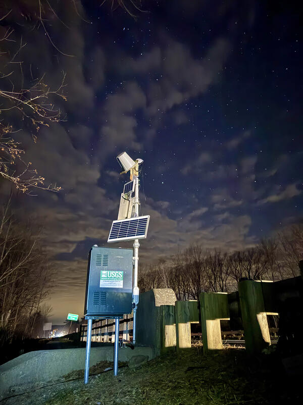
Where We Work
Photo of a U.S. Geological streamgage with additional solar panels added to help charge battery due to low light in the winter in Hancock, MA.
Winter 2026 Photo Contest Winner: Salvador Amador, Where We Work category
Photo of a U.S. Geological streamgage with additional solar panels added to help charge battery due to low light in the winter in Hancock, MA.
Winter 2026 Photo Contest Winner: Salvador Amador, Where We Work category
Aerial view of a fish research laboratory
Aerial view of the USGS S.O. Conte Anadromous Fish Research Laboratory and Connecticut River at Turners Falls, Massachusetts.
Fall 2025 Photo Contest Winner: Shannon Fisher, Honorable Mention category
Aerial view of the USGS S.O. Conte Anadromous Fish Research Laboratory and Connecticut River at Turners Falls, Massachusetts.
Fall 2025 Photo Contest Winner: Shannon Fisher, Honorable Mention category
Learn to Curl class
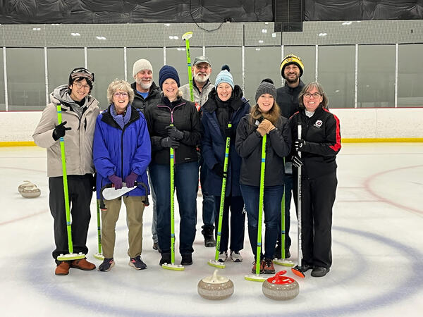
U.S. Geological Survey colleagues and friends on the ice at Ion Ice Rink following a Learn to Curl class in Leesburg, VA.
Winter 2026 Photo Contest Winner: Jean Self-Trail, Honorable Mention
U.S. Geological Survey colleagues and friends on the ice at Ion Ice Rink following a Learn to Curl class in Leesburg, VA.
Winter 2026 Photo Contest Winner: Jean Self-Trail, Honorable Mention
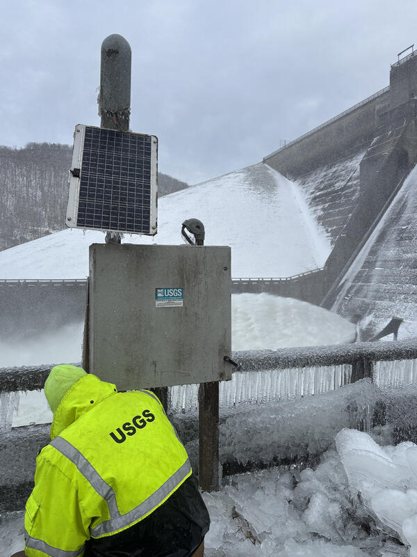
Winter removal
U.S. Geological Survey Hydrologic Technician, Ian Lynch, deconstructs a water quality deployment, removing it for the winter, at USGS gage 03012545 Allegheny River below Kinzua Dam at Big Bend, PA.
Winter 2026 Photo Contest Winner: Lindsey Sabo, Honorable Mention
U.S. Geological Survey Hydrologic Technician, Ian Lynch, deconstructs a water quality deployment, removing it for the winter, at USGS gage 03012545 Allegheny River below Kinzua Dam at Big Bend, PA.
Winter 2026 Photo Contest Winner: Lindsey Sabo, Honorable Mention
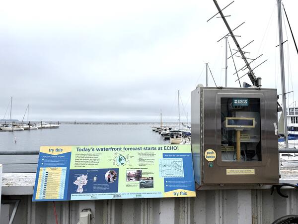
Lake Champlain Streamgage in Burlington, Vermont
The USGS streamgage on Lake Champlain in Burlington, Vermont, is near the ECHO Leahy Center, Vermont’s Science and Nature Museum.
The USGS streamgage on Lake Champlain in Burlington, Vermont, is near the ECHO Leahy Center, Vermont’s Science and Nature Museum.
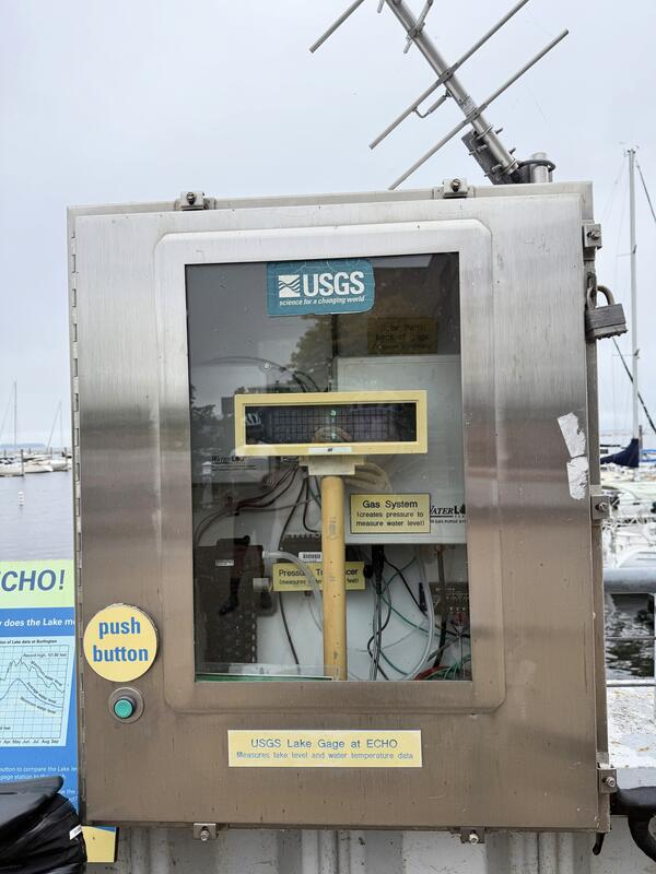
USGS Streamgage on Lake Champlain in Burlington, Vermont
USGS Streamgage on Lake Champlain in Burlington, VermontThe USGS New England Water Science Center operates a streamgage on Lake Champlain in Burlington, Vermont.
USGS Streamgage on Lake Champlain in Burlington, Vermont
USGS Streamgage on Lake Champlain in Burlington, VermontThe USGS New England Water Science Center operates a streamgage on Lake Champlain in Burlington, Vermont.
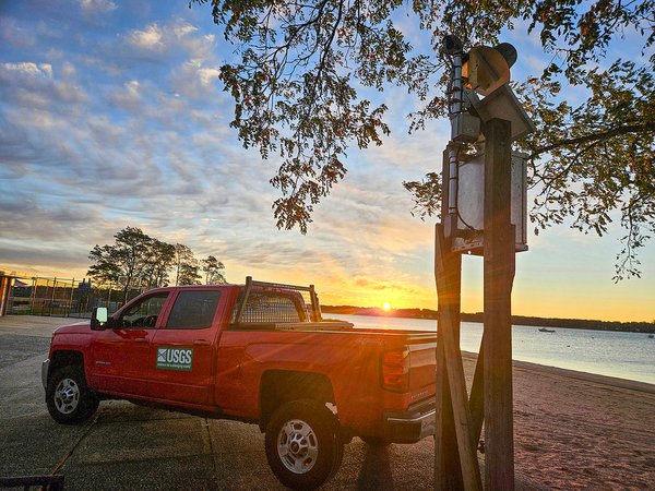
Making early morning at West Harbor Beach, New York
Making early morning at West Harbor Beach, New YorkSunrise during early morning checks at a USGS water quality/elevation station in West Harbor Beach Memorial Park, in Bayville, New York.
Fall 2025 Photo Contest Winner: Natalie Cheung, Where We Work category
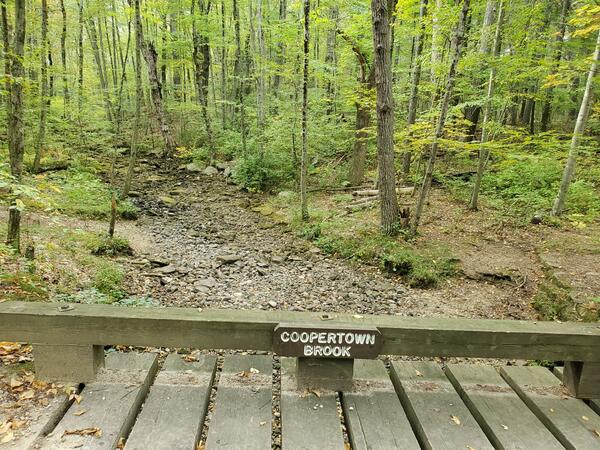
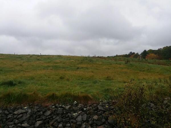
Dry Coopertown Brook in Douglas State Forest in Massachusetts
Dry Coopertown Brook in Douglas State Forest in MassachusettsCoopertown Brook, located in Douglas State Forest, Massachusetts, is completely dry in late September 2025.
Dry Coopertown Brook in Douglas State Forest in Massachusetts
Dry Coopertown Brook in Douglas State Forest in MassachusettsCoopertown Brook, located in Douglas State Forest, Massachusetts, is completely dry in late September 2025.