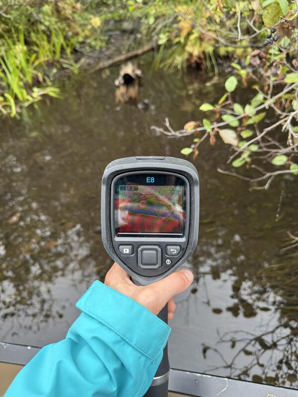
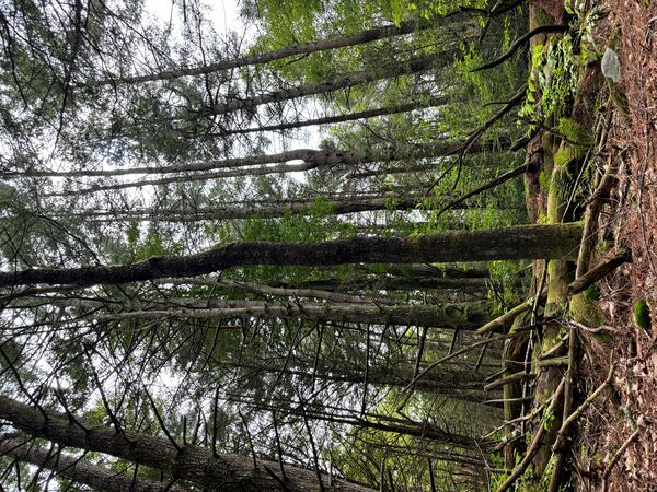
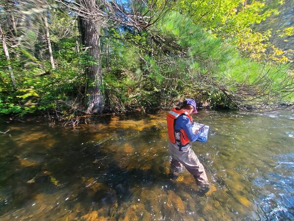
Wild River in Gilead, Maine, During a Drought Event
Wild River in Gilead, Maine, During a Drought EventWild River at Gilead, Maine, experienced low water levels during a drought event in the summer of 2025.
An official website of the United States government
Here's how you know
Official websites use .gov
A .gov website belongs to an official government organization in the United States.
Secure .gov websites use HTTPS
A lock () or https:// means you’ve safely connected to the .gov website. Share sensitive information only on official, secure websites.
Images below come from a wide variety of USGS science activities in the Northeast Region. Science Center staff showcase what we do, who we are, and where we work conducting science that inform decision makers and addresses societal needs.
Wild River at Gilead, Maine, experienced low water levels during a drought event in the summer of 2025.
Nezinscot River at Turner Center, Maine, experienced low water levels during a drought event in the summer of 2025.
From left to right, Amit Millo, Sandy Brosnahan, and Jennifer Cramer of the USGS Woods Hole Aerial Imaging and Mapping (AIM) group stand with their drone during sUAS data collection at the Darby Creek Superfund site in Darby Creek, PA.
A view of the Sheepscot River in Maine taken by USGS hydrologic technicians while surveying the channel for the purpose of updating floodplain maps.
A view of the Sheepscot River in Maine taken by USGS hydrologic technicians while surveying the river. The surveyed cross-section data is used to update flood insurance rate maps for FEMA.
Phil Woodford (Hydro Tech) driving a boat to service a water quality buoy located in Kingston Bay, Plymouth, MA. The Mayflower replica is in the background.
Summer 2025 Photo Contest Winner: Kaitlin Laabs, USGS at Work category
Phil Woodford (Hydro Tech) driving a boat to service a water quality buoy located in Kingston Bay, Plymouth, MA. The Mayflower replica is in the background.
Summer 2025 Photo Contest Winner: Kaitlin Laabs, USGS at Work category
Hydrologic Technician Conner Caridad observing the purge of a groundwter well located in the Army Base Camp Nett. Groundwater samples were taken and analyzed from this well for a study measuring nitrogen concentrations in groundwater before, during, and after sewering.
Hydrologic Technician Danny Hansen adjusts the speed of peristaltic pump at a groundwater well in the Pine Grove community Grove in Niantic, CT. Groundwater samples were being taken during 2025 as a part of a broader study looking at nitrogen concentrations in groundwater before and after sewer installation.
A USGS hydrologic technician uses a Van Dorn sampler to collect water quality samples from the Farm River at fixed depths.
A buoy carrying water quality monitoring equipment is deployed in Mount Hope Bay, Massachusetts, as part of a larger water-quality monitoring project.
A buoy carrying water quality monitoring equipment is deployed in Kingston Bay in South Duxbury, Massachusetts, as part of a larger water-quality monitoring project.
USGS hydrologic technicians Sam Banas and Curtis Yeager install a groundwater well (MA-F2W 80) in Franklin, Massachusetts.
USGS staff deploy a carbon dioxide sensor (pCO2) from the Beverly Pier into the Danvers River in Beverly, Massachusetts. This water quality sensor deployment is a part of a larger data collection effort in several Massachusetts rivers and embayments.
Newly established continuous streamgage on downstream right bank at Mill Brook at Plainfield, MA - 01178230. Gage is located on River Road.
Re-established continuous streamgage on downstream left bank of Sudbury River at Ashland, MA - 01097480. Gage is located on Front Street.
Nigel Pepin using a rotor hammer to install concrete anchors to secure a new gage to monitor the Poquonnock River in Bluff Point State Park, CT.
Summer 2025 Photo Contest Winner: Paul Solis, Honorable Mention category
Nigel Pepin using a rotor hammer to install concrete anchors to secure a new gage to monitor the Poquonnock River in Bluff Point State Park, CT.
Summer 2025 Photo Contest Winner: Paul Solis, Honorable Mention category
USGS Hydrologic Technician, Samantha Robinson, preforming a vertical profile and routine maintenance on continuous water quality monitors on the Norwalk River at Maritime Aquarium Near Southern Norwalk, CT (410606073245700) on May 21, 2025. Discrete water quality samples are also collected at this monitoring location.
Newly established continuous streamgage downstream right bank on Martha's Vineyard at Tiasquam River at West Tisbury, MA - 412238070403701. Gage is located adjacent to State Road in Chilmark, MA.
USGS staff installing a new streamgage on the island of Martha's Vineyard in Massachusetts. This streamgage is a part of the state’s cooperative hydrologic monitoring network with USGS.
USGS, in cooperation with the U.S. Department of Agriculture and the University of Maine, is predicting the potential hydrological impacts based on these climatic changes using the USGS Precipitation Runoff Modeling System (PRMS) to inform the New England farming industry.
Members from the Massachusetts office of the New England Water Science Center conduct bridge crane training for water quality at Hockanum Road in East Hartford, CT, April 29, 2029.
Spring 2025 Photo Contest Winner: Paul Solis, Where We Work category
Members from the Massachusetts office of the New England Water Science Center conduct bridge crane training for water quality at Hockanum Road in East Hartford, CT, April 29, 2029.
Spring 2025 Photo Contest Winner: Paul Solis, Where We Work category