
A hydrologic technician puts down a high-water mark at a debris line in a parking lot near the Black River in Vermont.
Images
Images below come from a wide variety of USGS science activities in the Northeast Region. Science Center staff showcase what we do, who we are, and where we work conducting science that inform decision makers and addresses societal needs.
Filter Total Items: 2050

High-water mark near Black River in Vermont
A hydrologic technician puts down a high-water mark at a debris line in a parking lot near the Black River in Vermont.

High-Water Mark at the Ottaquechee River
A high-water mark is installed by a USGS hydrologic technician next to the Ottauquechee River in Bridgewater, Vermont. This high-water mark indicates how high the flood waters from the river during the July 2023 heavy-rainfall event.
A high-water mark is installed by a USGS hydrologic technician next to the Ottauquechee River in Bridgewater, Vermont. This high-water mark indicates how high the flood waters from the river during the July 2023 heavy-rainfall event.

High-Water Mark Measurement
A USGS physical scientist holds out a level to a high-water mark near a stream in Vermont.
A USGS physical scientist holds out a level to a high-water mark near a stream in Vermont.

High-Water Mark at the Ottauquechee River
A high-water mark disc was installed into a tree next to the Ottauquechee River in Bridgewater, Vermont. This high-water mark indicates how high the flood waters from the river during the July 2023 heavy-rainfall event.
A high-water mark disc was installed into a tree next to the Ottauquechee River in Bridgewater, Vermont. This high-water mark indicates how high the flood waters from the river during the July 2023 heavy-rainfall event.

ADCP Measures High Streamflow on Deerfield River in Massachusetts
ADCP Measures High Streamflow on Deerfield River in MassachusettsAn acoustic doppler current profiler (ADCP) is pulled across the Deerfield River in West Deerfield, Massachusetts during a flood event caused by heavy precipitation. This measurement was taken near USGS streamgage 01170000.

Hydrologic technician showing a high-water mark on a debris line
Hydrologic technician showing a high-water mark on a debris lineHydrologic technician showing a high-water mark on a debris line next to the Black River in Ludlow Vermont.
Hydrologic technician showing a high-water mark on a debris line
Hydrologic technician showing a high-water mark on a debris lineHydrologic technician showing a high-water mark on a debris line next to the Black River in Ludlow Vermont.

UAS demonstration in Woods Hole, Massachusetts
A UAS demonstration in Woods Hole, Massachusetts with WH-Coastal and Marine Science Center personnel and NE Region administration.
Summer 2023 NER Photo Contest Winner: Jin-Si Over, People category
A UAS demonstration in Woods Hole, Massachusetts with WH-Coastal and Marine Science Center personnel and NE Region administration.
Summer 2023 NER Photo Contest Winner: Jin-Si Over, People category

High-water mark on door at Montpelier, Vermont Federal Building
High-water mark on door at Montpelier, Vermont Federal BuildingHigh-water mark on door at Montpelier, Vermont Federal Building during major flood event in July 2023.
High-water mark on door at Montpelier, Vermont Federal Building
High-water mark on door at Montpelier, Vermont Federal BuildingHigh-water mark on door at Montpelier, Vermont Federal Building during major flood event in July 2023.

Release at Townshend dam following Vermont flooding
Release at Townshend dam following Vermont floodingTownshend Dam on the West River in Townshend, Vermont, released water after flooding raised the water levels significantly in mid-July 2023.
Release at Townshend dam following Vermont flooding
Release at Townshend dam following Vermont floodingTownshend Dam on the West River in Townshend, Vermont, released water after flooding raised the water levels significantly in mid-July 2023.

Langdon Street Bridge stream gage 04285800 on the North Branch Winooski River
Langdon Street Bridge stream gage 04285800 on the North Branch Winooski RiverLangdon Street Bridge stream gage 04285800 on the North Branch Winooski River
Langdon Street Bridge stream gage 04285800 on the North Branch Winooski River
Langdon Street Bridge stream gage 04285800 on the North Branch Winooski RiverLangdon Street Bridge stream gage 04285800 on the North Branch Winooski River

High-water mark on door at Federal Building, Montpelier, Vermont
High-water mark on door at Federal Building, Montpelier, VermontHigh-water mark on door at Federal Building, Montpelier, Vermont during major flood event in July 2023.
High-water mark on door at Federal Building, Montpelier, Vermont
High-water mark on door at Federal Building, Montpelier, VermontHigh-water mark on door at Federal Building, Montpelier, Vermont during major flood event in July 2023.

Hydrologic technician measures stream discharge with handheld device
Hydrologic technician measures stream discharge with handheld deviceA hydrologic technician uses a wading discharge measurement instrument in front of a culvert near East Branch Dead Creek near Bridport, Vermont. A USGS streamgage station is nearby.

Flooded stairwell to Montpelier, Vermont Federal Building
Flooded stairwell to Montpelier, Vermont Federal BuildingFlooded stairwell to Montpelier, Vermont Federal Building during historical flood event.
Flooded stairwell to Montpelier, Vermont Federal Building
Flooded stairwell to Montpelier, Vermont Federal BuildingFlooded stairwell to Montpelier, Vermont Federal Building during historical flood event.

Hydrologic technician notes a high-water mark on the Winooski River
Hydrologic technician notes a high-water mark on the Winooski RiverHydrologic technician details a high-water mark next to the Winooski River in Vermont above the Hurricane Irene plate.
Hydrologic technician notes a high-water mark on the Winooski River
Hydrologic technician notes a high-water mark on the Winooski RiverHydrologic technician details a high-water mark next to the Winooski River in Vermont above the Hurricane Irene plate.

Flooding in Montpelier, Vermont
Heavy rainfall from two-day storm prompted extreme flooding in parts of Vermont in July 2023. The Winooski River overflowed into downtown Montpelier.
Heavy rainfall from two-day storm prompted extreme flooding in parts of Vermont in July 2023. The Winooski River overflowed into downtown Montpelier.

Streamgage on Otter Creek in Central Rutland, Vermont
Streamgage on Otter Creek in Central Rutland, VermontA streamgage station on Otter Creek in Center Rutland, Vermont (04282000).
Streamgage on Otter Creek in Central Rutland, Vermont
Streamgage on Otter Creek in Central Rutland, VermontA streamgage station on Otter Creek in Center Rutland, Vermont (04282000).

Winooski River Flooding at Bridge in Montpelier, Vermont
Winooski River Flooding at Bridge in Montpelier, VermontHeavy rainfall from two-day storm prompted extreme flooding in parts of Vermont in July 2023. The Winooski River stage is so high here it is touching the bottom of a metal truss bridge in Montpelier, Vermont.

ADCP Measures Discharge in Flooded Walloomsac River in Vermont
ADCP Measures Discharge in Flooded Walloomsac River in VermontHeavy rainfall from a two-day storm prompted extreme flooding in parts of Vermont in July 2023.
ADCP Measures Discharge in Flooded Walloomsac River in Vermont
ADCP Measures Discharge in Flooded Walloomsac River in VermontHeavy rainfall from a two-day storm prompted extreme flooding in parts of Vermont in July 2023.
Streamgage on Otter Creek in Central Rutland, Vermont
Streamgage on Otter Creek in Central Rutland, VermontA streamgage station on Otter Creek in Center Rutland, Vermont (04282000).
Streamgage on Otter Creek in Central Rutland, Vermont
Streamgage on Otter Creek in Central Rutland, VermontA streamgage station on Otter Creek in Center Rutland, Vermont (04282000).
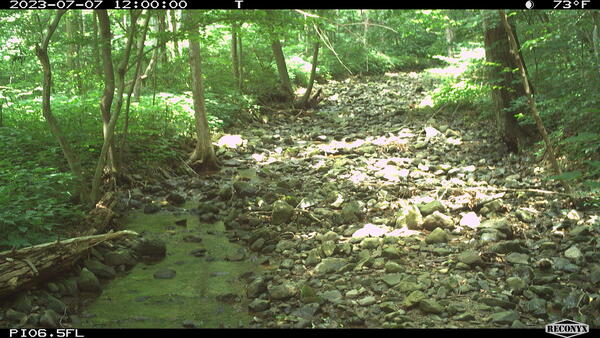
PI_06.5 Isolated pools
A still image taken from a USGS Flow Photo Explorer camera (Pl_06.5) shows isolated pools in a small stream in Shenandoah National Park.
A still image taken from a USGS Flow Photo Explorer camera (Pl_06.5) shows isolated pools in a small stream in Shenandoah National Park.

'Flood Rock' in Pittsford, Vermont, Near Otter Creek
'Flood Rock' in Pittsford, Vermont, Near Otter CreekThis is the "Douglas Flood Rock,” which has been used to document floods near Otter Creek in Pittsford, Vermont, since 1811. Local engravers in the area mark the flood rock at the highest water level after every big flood event. Locally called “Flood Rock,” this marble ledge is listed in the Pittsford Second Sentry Historical Book.