
LCMAP Change Stories: Where the Ocean Eats the Land
The unincorporated hamlet of North Cove, WA is the owner of a rather unfortunate superlative: fastest-eroding place in the West Coast.
North Cove’s residents refer to their home colloquially as Washaway Beach, owing to the steady and rapid clip of its shoreline recession – averaging 100 feet each year since the early 1900s.
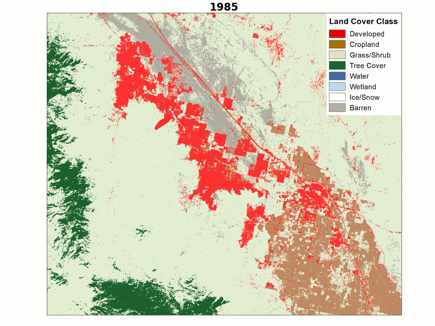
The Primary Land Cover product from the USGS Land Change Monitoring, Assessment, and Projection Initiative (LCMAP) offers a view of that erosion over the course of 32 years, from 1985 through 2017.

The deep blue of open water shaves away the red edges of developed land and gray-colored barren beach as the years pass in this animation, offering a stark view of the coastal erosion that has reclaimed so many man-made structures and swaths of rocky shoreline for the ocean.
The erosion is especially concerning for those connected to the area’s cranberry farms, seen here in the brown sections of land sandwiched between light blue wetlands and deep green tree cover. The southernmost cropland visible in the 1985 imagery gives way to barren beach by 2017.
The landscapes of Washaway Beach are best known for erosion and cranberry production, but other land uses are apparent to the west of its homes and bogs. The harvest of nearby forests has converted much of that tree cover to more open herbaceous vegetation since 1985, though some harvested sections have since regrown.
Related
Explore more LCMAP Change Stories by following the links below.

LCMAP Change Stories: Crops Give Way to Concrete LCMAP Change Stories: Crops Give Way to Concrete
LCMAP Change Stories: Building a Boomtown, Block by Block

LCMAP Change Stories: Gone in 60 Seconds
LCMAP Change Stories: It's a Sprawl World After All

LCMAP Change Stories: Hurricanes in the Everglades

LCMAP Change Stories: Alabama Tornadoes
Related
Explore more LCMAP Change Stories by following the links below.
LCMAP Change Stories: Crops Give Way to Concrete LCMAP Change Stories: Crops Give Way to Concrete
LCMAP Change Stories: Building a Boomtown, Block by Block
LCMAP Change Stories: Gone in 60 Seconds
LCMAP Change Stories: It's a Sprawl World After All
LCMAP Change Stories: Hurricanes in the Everglades